Baldy Pass - South Approach
Date Walked: 9th January 2012
Distance: 5.2 miles (8.5km)
Actual Ascent: 1771 ft (540m)
Time Taken: 4 hours
My first hike in Canada was intentionally selected to be cautious, more of a fact finding mission than a full blown hike. I was particularly interested in the incredibly dry air and how that would affect hiking here. I chose a popular hike at the Eastern edge of the Rockies. I made the short drive from our new house where I had stopped over to collect my hiking gear which is stored there (though we haven't moved in yet, we're still awaiting our furniture shipment from the UK). The map below gives some idea of the route taken and shows the tempting ridge walk leading to the summit of Mt Baldy which I will be hiking at some point in the future I'm sure.
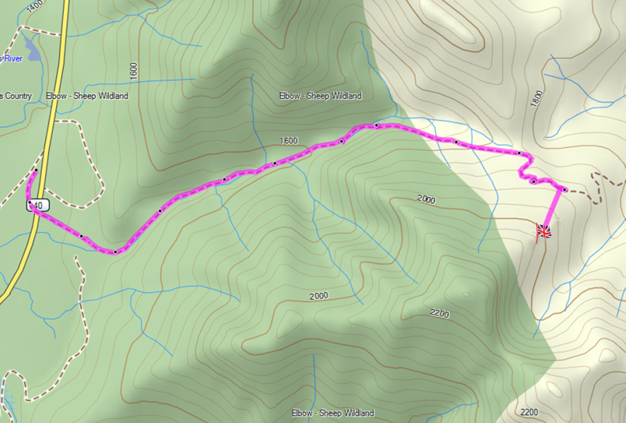
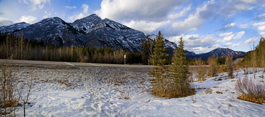
Taking the Trans-Canada highway to the intersection with highway 40, I then drove South for just 15km before turning into the 'Baldy Pass trailhead' parking area, it was great to find the car park empty meaning I would have the trail to myself.
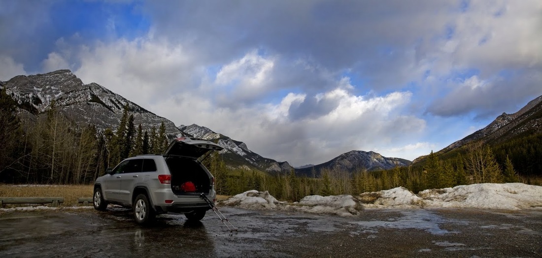
Looking across the ice covered car park and highway 40 beyond, I can see the pass between the hills leading out toward the distant mountain (Midnight Peak) which is where I will be heading (though not to the summit)
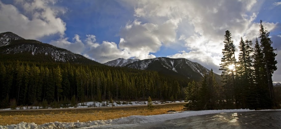
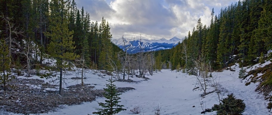
The trail begins on the opposite side of highway 40 to the car park and is clearly marked. With well trodden snow frozen on the surface micro spikes were needed immediately to maintain footing.
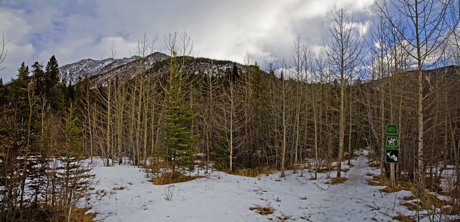
Even in the shade of the forest the path maintains it's coating of frozen snow but the trees provide shelter from the wind which is biting on exposed skin when out in the open.
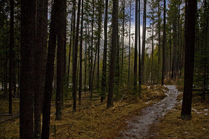
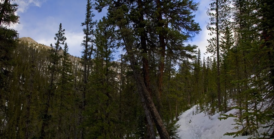
the trail changes frequently from a narrow twisting pathway through the trees to more open spaces as it meanders slowly up the pass.
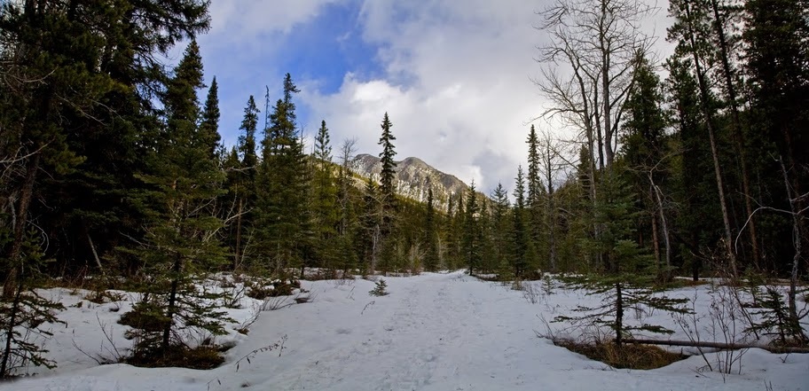
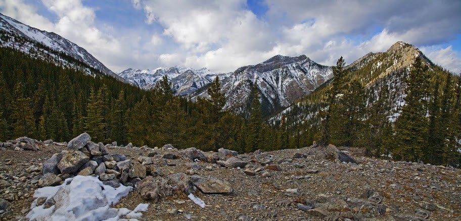
the pass is strewn with the carcasses of fallen trees and shale, no doubt washed down during the spring melt
back into the protection of the lodge-pole pines as the trail starts to climb more steeply, one step off the narrow trodden path and I sink almost to my hips in snow, seems the frozen surface is a great benefit and I watch my step more closely as I continue.
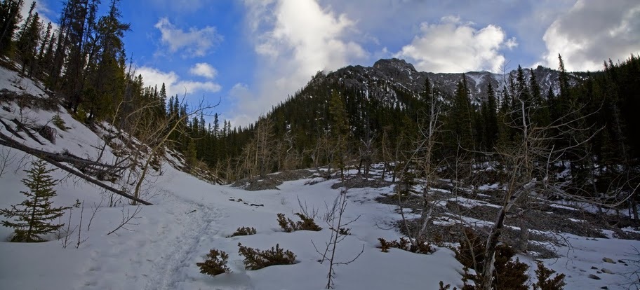
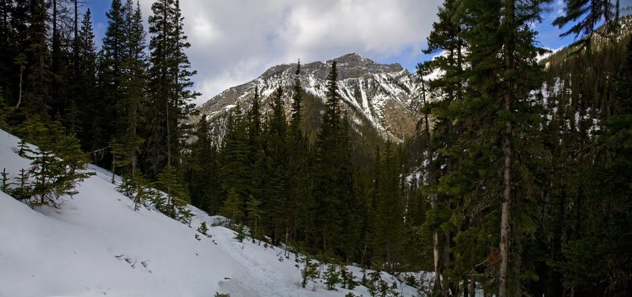
the pines begin to thin out again as I reach the Alpine zone and I look back at the 6800 foot unnamed peak that stands between Mt Baldy and Highway 40. The air is much cooler now and I am so dry I have actually stopped sweating, I need to stop for a drink.
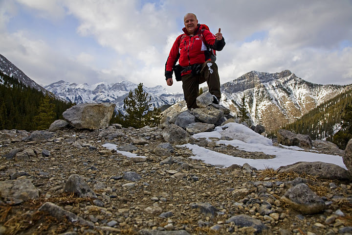
as I contemplate stopping I see the cairn ahead on the top of the pass so continue pushing for the last few feet of ascent before stopping to rehydrate. Suddenly I am quaffing water and lucozade sport like it's going out of fashion, so much so I feel sick and a little light-headed. It's clear that I need to drink much more (by volume) and much more frequently when hiking here than I ever did back home.

after consuming half of my water reserves for the day and a five minute sit down I begin to feel much better and look around for a little more ascent in the hope of expanding the view a little.
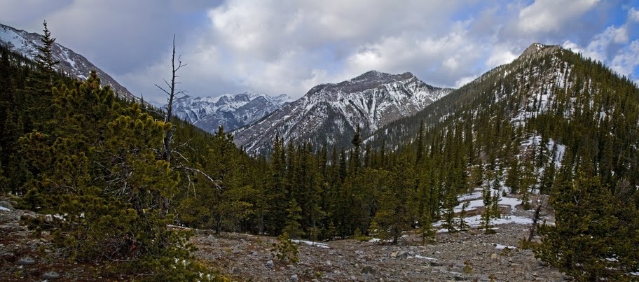
to the South-West is a small nub sticking out from the forest and I decide to aim for that in order to get a good view of the ridge to Mt Baldy.
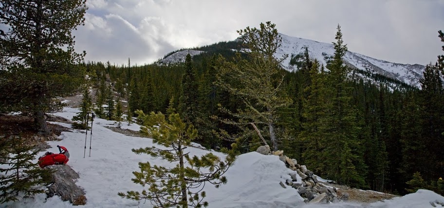
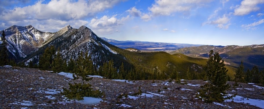
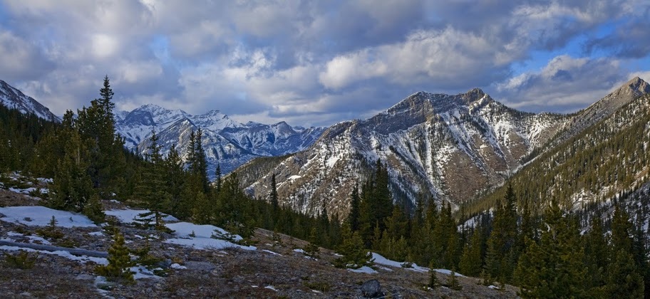
as I ascend further I rise up and out of the pass and can see the ridge heading to Mt Baldy and the expansive range to the west where the car is parked.
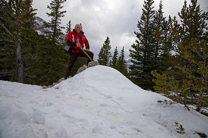
higher still and I find another small cairn on the hilltop and feel the bite of the wind again which has picked up significantly up here.
in true bagging style I grab another cairn shot, just for the hell of it.
to the East the mountains melt away to foothills and the flat arid desert of central Alberta, the ridge line hike to Mt Baldy opposite looks fantastic and I have made a note to get back here and do it when the days are a little longer.
I make a last push for the small nub I had targeted earlier before dropping the back pack and taking in the wonderful views of the Canadian Rockies.
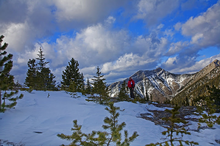
when it's time to start the descent it is hard to pull myself away, but the cold wind and snow showers help make my mind up to get moving.
the descent is fast and I am soon back in the pass crossing the wide gully that leads back down toward the car
in no time at all I find myself back at the trailhead looking across highway 40 at some more prospective targets in the distance.
This was a really enjoyable, intentionally safe hike that helped me understand some of the issues that I will face here, the fluids I need to carry and the timing of their consumption is more important than at home. The incredible biting cold higher up that requires a balaclava (made do with hat and scarf this time) and a change in the foods I carry and how I carry them (frozen biscuits anyone?) This trip did exactly what it was supposed to do, safely teach me a few things about the Rockies without having to call out Mountain Rescue. It was great to hike only a couple of thousand feet and end up at 6500 feet and the views were fantastic.
The next few hikes will also be short, tentative steps to help me understand, identify and feel comfortable in these mountains. Even I think it would be foolhardy to underestimate them and I am a notorious risk taker, the scale of these enormous lumps leave you all too aware of your own insignificance which I'm sure will help me maintain a healthy respect for this incredible playground.
The next few hikes will also be short, tentative steps to help me understand, identify and feel comfortable in these mountains. Even I think it would be foolhardy to underestimate them and I am a notorious risk taker, the scale of these enormous lumps leave you all too aware of your own insignificance which I'm sure will help me maintain a healthy respect for this incredible playground.