Eagle Hill - Kananaskis
Date Walked: 26th March 2015
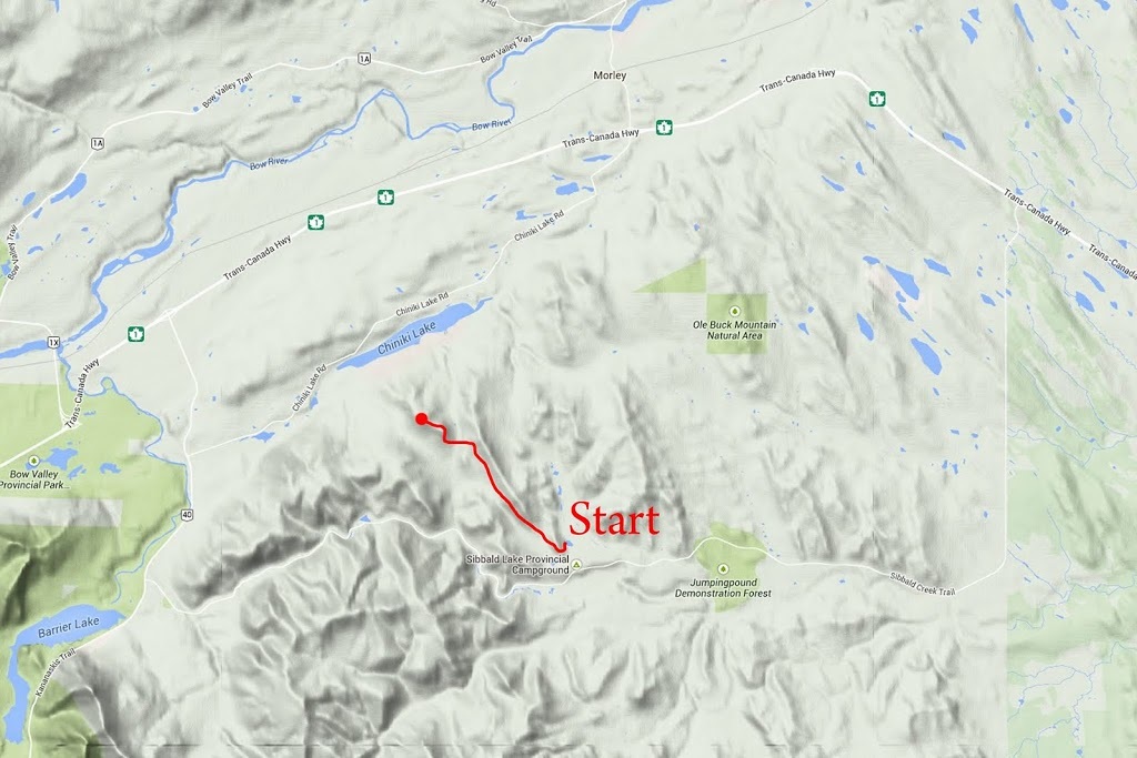
Distance: 9.1 miles (14.6km)
Actual Ascent: 2142 ft (653 m)
Time Taken: 5 hours
Back in July 2013 Sarah and I set off toward Eagle Hill on a hot summer day, the closeness of the forest and heat of the day proved to be a little too much for Sarah and we ultimately turned off our intended route and toward Deer Ridge (which turned out to be a good grunt on its own) you can see that walk here
So today, in search of a less demanding hike for Cecil and I to do, my mind turned to Eagle Hill again. I thought the trail might be clear and the forest would definitely keep the blustery wind off us for most of the day. We met up as usual at the junction of the Trans Canada Highway and Highway 22 where we discovered Cecil had left his boots at home due to rushing around after a dental appointment.
Fortunately Cecil was still up for a hike albeit in his nice dress shoes, so we made our way to the Sibbald Lake Parking area beside Highway 68 in Kananaskis. In the summer months this area is a hive of activity, and with campsites, fishing, hiking and covered barbecue spots it's easy to see why. Today the trail was ours and though we saw a couple of vehicles in the car park we didn't see anyone at all on the whole trail.
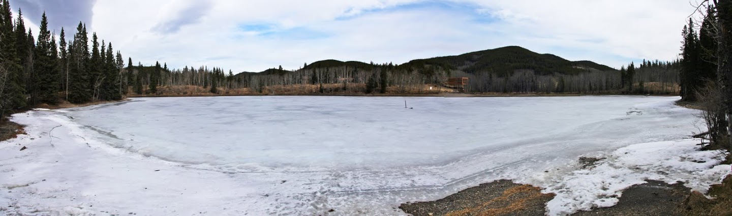
We began with a small poke around the edge of Sibbald Lake which remains frozen even though a number of local waterways are now ice free. (Click image for larger version)
So today, in search of a less demanding hike for Cecil and I to do, my mind turned to Eagle Hill again. I thought the trail might be clear and the forest would definitely keep the blustery wind off us for most of the day. We met up as usual at the junction of the Trans Canada Highway and Highway 22 where we discovered Cecil had left his boots at home due to rushing around after a dental appointment.
Fortunately Cecil was still up for a hike albeit in his nice dress shoes, so we made our way to the Sibbald Lake Parking area beside Highway 68 in Kananaskis. In the summer months this area is a hive of activity, and with campsites, fishing, hiking and covered barbecue spots it's easy to see why. Today the trail was ours and though we saw a couple of vehicles in the car park we didn't see anyone at all on the whole trail.
We began with a small poke around the edge of Sibbald Lake which remains frozen even though a number of local waterways are now ice free. (Click image for larger version)
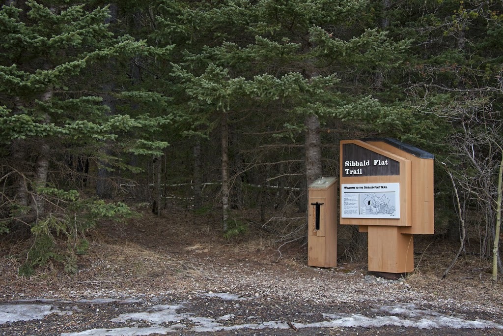
After one of us had got their boots on we set out along the Sibbald Flat Trail which climbs up and over the corner of the forest before dropping back down to meet our intended route. It's possible to avoid this ascent and descent by taking the trail through the meadow further back along the entrance road.
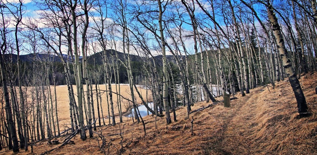
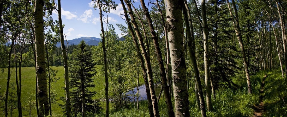
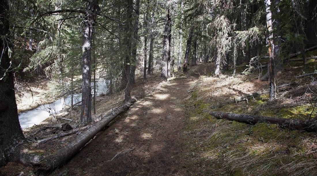
As we circle the short interpretive trail at the start of the hike I can't help but notice the difference between early spring and early summer here. The birch forest is much more open this early but (as can be seen in the image below from my hike with Sarah) it takes on a totally different appearance during summer, it would be nice to see it in autumn and catch the golden hues of the leaves from the same place for comparison.
Looking back along the trail Moose Mountain puts in an appearance as it always does when you are hiking this area. Moose is the tallest of the foothills peaks around here and dominates the skyline in most 'foothills' shots.
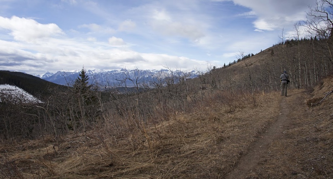
Ahead the trail picks its way through birch forest interspersed with bare patches that allow a clear view of the route to come. The sky held on to this well defined line for a long time today with cloud one side and blue sky the other and just an occasional threat of a snow shower though none ever came.
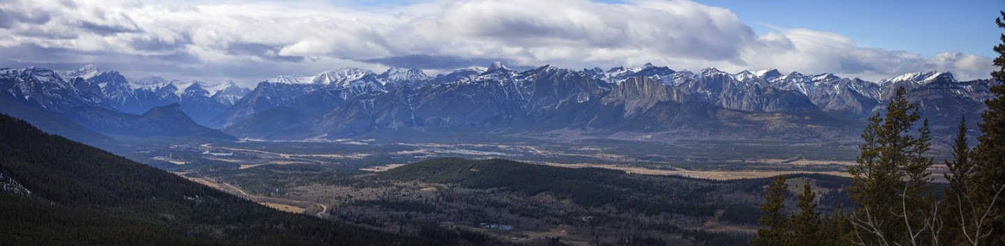
Rising and falling along the trail give glimpses of the distant mountains that are actually north of the Trans Canada Highway, across the Bow River Valley and Highway 1a almost 20 km away
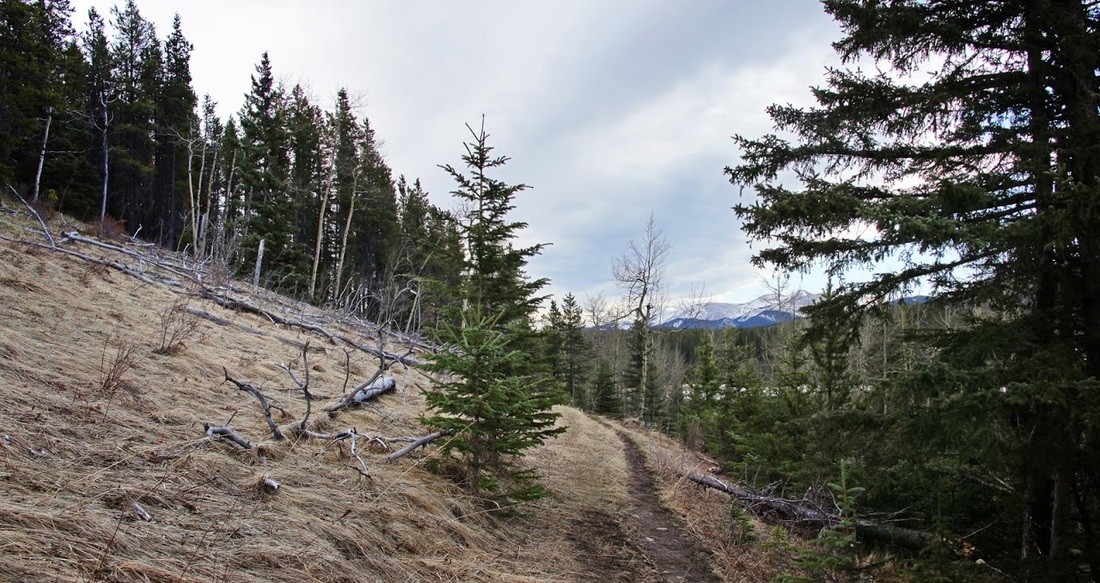
The trail falls again into a shaded valley where the frozen creek stands still in the dappled light of the forest, the trail here is in great condition, dry underfoot and easy going. The rise and fall is where all of the ascent comes from on this route, though it is over 650m (2250 feet) overall it is the result of several undulations which means there are no long grinding ascents that drain the energy.
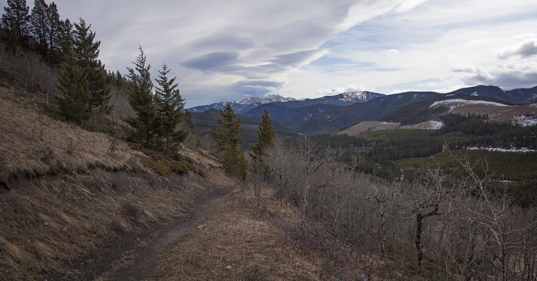
After about 6.5km (4 miles) the trail begins it's final ascent to the summit, the gradient is a long slow climb rather than a steep grunt and in no time at all you can see the small rounded summit of Eagle Hill ahead. The trail is in great condition up here, dry and well trodden making Cecils forced choice of footwear today no issue.
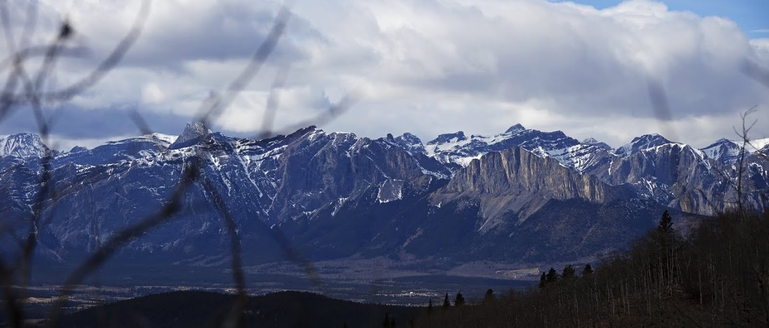
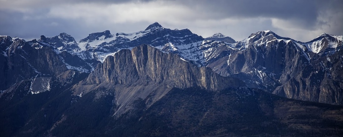
As we near the summit a zoomed shot of Yamnuska and the front ranges show how little snow remains now (relatively) The north facing slopes still carry some huge swathes of deep snow but many of the front range hikes are coming into their own now, incredibly early in the season.
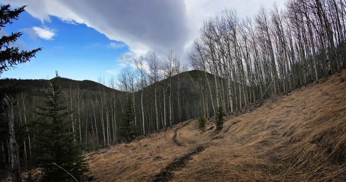
Looking back along the route travelled shows the effects of logging in the area (though without it there would be far less access to places like this) and beyond this the clear line of cloud leading us back to Moose Mountain still dominating the horizon so far away over the rolling hills.
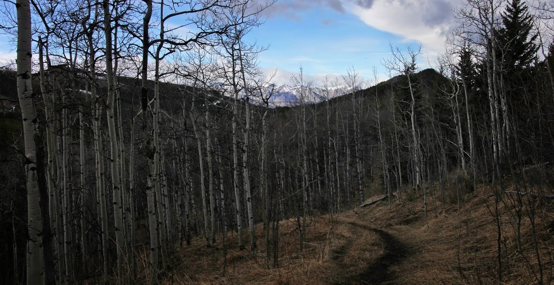
Almost at the summit we reach a barbed wire fence that seems a little pointless though may be acting as a boundary more than anything else, the horizon widens now to include the view to the west into the Bow Valley Corridor that leads west to Banff and beyond.
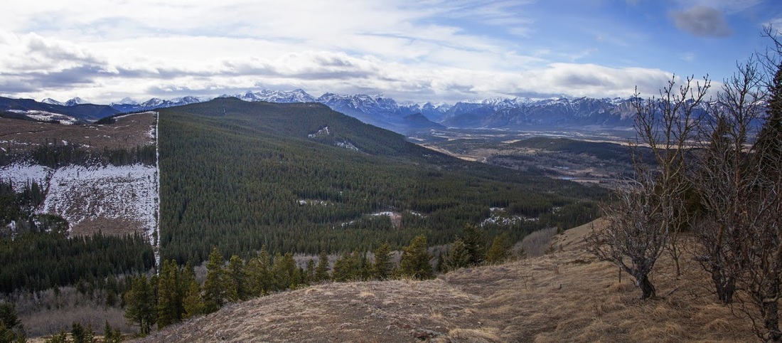
The view from here is still a surprise to me, such a wide expanse of mountains with the clear flat face of Yamnuska protecting the South Ghost at the far side of the valley and a thousand snow capped peaks stretching north, south and west, it is a wonderful sight even if the wind is howling around our ears and buffeting us as we try to grab some shots.(click image for larger version)
The final shot of the day is my favourite, a long zoom of Yamnuska with a beautiful cloudburst lighting up the yellow rock at just the right time, though the snow showers look close they are actually 20km away and the day remained dry throughout.
We got back to the car park in good time though the return stills holds a number of undulations to test weary legs, as we got close to that final little hill in the forest on the Sibbald Flat trail we stayed right and carried straight on circling through the meadow on level ground back to the truck to end what was a surprisingly enjoyable hike, one I might be repeating in future.