Galatea Lakes - Summer
Date Walked: 12th September 2012
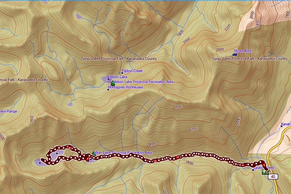
Distance: 11.5 miles (18.59 km)
Actual Ascent: 2277 ft (694m)
Time Taken: 5 hours
I have had my eye on this hike for quite some time but put it off for two reasons, firstly there is a long approach through a deep valley which meant it was hotter than hell through there in summer, and secondly it is a very popular route with both locals and tourists. It is probably fairer to say that the first section (to Lillian lake) is popular, the additional 4km and associated ascent to Galatea Lakes is not so popular.
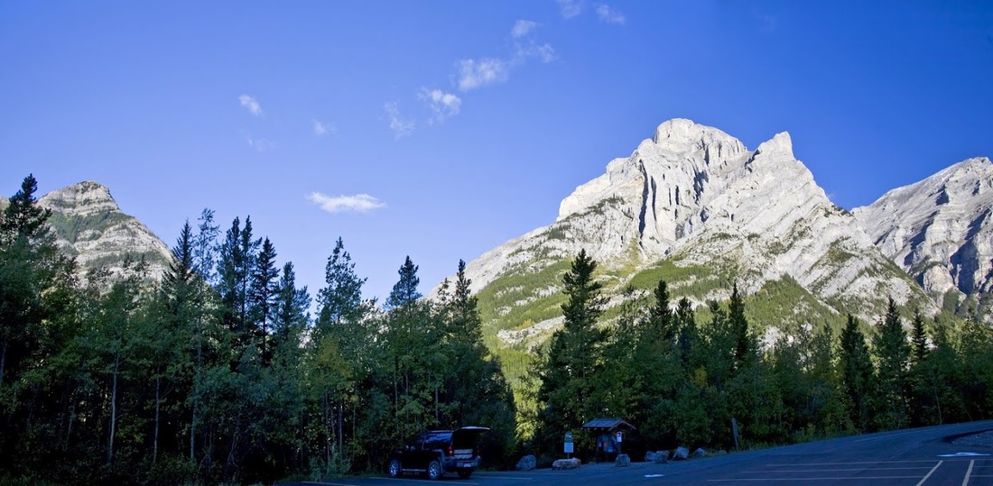
So, with this in mind I was pleased to pull into the well signed Galatea car park and find it virtually empty with only one other car (which had well frosted windows) The trailhead car park is only about 30km south of the Trans-Canada highway along highway 40 so it was a short journey for me today.
It was absolutely freezing in the shaded car park and two small areas of ice stood in vacant lots. I didn't hang about too long exploring the area as I normally do because it was too cold so I needed to get going and warm up.
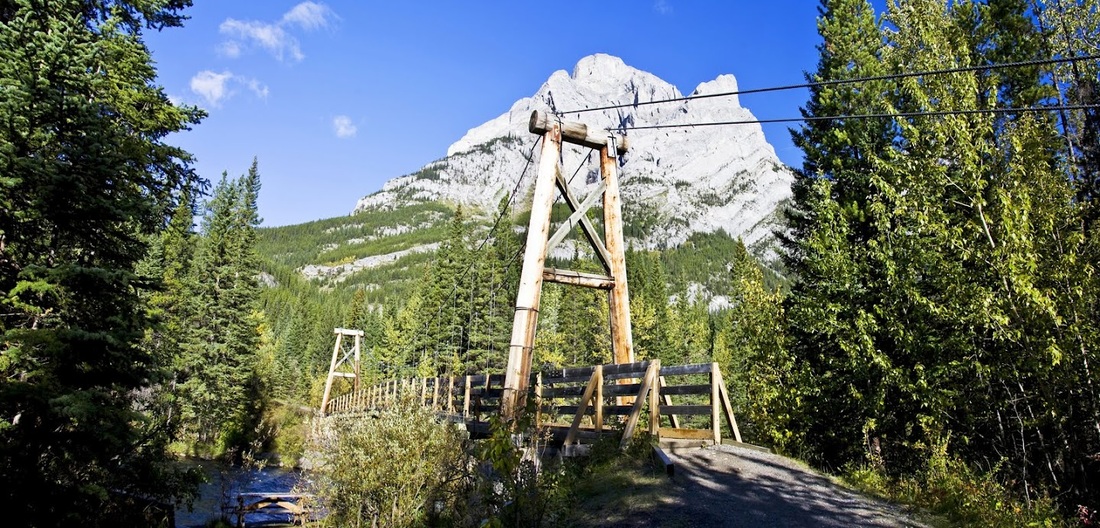
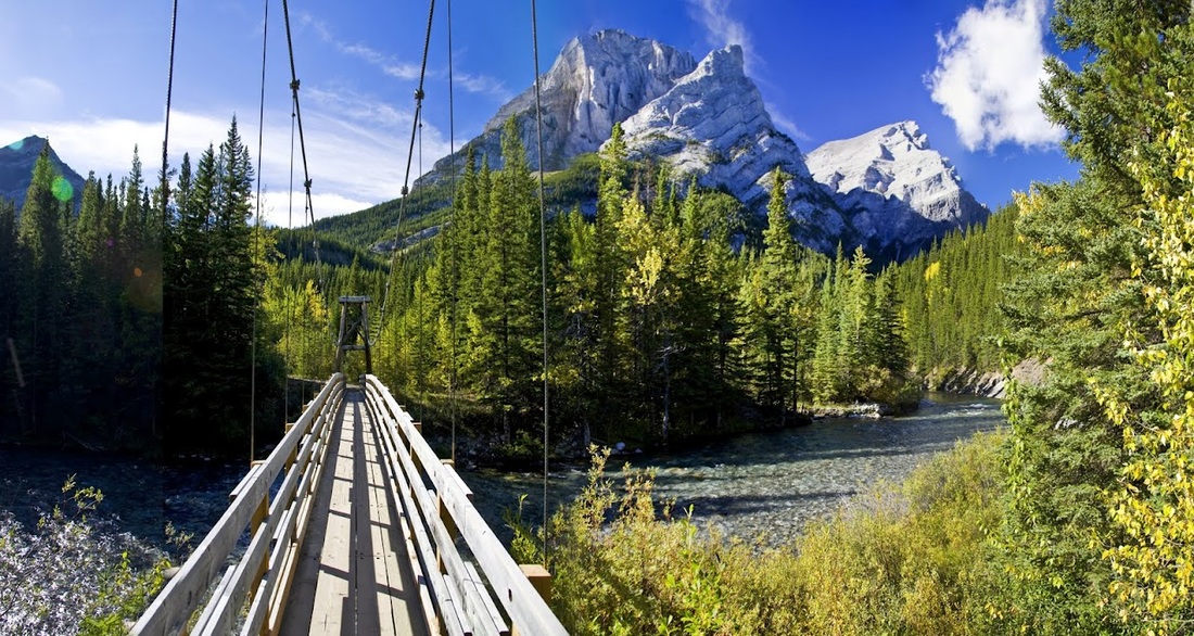
the hike begins with a steep descent to a well constructed bridge over the Kananaskis river, I was surprised that it moved so much given it's construction, as I crossed it lolled up and down like it was resting on blamanche.
Once across the bridge the trail comes to a T-junction where a left turn sets me on an unmissable trail alongside Galatea creek. The trail switches from side to side across the creek for no apparent reason but each time there is a well constructed bridge to ensure a dry crossing. I think there were about 9 of these in total along the creek....I lost count.
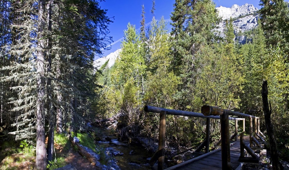
there are several places where melt water channels have destroyed the trail completely but it is easy enough to cross the boulders and rejoin the trail at the other side, though in spring these may present a real challenge
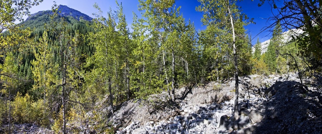
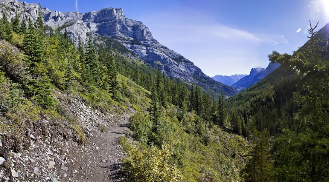
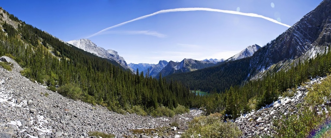
it is a densely forested trail for the most part as it rises slowly from the valley floor, it does pass a huge canyon with an equally huge waterfall deep within it. Whilst I could hear the falls for a long time I could only see the spray but not the actual falls. There are some open areas which allow a quick view back down the valley toward the start.
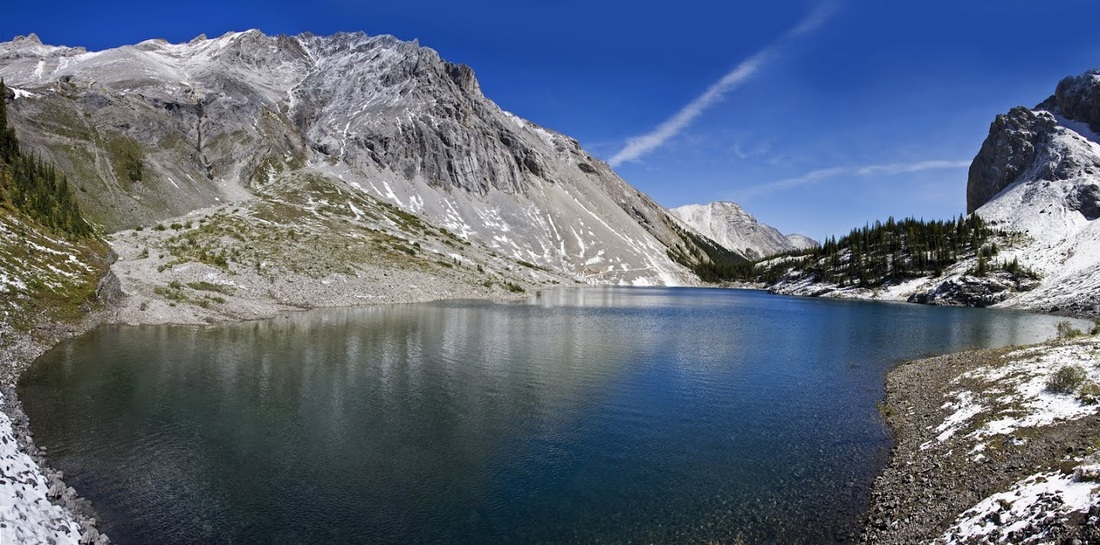
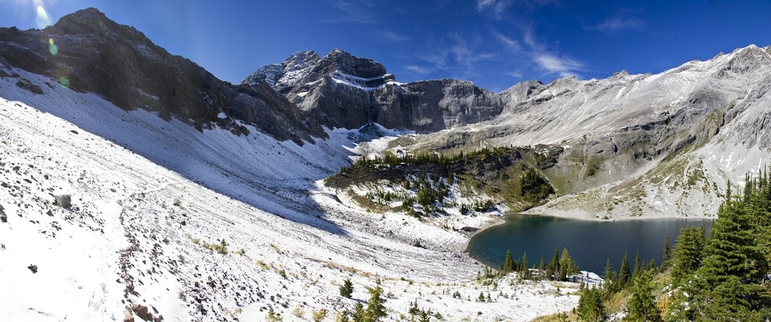
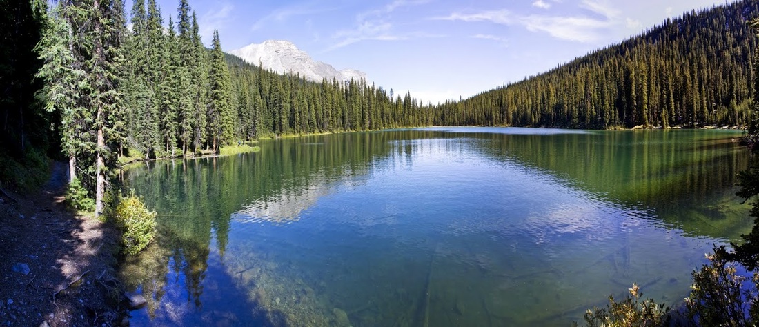
after about 6.5km I arrive at Lillian lake and stop for a photo or two at the eastern end of the lake before continuing on the trail along the northern bank. I hope to see more of the lake by dropping down the long scree and boulder slope visible in this picture as part of the return leg.
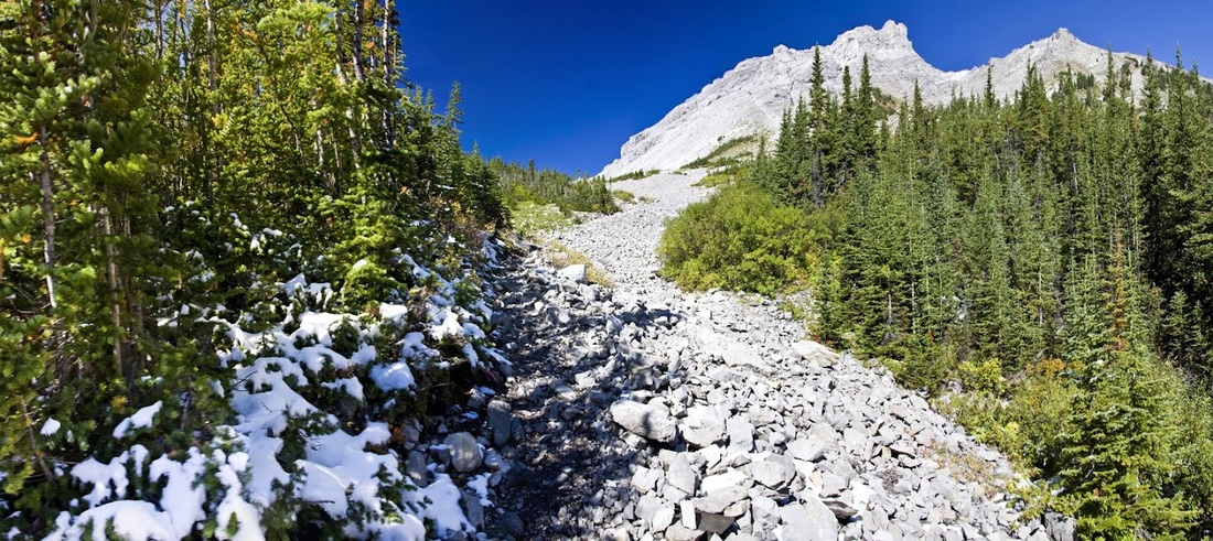
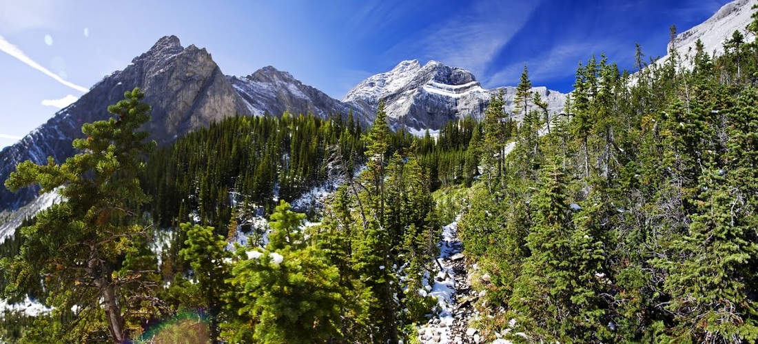
Once past Lillian lake the trail ascends quickly along another large scree ridge that is overgrown with trees and shrubs. Snow still sits here where the sun doesn't reach, which is no surprise as it is still very cool and I'm beginning to wish I'd put my gloves on.
looking back from the scree over Lillian lake and the forests below it seems a hellish long way back through the valley and yet I feel like I've done very little so far. One huge benefit of cool weather is the hiking is so much easier.
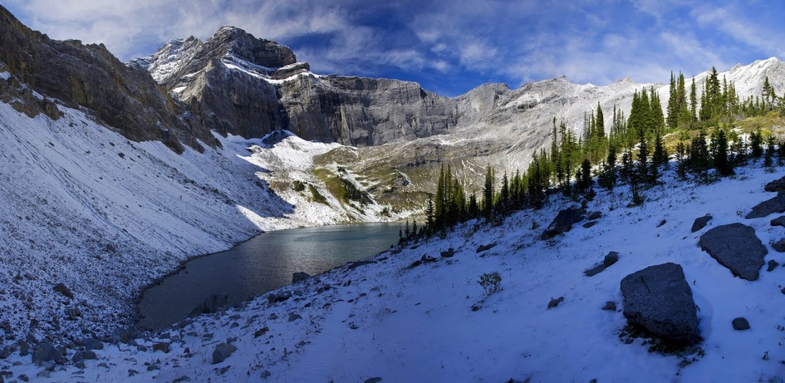
looking ahead I can see 'The Tower' rising above the final ascent and the view is sufficient to keep me going at a good pace through the last of the trees.
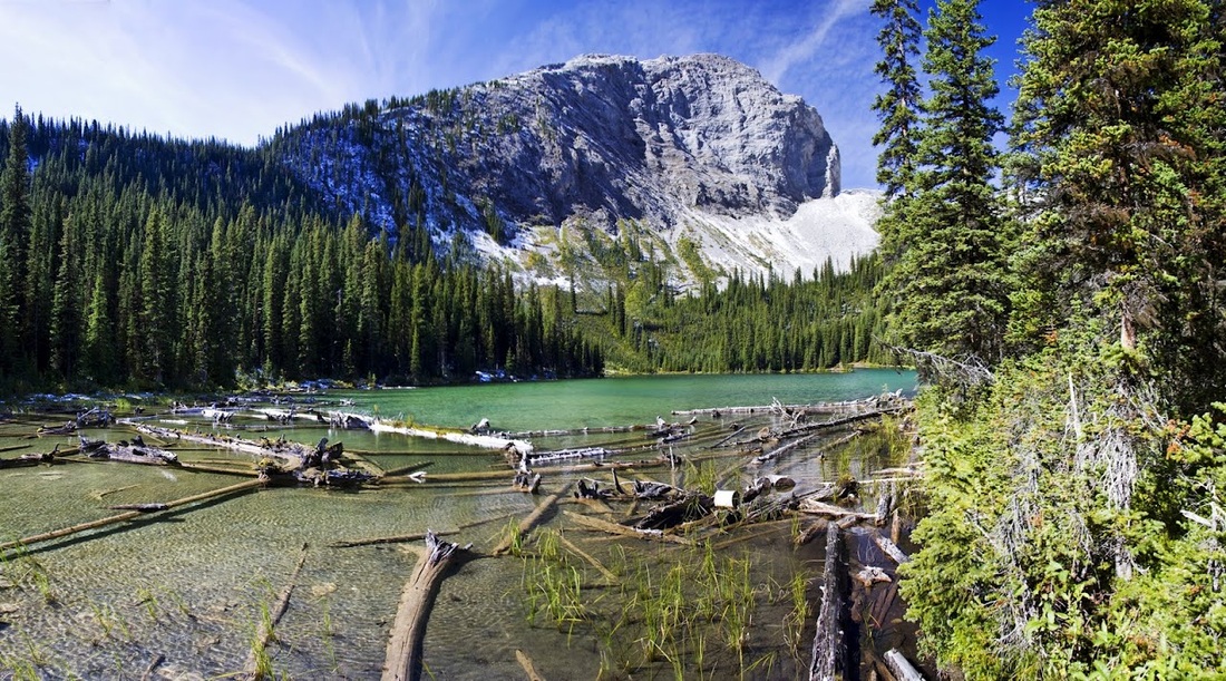
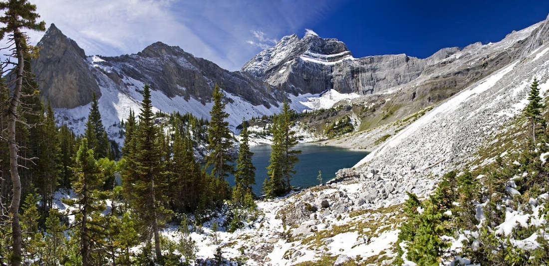
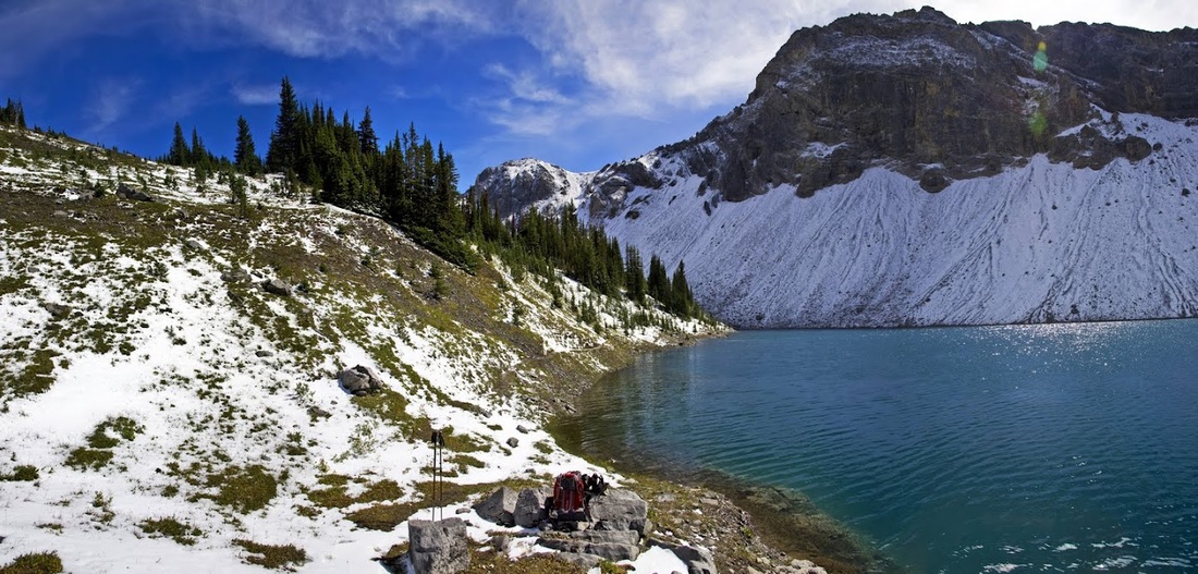
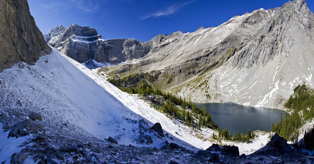
Lower Galatea lake is a beautiful sight as I reach the rise, surrounded by snow covered walls the blue water shimmers as a strong breeze whips the surface before hurrying past me and down the hill causing me to zip up the neck of my fleece as I stand a moment absorbing the view.
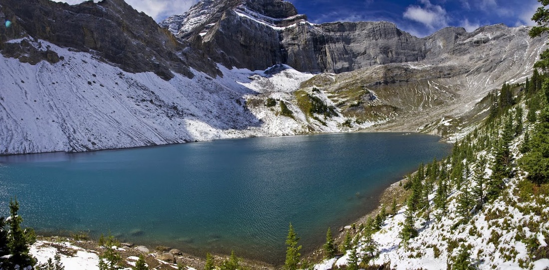
I cross the steep slope on the north side of the lake using the snow covered trail, as I circle around the western edge of the lake I meet a couple who were just leaving, they had camped down at Lillian lake camp ground and seemed genuinely amazed that I had made the hike this morning. I asked about the upper lake but they had not been that far and weren't going to go so I said my farewells and continued on. It provides some sense of scale that they can just be seen on the lower end of the snow covered trail seen on the left across the lake here.
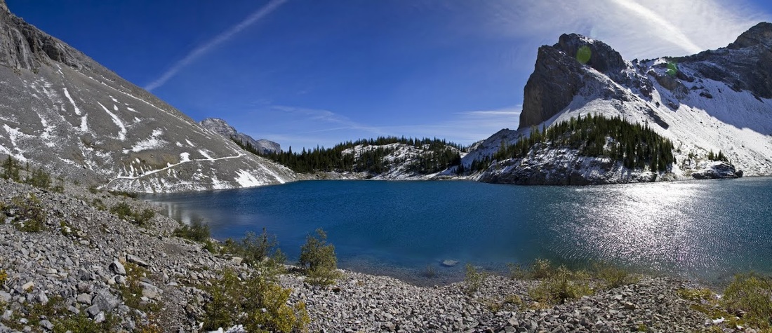
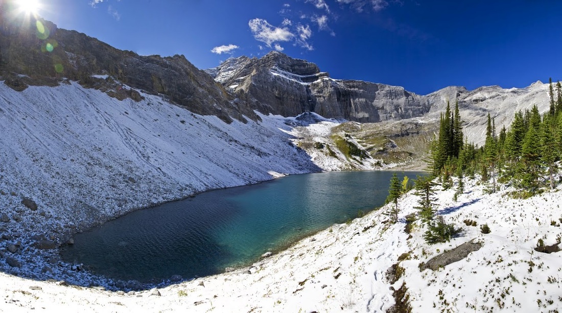
I make my own trail around to the south-west corner of the lake and grab a shot looking directly across the beautiful water, it's a little warmer over this side as it is protected from the wind by a huge ridge behind me, the ridge that stands between me and Upper Galatea Lake.
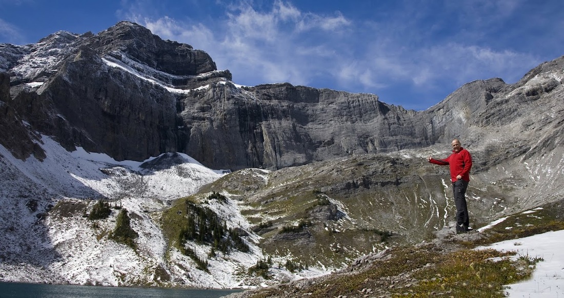
skirting around the eastern edge of the ridge to a lower point before ascending for my first view of the upper lake. The wind here is incredible and damn cold as I pick my way down the ridge toward the lake.
I follow the ridge along looking for a suitable descent route so I can make my way down to the lakeside for a lunch break.
once I get down to the waters edge without slipping on my backside I strike a pose for the usual evidence shot.
My lunch spot was almost perfect, a good clean rock seat that was flat and even had a back rest, as I settled down and dug out the oranges and Swiss army knife I smiled to myself from the absolute enjoyment of the moment.
the only thing was, it was still bloody freezing up here, it's only 7500 feet but winter has clearly arrived up here now, I decide to save lunch for Lillian lake on the return and after exploring the shore and taking more photos I set off up and out of the freezing bowl.
as I reascend I stick to the southern, snow covered slopes in an attempt to make my way around to the long scree slope overlooking Lillian lake.
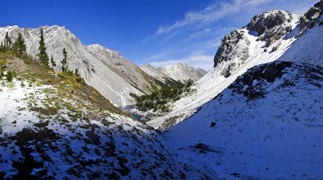
I find a good trail along the slopes and find myself enjoying the boot deep snow along it, the view back across the lower lake is stunning and away on the far side picking his way through the rocky slopes is a huge mountain goat.
After a few dicey moments crossing the snow covered slopes I make it to the top of the ridge unscathed only to find it iced over and promptly slip banging my knee on a rock, nothing serious just one of those '#@%^&' occasions.
following the usual ranting about the knee I stop for a moment to take in the stunning view back down across Lillian lake and along the green valley.

I rampage down the scree in bounds for the first hundred feet or so before it turns to larger boulders and I make a more controlled descent into the forest where a short walk through the camp ground leads me to the south-western corner of Lillian lake where I finally stop for lunch. Surrounded by trees keeping the wind away and bathed in full sunlight, this is the spot. It was great to see so many trout drifting by....I wished I'd brought my rod.
After a good 20 minutes enjoying the lake I made the long haul back through the valley which was now really warm, I was pleased to reach the wobbly bridge and cross over before turning for one last look. The clear water of the Kananaskis river is almost invisible and some of the trees are just beginning to show those subtle shade of yellow as autumn approaches.
This was a really enjoyable hike and though it was my longest yet out here I seemed to have twice the energy than I've had of late which I'm sure was down to the cooler temperatures. I've seen my first snow of the season and slipped on the first ice of the season, I'm looking forward to Autumn.