Indefatigable Ridge -Winter
Date Walked: 16th December 2015
Distance: 4.9 miles (7.9 km)
Actual Ascent: 1735 ft (529m)
Time Taken: 3 hours
My day started early with a surprise heavy snowfall so rather than setting off to the mountains I found myself clearing the drive and path in front of the house. Something I really like about Canada is the requirement on every homeowner (or business owner) to clear snow from the portion of path adjacent to their property, this results in clear walkways throughout the town/city, I even had time to do the neighbours bit before heading out.
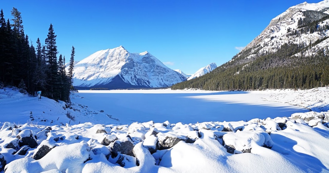
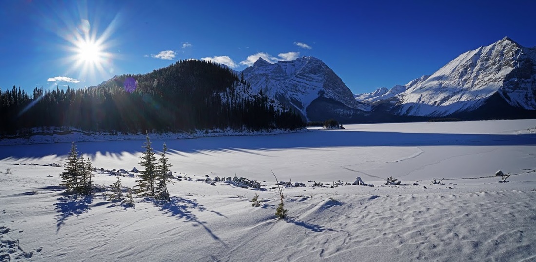
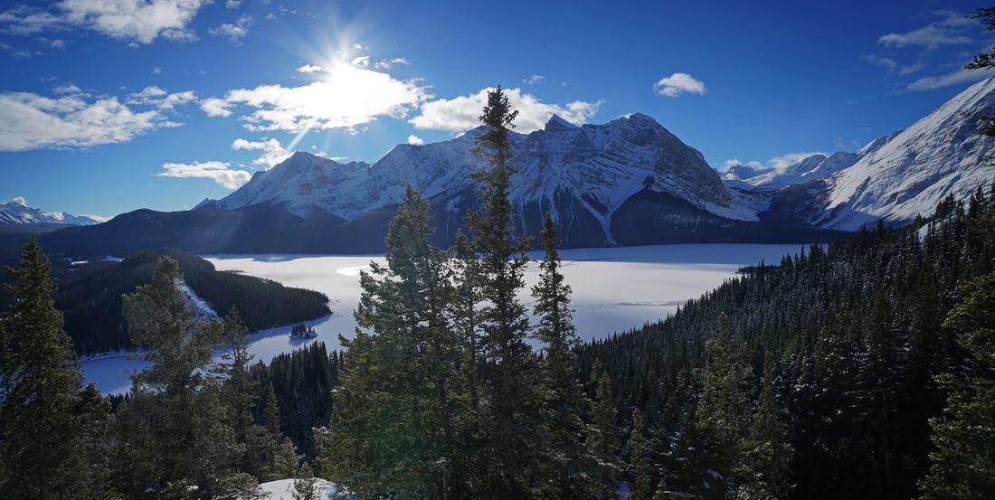
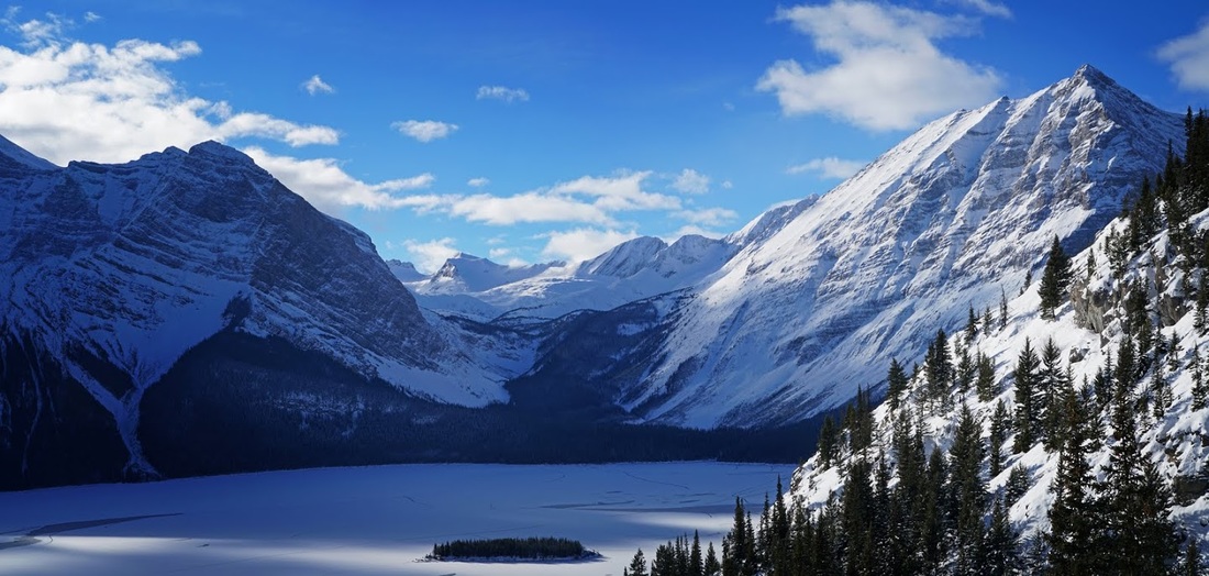
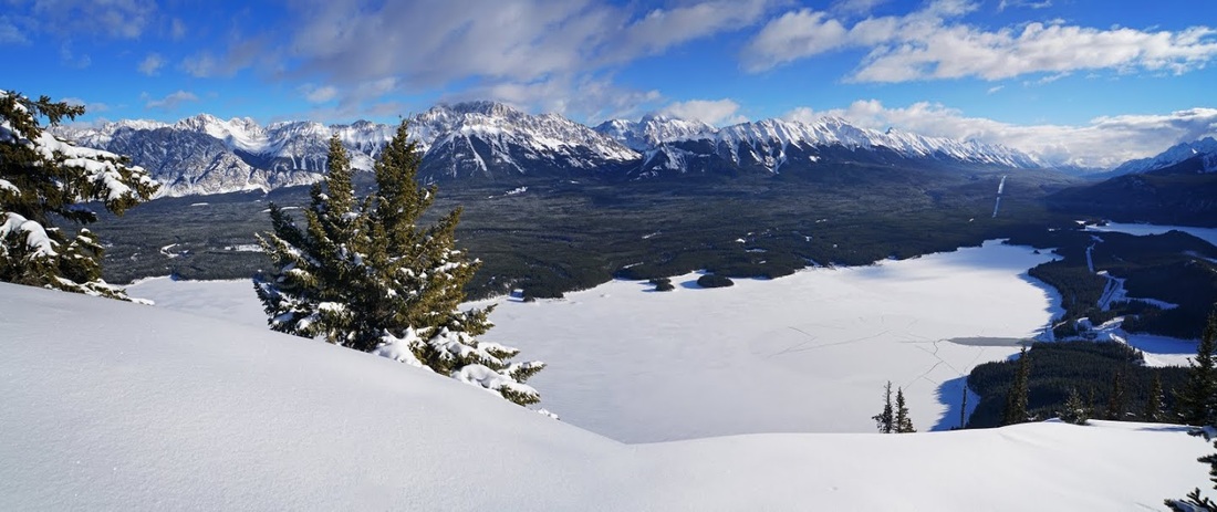
I had no plans for any particular hike today and had actually thrown my snowshoes in the back of the truck intending to make a nice steady plod somewhere when the mood took me. But, as is very often the case when I have no specific target in mind, I found myself at Upper Kananaskis Lake, long shadows still hung across the frozen surface but at least that means sunshine. As I stood on the isthmus looking across to Mt Lyautey I felt the -14 degrees nipping at any area of exposed flesh and shuffled back to the truck to gear up.
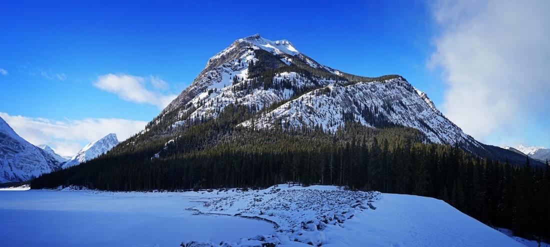
Once I'd pulled on the winter boots, coat and hat I took another look around while deciding where to head, suddenly it struck me that there was only a few feet of snow and I could perhaps still make it up the ridge on Mt Indefatigable, it's such a beautiful mountain and so perfectly placed that it took little more than a whimsical thought to see me dispatching the snowshoes back into the truck and digging out the crampons instead.
As I set out I stopped briefly to talk to two guys who just arrived and intended going ice fishing, with the water falling through the hydro plant the ice on the upper lake was creaking and groaning and the stillness of all else made it seem much worse. One of the two was still up for it and trying to explain to his friend why it was creaking and pointing out that the ice was over a foot thick but his friend was not keen. I left them to it and headed out looking back at Mt Sarrail and Mt Lyautey and Hidden Pass that sits between them.
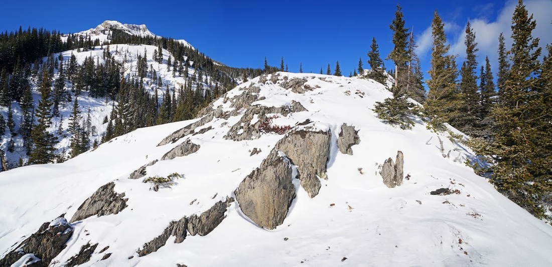
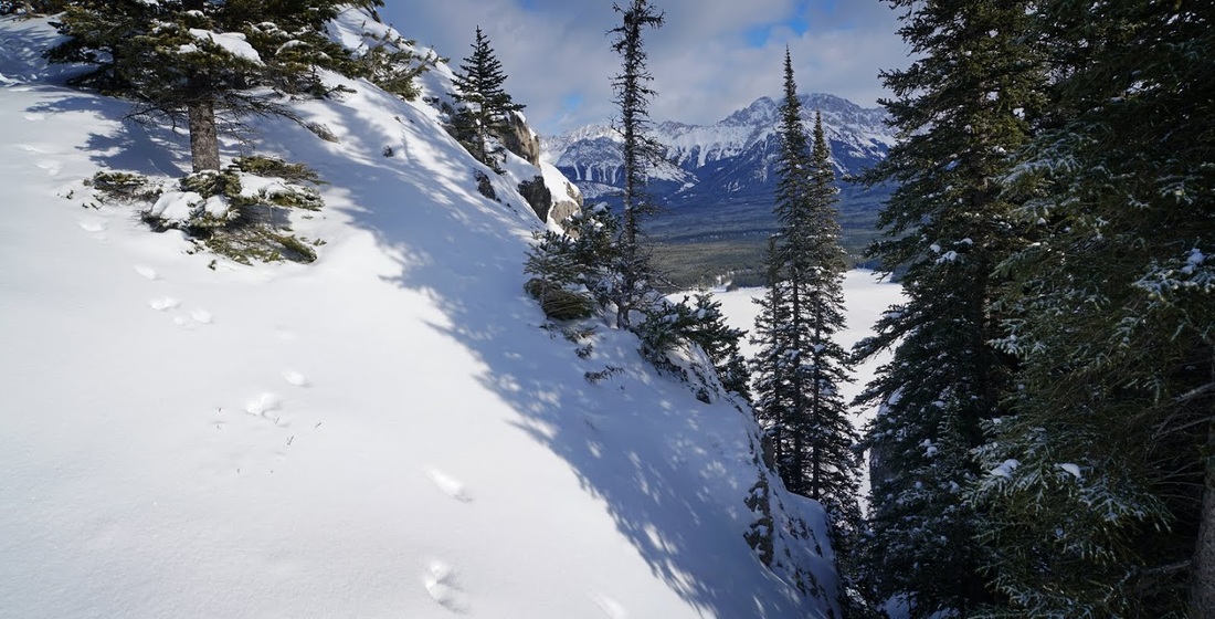
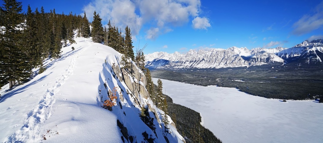
Most of the exposed areas are almost clear of snow where the wind has swept away all but the most sheltered spots, this gives me hope for the ridge to come as it is exposed in it's early stages.
Once over the bridge which crosses the floodway at the end of the isthmus the trail curves left (west) and I am soon on the junction needed, straight ahead is the start of the route around the upper lake or (from another junction ahead) on to Three Isle Lake and the Alberta/British Columbia border. Back to my junction, from here I'm heading right to the Grizzly warning sign.
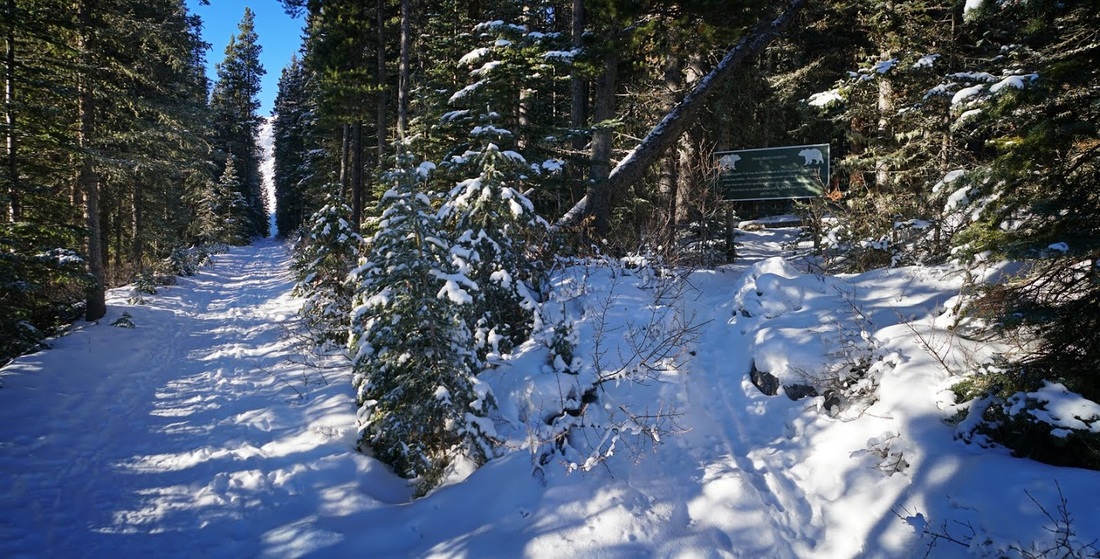
The bear warning is worth taking note of as the hike is in prime bear country and the slopes are perfect for denning. Black bears tend to like slopes of 20 to 40 degrees at 5500 to 8500 feet and will dig under windfall, hollow trunks and occasionally caves. Grizzlies tend to excavate on 30 to 60 degree slopes at 6500 to 10000 feet and much prefer the base of a large well vegetated tree to dig beneath.
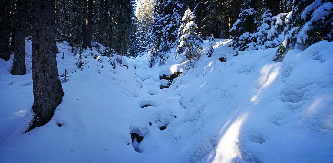
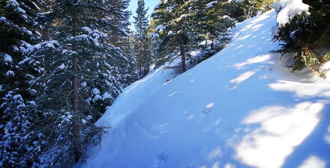
The trail to Indefatigable ridge is on 20 to 60 degree slopes, between 5500 and 8300 feet, it has plenty of windfall and large vegetated trees, hollow trunks and small caves, so with a few feet of snow on the ground it's really important to know where you're standing and avoid standing close to these types of potential denning sites, creeks like the one below are a good place to walk as bears will avoid creeks when denning.
The trail to Indefatigable ridge is on 20 to 60 degree slopes, between 5500 and 8300 feet, it has plenty of windfall and large vegetated trees, hollow trunks and small caves, so with a few feet of snow on the ground it's really important to know where you're standing and avoid standing close to these types of potential denning sites, creeks like the one below are a good place to walk as bears will avoid creeks when denning.
Areas like this on the other hand are definitely places to be wary of, fortunately I know there is a trail beneath here and bears will avoid trails (for the most part) but it's still worth giving a wide berth to potential denning sites.
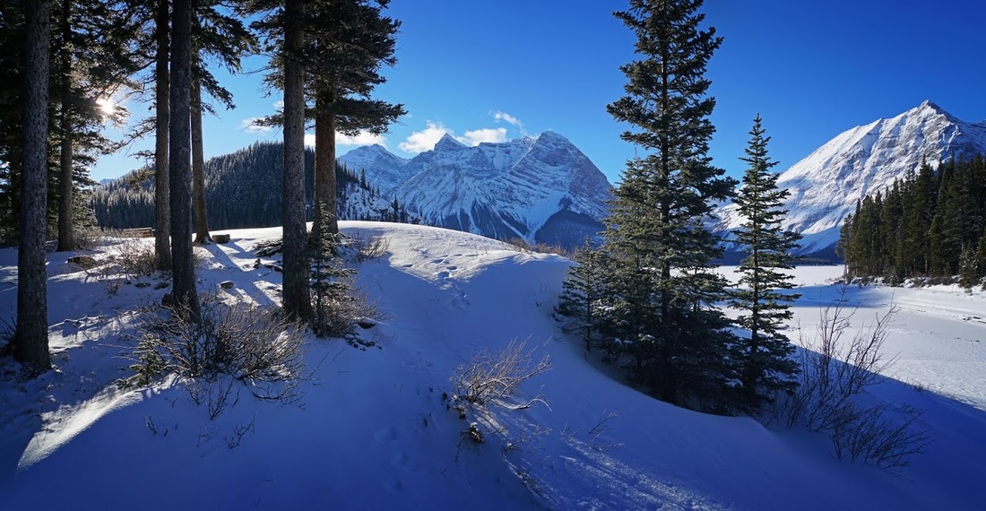
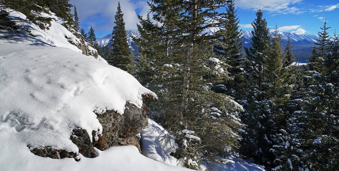
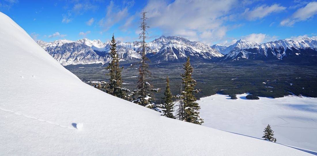
It's nice to ascend into the more rocky areas where digging is unlikely and the snow is often blown clear, the bear concerns are much reduced and the views begin to open up at last. The hike up so far has been fairly good with only boot deep snow for the most part with the exception of occasional drifting.
I'm soon up and out of the forest, looking back I can't see any sign of the guys who were discussing fishing so I guess the creaking ice was just too much for one of them at least.
After grovelling through some deep drifts on the steep slope to the low point of the ridge I pop out onto the welcome rocky terrain and can now enjoy at least a short stretch of easier going with the reassuring sound of crampon on rock my only accompaniment.
From low down a zoomed shot of the Hidden Valley doesn't quite show the huge frozen sheet of ice that is Fossil Falls which looks fantastic with the naked eye. The glacier above now has a heavy blanket of snow which will remain until at least July though Fossil Falls will be flowing long before then.
The easy going trail along the top of the rocky ridge is interrupted by a need to drop down into a crevice and cross over to continue along the ridge. In the dip the snow has accumulated to thigh level but mercifully it is for a short distance only, following rabbit prints in the snow wasn't helping much.
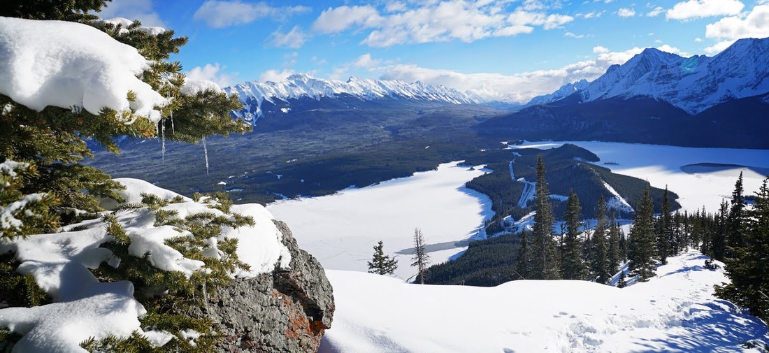
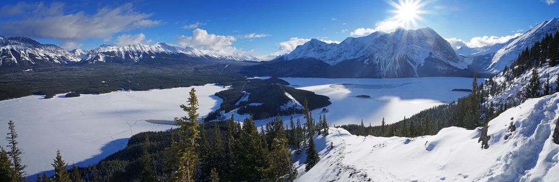
Once up and out of the big dip the snow is back to boot depth and good going again, turning round to look back on the view is just spectacular. I've seen this so many times but I still find it to be one of the real beauties of Kananaskis. I can now see my truck is all alone in the car park so I guess the fishermen decided against it.
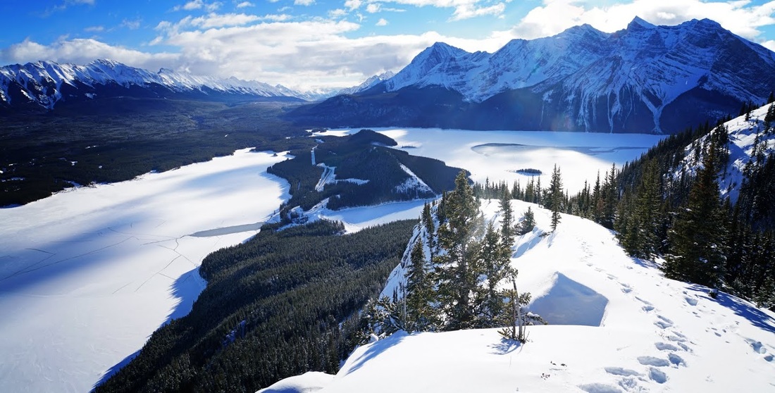
Looking up the ridge I can see the snow depth changing where the trees have stopped the wind from sweeping across the rocks and clearing the route. To the right (east) is the frozen surface of Lower Kananaskis Lake and the Opal Range beyond, if you look closely you can just make out highway 40 running at the base of that range which is actually 5km from here.
Continuing on into the trees on the next level, the snow is well over knee deep and combines with the slope to make some real thigh busting work requiring plenty of 'photo stops'
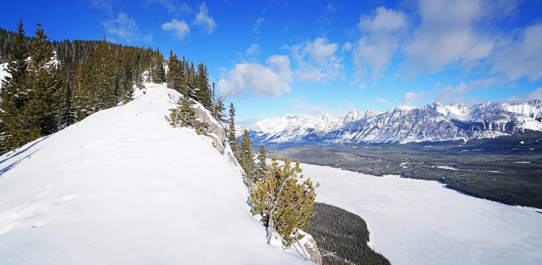
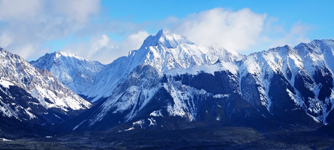
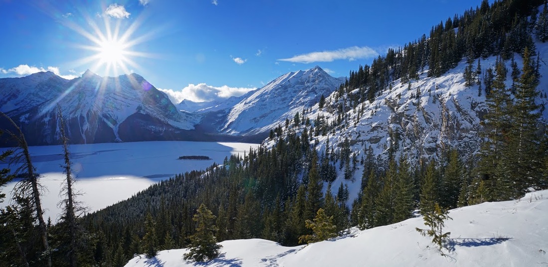
Still ascending I can now see through the valley to the east which allows highway 40 to turn toward Elpoca Mountain and Elbow Lake before turning again to become the highest paved road in Canada at Highwood Pass. The isolated behemoth towering above the Elk Range on the right of shot is Mt Rea which reaches 10500 feet and casts a long shadow over Elbow Lake year round.
I couldn't resist a zoomed shot of Mt Rea as it catches a passing cloud, the valley turning left is the Elbow Valley which leads to Tombstone Lake and ultimately to Highway 66 some 30km east through wonderful mountains all the way.
After slogging through the deep snow for a while longer I decided to call it day, I wasn't going to make a summit today so forcing myself on this thigh buster any further would just be masochistic.
Following my own footprints back down the ridge made for some good going and I was soon looking out for a seat for my first (and only) break of the day.
I actually had to drop even further down the ridge to find a snow free spot to park my butt on and take in the view, the sun was already dipping behind Mt Sarrail and casting shadows across the upper lake
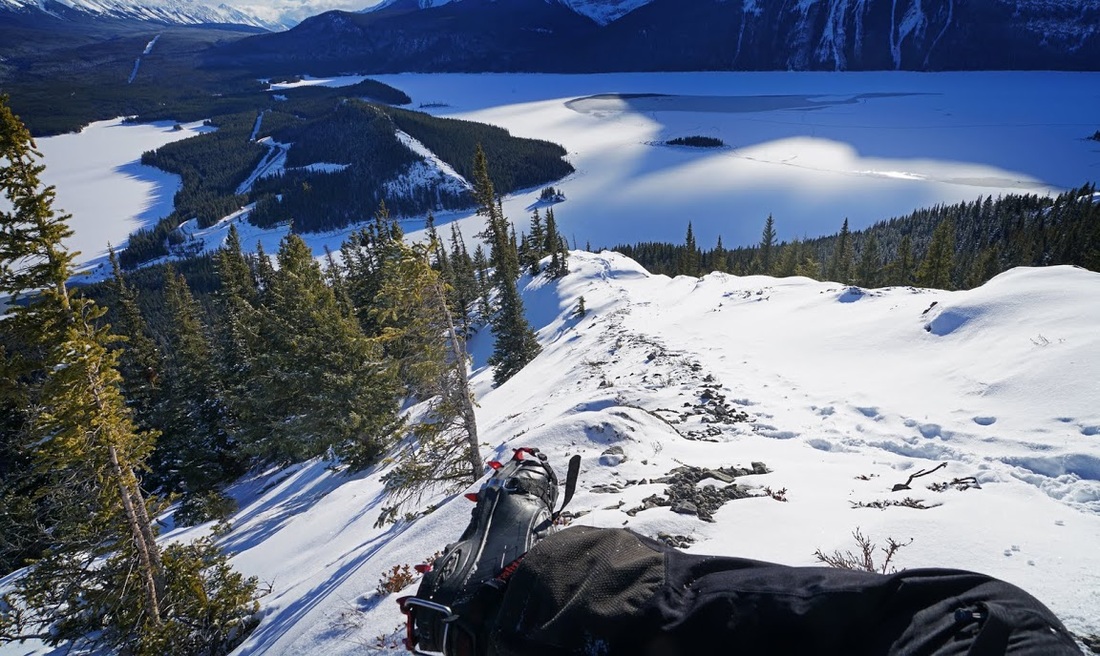
Taking in almost the entire view from my rocky seat shows just why I love this area so much, it is such a wonderful vista it defies adequate description. There are so many hikes just around the upper lake that you really could spend a week here and not see it all, when we leave Canada I will miss this place like no other.
Sitting still for the first time today really reminded me of just how cold it was, checking the temperature showed it had actually cooled to -17 up here and with the sun dipping it would soon get much cooler so I set out for the forest below and the trudge back to the truck.
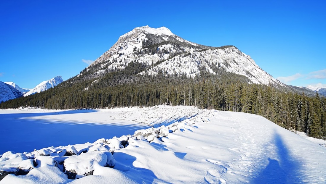
I could really feel the cold in the shaded forest as the sun got lower, and back at the truck which had now been in the shade for quite a while, it was down to -19, I didn't hang around much longer except to shoot one more image of that wonderful mountain.