Mt Lipsett - Summer
Date Walked: 16th September 2014
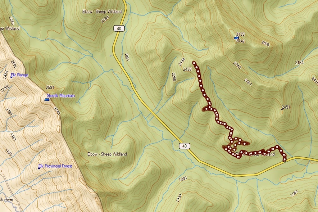
Distance: 8.2 miles (13.3km)
Actual Ascent: 2322 ft (708 m)
Time Taken: 5 hours
It seems like a lifetime since I ascended anything even remotely challenging, winter had dragged on forever, then I took a 3 week road trip down to the US. I followed this with a contract in the UK keeping me over there for 7 weeks and soon after my return I had minor surgery keeping me out of the mountains for 6 more weeks, so I find myself (with the summer almost over) and no hills to speak of under my belt.
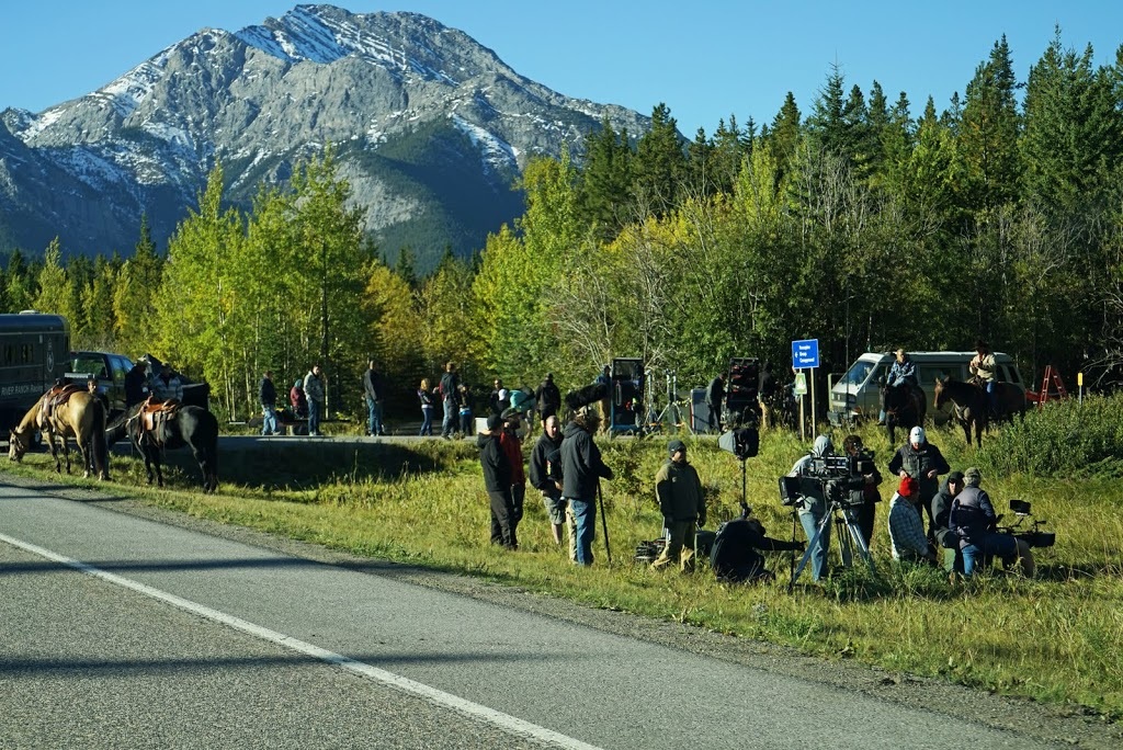
As I took highway 40 south from its junction with the Trans-Canada highway my first view was of a film crew who have been in the area a few weeks now, I don't know what they are shooting but it's a huge set up with loads of trucks, crew and traffic control which allowed me to steal a photo or two.
As I took highway 40 south from its junction with the Trans-Canada highway my first view was of a film crew who have been in the area a few weeks now, I don't know what they are shooting but it's a huge set up with loads of trucks, crew and traffic control which allowed me to steal a photo or two.
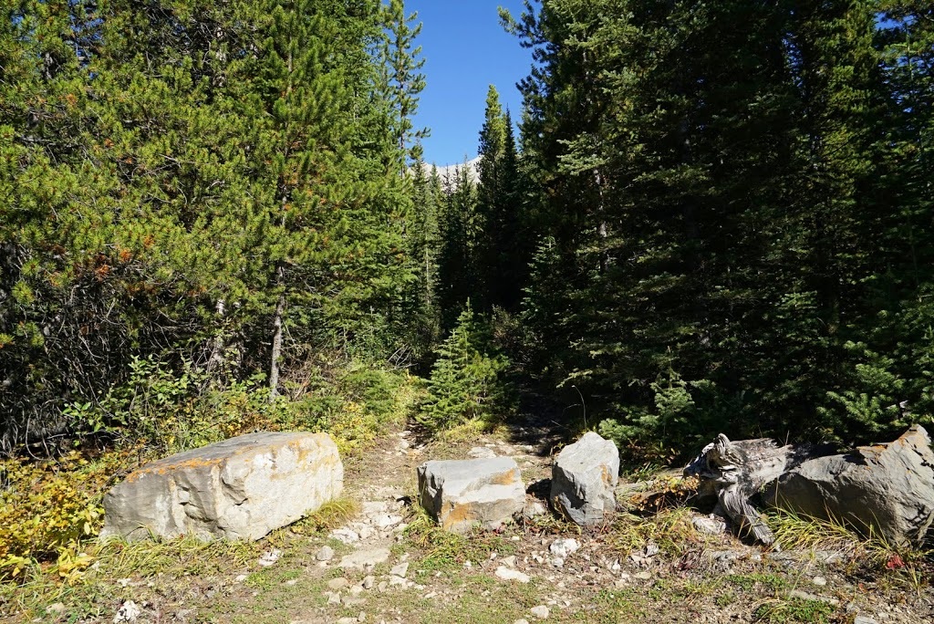
All references to this hike speak of parking on the verge beside the road, so I actually drove past this area thinking this can't be it. I only had a distance from Highwood Pass as a reference to the trailhead and I was scouring the treeline looking for an entrance blocked by boulders. I drove up and down a 1 km stretch of road 3 times before seeing it, set far back close to this freshly levelled 'car park'.
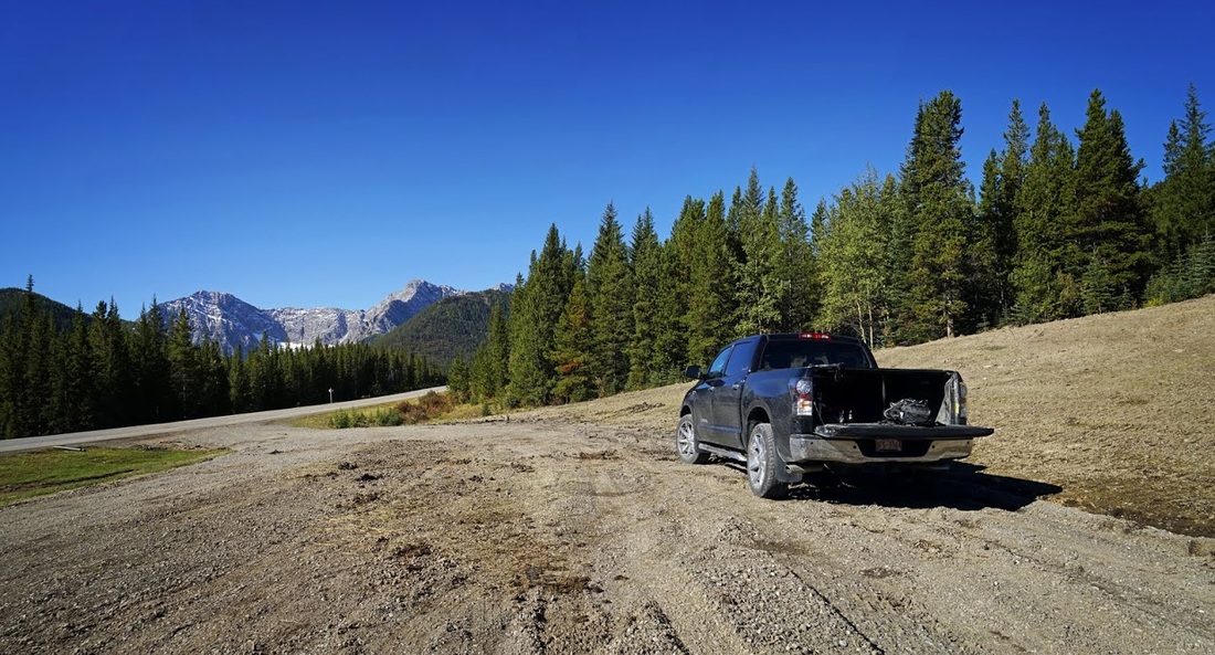
I think it is going to be a car park eventually but at the moment it must be under construction. As there was no sign of construction work and no signs to the contrary I parked up, got my gear together and set off toward the entrance.
For those seeking the entrance, it is 13.2 km south of Highwood Pass, it is set back from the road on a high lip and can just be seen with an attentive eye. My first thought on seeing the trail was............... bears, I screwed a bear banger to its firing mechanism and put it in an 'easy to get to' spot on my shoulder straps.
In its early stages the trail is a steep climb (for about 750 metres) and has an amount of deadfall to contend with along the way, this is followed by a further 750 metres of bog and deadfall combined making the first 1.5 km decidedly unimpressive.
Eventually the trail opens out to a wider old logging road that cuts a clear dry path as it zigzags up through the forest. There are signs of recent bear activity all along the trail (recent as in this week but not today) combined with the deep brush and its proximity to the trail I am sounding out some loud "YO BEAR" chants as I make my way along the easy climb.
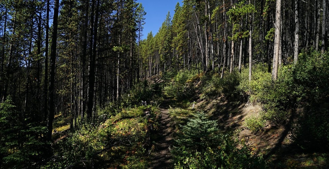
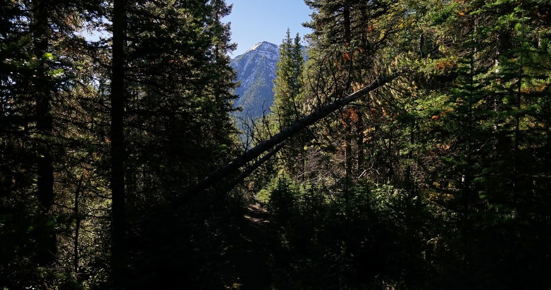
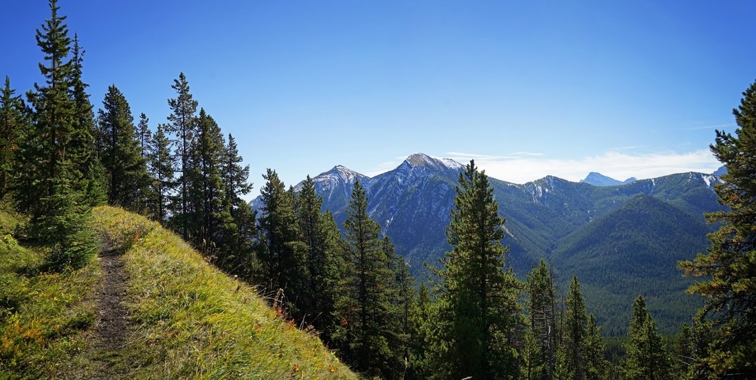
After that miserable opening 1.5 km there is a 4 km stretch of easy wandering along the dry logging trail as it ascends gently toward the target. There are few openings to provide a window to the world outside the forest but occasionally the elements combine sufficiently to cause me to stop and take out the camera.
It is a long (but not difficult) hike through the forest, climbing steadily until you begin to see more and more of your surroundings and less and less of the forest. With all the signs of bear activity it's nice to get out into the more open spaces.
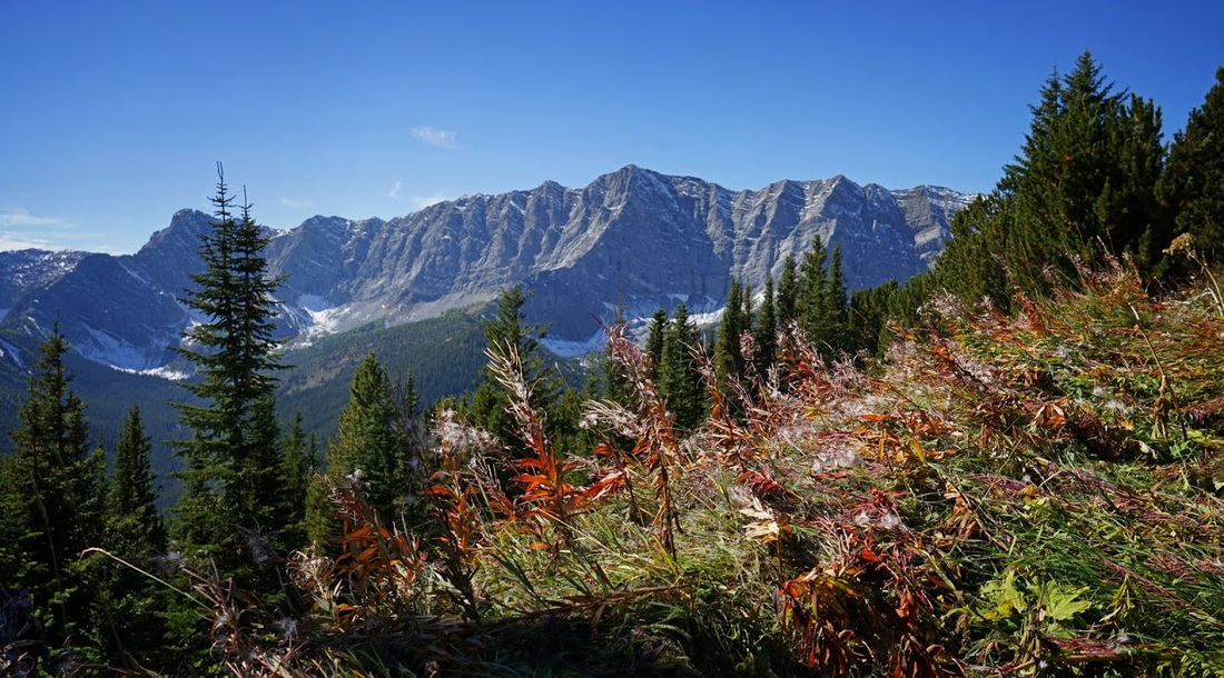
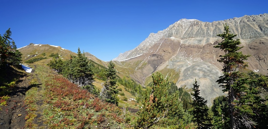
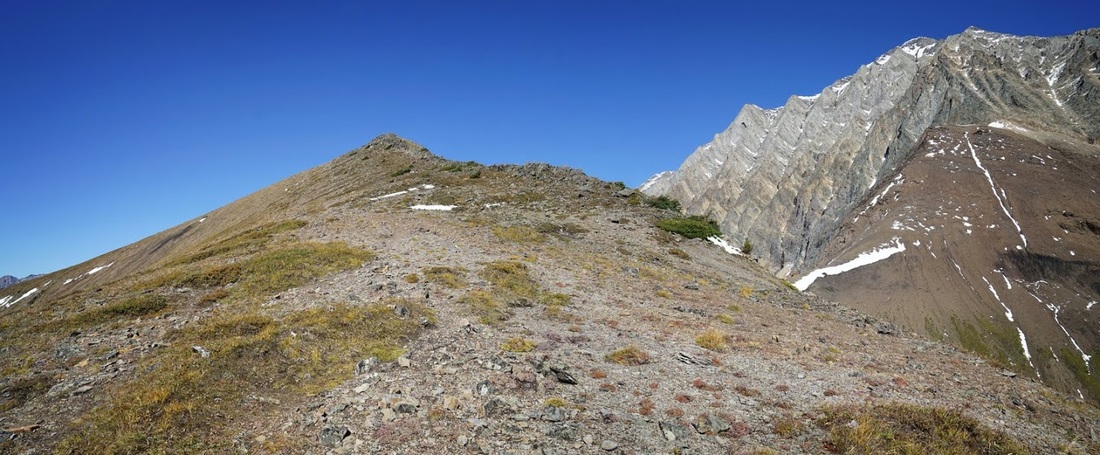
The huge vertical wall of rock dominating the skyline is the Elk Range which marks the continental divide and the geographic boundary between Alberta and British Columbia, the closest peak in the range is Storelk Mountain which spans the border between provinces directly opposite Mt Lipsett.
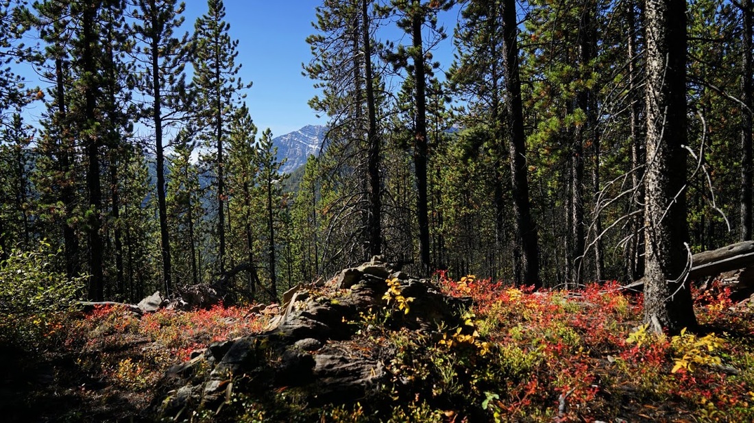
Out in the open the sun is beating down and the silly hat is required to prevent overheating, what a change from the deep snow last week. There are still very few signs of autumn out in the mountains but these few plants add a nice splash of colour to a beautiful scene.
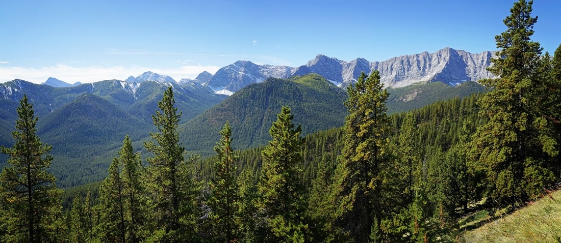
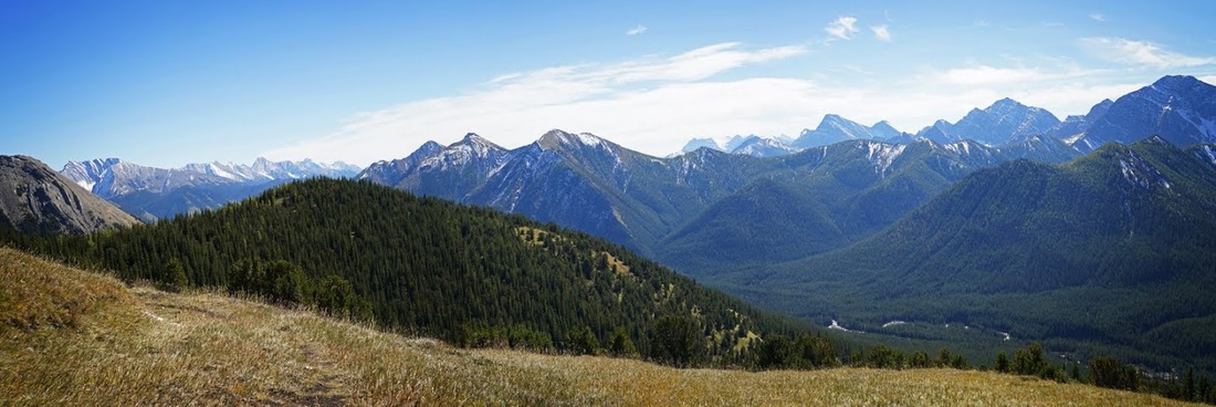
Breaking out of the trees I am surrounded by lush mountain meadows, no wonder there are signs of bear activity all the way up here, this is prime area for a grizzly and I find myself scanning the horizon frequently. Ahead I can see the lower end of the ridge that leads to the summit of Mt Lipsett though the distance is deceivingly shortened, there's still about 2 km to go (if you stick to the trail)
Looking back as I ascend a grassy trail circling a small knoll, I am struck once more by the incredible beauty of the Rocky Mountains. Peaks puncture the sky in all directions, too numerous to name, many are still just represented by numbers on a map.
All that very gentle ascent comes to a sudden end and I am now ascending at a good rate toward my target. To my right (east) is the enormous flank of Mist mountain reaching 10301 ft / 3140 m and overshadowing the 8399 ft / 2560 m summit of Mt Lipsett ahead.
Stopping to look back comes easy when you're blowing like a steam train, I have never got myself accustomed to the altitude around here and I've been here years now so I guess I'm not going to. I simply stop and take a breather and then move on again, I think it works out well as I get a lot of images to reflect on.
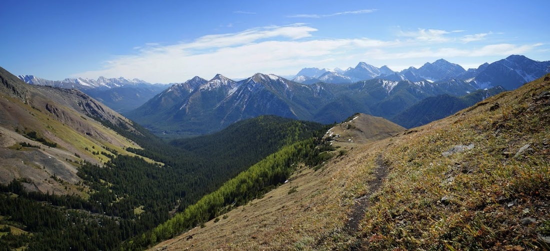
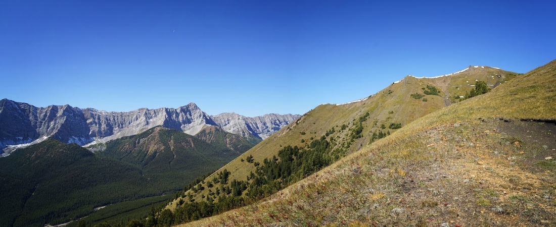
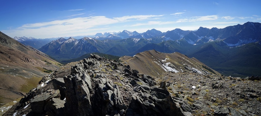
Now well clear of the forest section I find myself on an open ridge where a stiff breeze brings a welcome cooling. The ridge works away to the south in steps and the forested section can be seen lower down to the left of the grassy bulk.
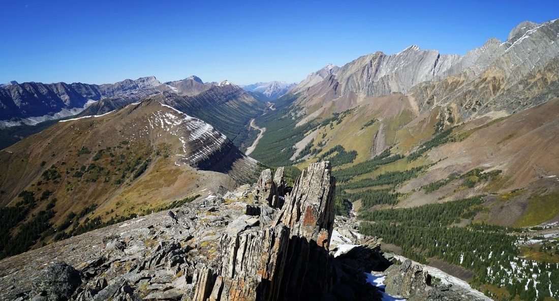
All that remains now is a steep ascent along a rocky ridgeline to the pinnacle like summit, again the photo doesn't adequately capture the distance remaining, I think the immense flank of Mist mountain may be spoiling the perspective.
The rocky ridge provides an excellent foreground for the photos, the vertical lumps are reminiscent of a dinosaur spine. The view along the ridge back down to the valley leads the eye right through the image from front right to rear left
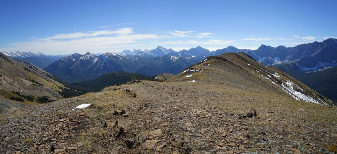
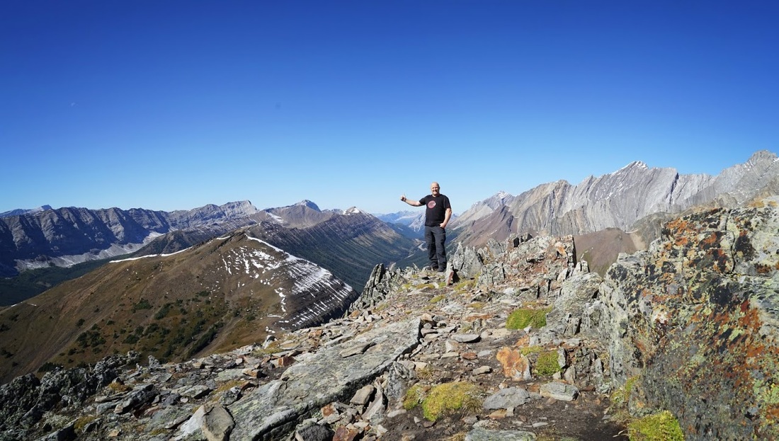
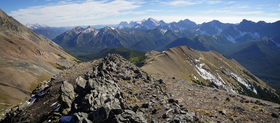
On reaching the summit the effort is rewarded as always with far reaching views across multiple mountain ranges, each one drawing the eye from summit to base and back again. The elk Range continues on the left of shot (west) providing a definitive demarcation between Alberta and British Columbia.
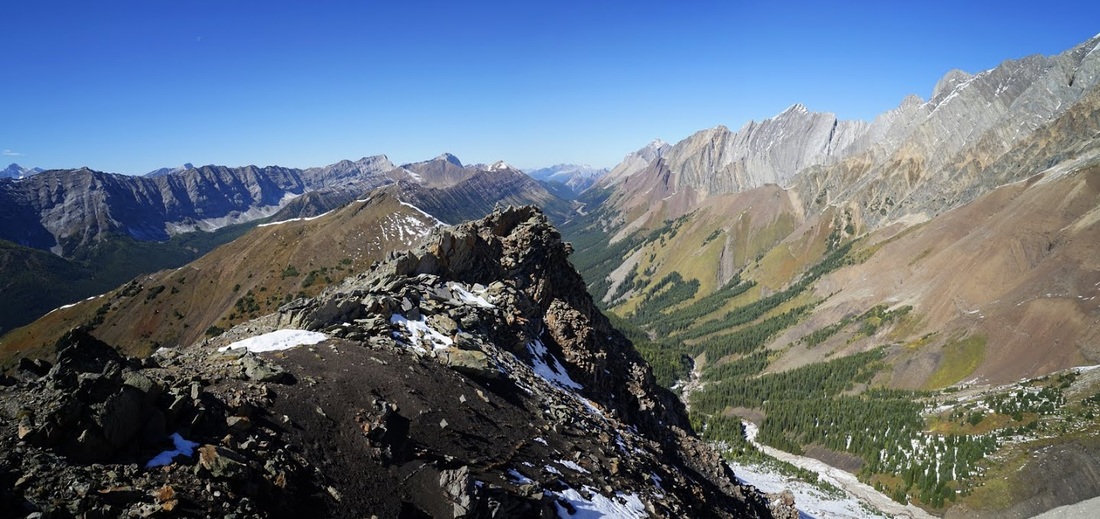
I take myself off to a rocky outcrop to grab the evidence shot, behind me and beneath my outstretched arm is Highwood Ridge which makes a horseshoe with Grizzly Ridge via Grizzly Peak, the valley between them is called Paradise Valley, that is just another hike to add to the list of 'I have to see that' places.
The view north from the summit, back along highway 40 is breathtaking. Mist mountain on the right (east) gives way to Mt Rea and then Elpoca mountain, staring right back at us down highway 40 is the aptly named Gap mountain, returning along the left of the highway is Pocaterra Ridge and Grizzly Peak leading to Highwood Ridge, all of which are overlooked by the Elk Range on the far left (west)
I took a well earned rest on the summit and had hot stew and bread rolls followed by fruit and a 15 minute sleep in the sunshine, what could be better. The return journey is simply a matter of retracing my steps along the dragons back, through the dense forest echoing my "YO BEAR" shouts throughout.
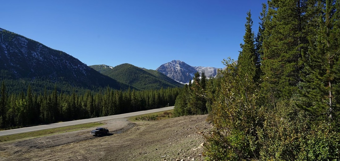
On the return I did chop off a little distance by dropping straight down through the forest instead of taking the overly extensive switchbacks along the initial climb. I ended the day sitting on the tailgate of my truck drinking tea in the evening sunshine.