Smutwood Peak
Date Walked: 22nd June 2015
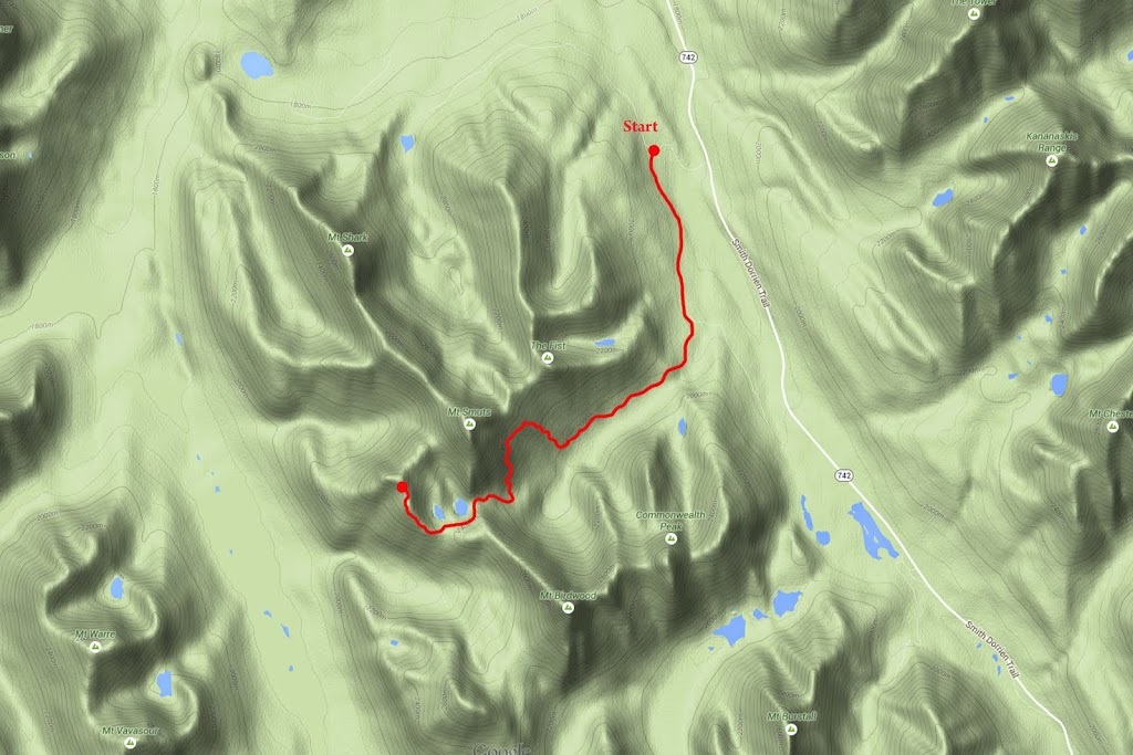
Distance: 11.7 miles (18.9km)
Actual Ascent: 3303 ft (1007 m)
Time Taken: 7.5 hours
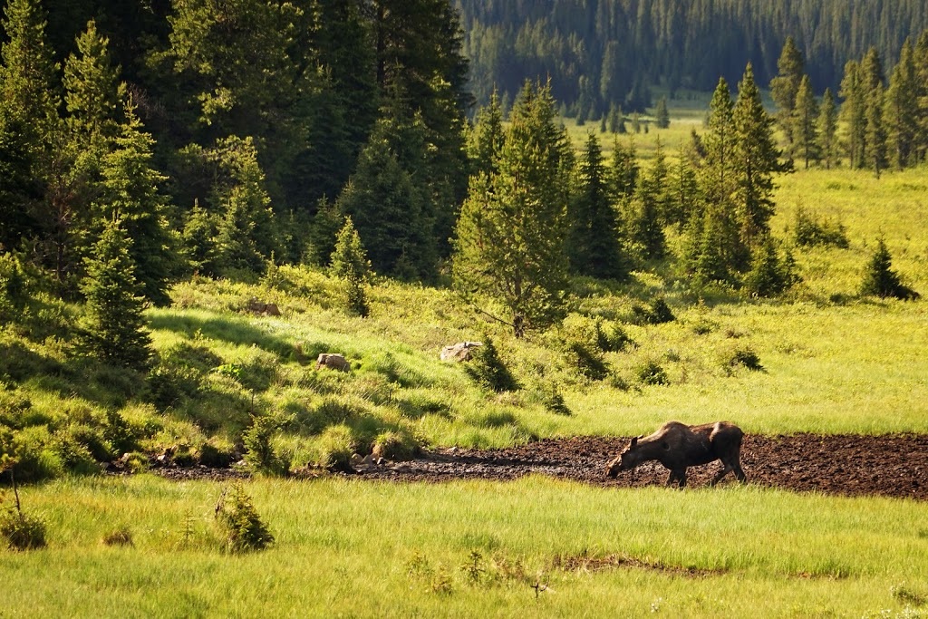
When I set out today I had no idea of just how fantastic a hike I was going to enjoy. I knew it would be long, I knew I was heading into the backcountry and more likely to meet wildlife, I just didn't know I was going to meet so much of the big stuff today. It all started as I turned onto Mount Shark road from highway 742 about 40km south of Canmore, this road has always been a favourite for wildlife and sure enough, just over the bridge I saw a moose enjoying the morning sun and some breakfast down in the wetlands south of the road.
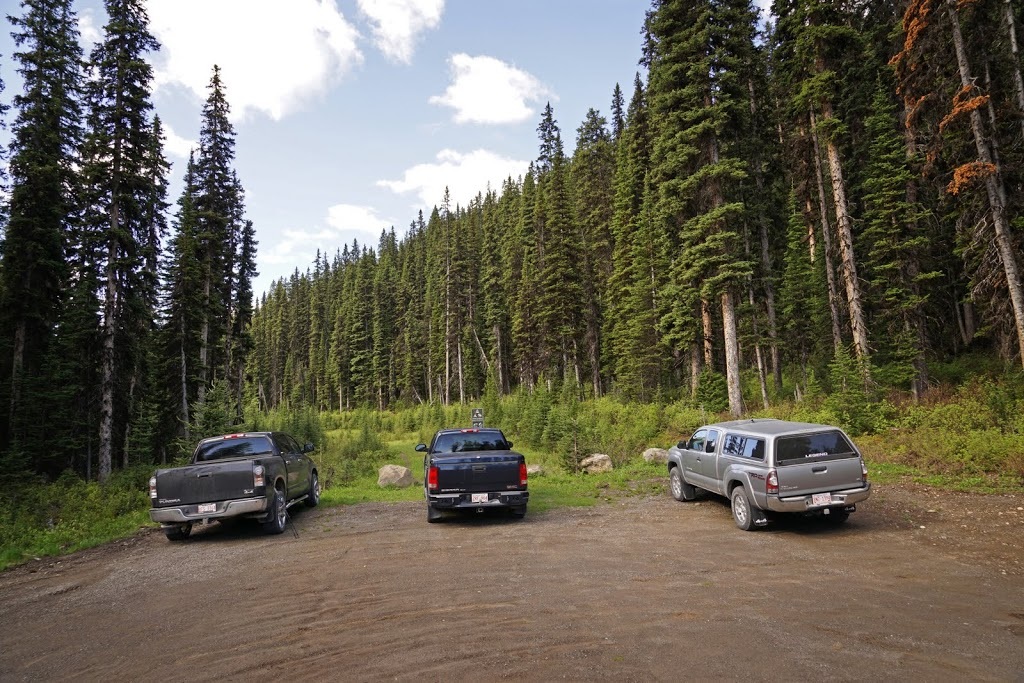
After stopping to grab a shot of the moose I continued the short distance to the trailhead parking area just 1km further on the left side of Mount Shark road. I was surprised to see 2 other vehicles already there but I guess if you are aiming for a long day an early start is a must.
Smutwood Peak is not in any of my guidebooks, nor are there any marked trails on my maps but whilst researching a hike to Birdwood Lakes I found reference to it online. The few write ups I found spoke of a 'long trudge' to wonderful views, the distance didn't bother me as I was already intending doing most of it to reach Birdwood Lakes so the extension was just a minor addition. So it was that I found myself in the car park just off Mount Shark road some 2 hours from home looking forward to a long day in the mountains.
Smutwood Peak is not in any of my guidebooks, nor are there any marked trails on my maps but whilst researching a hike to Birdwood Lakes I found reference to it online. The few write ups I found spoke of a 'long trudge' to wonderful views, the distance didn't bother me as I was already intending doing most of it to reach Birdwood Lakes so the extension was just a minor addition. So it was that I found myself in the car park just off Mount Shark road some 2 hours from home looking forward to a long day in the mountains.
I had been walking just a few hundred metres when two little bears came crashing out of the forest that flanks the trail on both sides and right behind them was mum. I stopped dead still as she grunted a command which saw the cubs darting back into the trees, I stood my ground and talked to her as I moved slowly to the far side of the trail, she in turn moved back to the forest edge and then sat down as if to say "OK, I'm staying right here" I kept talking and slowly walking forward and past the beautiful creature (bear spray and bear bangers in hand) I looked down as I spoke to her, to show I had no interest in her or her cubs (I actually had the camera screen flipped so I could look down and still keep her in sight)
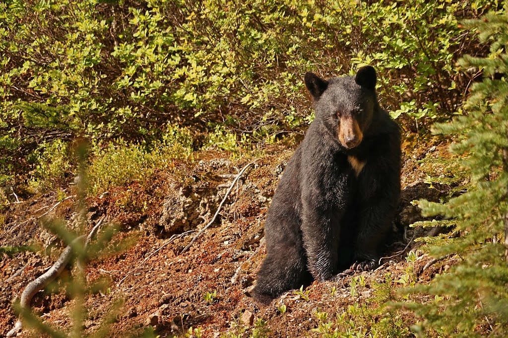
I got a couple of shots that weren't blurred to oblivion from the 10 or so I'd tried to get whilst walking (I didn't want to stop as it might appear as a challenge, walking just says I'm passing by) At this point I have the bear banger launch tool and the camera in one hand and the bear spray in the other, I'm lucky I got a shot at all.
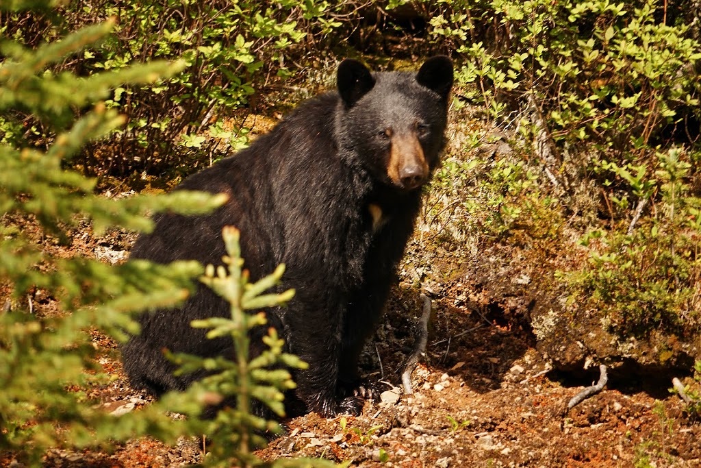
The bear just watched me pass by and then got up and started eating the grasses around her as I kept on walking, I really wish I'd got a shot of those cubs though. Soon I'd covered the 3km or so that brings me to a fork in the trail marked by a small cairn, a right turn here toward Commonwealth Peak standing tall in the distance sets me on the way.
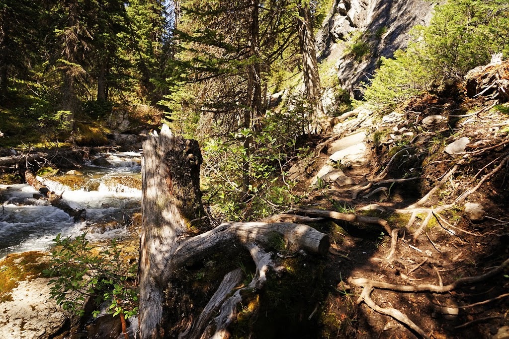
A short section of sparse trees is soon followed by a step into a very dark and dense forest where there is such a smell of bear I find myself scouring every inch. The smell is unforgettable and once known it sets the mind and body on full alert at the slightest whiff, and this wasn't a whiff this was as if I was standing right next to another bear. I looked all around and back to the sparse area just beyond the treeline but saw nothing so carried on with plenty of "Yo Bear" shouts echoing out.
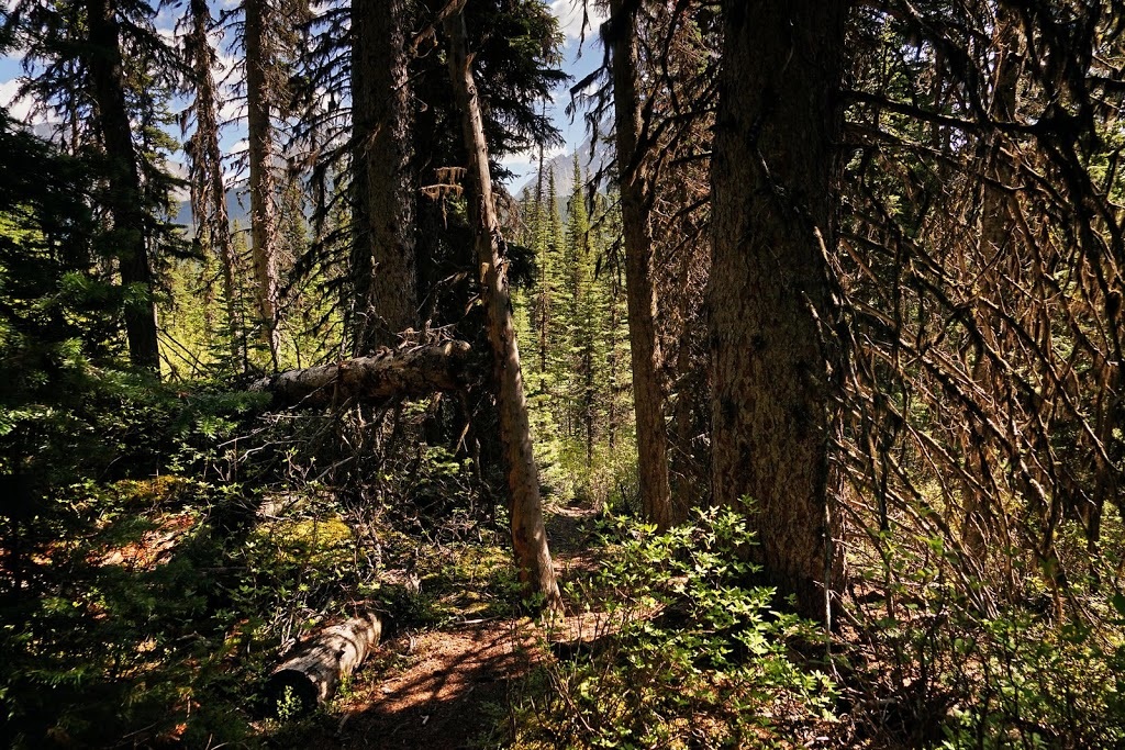
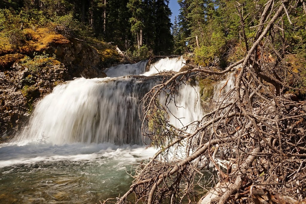
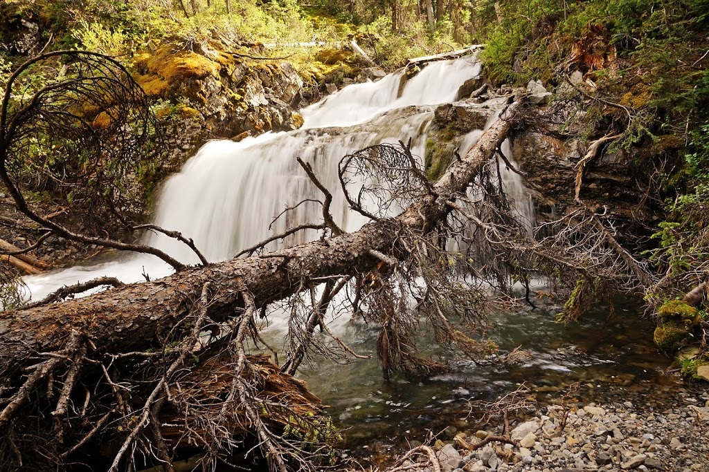
The trees really are dense and the narrow unmaintained trail sweeps left and right hiding everything but the very closest object, I can hear a waterfall ahead and it's nice to drop down off the trail to the more open space beside it and take a moment to grab a few shots (looking over my shoulder frequently as I do)
There is a nice enjoyable section of trail for the next km or so, meandering beside the stream with a rock wall on one side and the stream on the other I can actually see a little way ahead so I can stop the "Yo Bear" shouts for a while.
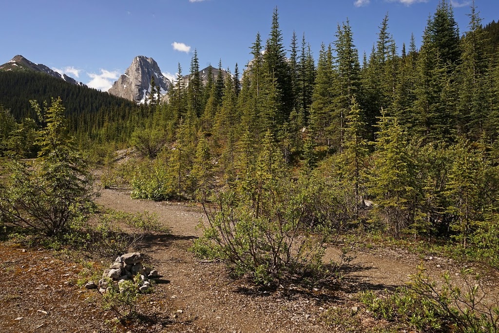
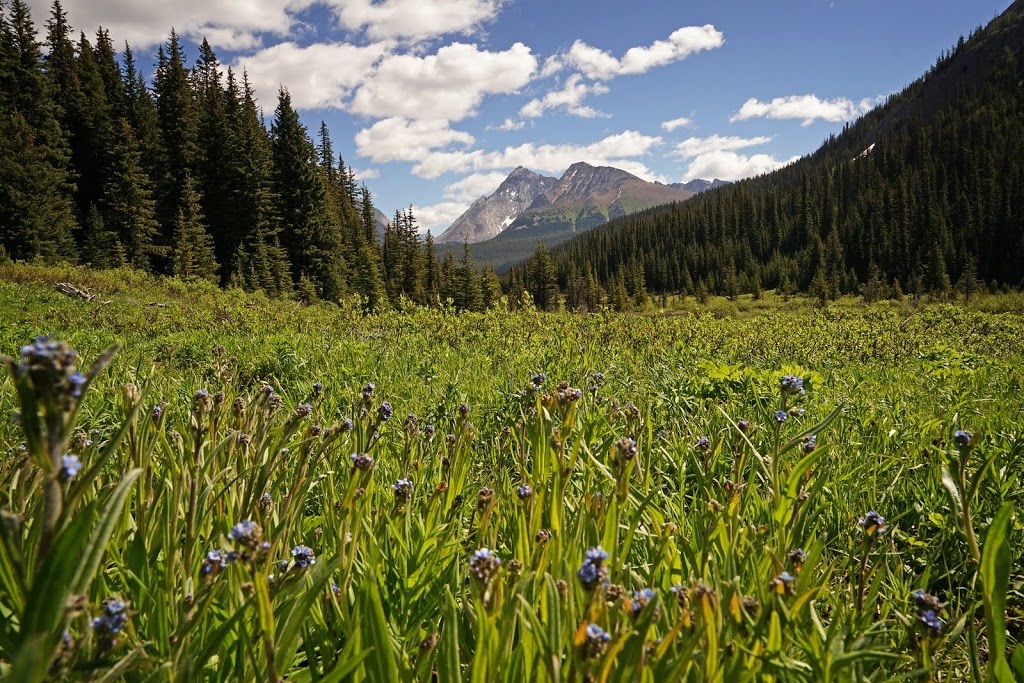
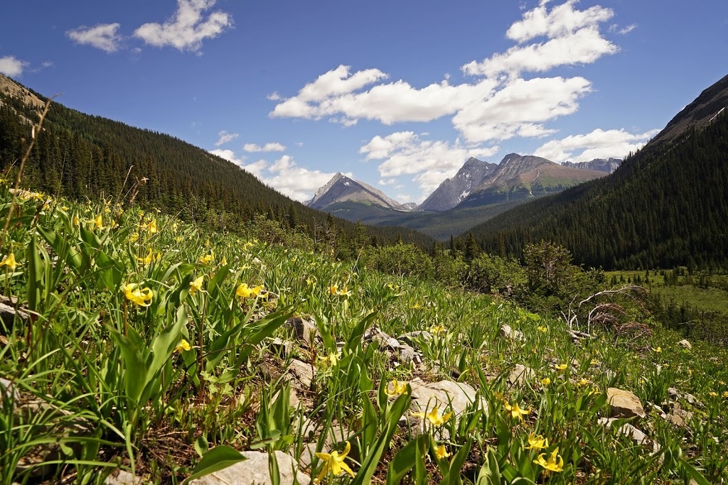
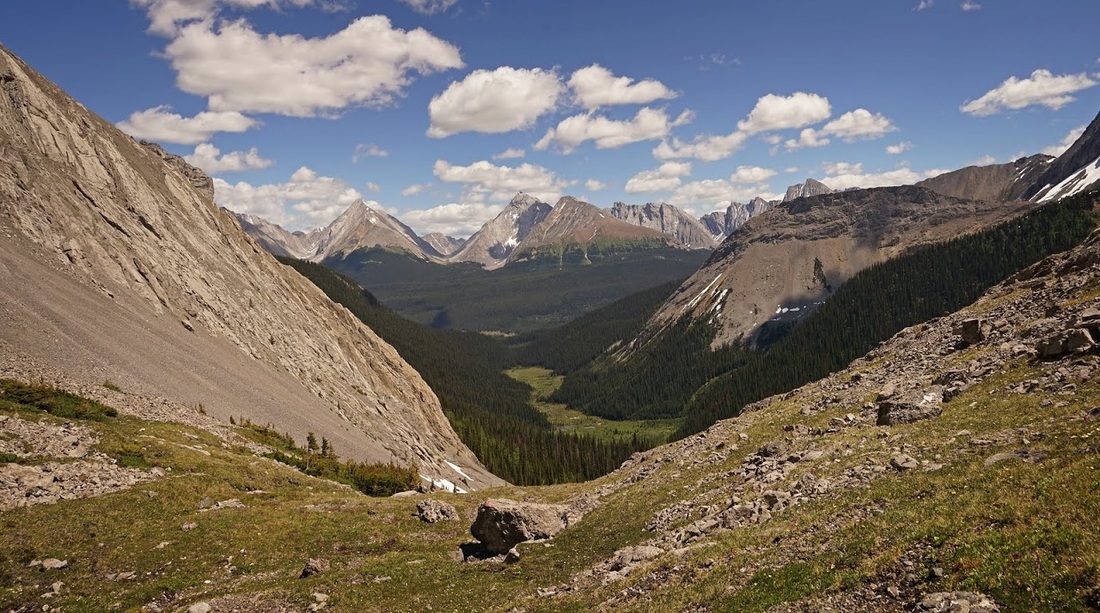
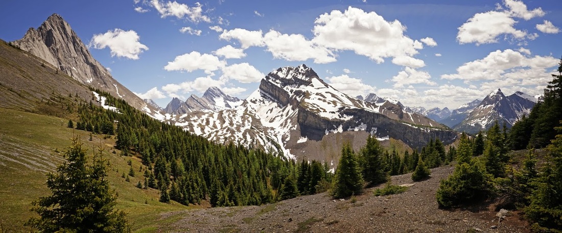
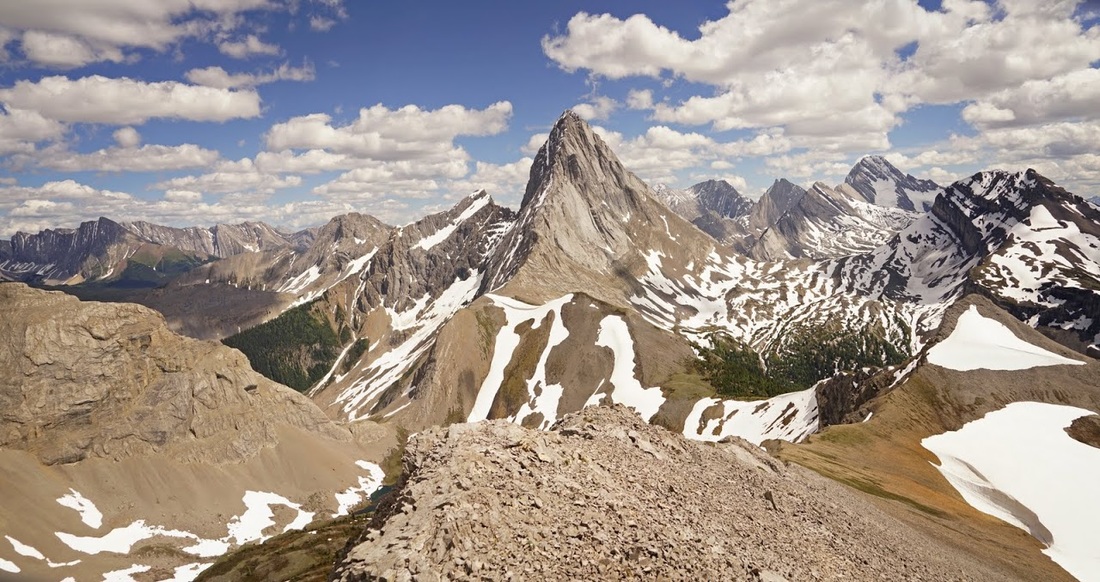
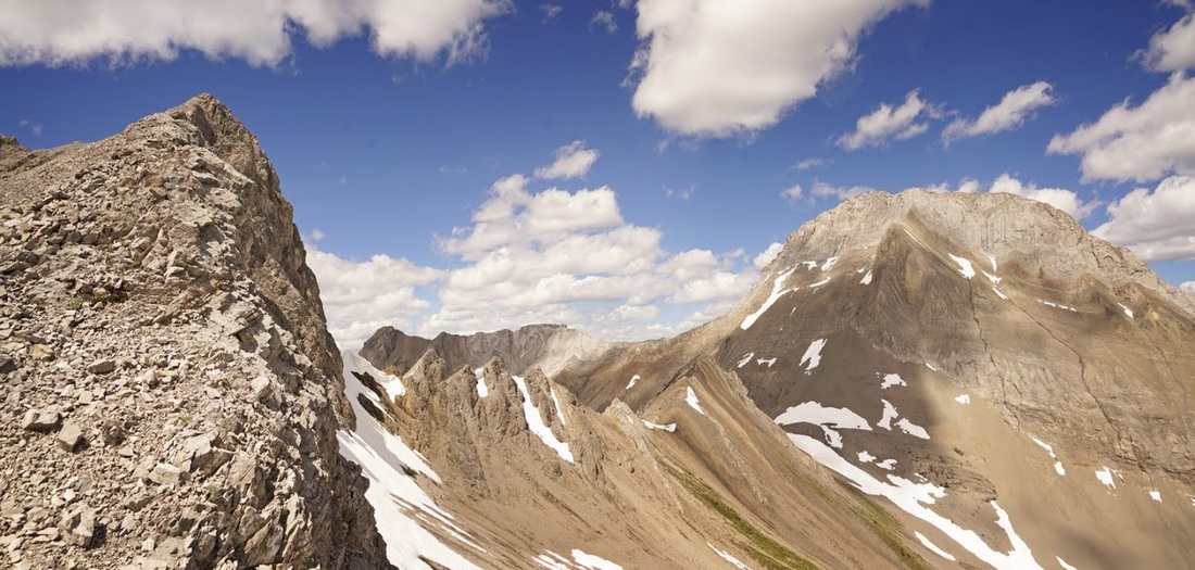
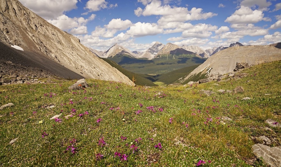
After a short time another twisting tight forested trail restarts the "Yo Bear" shouts until I exit into a lush deep meadow, so packed with vegetation that the trial doesn't even show up on camera. Close scrutiny shows a very narrow trail up the centre of the frame here. The mountains ahead are familiar to me now albeit from a different angle to this. On the left is the Pig's Back which I hiked last year then the long flanks of Mt Birdwood towering on the horizon, next right is Mt Smuts and the lump on the far right is The Fist.
It's a beautiful meadow to walk across, very level easy going with the morning sun really heating up and the buzz and ziiip of insects filling the air as the shallow water of Commonwealth Creek slips silently by.
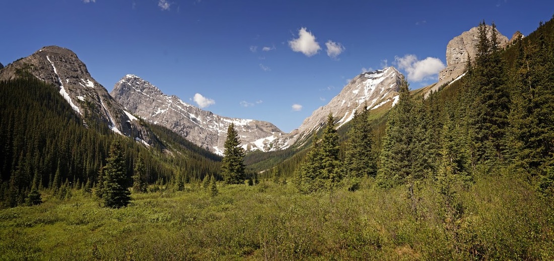
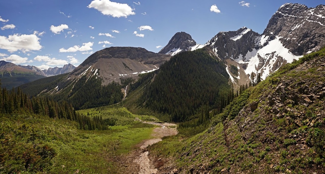
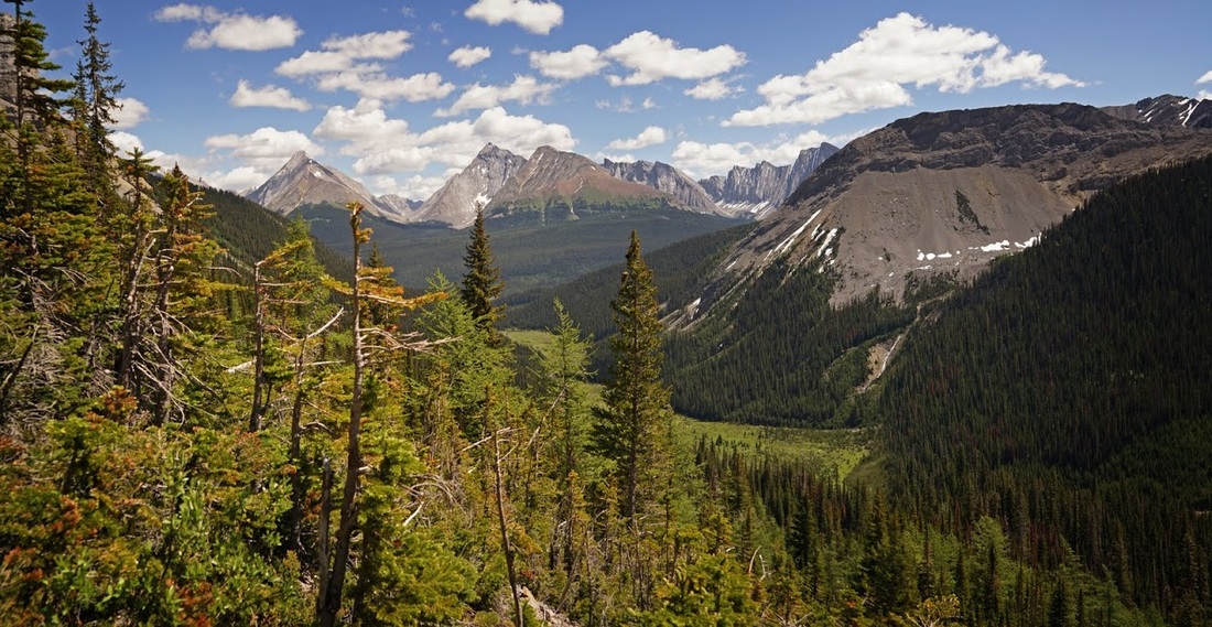
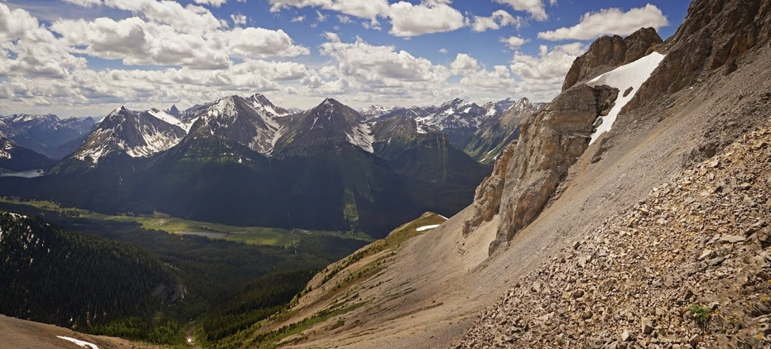
The valley hike is dense forest interspersed with long open meadows, each has it's own crop of wildflowers and lush deep vegetation that rustles as I swing my boots past on the narrow trail. Looking back to the Kananaskis Range shows how quickly I've covered the ground across the valley.
The trail finally begins to ascend beside a small watershed running off the south face of Mt Smuts, the ground is blanketed by yellow Glacier Lilies that demand to be photographed. As I turn to continue I see a small snow bridge across the flowing stream and just two steps in I crash through into the stream below, my ranting as I drag myself out breaks the wonderful silence of the valley.
Here is where I made an assumption that cost me a lot of work on the day, I looked upstream for a crossing point and saw people much further ahead, I assumed they knew a way that went up and across the creek so followed them on the ascent. It was hard going but it's the first real ascent of the day so I ploughed on meeting up with the last of the four people in a string heading up. I ask if he's going to Birdwood Lakes which he says they are, so I say "is there a crossing point up top", he says "you don't need to cross over the creek, Birdwood is over there" (pointing in a northerly direction between The Fist and Mt Smuts)
I tried the usual diplomatic approach with "oh, I thought it was over there" (pointing west to the gap between Birdwood and Mt Smuts) but the guy says not, his friend who is out in front has "been here loads of times". I decided to continue the diplomacy and just say "oh we must be going to different places, I'm going to head this way" and with that I pick my way across the narrow stream and set into the worst bushwhacking I've ever had to do.
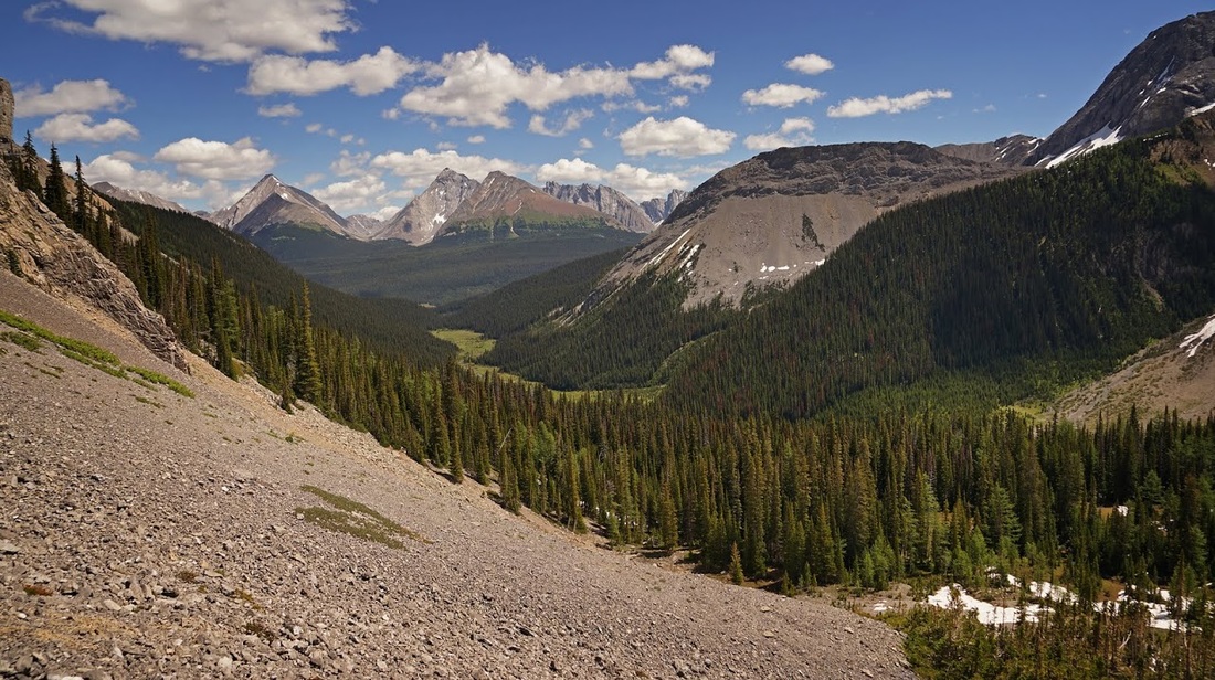
I'd only ascended about 300 metres but I didn't want to lose that ascent so I bushwhacked a hideous loose slope covered in dense forest which at times was almost impassable, to make matters worse I eventually had to drop down about 200 metres to go around the southern end of Mt Smuts. When I did get around it I was greeted by a steep, untrodden scree slope that had me blowing all the way to the top.
The slope tops out on a stepped terminal moraine which I really enjoyed (maybe because I was off that damn scree) Each level of the moraine is covered in a neat carpet of grass and wildflowers, there are ground squirrels everywhere and, more worryingly, fresh bear scrapes. Luckily there was no sign of a bear and I could take a moment to have a sit down and get my breath back looking back over the route so far.
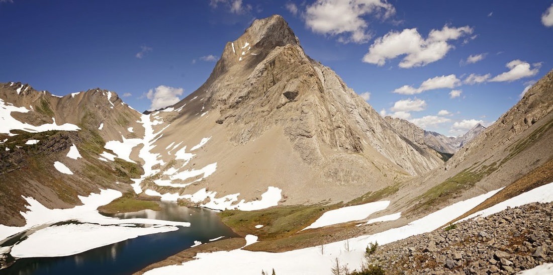
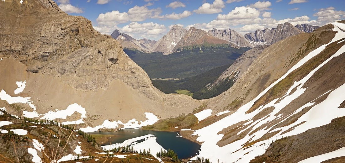
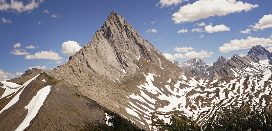
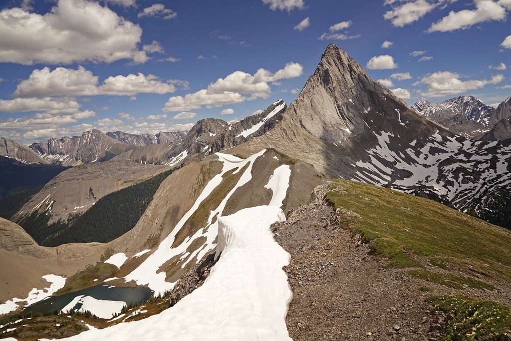
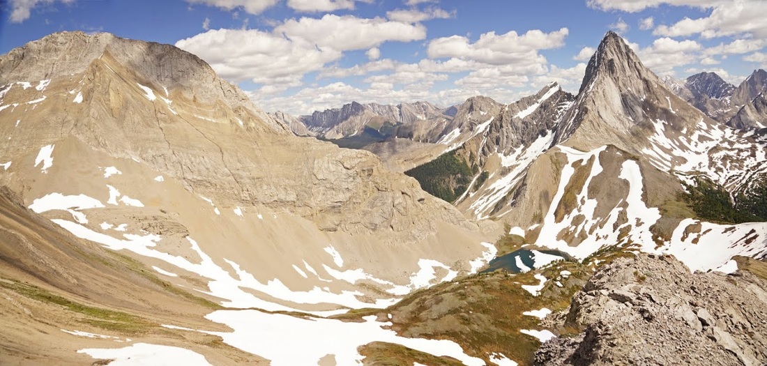
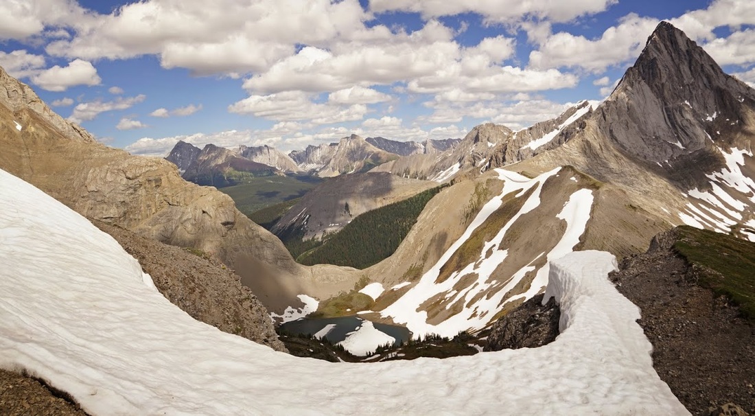
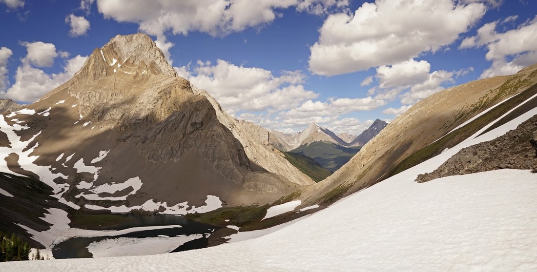
As I restart the journey I go over a small hump and get my first view of the first of two Birdwood lakes, the second sits behind the low centre ridge. There is a long waterfall cascading down into the corner of lake from the remaining snow melt and across to the far side is the ridge I am heading for. The centre bump is a 'false summit', the peak to the right is Smutwood Peak.
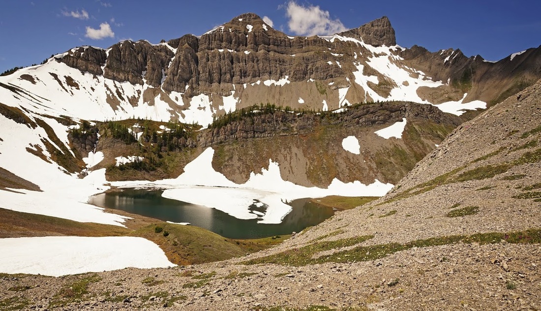
There is now a narrow trail through the scree slopes on the southern side of the lake which I take to make my way to the ridge, the snow is much deeper and more problematic than the images might suggest which ultimately results in those annoying 'sink to the thigh' events as you go but the view of Mt Smuts with Birdwood Lake in front makes it worth every step.
As I reach yet another thigh buster and plough my way through I am surprised to see the second of the two lakes still frozen and wearing a blanket of snow over the ice, there are a couple of melted spots that show an incredibly vibrant blue colour not captured by the camera.
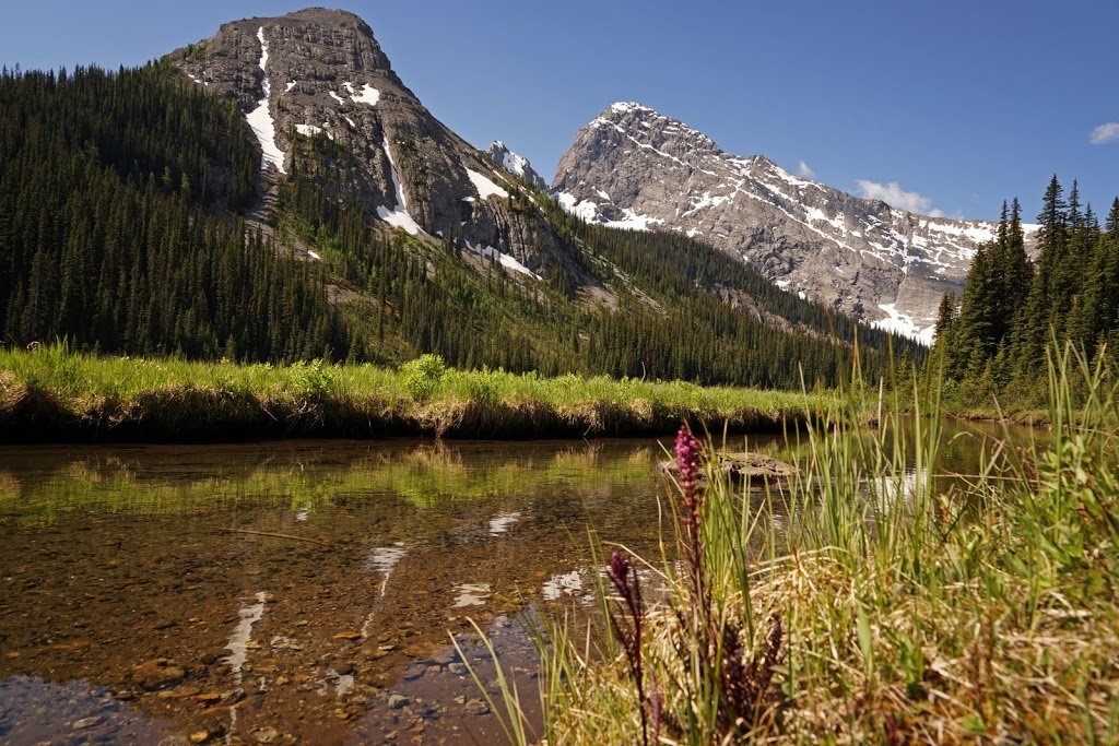
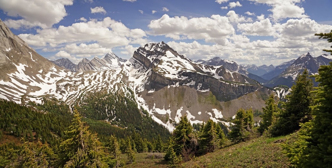
Off the scree slope and out onto the low southern end of the ridge I'm treated to a view over the top where the rear of Snow Peak is a real surprise to me as from the front it is a pointed as a pyramid but from here it's a long slope with a sheer vertical wall. I can also see Mt Sir Douglas who's watershed falls into both Alberta and British Columbia and Whistling Rock Peak all of which are familier to me from my jaunts up Burstall Pass (which is just beyond Snow Peak).
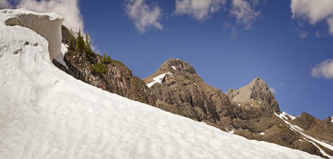
As I begin the ascent of the ridge toward my target I'm tempted to take to the snow as the rock is so loose and weak it simply falls away underfoot or in my hand as I attempt the scramble, but the cornice hanging over a sheer drop keeps me well away from the snow, just in case.
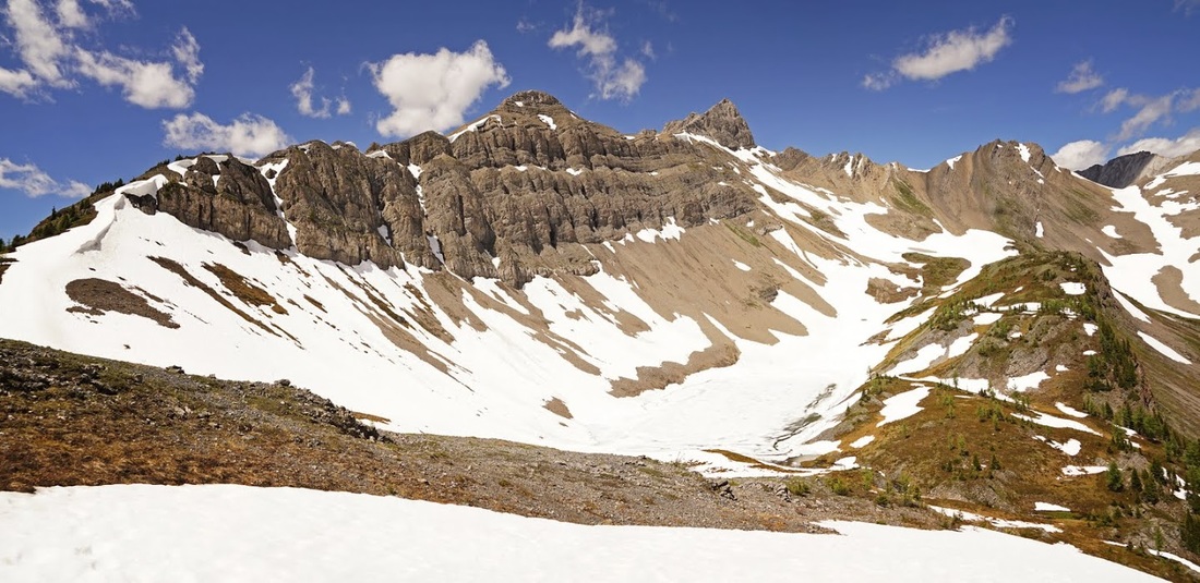
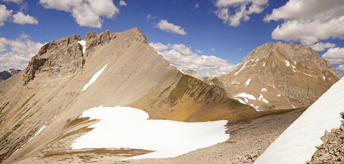
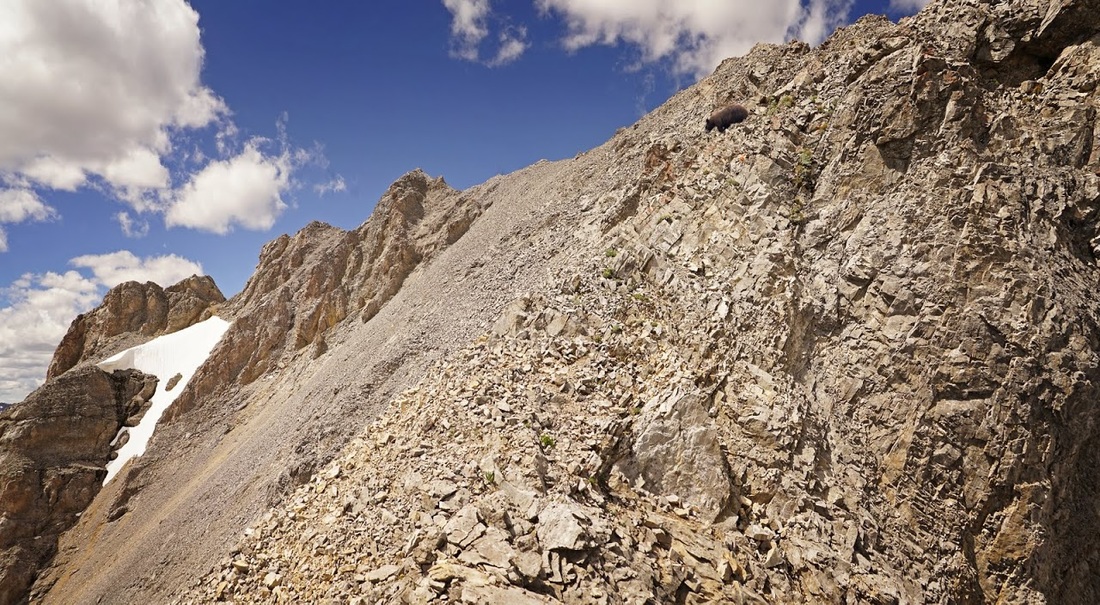
As I scramble (perhaps that should be scrabble) my way up the ridge I can now see over Snow Peak and onto Belgium Lake which is overlooked by Mt Queen Elizabeth and Mt King Albert marking the Alberta/British Columbia boundary. The ridge climbs in steep and sometimes sheer rock bands (as seen below) that are comprised of loose broken limestone which is hell to scramble on as it gives way without warning frequently.
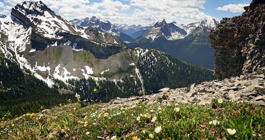
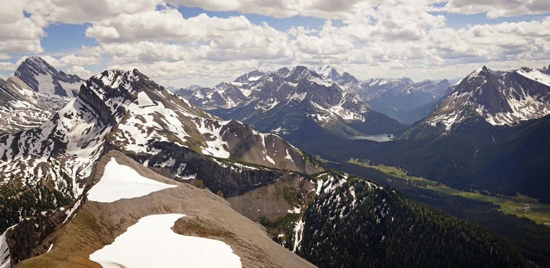
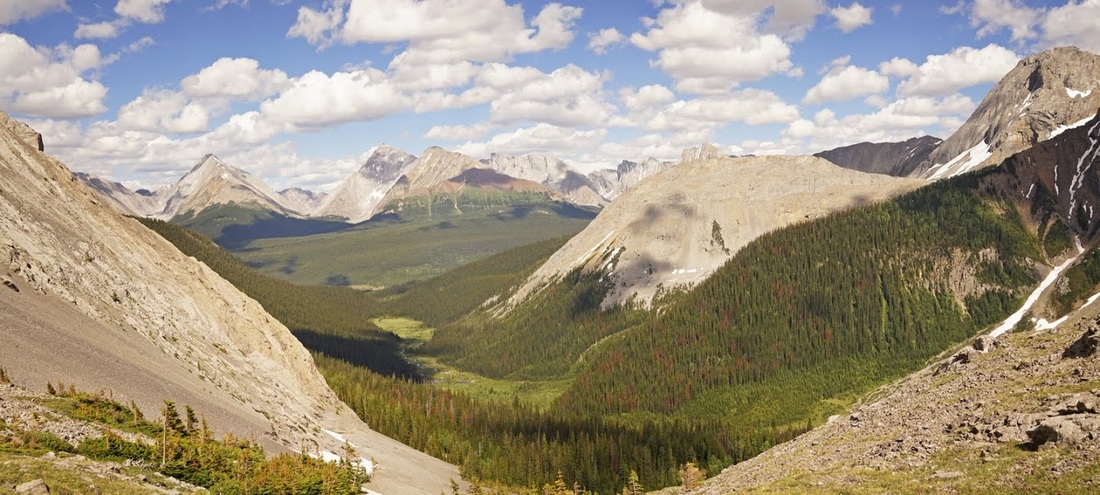
Once over a rock band the ridge tends to be made of loose rock with patches of nice meadow grass sloping away until they turn into vast scree slopes that fall the entire way to the valley below. To the east I can see over Birdwood Lakes and the terminal moraine to the entrance valley and the Kananaskis Range beyond the highway.
Even from up on the ridge and comfortably above 8000 feet the gigantic frame of Mt Birdwood still towers above me, it's 10160 foot summit pierces the sky and dominates the frame to the south.
There's more scrambling along the ridge on the broken limestone occasionally helped by a lush alpine meadow but even then there are spots that are impossible to scramble up, one in particular requires a long diversion to go around including some loss of height previously gained.
I find another rest spot along the short meadow toward the false summit in the middle of the ridge, the view is truly magnificent and helped by the snow that remains in the cracks and gullies along the mountainsides.
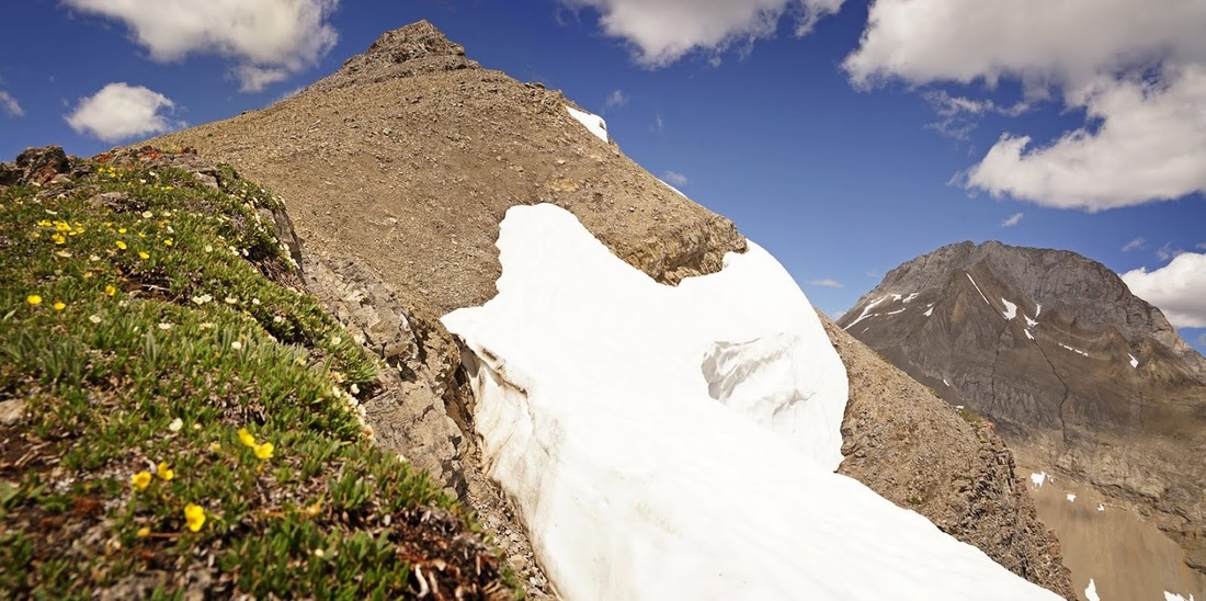
After the false summit (which is hell to negotiate with 'fall away' scree covering the entire thing) I get my opening view of the final ascent. A narrow trail is visible higher up so perhaps this might be a little easier to negotiate, but first there's a nice steady wander down and across to the ridge.
I stopped on the grassy edge for an orange and rest before taking on the final ascent which is a straightforward scree plod that offers the most incredible views back over the lakes and beyond.
The fall away to the west side of the ridge shouldn't be underestimated here, the scree is loose and moves easily and often as I make the traverse and I'm pretty sure I would pick up some speed quickly if I lost control on here.
The continued careful plod has soon lifted me high above the false summit of the ridge and almost to the level of Snow Peak beyond though not quite, Snow Peak is 9400 feet, Smutwood is 8900 feet. Smutwood actually takes it's name from a combination of Mt Birdwood and Mt Smuts, though the name remains unofficial it is the only name for this particular peak.
As I get higher and higher even Mt Birdwood seems a little less dominating though I wouldn't fancy taking on that 'shark fin' like lump of rock...well not today anyway.
Mt Smuts looks like it might be achievable from the north ridge though a mountain will often look benign from a distance only to bare its teeth up close, a bit like this damn brittle ridge and it's constantly collapsing shale rock formation which makes what should be a nice hike into a more challenging focussed scramble.
As I scramble around a shale corner just a hundred metres or less from the summit I see a good sized brown bear making a descent, I can't believe it for a moment and I just stand staring until it clicks in my head that I have nowhere to go, I'm heading up and he's heading down on the same narrow ridge. It would be no good scaring him as the ridge is a dead end so he has nowhere to go, scaring him might make him aggressive. I decide to turn around and make some hasty steps back down the ridge.
I make some pretty big steps as I descend slipping and sliding along the scree to the grassy section of ridge then back over the false summit where I look back to see the bear descending the main summit about 2/3 of the way down, I rush to the rock bands where I decide it would be smart to avoid the 'go around' and save time by scrambling down a steep crumbling rock face, the inevitable fall that followed only cost a little skin here and there as well as a few bruised bits but it did put some real space between me and the bear.
When I got back to the lowest end of the ridge I was able to relax knowing I could scare the bear off down the forested slopes if need be though I didn't hang around to test the theory
I ploughed through some of the smaller snow patches and enjoyed a glissade on others to put even more space between me and the bear that didn't even know I was there.
I kept constantly moving until I was back on the top of the terminal moraine even though there had been no sign of the bear for some time, I think I saw him dropping down the south side of the ridge in the trees but decided to keep moving until I had real open space between us, then at last I stopped to get my breath back and for a bit of lunch
As I had no idea where the trial was beneath the moraine and there was no indication from up here I decided to just pick a line and plough through the forest below until I either found it or hit the open meadow
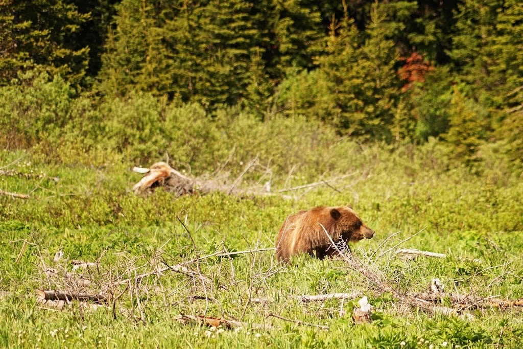
The plan worked solidly and I made a rapid descent into the forest and after a bit of bushwhacking (which is always easy going downhill) I appeared at the other side where I found a neat little trail running back toward the start point, but as I hit the first open meadow I saw a large bear mowing the grass in the distance....right beside the narrow trail I was on.
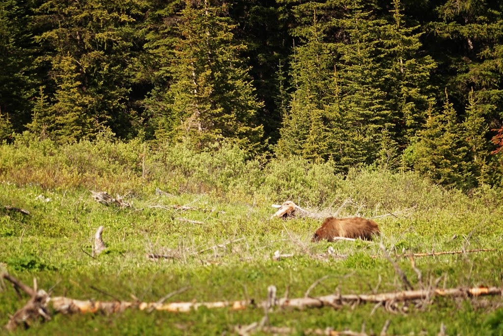
I shouted, and shouted and shouted some more to try and get the attention of the young grizzly that was far too busy enjoying the grass and flowers of the meadow. Eventually I stood up on a stump and waved both arms in the air while shouting which finally did the trick but only because he'd looked up to seek out more flowers and caught the movement. Once he'd seen me he just looked away and got right back to eating.
It was nice to see him so calm about it and I made my way forward always talking to him and taking a very wide half circle off the trail and around him, giving him lots of space and chattering away to ensure I didn't appear to be 'sneaking' around.
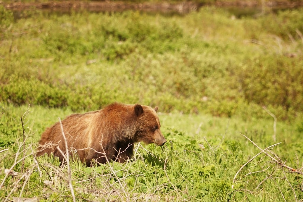
Don't think this is just a nonchalant affair, I assure you it isn't but bears don't respond well to panic so a calm demeanour whilst carrying your bear spray (safety off) and bear banger (in the launcher and cocked) is the only real option. I needed to be past him and made sure he knew I was there and non threatening. It did make me laugh when he started sniffing the air in big deep intakes over and over as I crossed upwind....I said out loud "well I've been walking all day....and it's hot....y'know" I'm pretty sure that's why he's smiling in this next shot.
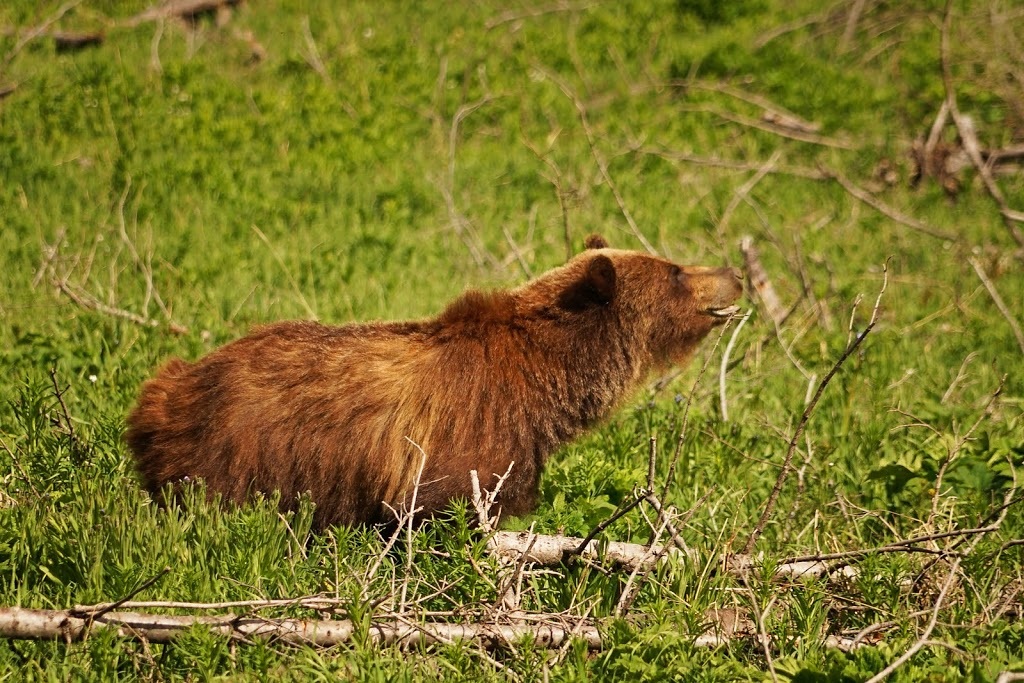
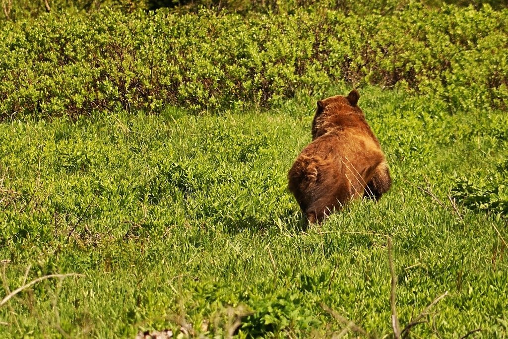
As I passed and got behind him he trotted off deeper into the meadow and soon disappeared into the bearberry bushes that are plentiful around here, I was going to say it might be best to avoid this area in autumn when the bears are feeding up for hibernation but to be honest it might be best avoided now too!!
After clearing the meadow I Yo Bear'd it back through the dense forest with massively heightened senses, I could hear every twig snap, every rustle in the undergrowth and even the light dancing of a dried leaf skipping across the floor, it was actually pretty cool to be so aware of so much. By the time I reached the waterfall I was ready to sit a while and unwind.
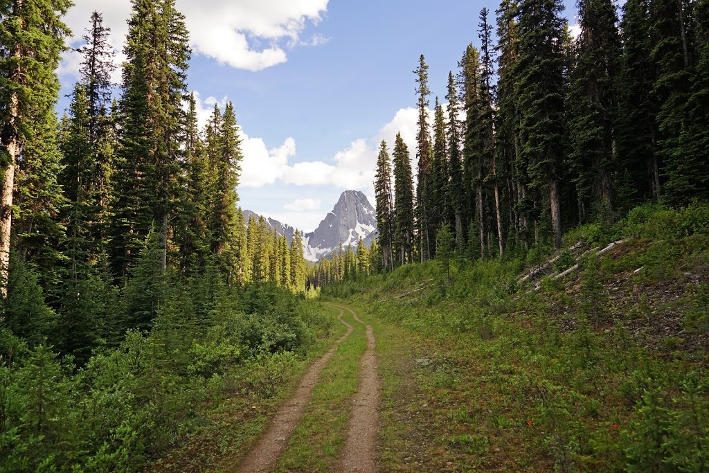
Breaking out to the seemingly 'super wide' trail that leads back to the trailhead felt fantastic, it had been one hell of a hike and even though I was prevented from making the summit I did get to see most of the views, maybe I'll come back one day but I doubt it there's a few too many bears around here and plenty of other mountains to go at.
The hike would have about 200m less ascent and maybe 2km less distance without my erroneous 'hump' seen in the map below, it really is a wonderful hike but the ridge is not for the faint hearted nor is it for the unskilled. This is a real backcountry hike, not one for the family but if you like adventure this one should keep you going.