Stanley Glacier - Kootenay National Park - British Columbia
Date Walked: 19th October 2014
Distance: 7.3 miles (9.8km)
Actual Ascent: 1814 ft (553m)
Time Taken: 3.5 hours
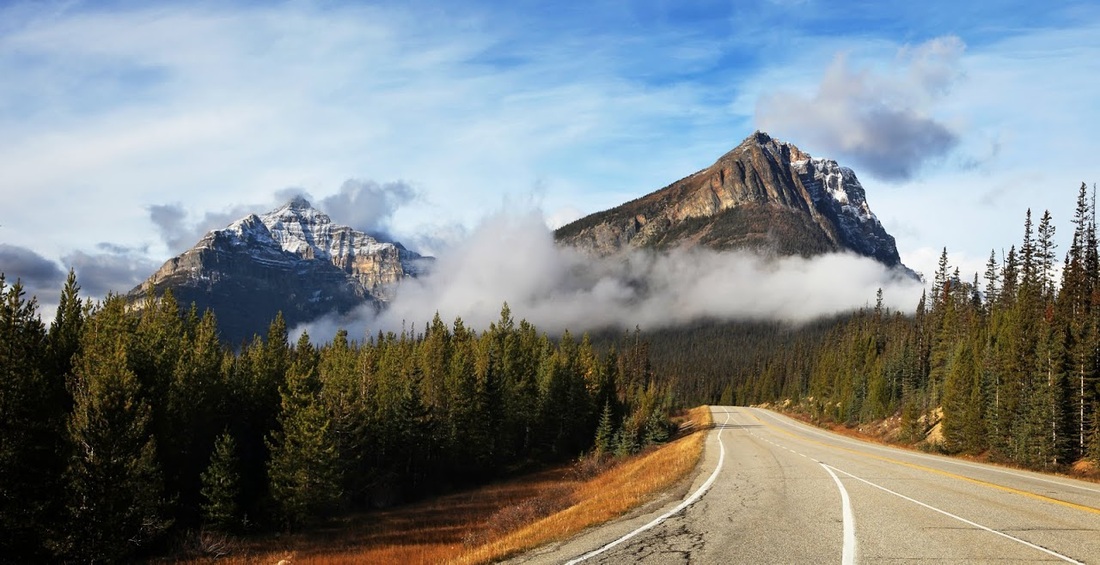
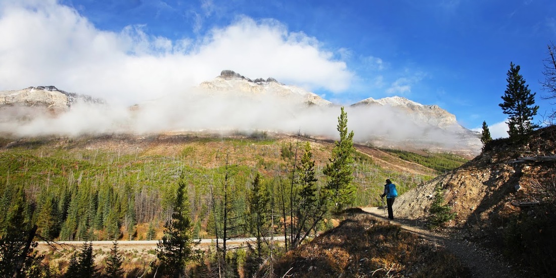
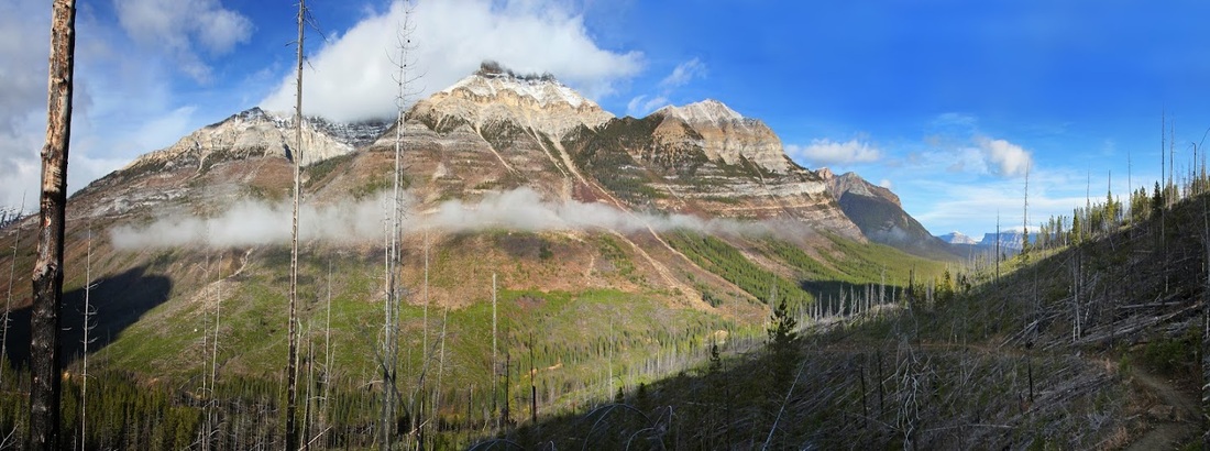
Sarah and I decided to spend the weekend in Banff at the Rimrock Resort so we could get to Stanley Glacier before the thronging masses. One of the most popular hikes in the park, the Stanley Glacier trailhead is just 13 km west of Castle Junction on highway 93. Though we were keen to get there we did stop soon after joining the highway to capture this image of the morning cloud drifting across the mountains.
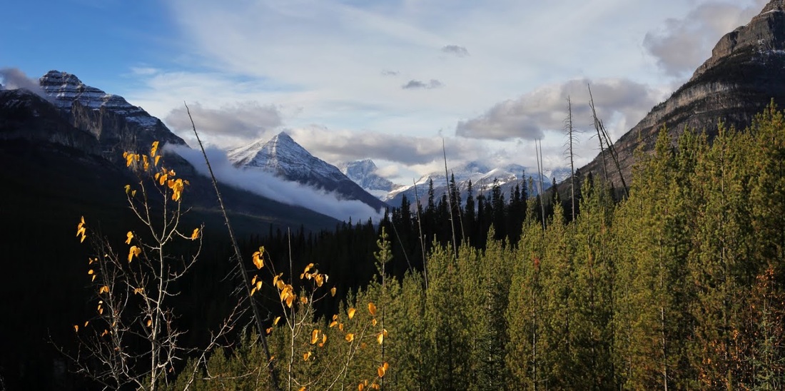
We stopped again at the Vista Lakes viewpoint to capture another of those low cloud shots looking west toward Storm Mountain and Stanley Peak
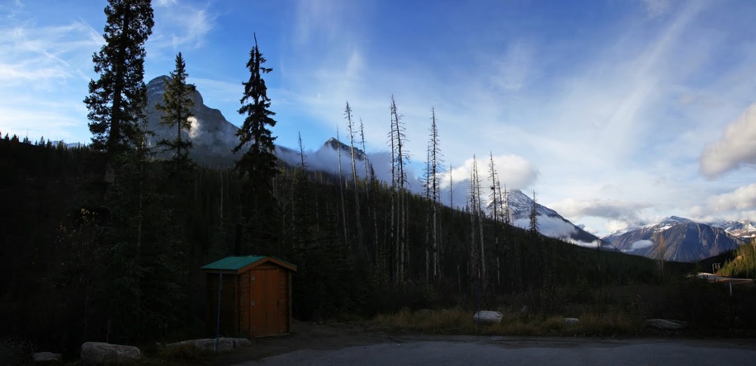
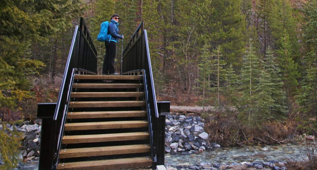
After our two short dalliances en-route we arrived at the trailhead car park, we were very pleased to see just two other vehicles there already, their occupants long gone. The shade held on to the overnight chill and we were quick to get our boots and packs together and set off along the clearly marked trail.
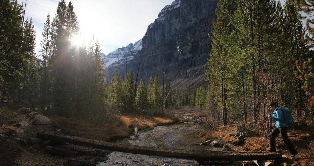
The trail drops down to the Vermilion River where a new bridge sees us comfortably across the water (which appears to be running 'the wrong way' owing to us passing the continental divide just a few miles east)
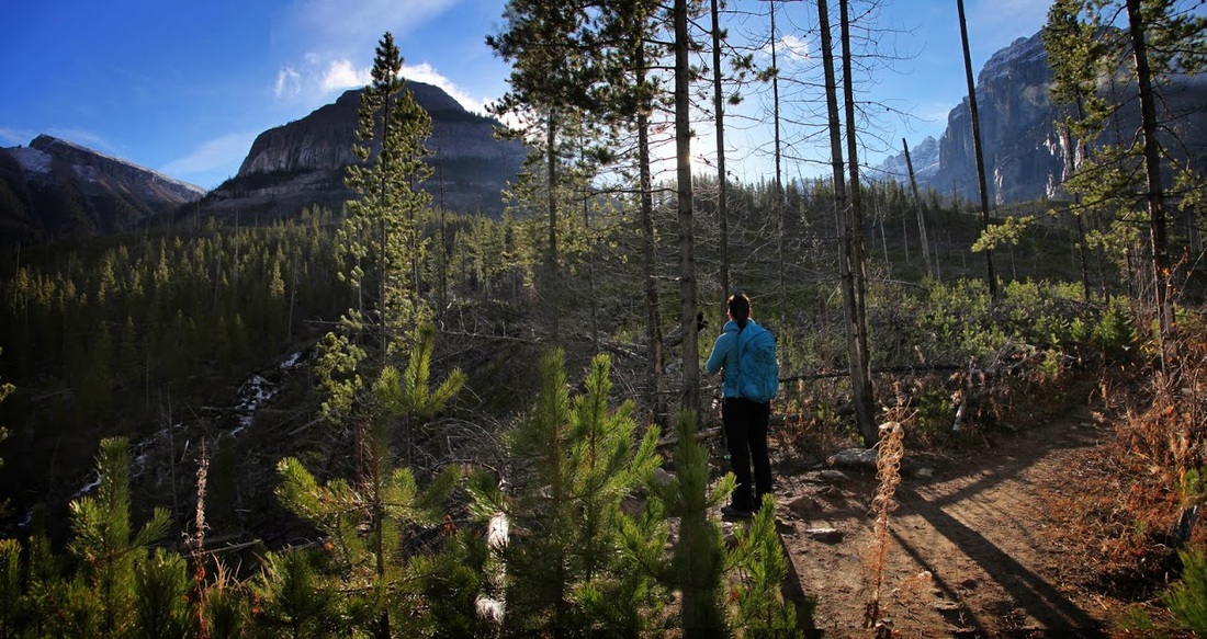
From the river the trail climbs steadily through an area cleared by forest fire some years ago which allows us to take in some stunning scenery including the shrouded peaks of Mt Whymper opposite.
The meltwater from the glacier forms Stanley Creek which helps to maintain the Vermilion River below, we stopped to look at the small waterfalls along the way trying hard to find shade for our eyes from the low winter sun.
As the trail winds its way up the hillside the views along highway 93 begin to open up, the shade keeps the temperatures down to a pleasant level for hiking and we make good time along the steady climb.
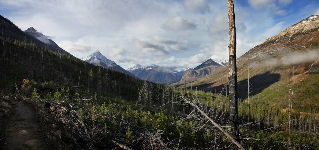
The trail continues upward in gentle inclines, perhaps a little too gentle to be honest, but at least it keeps us out on the side of the slopes looking toward Mt Whymper which is still hanging on to a small skirt of cloud.
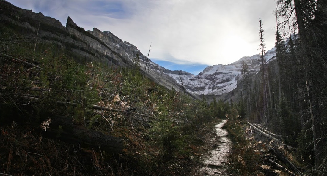
At the top of the first rise (around 2 km from the trailhead) we turn south on a more level area through established woodland that has escaped the forest fire. Stanley Creek is easily crossed with the trunk bridge provided and from here we catch just a glimpse of the glacier still some distance away.
A more steep section soon greets us, initially made of rock 'steps' it leads us up and along in stages. the trail still glistens with morning dew as we get a straight look toward Stanley Peak and its hanging glacier
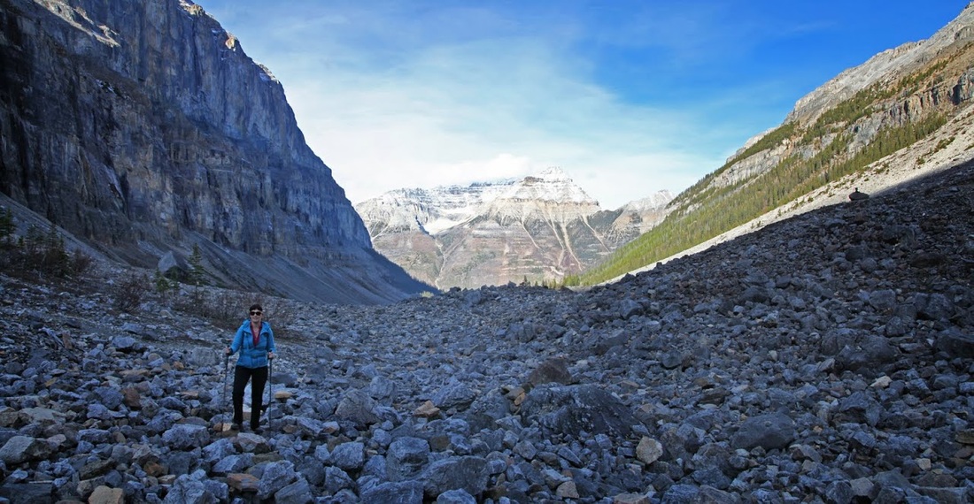
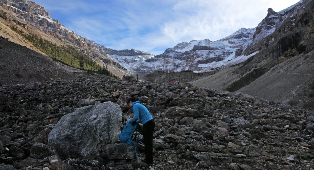
The steep climb on a makeshift rock pathway leads us out to the boulder field where we can see the beautiful blue hue of the glacier, even with no sunlight to help bring out the colour.

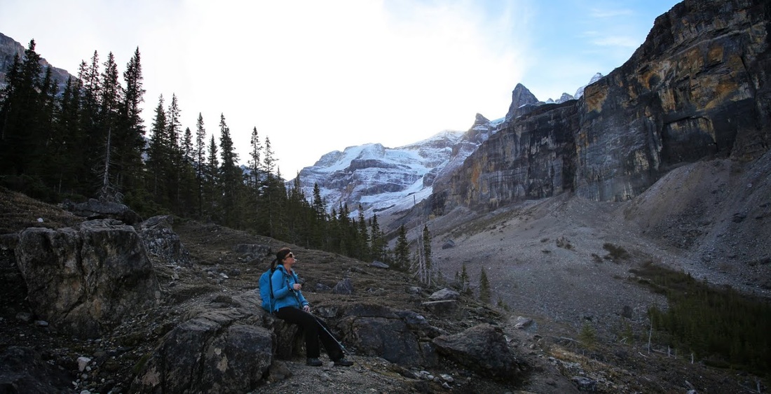
As we maintain a steady climb through the boulder field on a well trodden trail we take advantage of the seating provided, even if it did leave Sarah with a cold bum for an hour after!
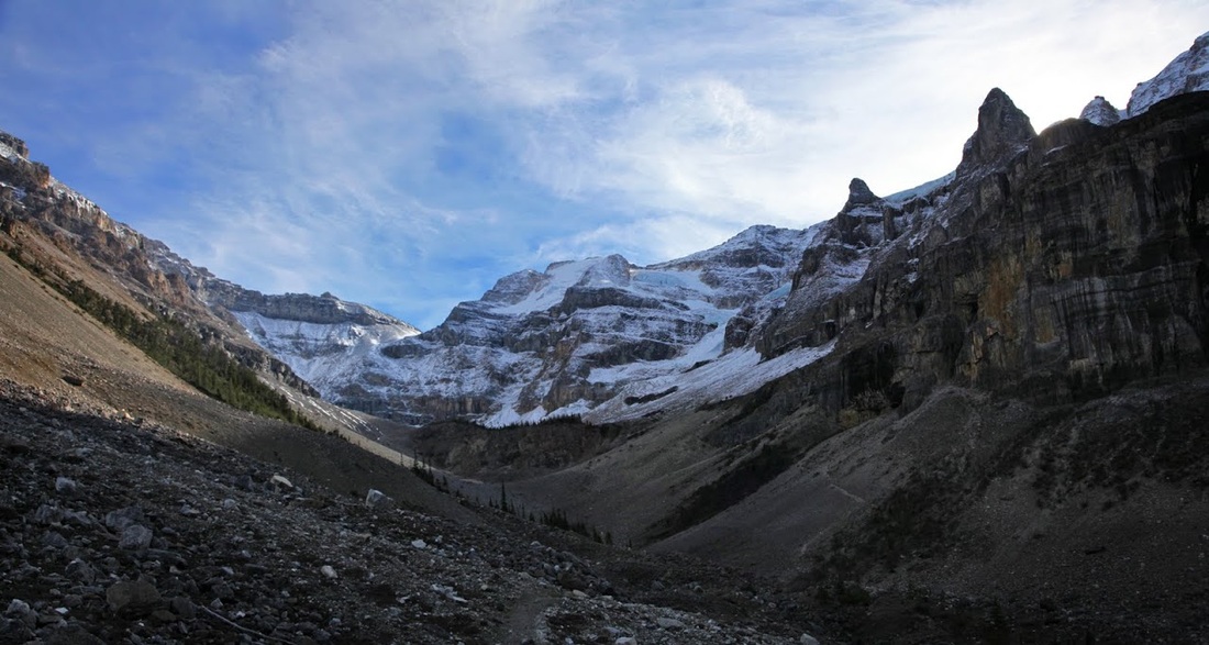
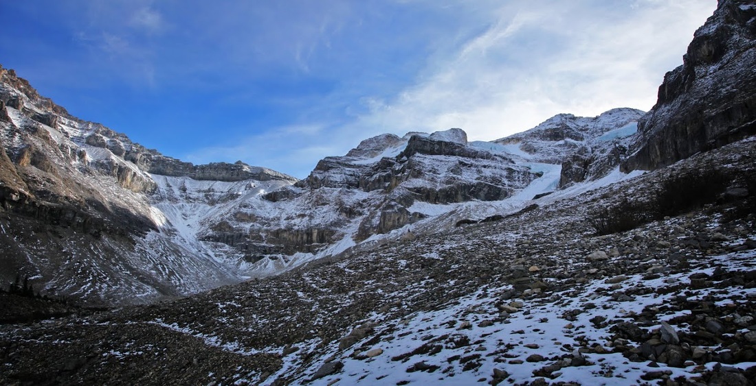
The boulder field levels out and the maintained trail comes to an end at a small sign reminding us of the fact. As the glacier is a hanging glacier on the southwest corner of a huge cirque it is difficult to see from the end of the trail, so we continue across the mobile rocks toward our goal.
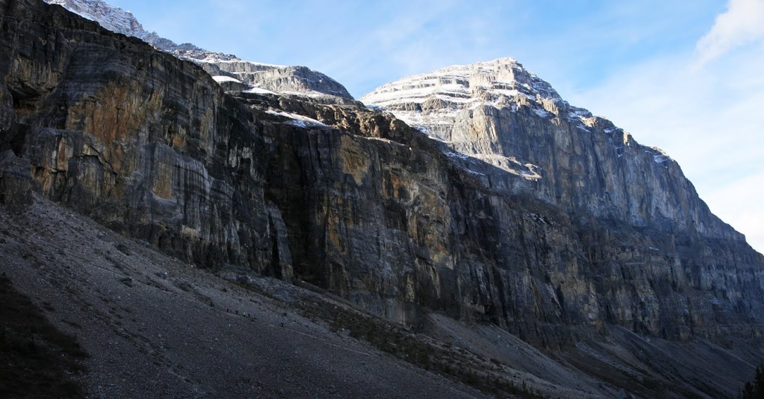
We meet a family who are searching for fossils and they tell us the trail to the right leads to a pair of caves in the adjacent wall of rock that keeps the winter sun from ever reaching the valley floor. They point us to a different route to view the glacier, as we head along it we see a number of other people taking the cave trail dwarfed by that enormous slab of raock.
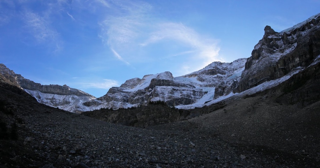
We take the route suggested by the family and keep on toward the glacier but it is very steep and made entirely of loose scree and boulders, at one step I stop for a shot and Sarah tells me she is pretty sure someone is moving the glacier further away. We will need to cross this rubble field and then circle around to the right up another steep slope to get above the ridge ahead.
It's Sarahs first experience of a boulder field and the constant climb on moving rocks is taking its toll, I tell her to stop and have a bite to eat and rest while I go on and grab some pictures from the top of the ridge. Sarah puts up little fight against the idea, she has matched her personal best ascent (set only last week) and done it on some hard going. After sorting a seat and some fluids for her I set off pushing hard for the ridge until Sarah is just a speck in the valley.
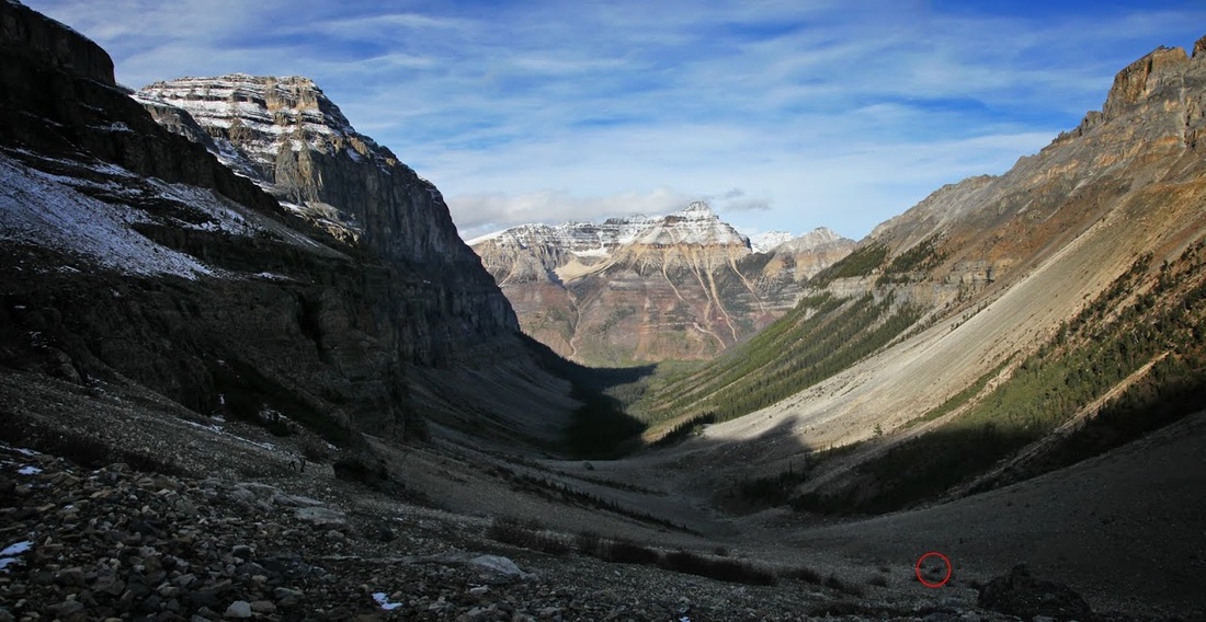
Trying to speed up the loose scree really drains my energy levels as I top out on the ridge, I see a small trail leading to the left which I'll need to take to get the angle for a nice shot of the glacier. I turn to check on Sarah and see she is up pointing her camera all around so I carry on along the short trial, still blowing hard from that ascent.
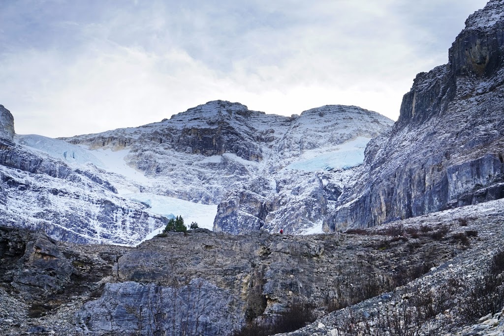
Sarahs zoomed shot shows me as a red dot on top of the ridge as I make my way along the edge, all the time looking up at that wonderful glacier
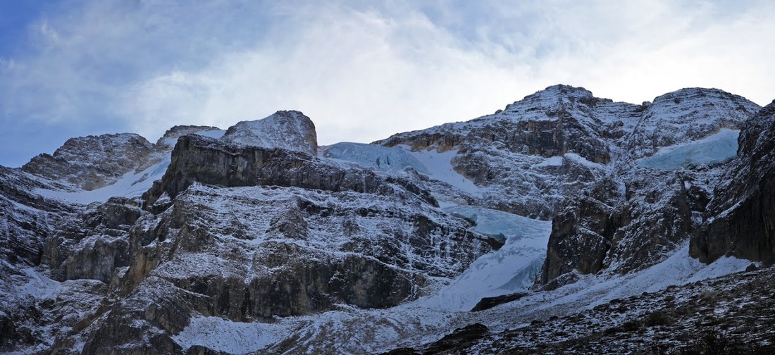
I reach a point where I can see all of the faces of the glacier and decide that will be enough, tempting though it is to keep on going to the toe, it would take quite a while and I've left poor Sarah sitting on a rocky slope alone. I can't help but think of coming back here with my crampons and climbing up to the summit via the glacier.
I descend by charging down the slope in a mix of scree running, boot skiing and jumping until I am back at the point where I left Sarah who is now wrapped up against the cold. After an orange and a drink we set off back down, in no time at all Sarah warms up and the jacket goes back in the rucksack (The new 'matching' rucksack I might add)
We head back out the way we came in and can't resist turning around again and again to look along the cirque. The trail is now full of people ascending, we seem to pass a group every few minutes, it makes me glad we stayed locally and got out here early this morning. We make very good time on the descent and we're soon back in the truck and heading home to Calgary talking about another wonderful hike.