Tent Ridge - Summer
Date Walked: 5th July 2012
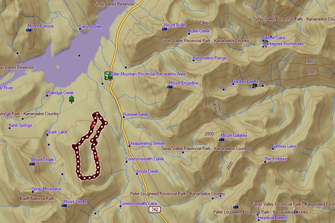
Distance: 7.8miles (12.7km)
Actual Ascent: 2752ft (839m)
Time Taken: 6 hours
Last weekend was 'Canada Day' weekend (National Holiday) so Sarah and I travelled a little further into the mountains in the hope of finding a quieter location away from the crowds. I had found a small lake called Tryst Lake and we hiked to that, it was tough going through deep snow high up but it did lead me to consider another potential hike in this area that would bring me up to the top of the ridge overlooking Tryst lake. It looked a great viewpoint so I checked out my maps as soon as I got home and explored further, it didn't take long at all to convince me to make the journey back.
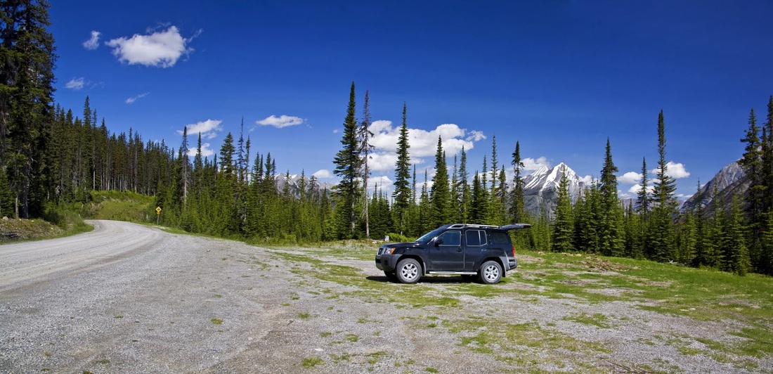
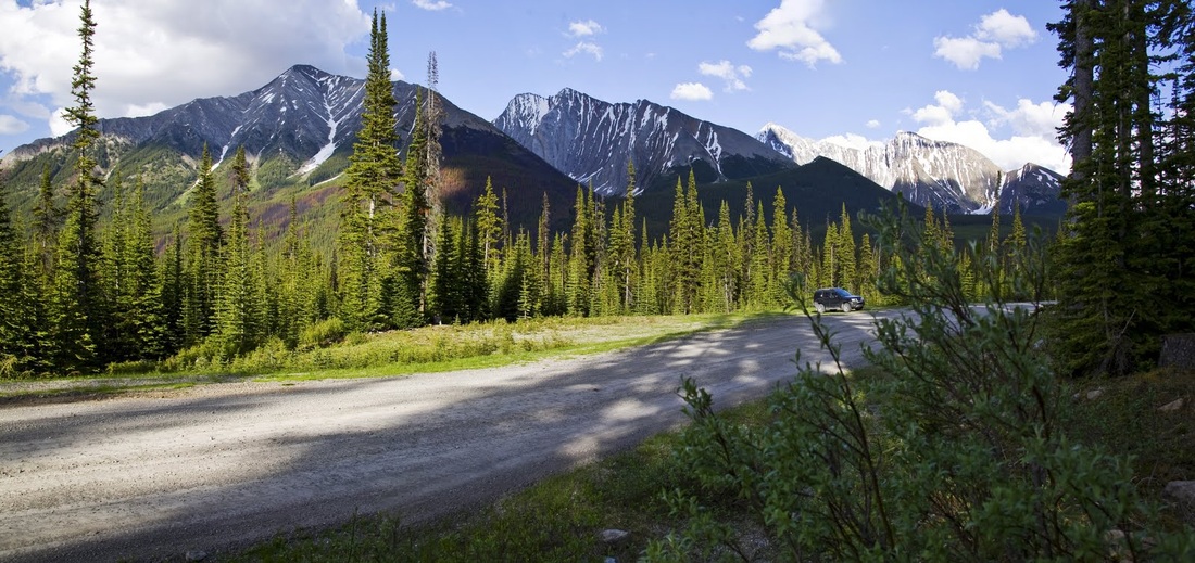
So on Thursday I returned to the long dusty gravel road called the 'Smith Dorian Trail' (or 'Spray Trail') that is actually Highway 742. To get from Calgary to the Spray Trail means a long journey beginning by travelling west along highway 1 (Trans-Canada Highway) then 50km South on Highway 40 (Kananaskis Trail) before turning onto the Spray trail and heading 30km North. The U-turn is needed in order to go around the southern end of the Kananaskis Range of mountains. After 30km on the Spray Trail you will see a left turn with a sign for Mount Engadine Lodge, turning here takes you onto Mount Shark Road and just 2km further along that road (gravel track) is a large roadside parking area on the right.
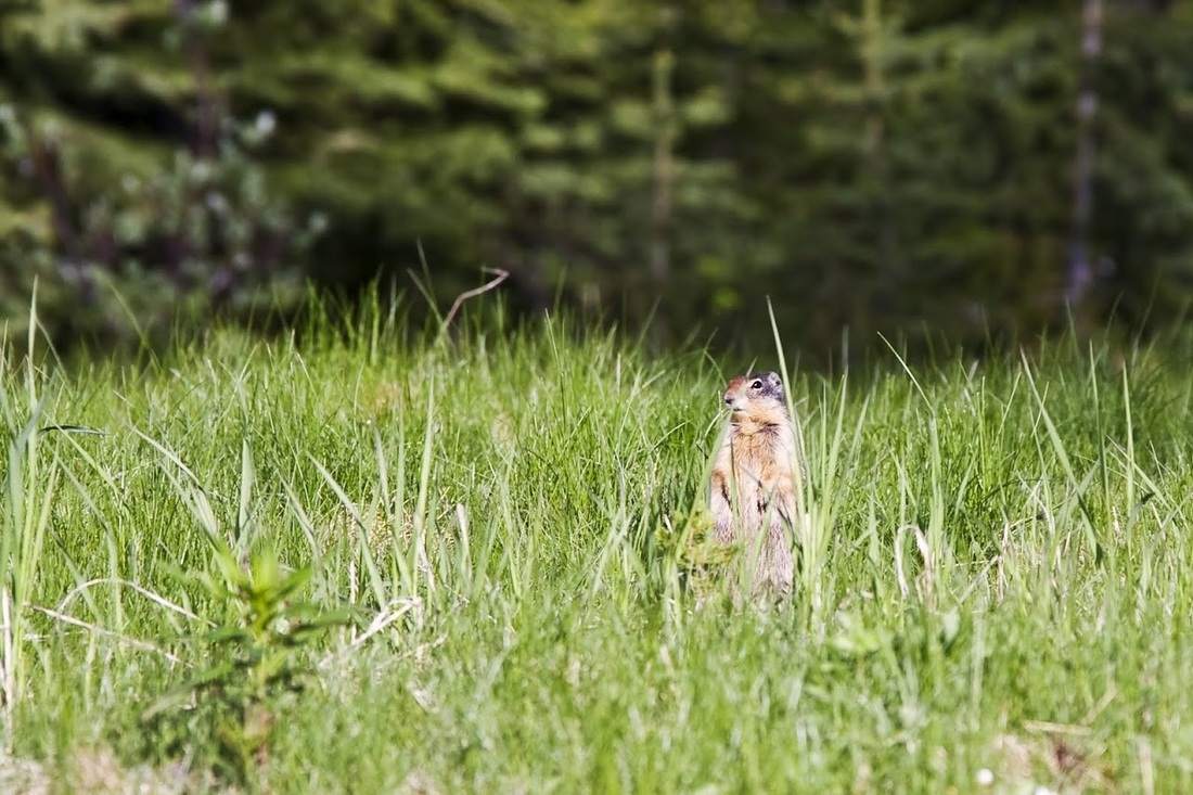
On arrival I was greeted by an army of Columbia Ground Squirrels who darted back into their burrows as I pulled onto the roadside area, the beautiful blue sky was a sign of the heat to come. After my usual car park wanderings and getting ready I finally set off around noon.
So on Thursday I returned to the long dusty gravel road called the 'Smith Dorian Trail' (or 'Spray Trail') that is actually Highway 742. To get from Calgary to the Spray Trail means a long journey beginning by travelling west along highway 1 (Trans-Canada Highway) then 50km South on Highway 40 (Kananaskis Trail) before turning onto the Spray trail and heading 30km North. The U-turn is needed in order to go around the southern end of the Kananaskis Range of mountains. After 30km on the Spray Trail you will see a left turn with a sign for Mount Engadine Lodge, turning here takes you onto Mount Shark Road and just 2km further along that road (gravel track) is a large roadside parking area on the right.
On arrival I was greeted by an army of Columbia Ground Squirrels who darted back into their burrows as I pulled onto the roadside area, the beautiful blue sky was a sign of the heat to come. After my usual car park wanderings and getting ready I finally set off around noon.
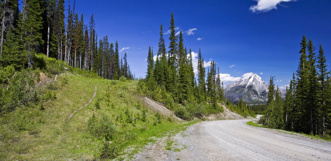
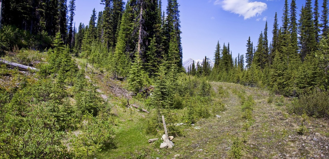
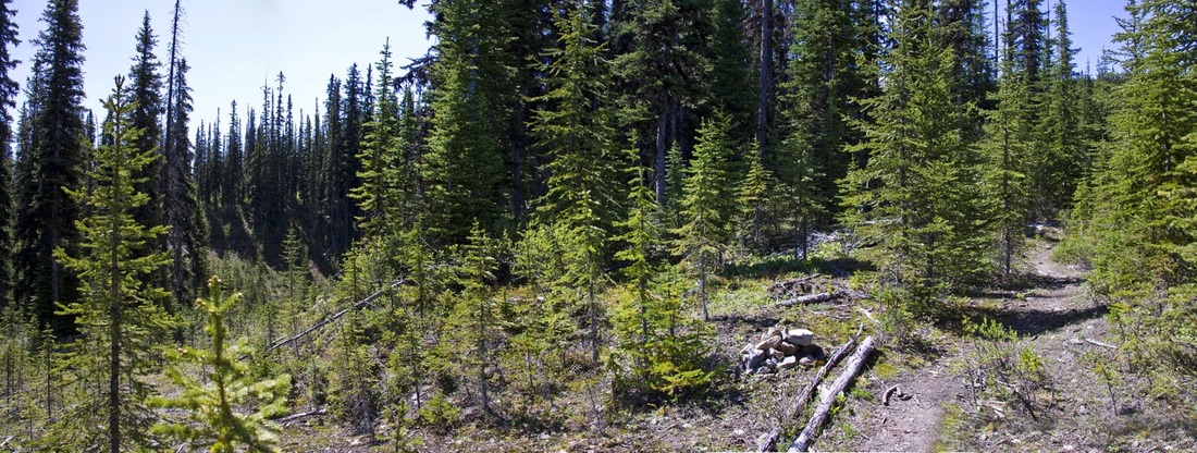
the route begins by following Mount Shark Road about a hundred metres further where a narrow trail makes its way up an old logging track, a short rise then leads me to a flat easy hike along the wide grassy bank
it is a great warm up striding along the grassy route and it would be easy to walk right past the small cairn marking the left turn up into the forest, my measly efforts to rebuild the cairn and replace the post did little to help. Better to count off a little less than 1km then look for the turn.
the next section is very easy to follow up into the forest winding its way left and right along a good trail, as you get toward a more open section populated with much younger trees, the trail splits into 2 at a 'Y' junction, keep right here and you should pass another very small cairn a just short distance from the junction.
The heat within the forest is stifling, there isn't a breath of wind as I make my way through the plantation to the upper left corner where 2 arrows carved into trees direct me left and back into the established forest.
The heat within the forest is stifling, there isn't a breath of wind as I make my way through the plantation to the upper left corner where 2 arrows carved into trees direct me left and back into the established forest.
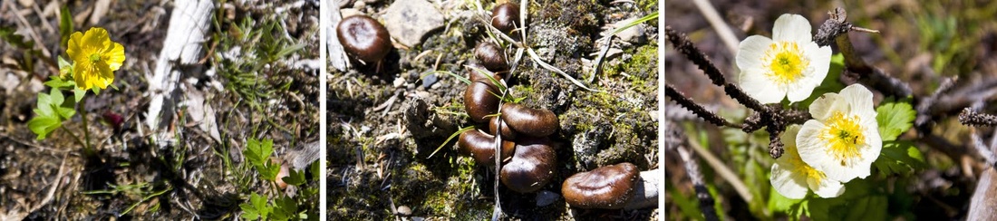
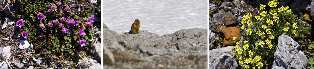
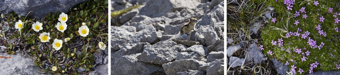
the open ground around the plantation allows plenty of wild flowers to bloom and the occasional fungi too which all add to the interest of the hike, the forest is alive with bees and other insects though few of the biting variety as yet.
in the forest the trail comes to a 'T' junction with a narrow cutting where a right turn finally sees me set in the right direction toward Tent Ridge
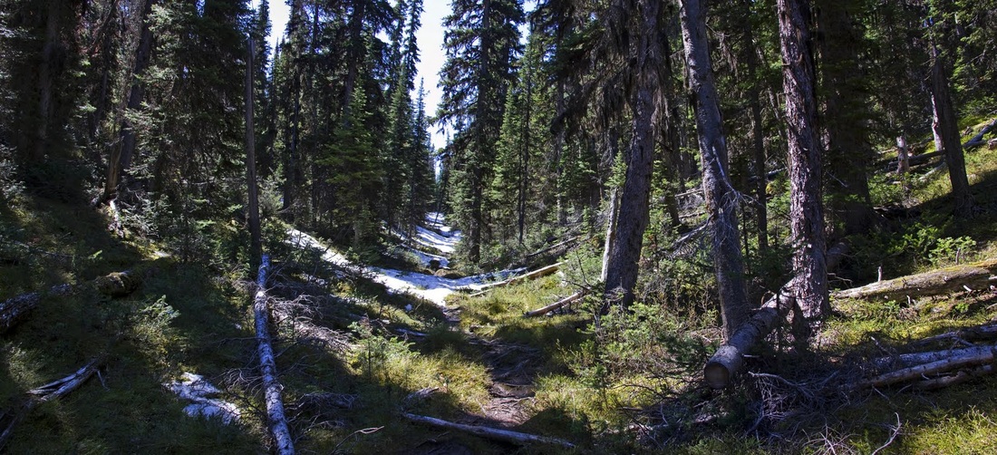
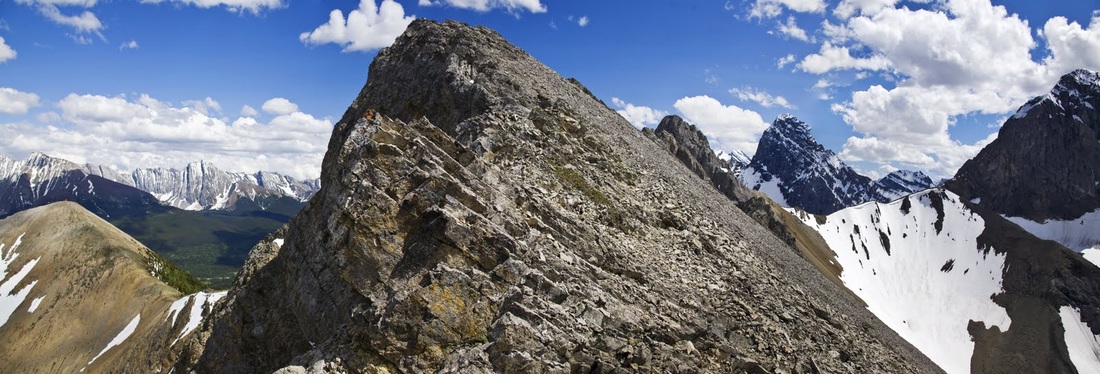
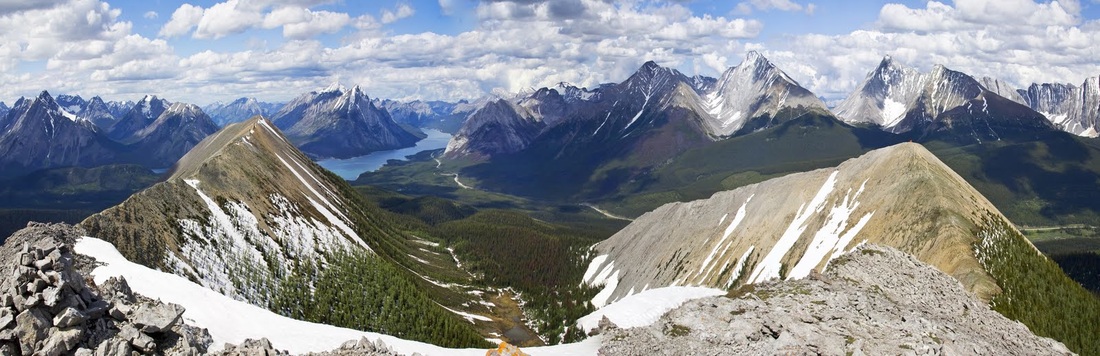
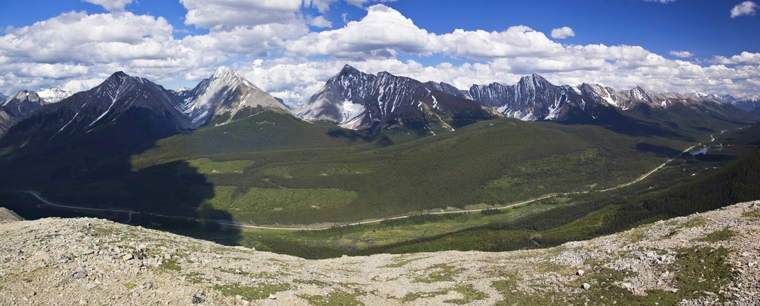
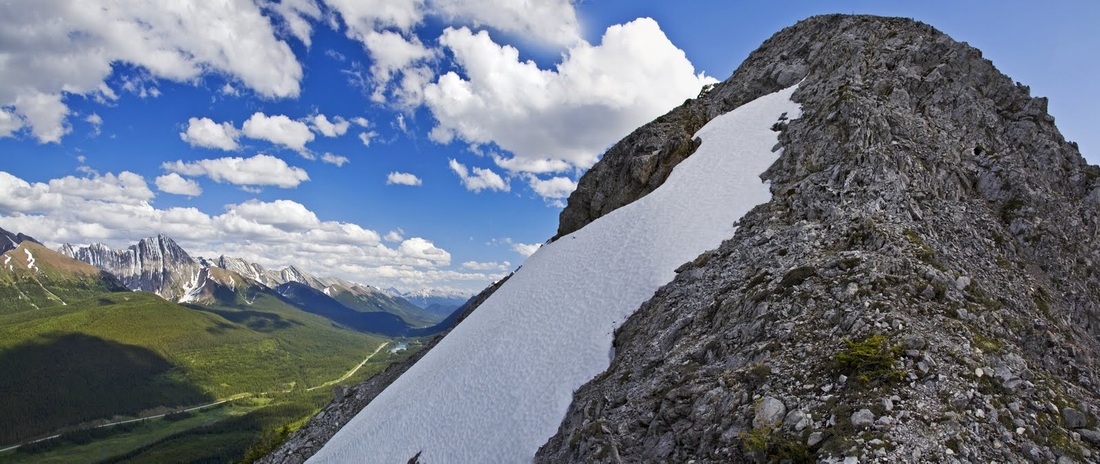
the northern end of the ridge comes into view as I approach the edge of the established forest once more, with a good covering of snow I pick out a clear section shaped like an exclamation mark in the centre of the hill where I can ascend and then traverse left to the rocky upper left corner of the ridge.
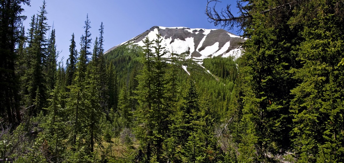
a short section of new growth conifers with wide spaces between makes a great approach toward the base of the ascent and I am soon on my way up an ever steepening slope, looking back I can already see over the forest to the western flanks of the Kananaskis range where dark purple areas mark it's history of forest fires.
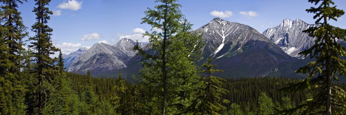
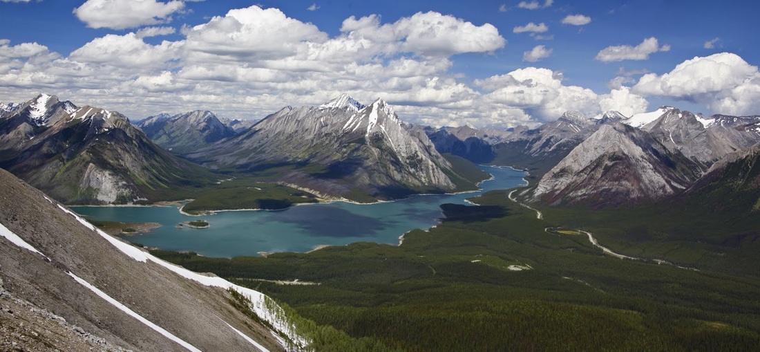
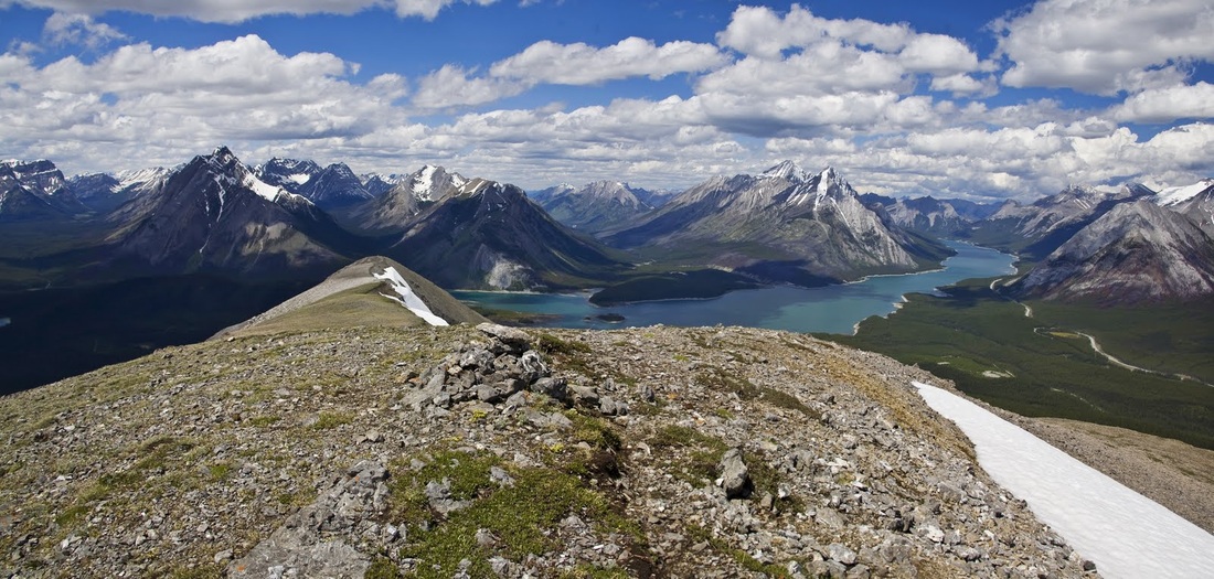
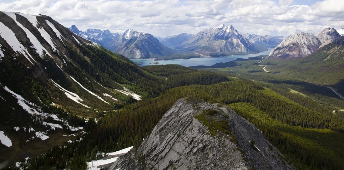
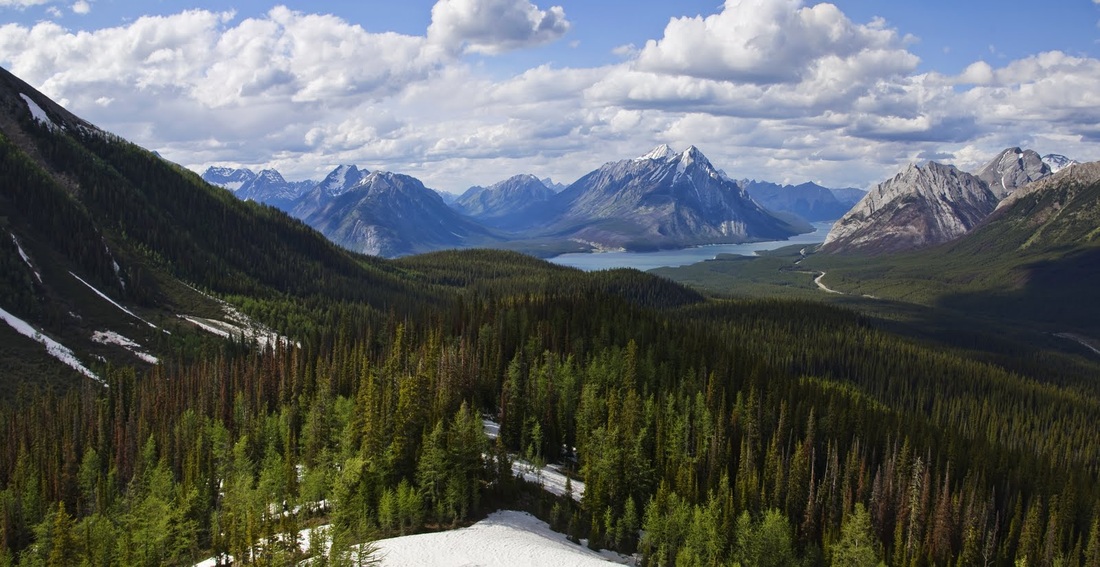
reaching higher still I can see across the beautiful blue water of Spray Lakes Reservoir and I already know that this route was a good choice.
once I am into the alpine zone the ascent changes to a very steep climb up loose scree that slows my progress though the views also contribute to the change of pace as I repeatedly stop to capture more photos
to my left as I ascend are the towering peaks of the Kananaskis range and I begin considering a route through here and across to highway 40, another one to research when I get home. Ahead is the rocky step at the north end of the ridge that requires a little hands on scrambling for the final few metres
before making the scramble I stop for a few minutes on the bottom ledge and take in the incredible views, it is a tough grunt up the scree and the traverse across it is even worse requiring a hike upwards at an angle with every step to produce a level trajectory once the scree has moved underfoot
even on those steep scree slopes alpine plants bloom and the occasional rodent peeks out of hiding to see who is scrabbling around on the rocks, I threw this little ground squirrel a link of a tangerine, he stayed motionless until I moved away then ran up and grabbed it with both hands and began nibbling away, it made me smile.
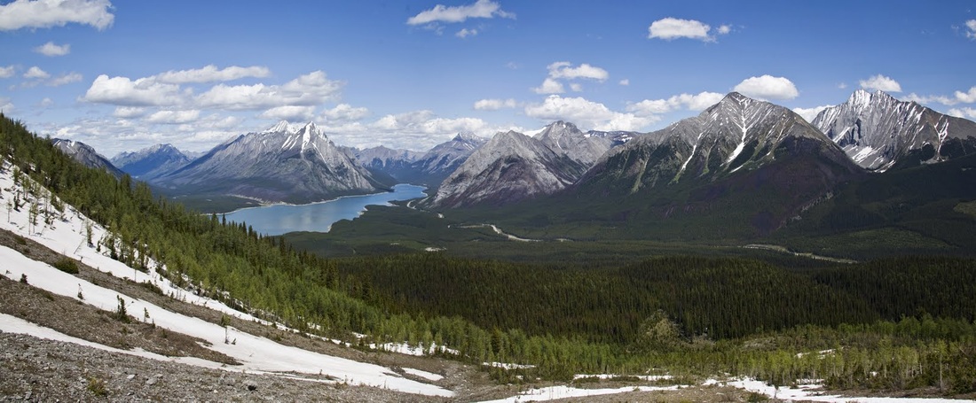
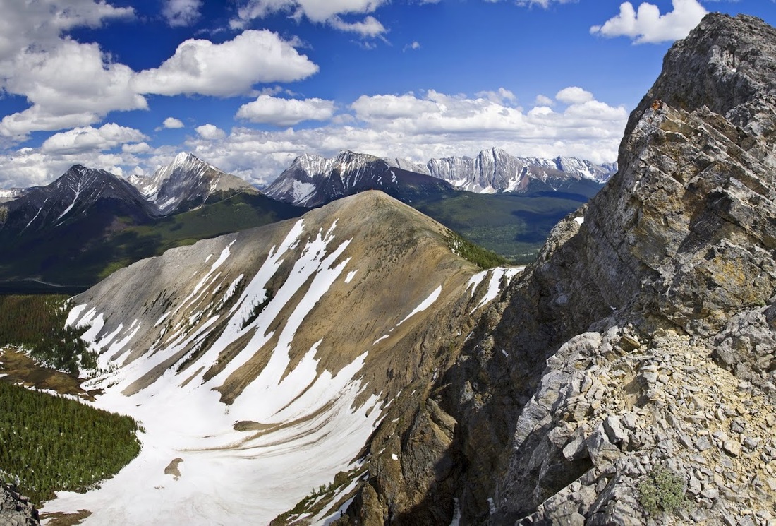
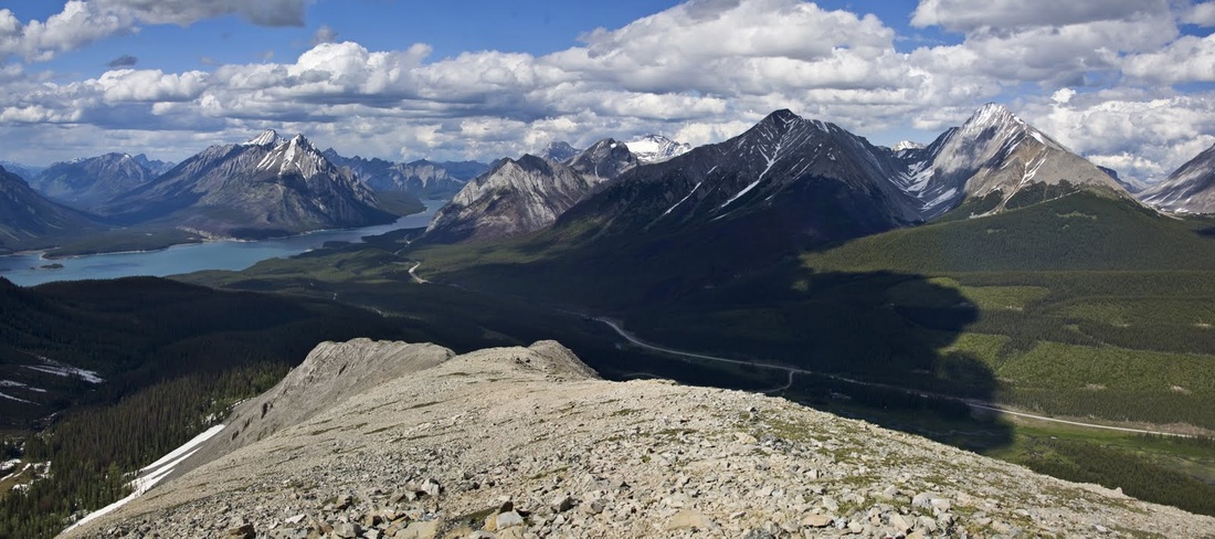
after a 5 minute rest the scramble was both easy and short and I was soon standing on the top of the ridge looking north-west at the stunning scene, and at last a cool breeze blew across the ridge. When selecting my route up here I didn't think about the views I was just avoiding the snow, but now I'm standing here it is clear I am going to have to backtrack to the point overlooking the lake, it will add a couple of km for the return journey but I'm sure it will be worth it
I made the short trek in double quick time along a nice flat ridge top with just a few metres of descent to reach that beautiful overlook marked by a modest cairn
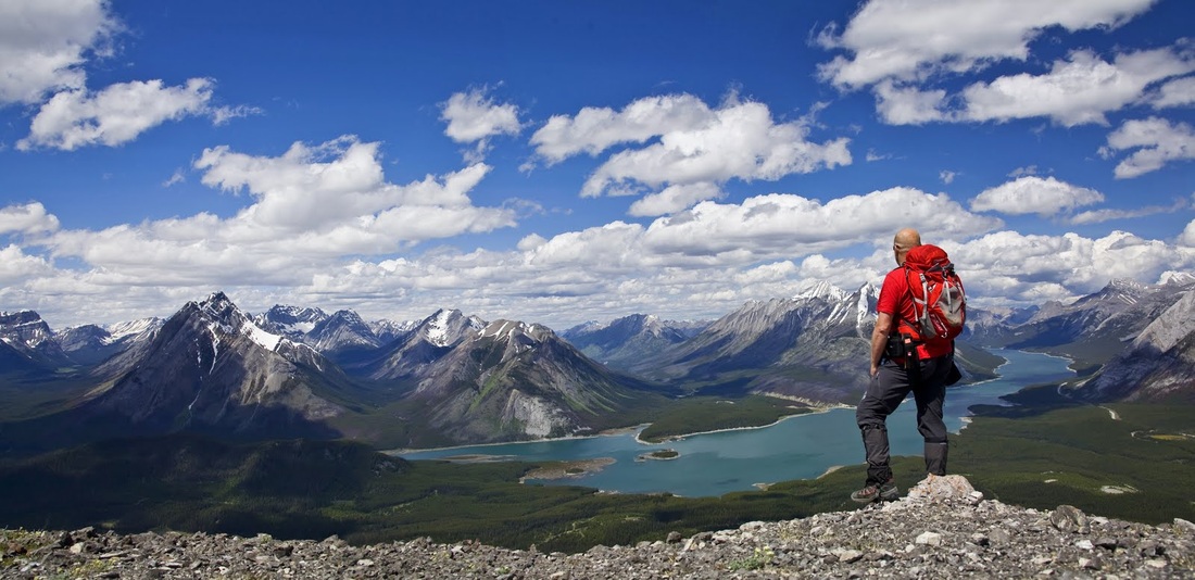
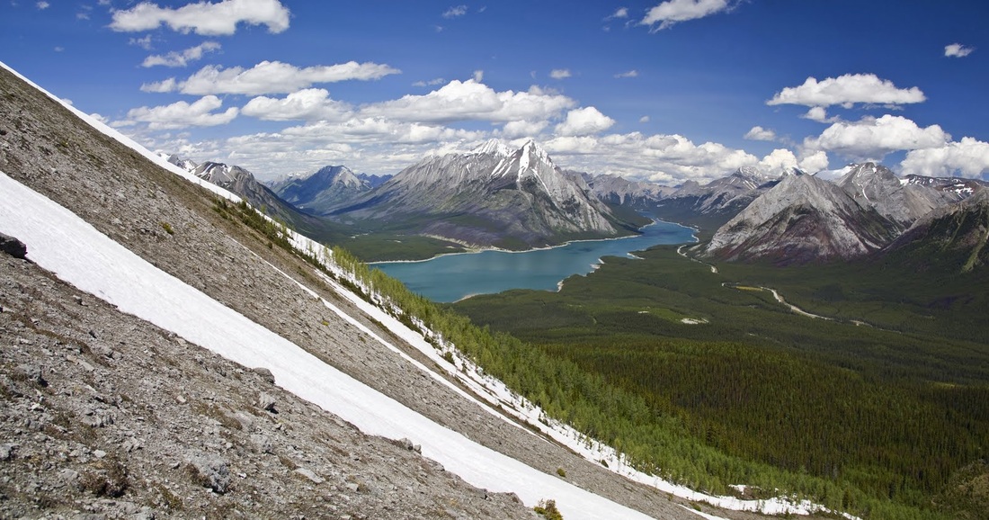
it is an injustice to put anything in front of this view so here is a shot from the overlook without my fat head in it, I thought for a long time about how to describe this but ultimately it needs no description.
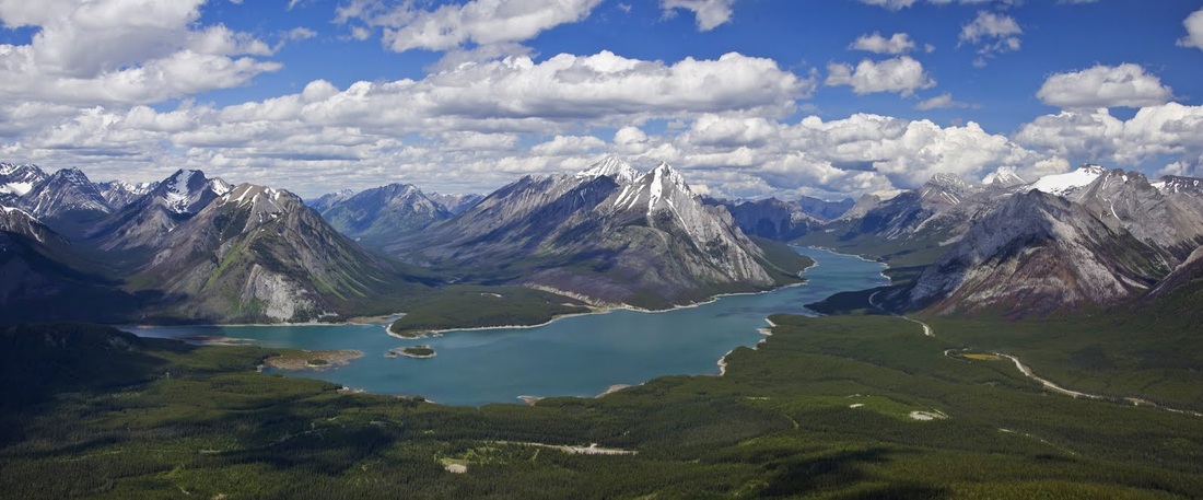
to the west there are a couple of smaller lakes with odd colours that wouldn't look out of place south of the boarder in Yellowstone and another huge range of mountains with oceans of fir trees spanning the valleys between
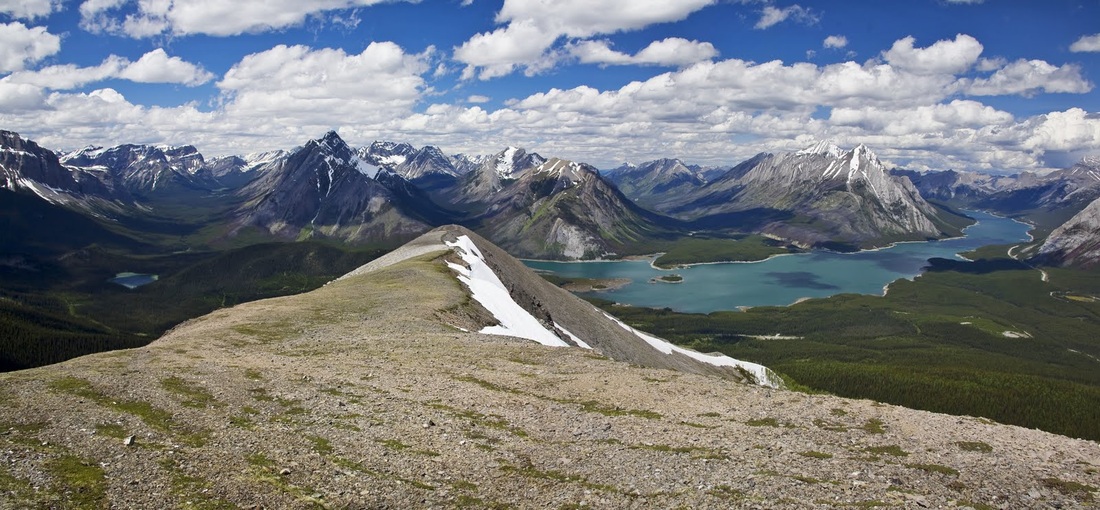
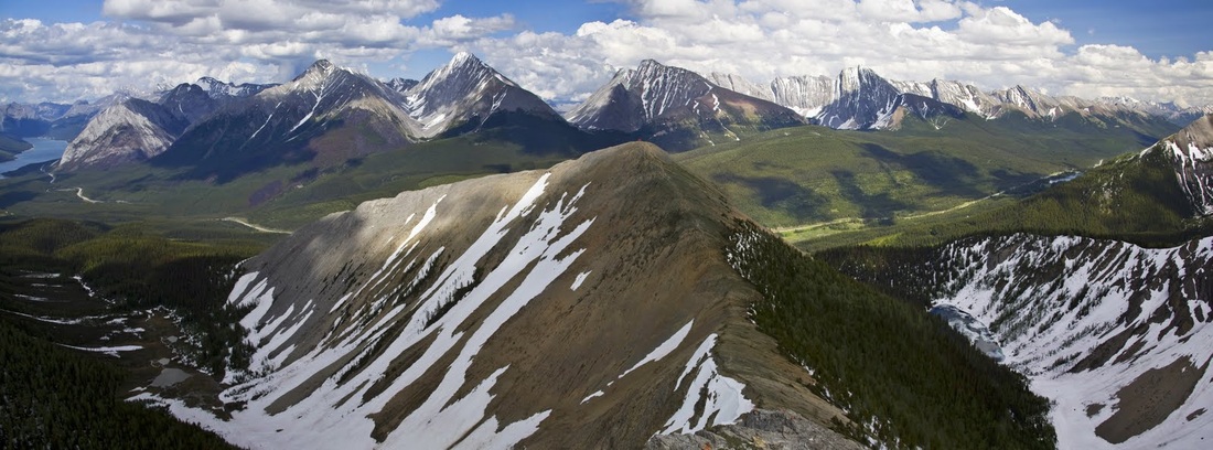
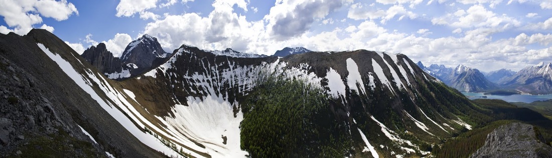
looking back along the ridge the green mound ahead is where I initially ascended and behind it heading right is the ridge I intend to follow
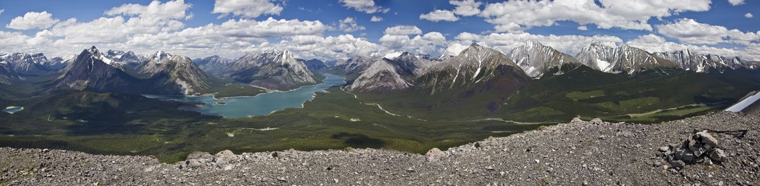
a multi shot panorama gives some idea of the incredible beauty of this location (though in miniature) this is a sight that will remain in my memory for some time
returning to my ascent point I find a nice little grassy spot to stop for lunch, as I sit on the soft ground with a cool breeze blowing across the top of the ridge I find it difficult to get myself moving again, this is a location where I could sit for a very long time.
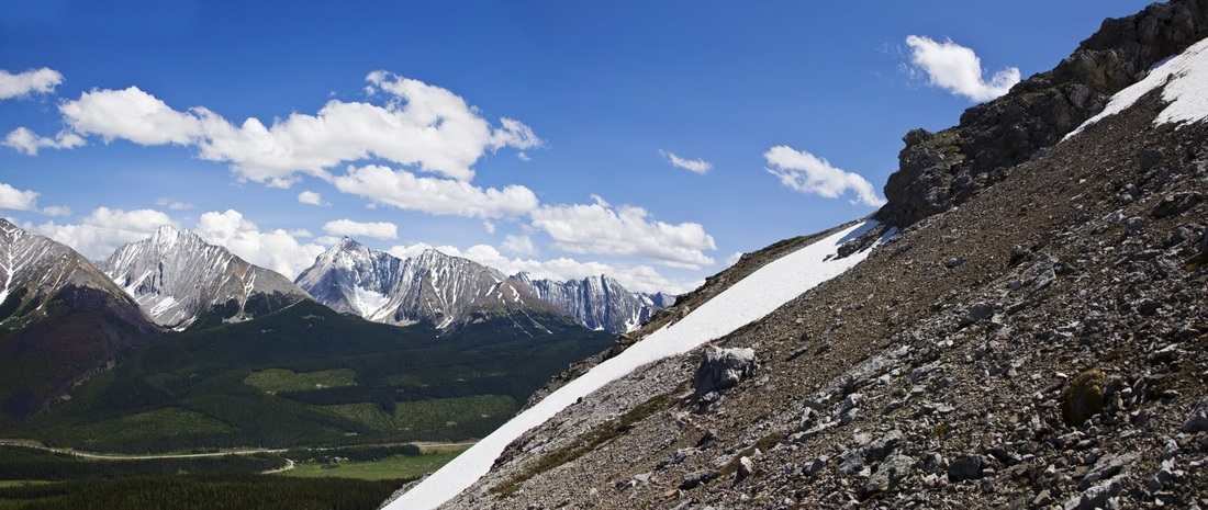
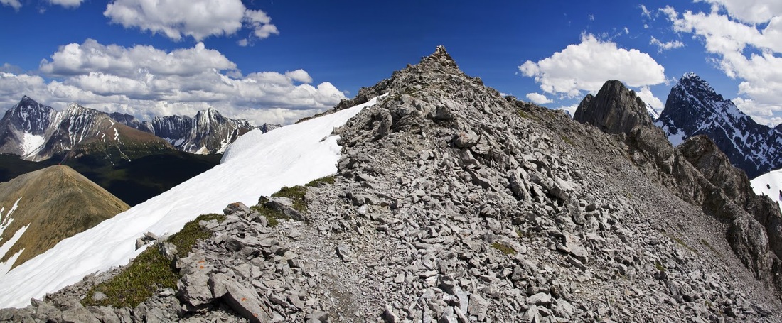
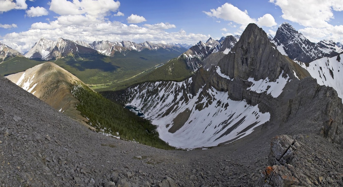
after a nice 20 minutes I turn my attentions to the south and the ridge walk ahead, I noticed my planned exit from the far end of the semicircular ridge looked very steep in places (left of shot) but not steep enough to put me off
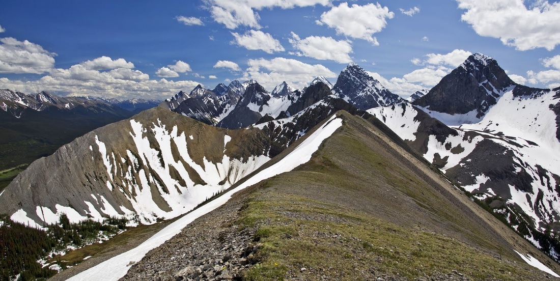
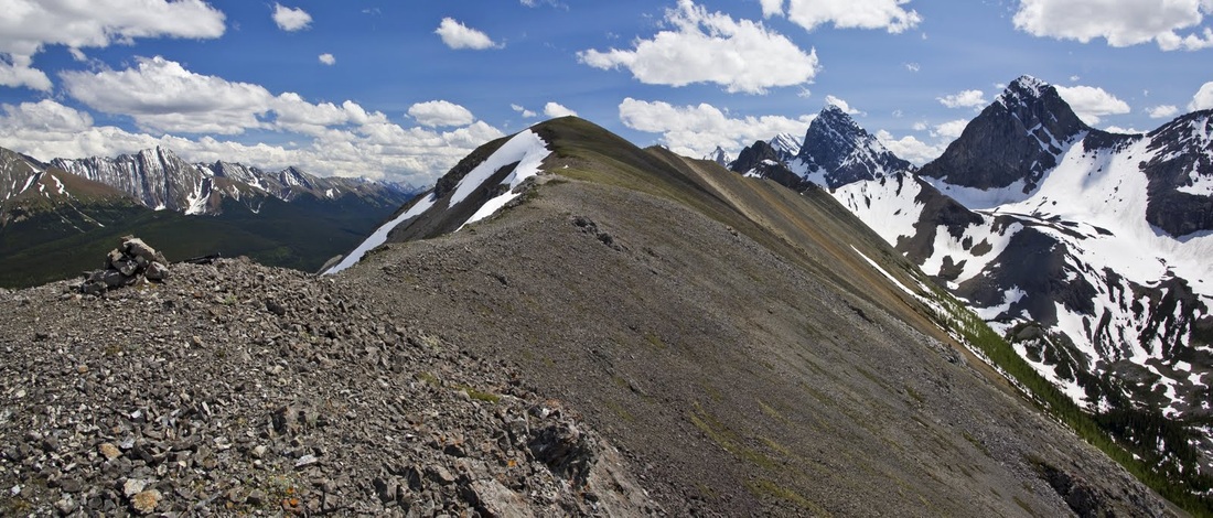
the ridge is very easy walking over shale with stunning views of more of the Spray Mountains ahead and occasional alpine flowers struggling for a foothold on the very crest of the ridge, though the walk isn't steep (in terms of falling) you certainly wouldn't want to drop your orange on here.
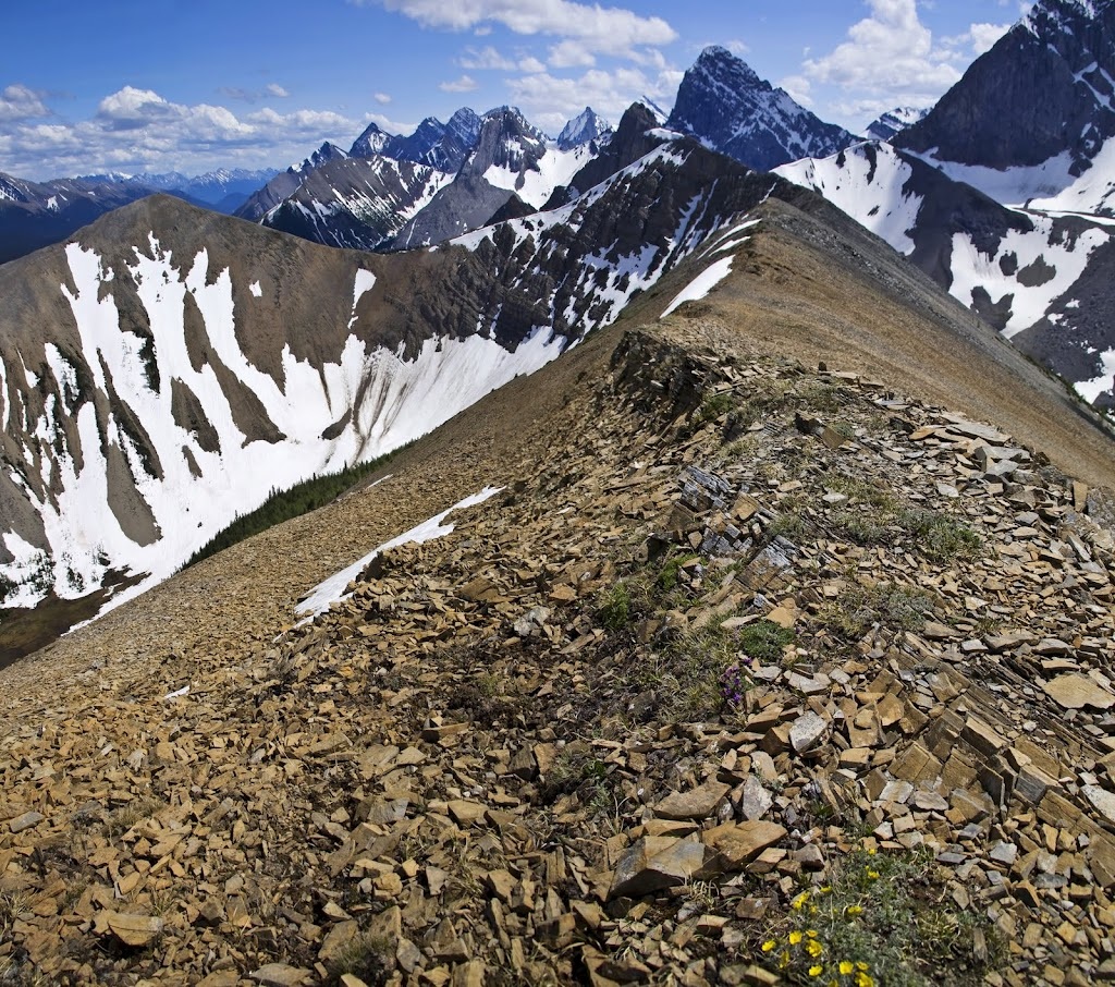
the ridge falls slowly in steps as you head out toward the southern summit losing quite a bit of height as you go but the views remain with the mountains spreading out infinitely in all directions
once I begin to ascend again I realise just how much descent I've made and the large summit cairn seems a long way off along an ever worsening trail
to the right is a steep scree slope leading down to a huge glacial moraine below and to the left is a vertical drop of several hundred metres, beyond these the Kananaskis range dominates the horizon
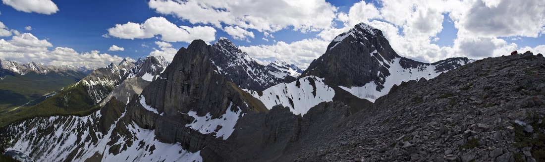
once past the large step and a little hands on scrambling the final section levels out leaving a nice steady plod to the large summit cairn ahead
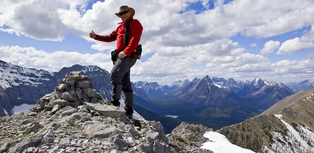
finally summit No.2 is reached, the sun is still beating down and the sun hat is back out though the cool breeze at 2554m (8350 feet) means a fleece is required
from here it is just possible to squeeze in the whole 'U' shaped ridge and the incredible mountainous surroundings, I am still a little concerned about the angle of the descent route and I need to determine whether to continue that way or return the way I came, I decide to carry on as planned knowing that if it is too difficult I can drop down the east side to Tryst lake and take the route that Sarah and I hiked a few days ago, it would be much longer but it's safe and I am familiar with it.
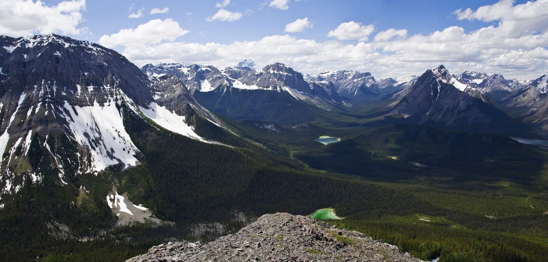
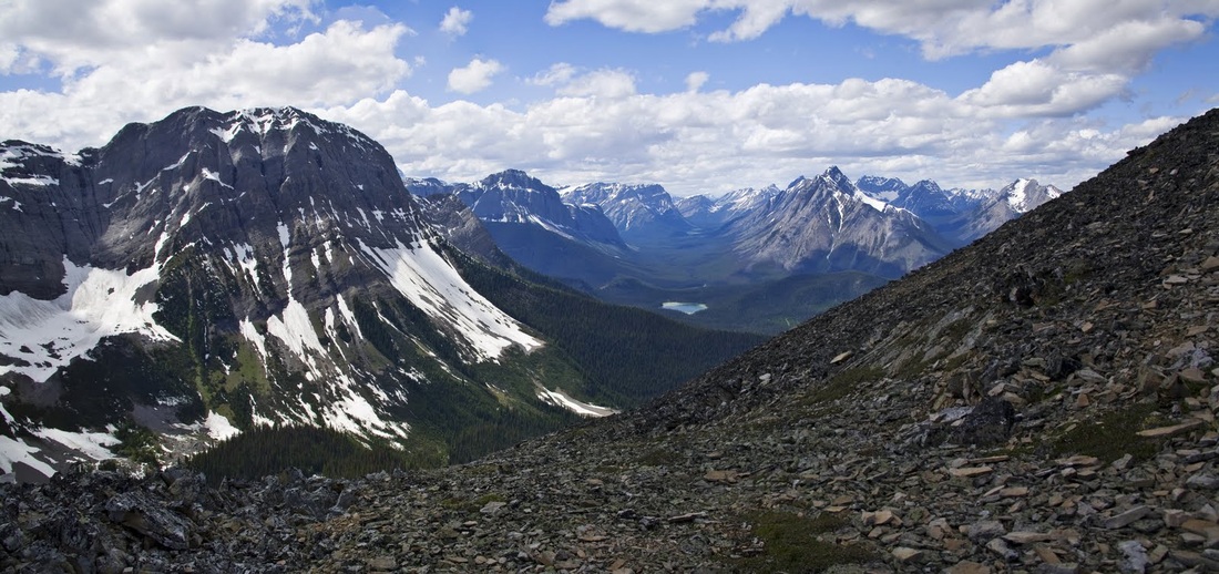
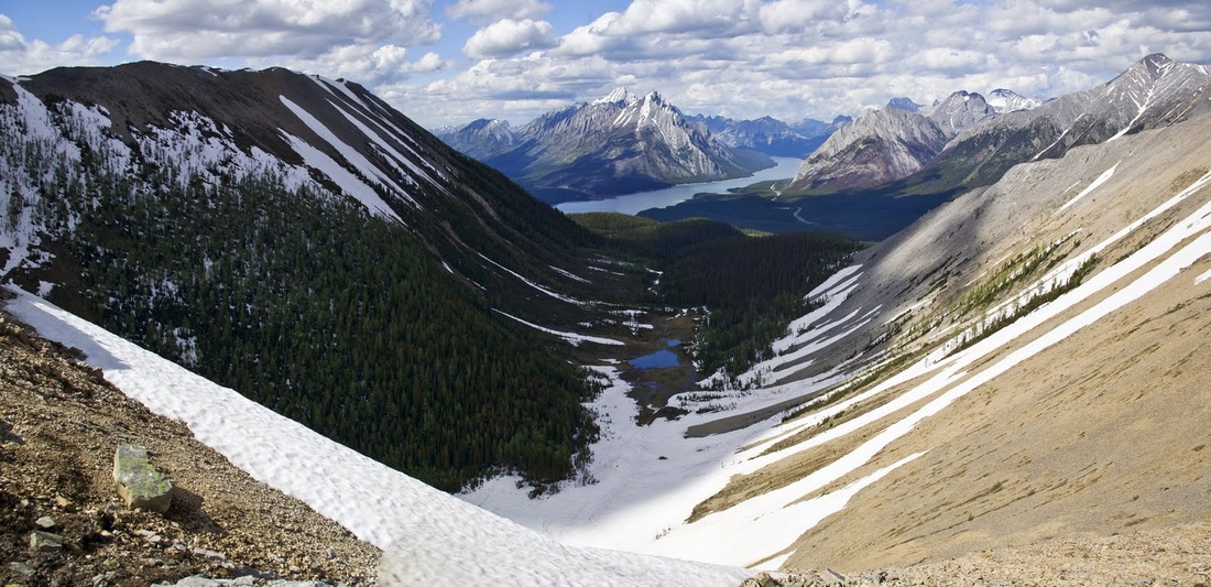
before heading for the last summit I took a detour down a short slope and across toward the back of Tryst Lake which seems so much smaller from up here
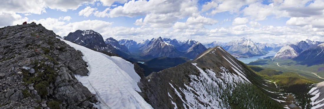
I have a little wander around at this summit taking photos and enjoying the location, the summit is on the right here and the first of the pinnacles to the centre is where I took the last photo of Tryst lake from and the left of shot is the long Spray Valley corridor
with the summit on the left of shot now it is possible to see the large step on the final ascent (just right of the cornice) and the ridge covered so far reaching out toward Spray Lakes Reservoir
looking to the route ahead there is a very steep descent to make down a scree slope with a part worn zig zag trail to guide me, to the right is Tryst Lake, when I stood there with Sarah a few days ago I though that on my return I was going to be on the summit directly ahead of me now and I suppose I am .....eventually
the bottom of that steep descent leaves me standing in the 'U' looking along the insides of both ridges to the lake beyond, there is more cloud now as the afternoon heat generates moisture but it is still a beautiful day and I have only one more summit to go
the small red box on the top of the summit ahead is a 'Firenet Repeater Station' or so it says which I'm sure won't do much for the summit scenery but such things are necessary I'm sure and it's not like they don't have a few mountains to go at round here
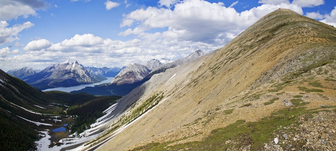
the descent from the highest summit can be seen in full as I climb once more toward my final target for the day, how flat and level that ridge looks from over here......

it is a short hike up the grassy slopes to the final summit and the repeater station with its solar panels and antenna cluttering up the skyline
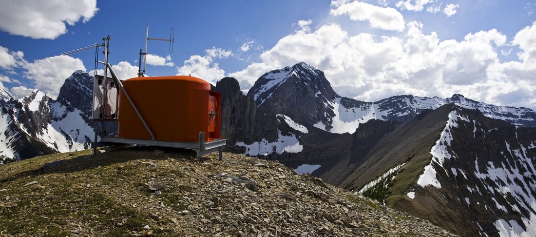
I stopped momentarily for a 5 minute break here and watched the dark shadows of the clouds dance across the Kananaskis range and the tiny specks of vehicles moving along the 742 below
I turn my attention to the descent route now which starts well with a steady fall on good firm going but ahead I can already see the first in a number of steep steps though the view prevents me worrying about it too much
the first step is like the prow of a ship and has a drop that almost matches that, a very steep hands on descent with loose rock everywhere, it is genuinely concerning in places.

once on the next step I get a moments respite and can take in the surroundings a little though I confess I am relieved to get down that section unscathed
to the left is the hike so far and all the beautiful scenery beyond, it has been spectacular up to now but I need to focus on this last section, tired legs and very steep scrambling do not go well together
I stood looking over this hump for some time trying to work out the best way to go once I had reached it, the left side was too steep and the small prominence to the right only went a short way and then dropped off almost vertically, I decided to go for the right and hope for a forward line from there.
sure enough there was a small gully off the right side that led into a snow filled crevice that I crossed gingerly before finding a steep but serviceable descent on loose scree, looking back up at it does not do justice to the trepidation I felt making my way around the side on loose rock with huge chunks falling away and crashing down for hundreds of metres
I was pleased to see the last step end leaving a snow filled descent to the forest and a final stunning view over the lake, the snow prevented any chance of seeing a trail so with a bit of old fashioned map and compass work I took a bearing and headed off into the forest in search of a stream that I looked to follow down to the car park area
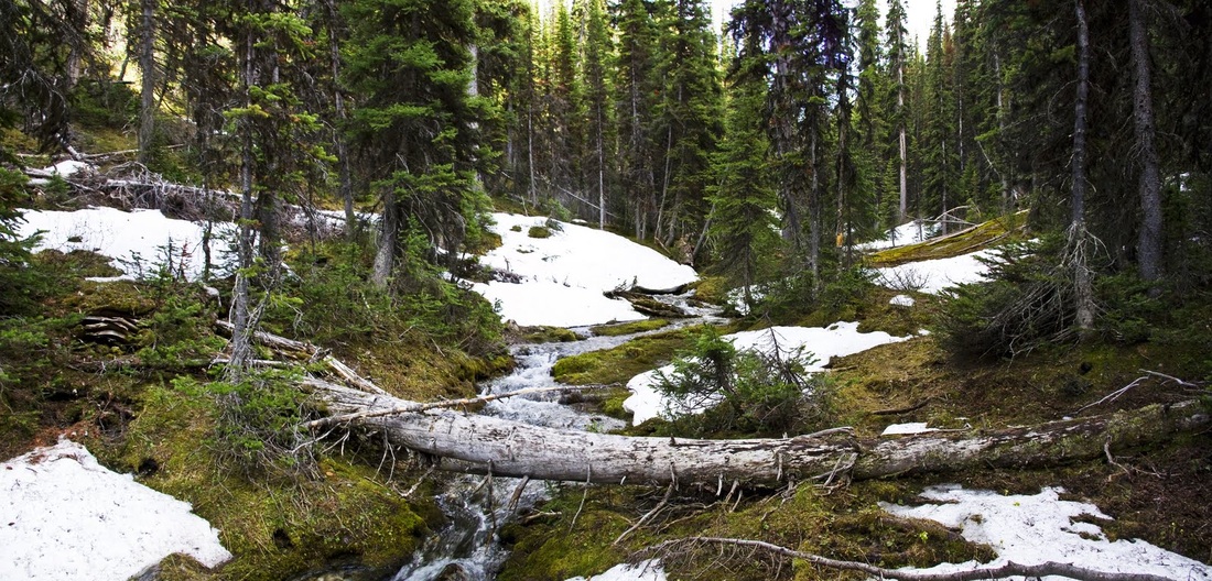
it was quite a trek through the forest which was made worse by tons of deadfall from this winter and many before it, I stepped over, scrambled and circled round tree after tree until I cam to the stream I was seeking, it was nice to get my tired legs and feet on to a little soft moss and to wade through the stream occasionally when crossing was required
sure enough, after a couple of km of shouting "YO BEAR" very frequently and wading through the cool meltwater I emerged from the forest just a short distance from the truck.
I arrived to see the sentries were still posted and I enjoyed watching them pop up and down as I wearily changed my kit and settled in for the long drive home.
This was another spectacular hike but anyone thinking of doing this should take the route on clockwise from the car park to eliminate that difficult and at times dangerous descent, as an uphill scramble it would be much more manageable.