A Week in Jasper National Park
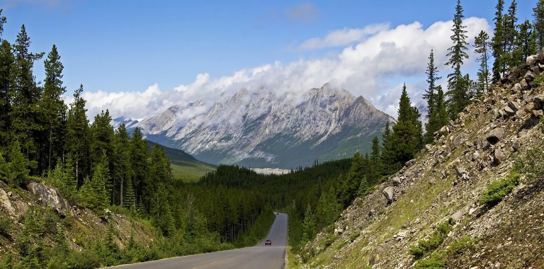
It is 400km (250 miles) from our home in Calgary north-west to the small mountain town of Jasper. We were looking to spend some time together and considered flying south to the US for a week but the thought of putting ourselves through the nightmare of an airport for a week away didn't seem worth it. We opted for a drive along the beautiful Icefields Parkway and a week in the mountains, glaciers and lakes of the Rockies.
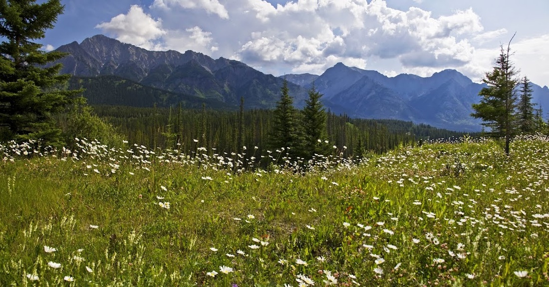
All along the roadside for the entire journey were thousands of flowers covering the verges, and in the distance mountain ranges of all sizes, it is a spectacular drive.
All along the roadside for the entire journey were thousands of flowers covering the verges, and in the distance mountain ranges of all sizes, it is a spectacular drive.
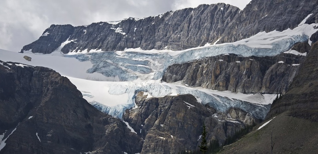
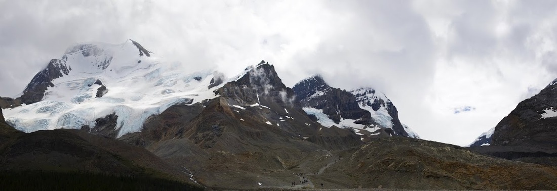
We made stops whenever we felt like it and really enjoyed the journey. A short distance after Lake Louise we stopped to admire the Crowfoot Glacier in Banff National Park, hanging from the north-east flank of the Crowfoot Mountain
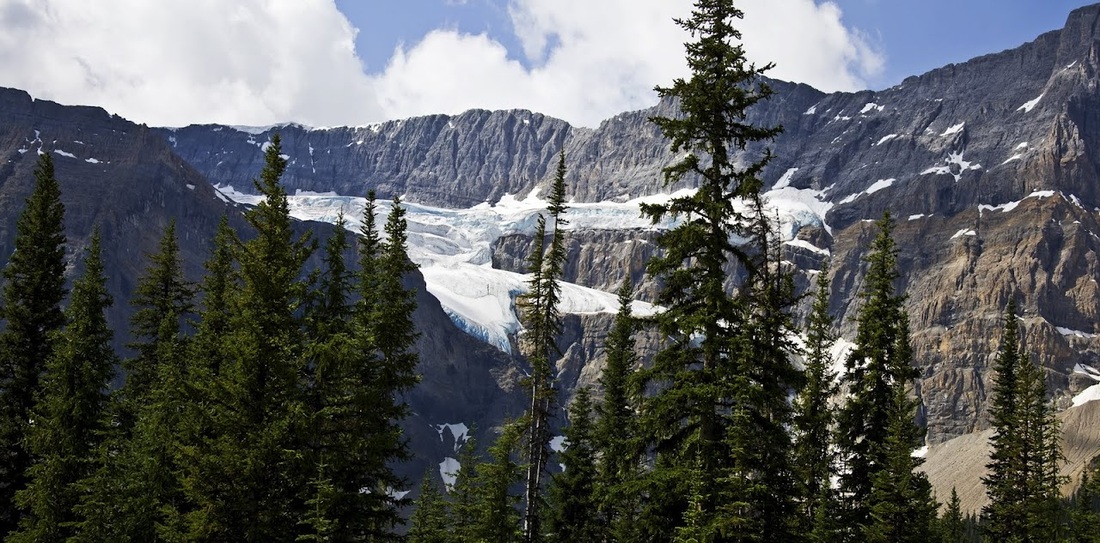
As part of the less popular Wapta Icefield, Crowfoot is perhaps a 'lesser' glacier according to most visitors to the area who head for the enormous Columbia Icefield which spans the north-east of Banff National Park and the Southern end of Jasper National Park. We'll be heading there ourselves soon enough but Crowfoot Glacier is worthy of a stop off and wander before continuing.
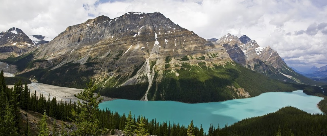
After Crowfoot Glacier we travelled up to one of the most famous lakes in the Canadian Rockies and hiked the short trail to the viewpoint overlooking the stunning turquoise waters of Peyto Lake. At over 1850m (6000feet) above sea level the summer season is short for this lake and the glacial rock flour that pours into it ensures the incredible water colour remains throughout that short season.
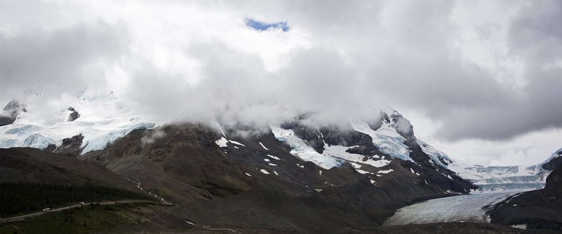
After stretching our legs at Peyto Lake we continued on to the immense Columbia Icefield. With 325 square kilometres (200 sq miles) of ice spanning the continental divide at depths up to 360 m (1180 feet) it is one of the largest accumulations of ice and snow south of the Arctic circle and feeds 8 major glaciers and many more minor ones. Waters from here make their way to 3 different oceans, the Arctic, Pacific and Atlantic and the Icefields Visitor Centre is the perfect place to begin exploring the area.
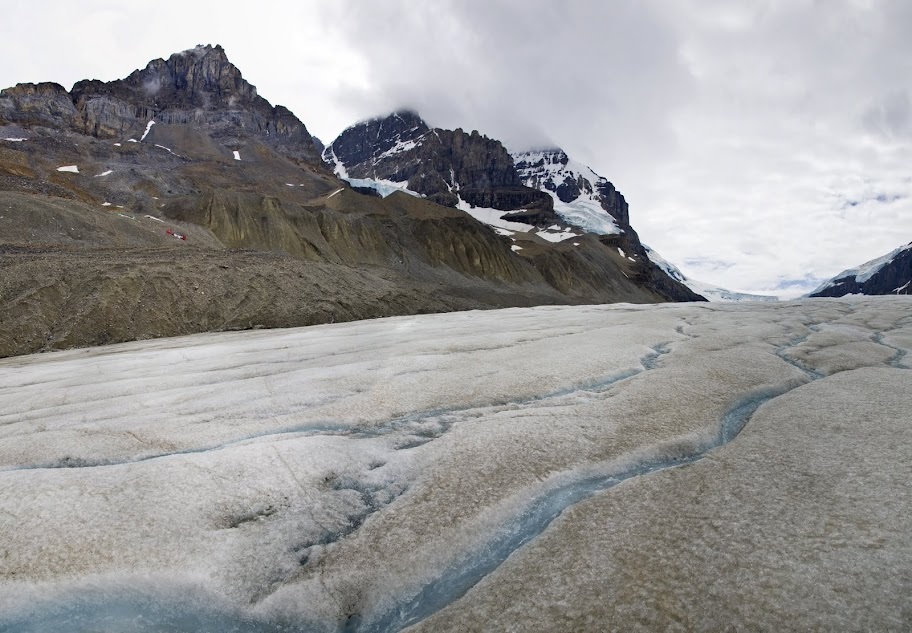
Directly across the road from the centre is the Athabasca Glacier, 6km (3.5 miles) long and 300m (980 feet) deep. Receding at a rate of 3m (9.5 feet) per year.
Directly across the road from the centre is the Athabasca Glacier, 6km (3.5 miles) long and 300m (980 feet) deep. Receding at a rate of 3m (9.5 feet) per year.
A procession of glacier tour buses make their way along a prepared track to a prepared flat area on the lower level of the glacier, we considered taking the tour but before we booked we saw a number of people hiking along the front edge.....now that is more like it, we crossed the road and headed for the trailhead.
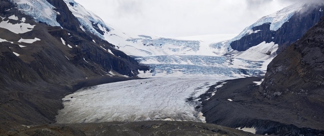
There are a good number of people making the short hike up and over the moraine at the front of the glacier, along the way markers show where the glacier was in 1900, 1930, 1950 etc up to 2010, it's amazing to think that all of the land in view in the photo below was under the glacier just 100 years ago.
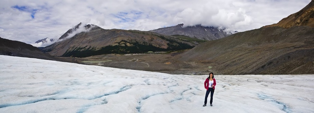
Once over the short steep climb up the moraine we get our first view of the front of the glacier, to the left there are a few people walking to a small bridge across the water and out onto the toe, we set off in that direction with a real sense of excitement.
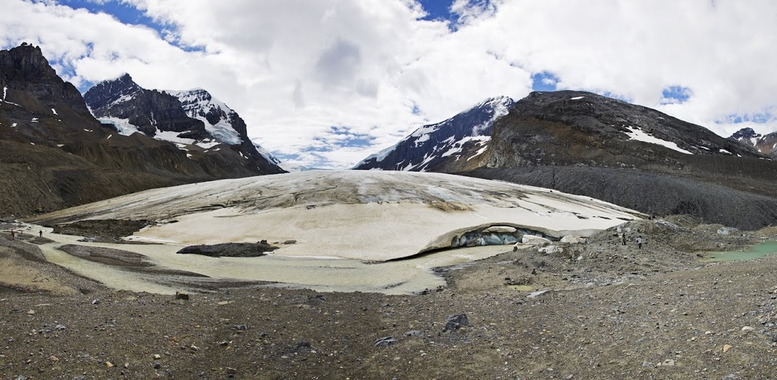
the surface of the toe was covered in tiny rocks embedded in the ice making the grip easier than expected though I had taken micro spikes along in anticipation/hope of being able to get up on here.
As we hiked along we waved to the people in the glacier tour buses riding along the lateral moraine to our left, looking at them all pressed against the window with their cameras in hand showed that this was the right decision.
further along the ice was much cleaner but the surface was beginning to look like a road map of great britain with small streams running all over, with Sarah huffing and puffing I decided to turn back, we had a nice little adventure and walked along a glacier, no need to take any risks.
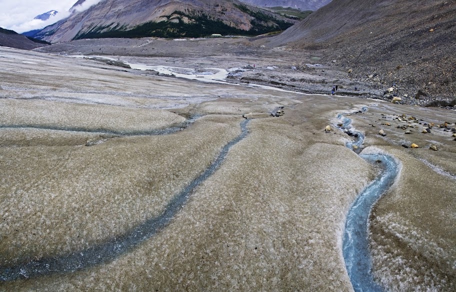
before heading down we filled our drink bottle with fresh glacial ice water and took a drink or two, it was actually really nice, obviously cold, soft water and we felt like we had something as we descended with large smiles on our faces.
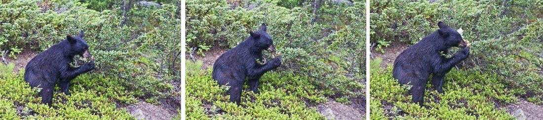
We were soon back to the car park and heading north toward Jasper, on our final leg stretcher before we reached the town we came across this beautiful black bear munching berries, absolutely uninterested in us, though he could probably only see me as Sarah was behind me peeking over my shoulder repeatedly telling me "it's a bear"........
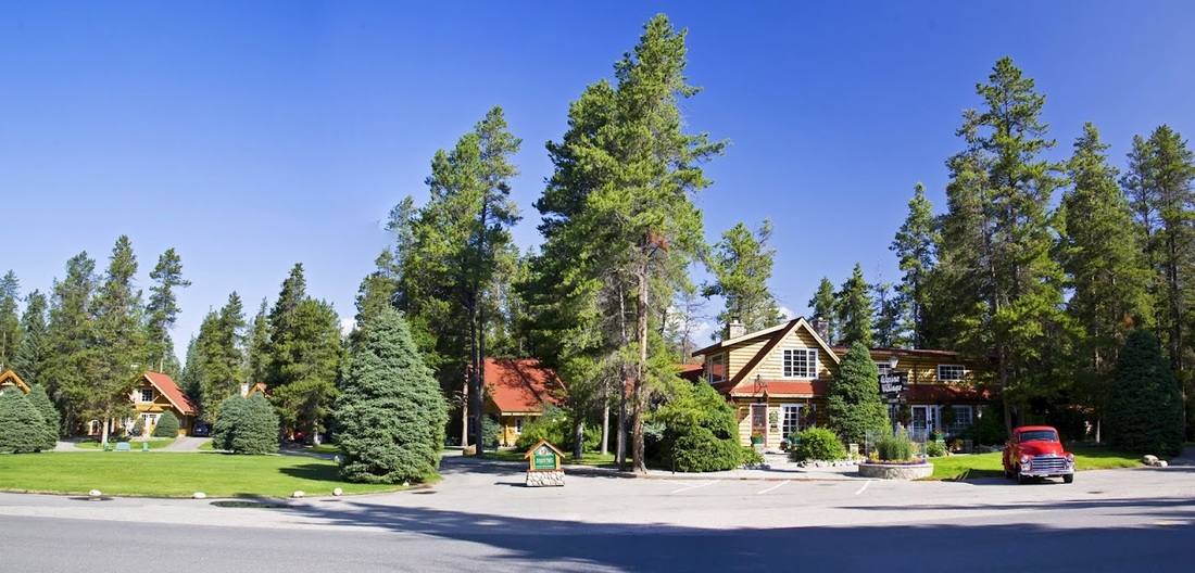
after having our first bear encounter of the week before we had even got to our destination we made the final short leg to the 'Alpine Village' 2km south of Jasper. Situated in the forest beside the Athabasca river with a hiking trail that led into town it was a perfect setting, the only downside was the stone age internet that made google searches of the area a hideous experience.
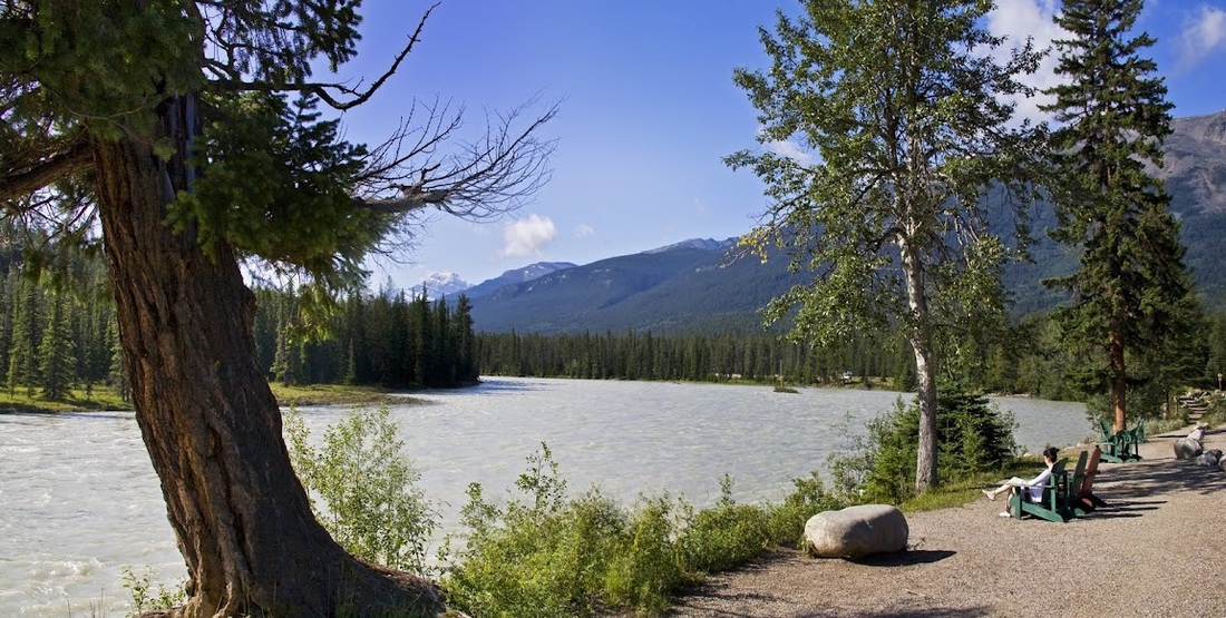
Sarah didn't take long to find the riverside chairs and after unpacking and taking a look around, that was the way we spent the rest of day one.
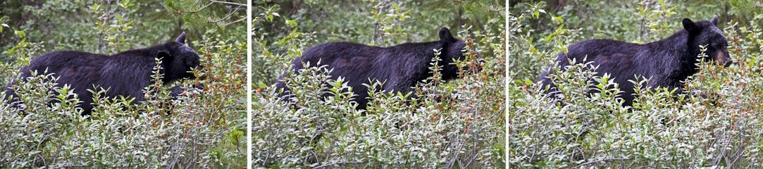
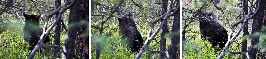
After breakfast on day 2 and being told by the receptionist that a grizzly with 2 cubs was on the site we decided to walk along the hiking trail into town, we didn't see a grizzly with 2 cubs but we did see this sneaky bear making use of the boulder field to cross from berry bushes to berry bushes, to save any confusion Sarah told me "it's a bear" ..........
it is a lovely walk along the trail to the town, much of it beside the river and through forest until crossing the railway to reach the town site
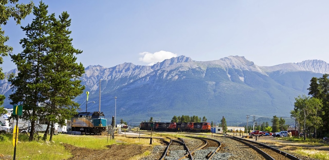
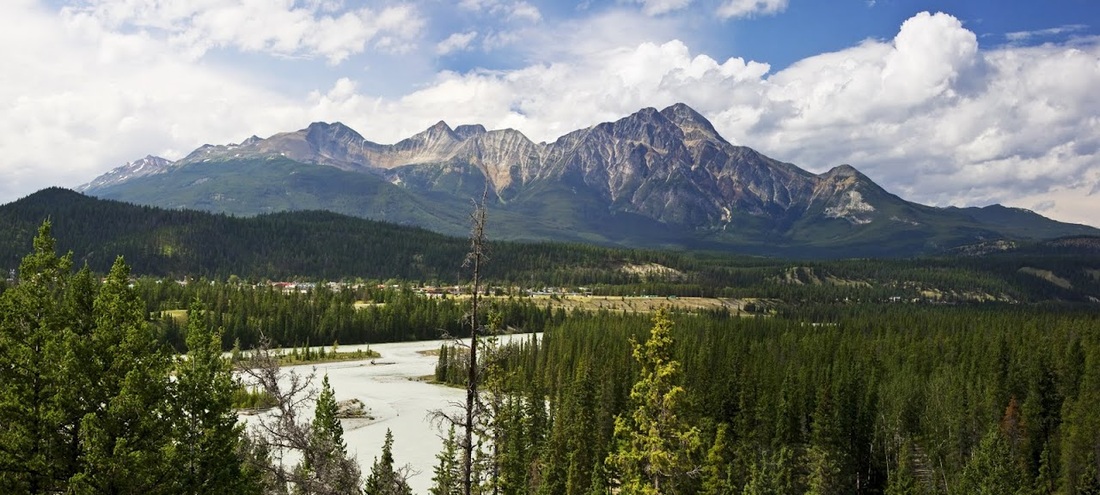
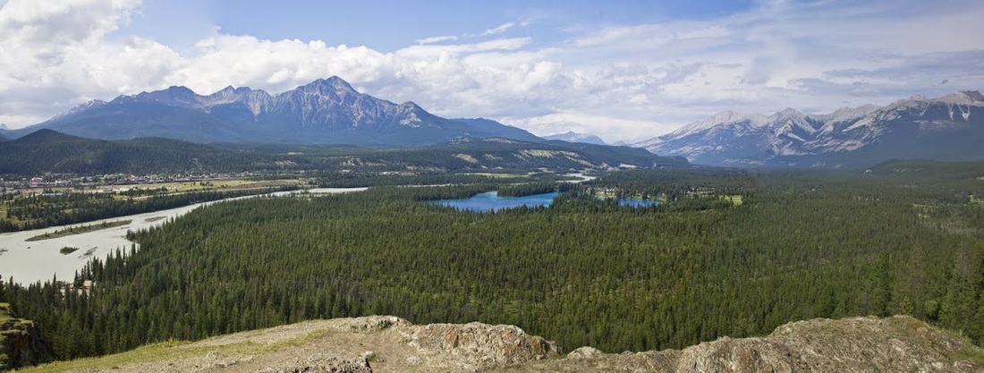
the first view of Jasper is beautiful nestled at the foot of Pyramid Mountain it is the archetypal rocky mountain town.
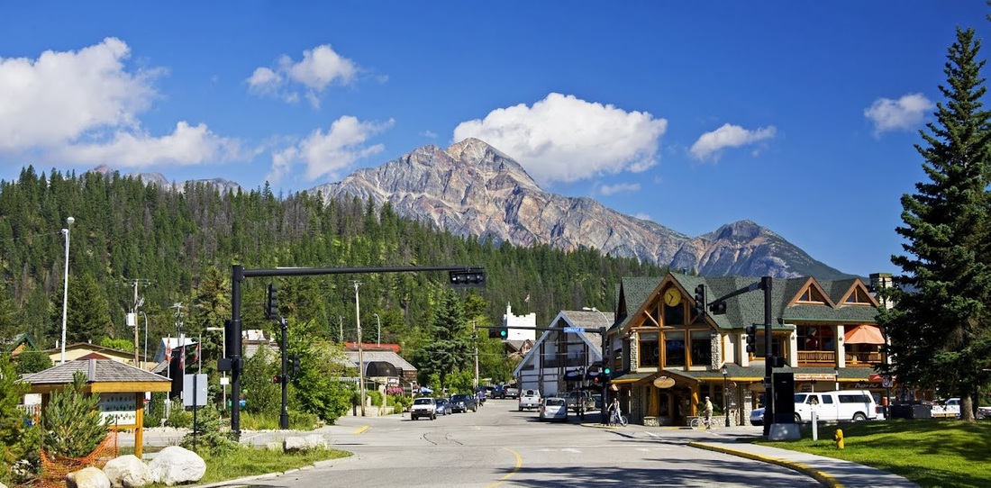
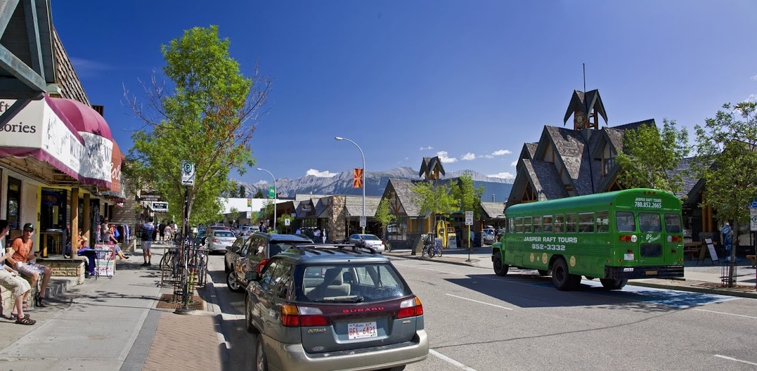
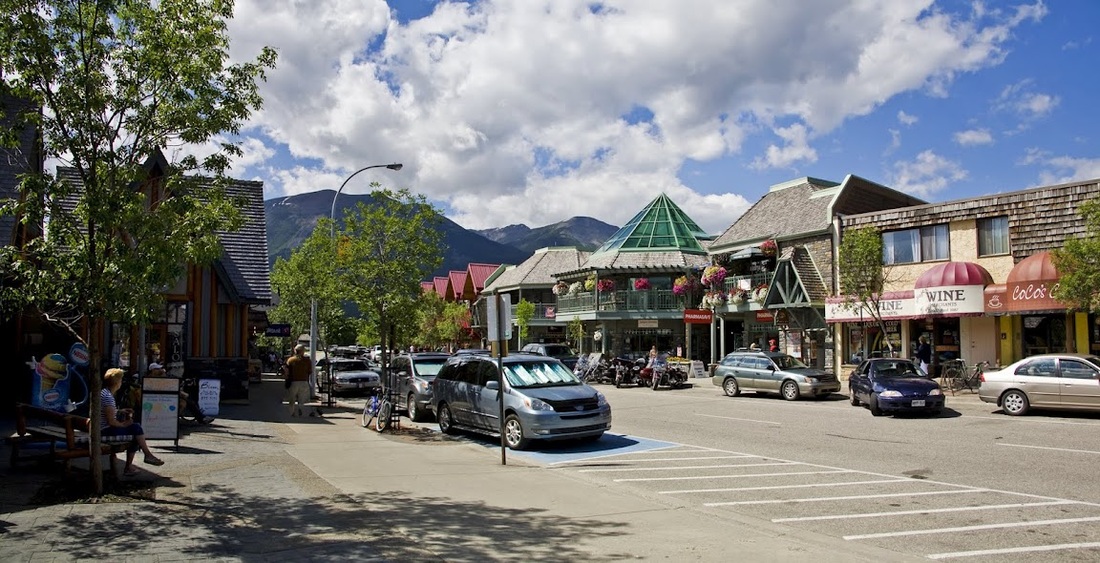
the town is a mass of gift shops, restaurants and café's, everything Sarah could wish for
during the week we sampled as many of the eateries as possible, during dinner one evening we saw an enormous elk trotting through the town centre with a ranger vehicle in hot pursuit, cars swerved in all directions as the unconcerned critter waved its huge antlers in their general direction as he trotted through.
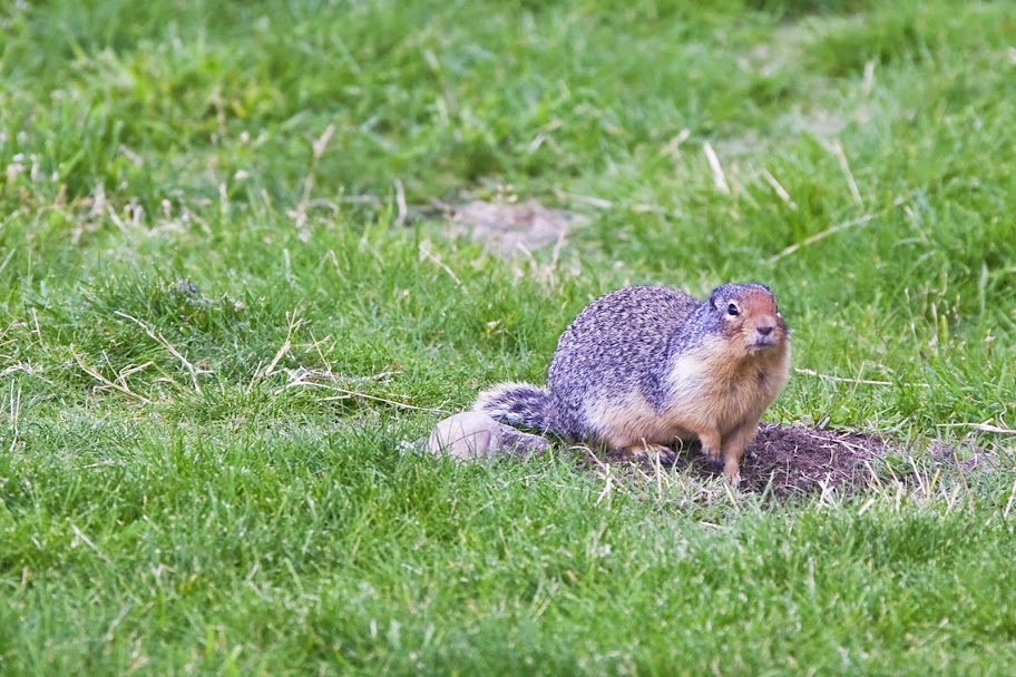
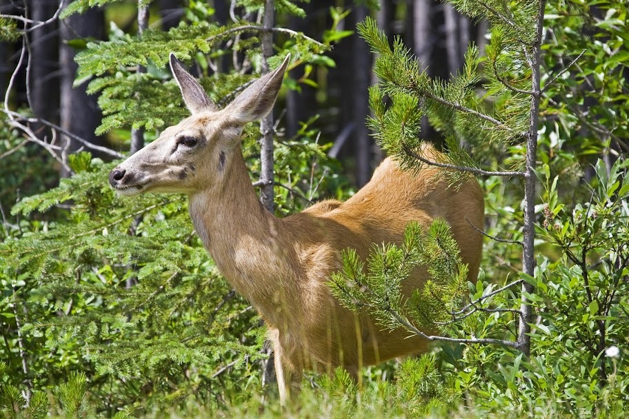
the town has plenty of other wildlife too, many of which will strike a little pose if you approach slowly as this columbia ground squirrel did...just for a second before dashing down it's burrow
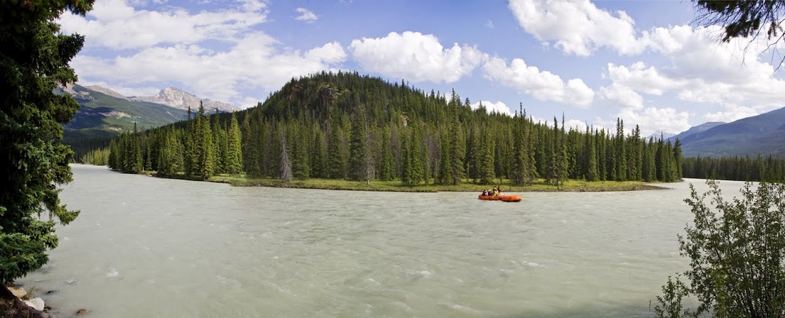
After a good look around the town we noticed the new Batman movie was playing in the little movie theatre there so went along after lunch and enjoyed the film before walking back to the riverside seats and spending the rest of the day watching the rafting tours go by, each one waving as they went.
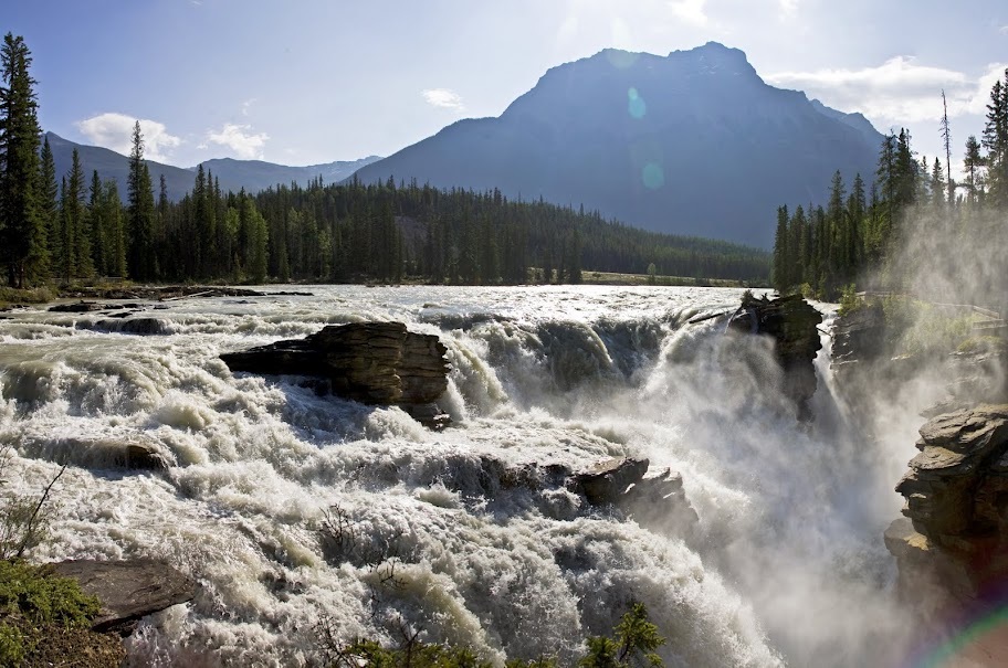
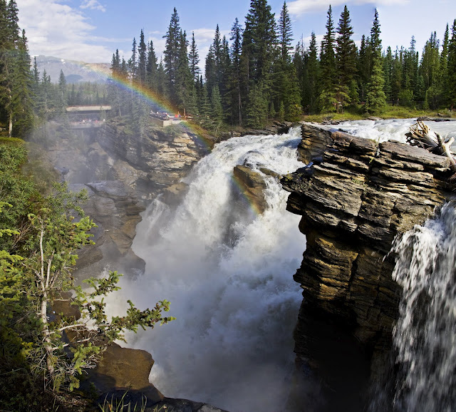
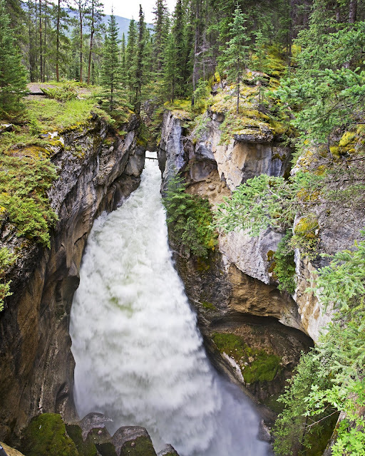
on day 3 we rose early and drove a short distance to Athabasca falls, we were surprised to see so many people there so early in the day. As we walked from the car park we could hear the falls roaring but couldn't yet see them.
a short walk leads to a view of the top of the falls with the sun rising above Mt Kerkeslin across the way, it is a fantastic sight but doesn't yet do justice to the whole of the falls.
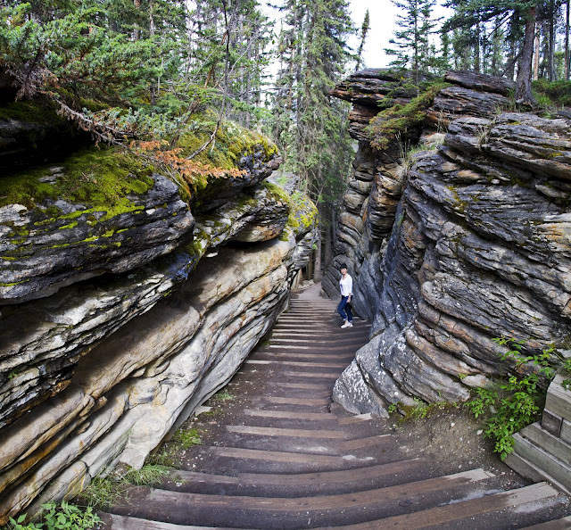
walking further downstream leads to a rather ill fitting concrete bridge that detracts from the area quite significantly but does provide an excellent platform to look upstream to the falls and the thundering cascade through the canyon below.
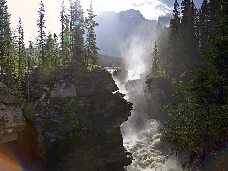
once across the canyon we hiked back up to the head of the falls and looked downstream at the beautiful natural wonder only slightly spoiled by the two hideous concrete bridges downstream.
we took the whole circular hike that runs downstream through the older dry channels of the falls and provides a nice river view before climbing back up through more of these dry channels
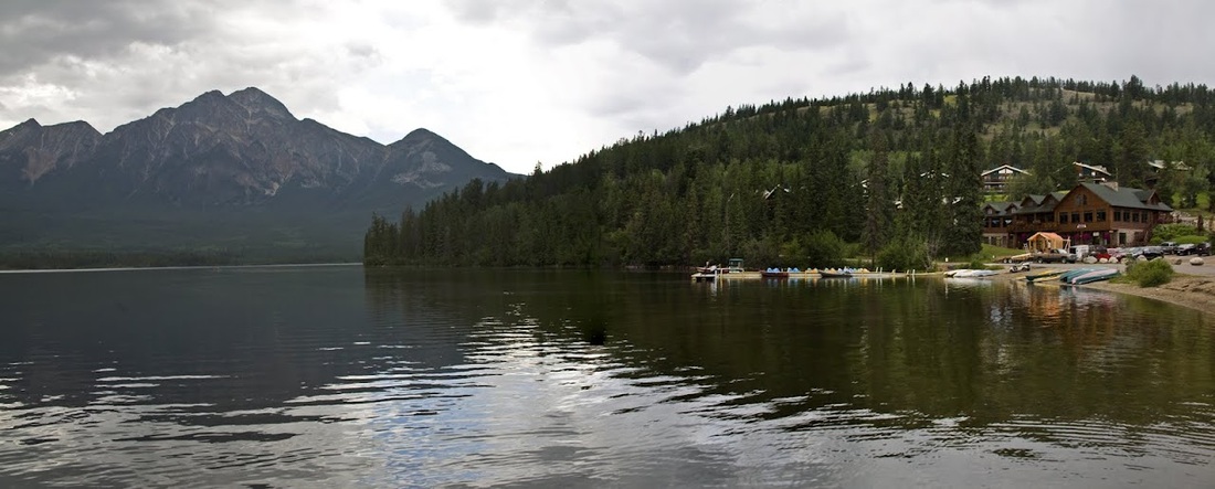
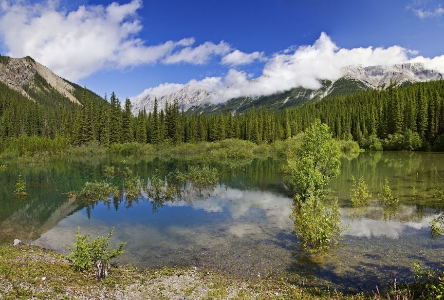
from the falls we drove back through Jasper and visited both Pyramid and Patricia lakes before dropping back into town for dinner.
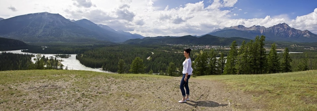
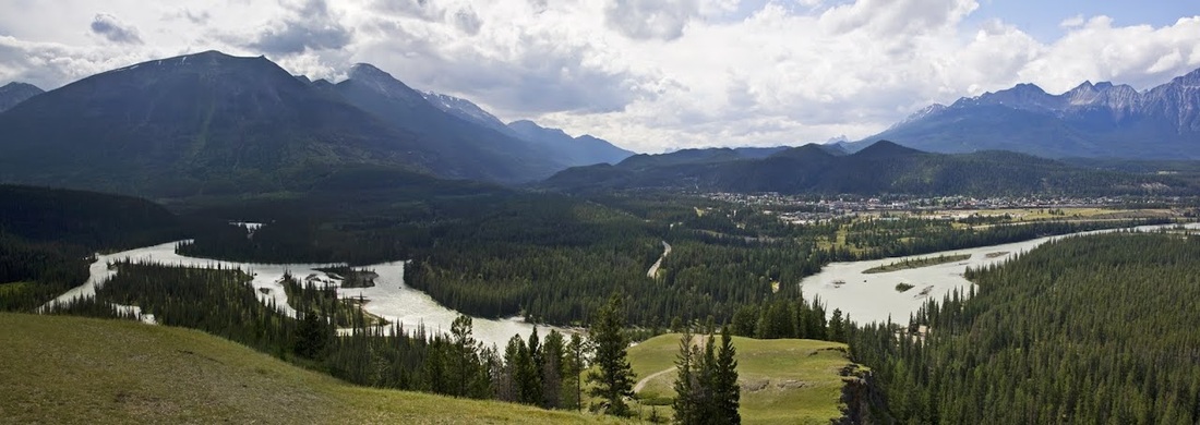
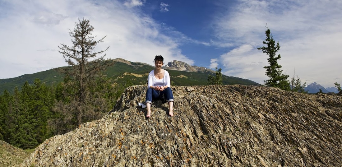
we began day 4 with a hike to Old Fort Point just a couple of km East of our cabin, the initial ascent is a series of wooden steps over a steep rock face that affords a great view back over to pyramid mountain
once up the steps it is a nice gentle stroll though Sarah may disagree with this statement, along a grassy knoll overlooking the town and surrounding mountains
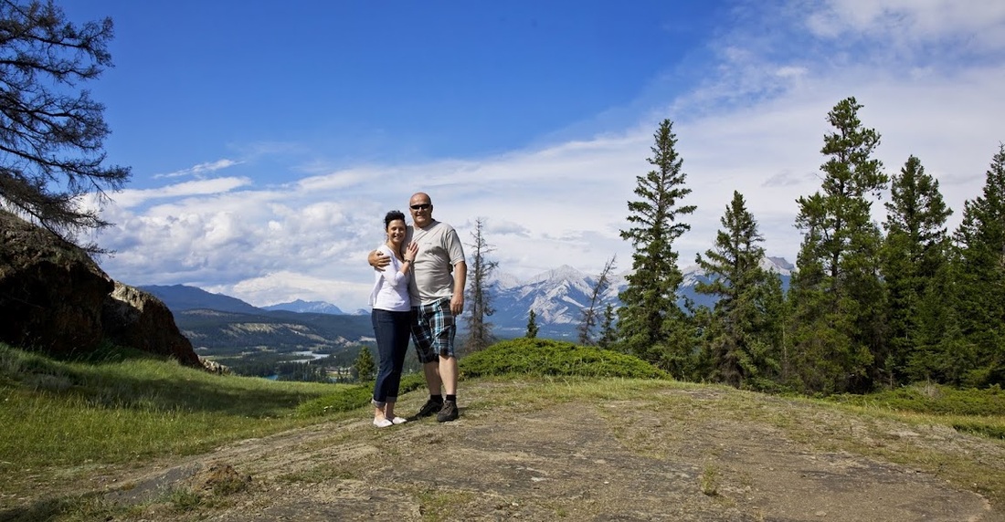
Almost at the summit we use a good lump of rock as a tripod for our timed pose in order to capture the full brilliance of those shorts!!
the view across to whistlers mountain and along the Yellowhead Highway was worth the climb though we were disappointed not to see marmots in the meadows along the way, still something we haven't seen yet.
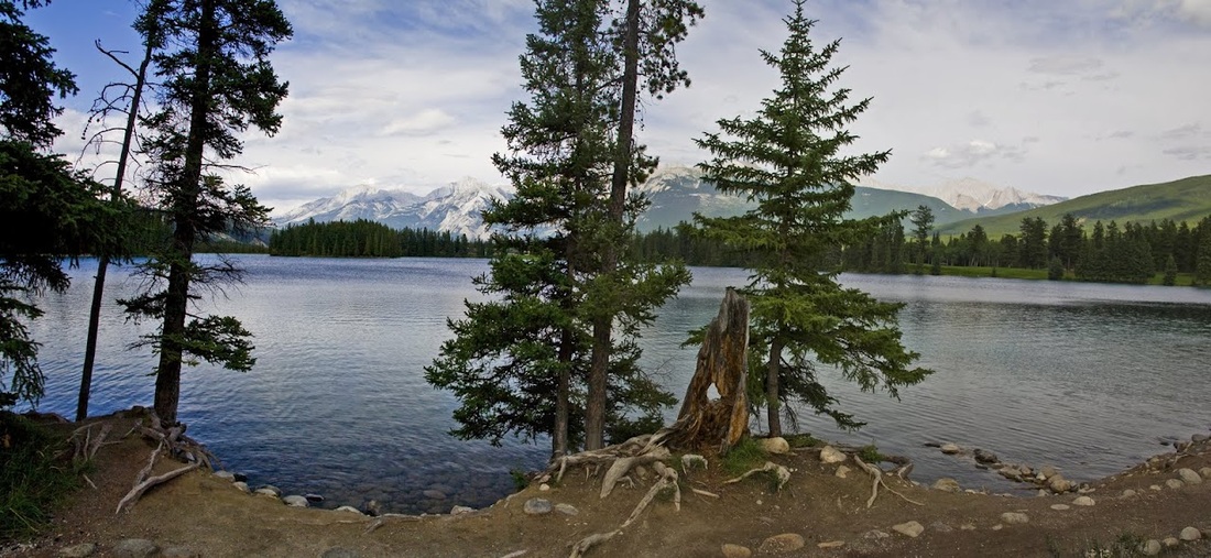
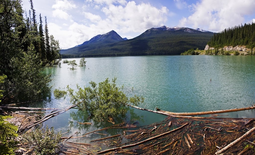
to the east Beauvert lake almost looks painted into the landscape, we will be going over there for a closer look once we have enjoyed the mountain a little longer.
we needed just a little while for Sarah to rest her aching feet though I couldn't let her sit for too long in case she refused to get up again, I promised her a cool soothing foot treatment once we were down off the mountain
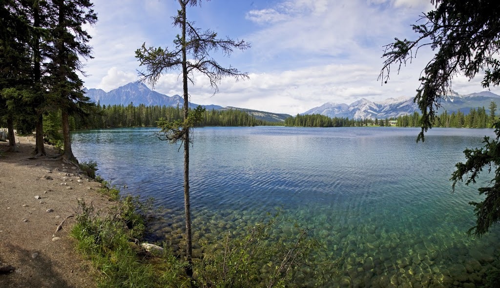
As soon as we are down from the mountain I take Sarah for the promised treatment.......she is not impressed and refuses to go any further than a toe in the water at Beauvert Lake
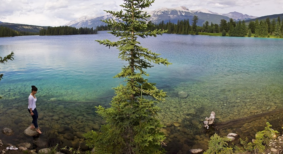
all the same the cold water does invigorate sufficiently for us to take a short walk along the lake shore trail
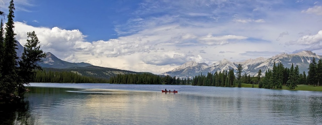
at one point a family pass by in a Canadian canoe enjoying the lake and providing a perfect stereotype for a rocky mountain photo.
we leave the crystal clear waters of the lake and head into town for dinner before enjoying another quite evening by the river and an early night.
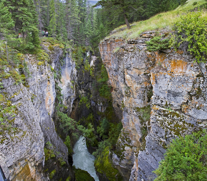
Day 4 saw us up and out to Maligne Canyon just a few miles east of Jasper, the huge car park gave away the popularity of the venue and there were already crowds of people making the short walk to the lower tea house. To avoid the crowds we took the longer journey upstream and were pleased to have the venue to ourselves from that point.
The Maligne Valley is riddled by the most extensive "karst" system in the world (a geological formation of caves above and below ground level). In the case of the Maligne Valley, no one knows just where water from Maligne Lake goes. When traced by dyes it has taken anywhere from half a day to a week for the water to make the journey from Medicine Lake to Maligne Canyon (about ten miles). Even then, the dyes didn't show up at only one final destination. Dyes turned up in the Canyon, Lac Beauvert by Jasper Park Lodge and in several of the other lakes between.
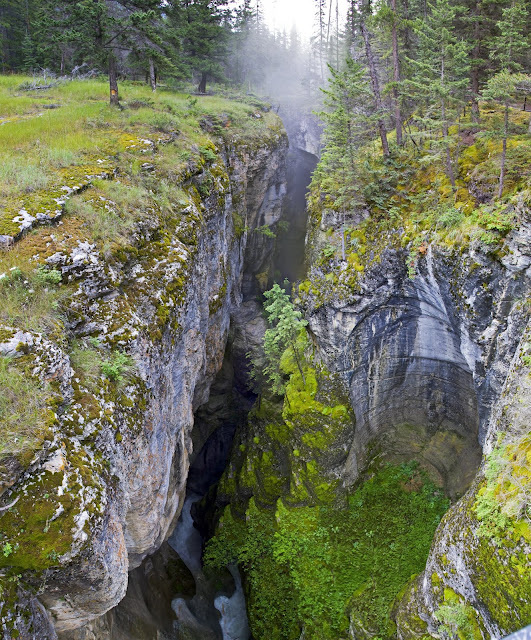
there is a tremendous amount of water hammering down the canyon and literally flying over the drops making the waterfalls more of a water chute
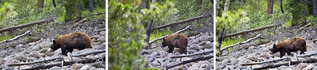
Maligne Canyon also added to our bear sighting tally with this good size black bear enjoying the bright red berries along the trail, its great to watch them pull a branch into their teeth and then strip it by closing their mouth and pulling the branch out again, sans berries.
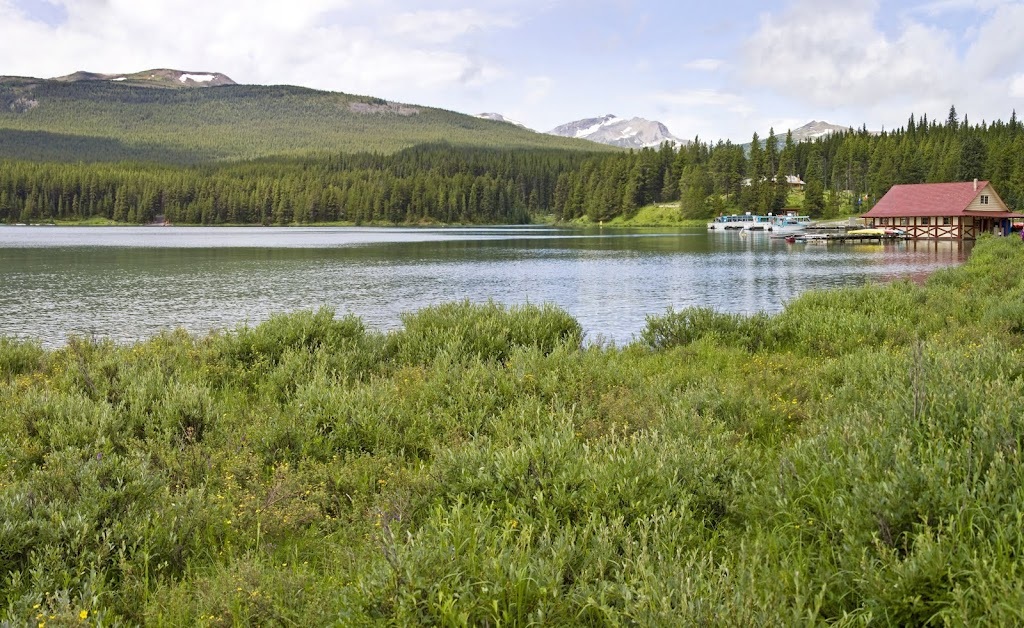
after visiting the cafe and gift shop we got back to the car and continued on along the Maligne road to it's destination, Maligne lake where we had intended to take the 90 minute boat trip. After seeing the boats and realising that they are 'closed in' neither of us fancied it so we walked along the lake trail instead.
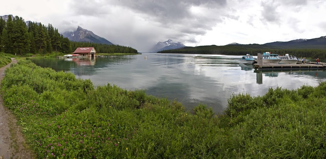
as most people take the boat trip the trail is nice and quiet, the boathouse for canoe rental is flooded out and no rentals are available as a result.
the locals were quite friendly and even though they had some good size ears to hear us coming some of them stayed around long enough for a photo
after wandering the lake area for a while we took advantage of the excellent on site cafe and huge decking area to enjoy lunch before setting off back down the stunning Maligne road
our next stop was at Medicine lake where we watched a little whirlpool dragging water down into that endless 'karst' system
the Maligne road curves around the northern end of Medicine lake which is well above it's normal water level giving us no chance of being the first to discover exactly where exactly the water goes.
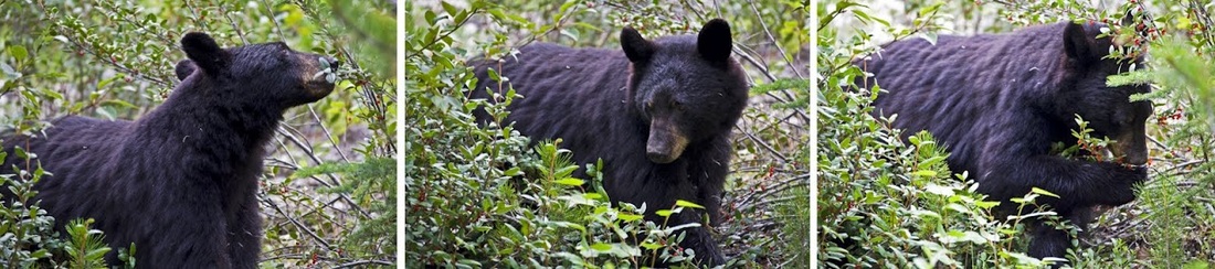
We continued our journey east and picked up the Miette road that leads to the Miette Hot Springs, it was along this road that we saw a huge black bear enjoying the berries, again he had no interest in us as we watched him for quite a while going about his demolition of the forest fruits
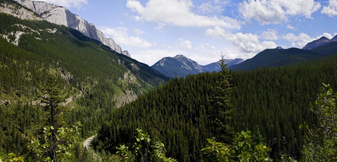
The road is a winding scenic highway with pull out locations to take in the views of the extensive forests and mountains
The road ends at the car park for the hot springs, fortunately there are a number of hiking trails up here, I say fortunately because the hot springs themselves are a disappointment. They are fully commercialised with no natural look remaining, they look very much like two small man made swimming pools and are heavily fenced. Another up side is a very nice little cafe, after all you can't get too many cups of tea
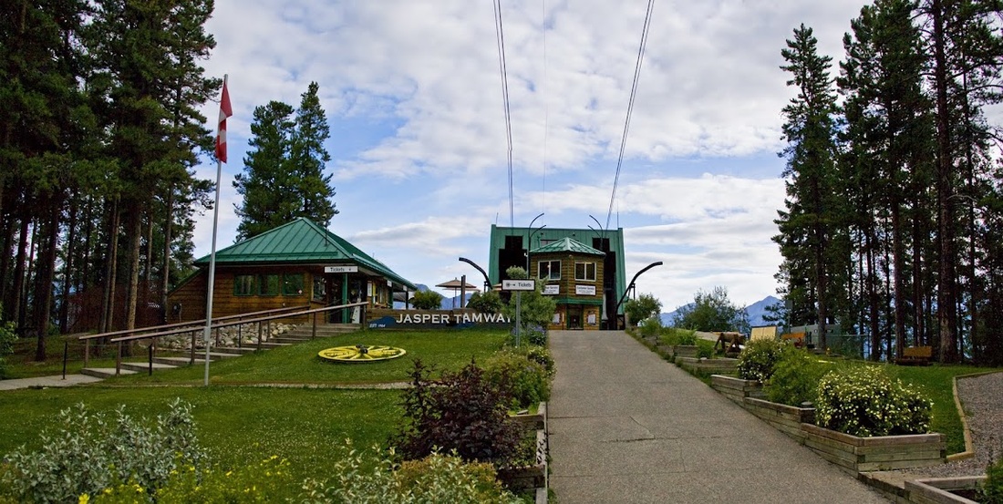
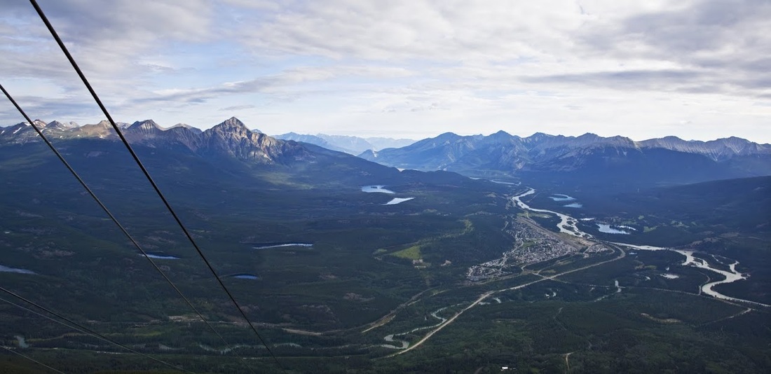
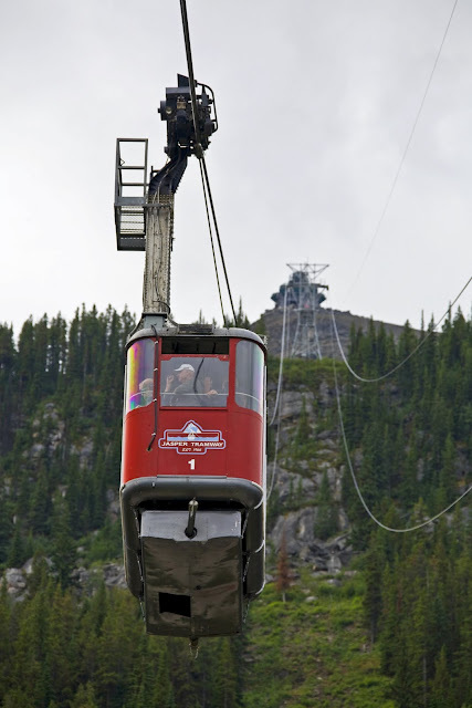
Day 5 saw us up at the Jasper Tramway by 09.00 to take the mountain gondola up to Whistlers Mountain where a short hike gets us to the summit. The gondola is a large 20+ person car so we were pleased to find we had it to ourselves for the ascent.
the ride up gives a great view out over the town of Jasper, the bend in the river to the right of the shot is the location of our cabin. To the far left Pyramid Mountain is just being touched by the rising morning sun
we decided to take the hike to the summit as soon as we exited the gondola and set off with Sarah already feeling the effects of altitude. It wasn't long before we were stopping to 'admire the view' quite frequently.
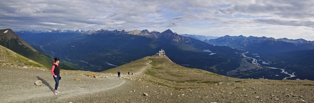
as we continued the climb there were plenty of opportunities to 'take in the views' again, but Sarah wouldn't give up even if she did take advantage of every 'seat like' rock on the ascent.
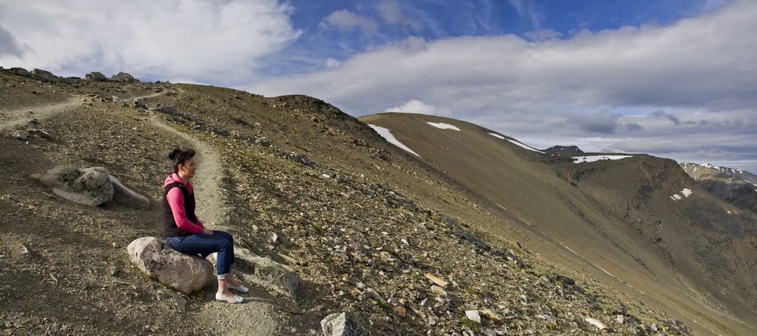
there was still a chill in the air at the top but the views in all directions were worth the effort. Looking south the depth of the ranges was incredible and the colours of the rocks even better.
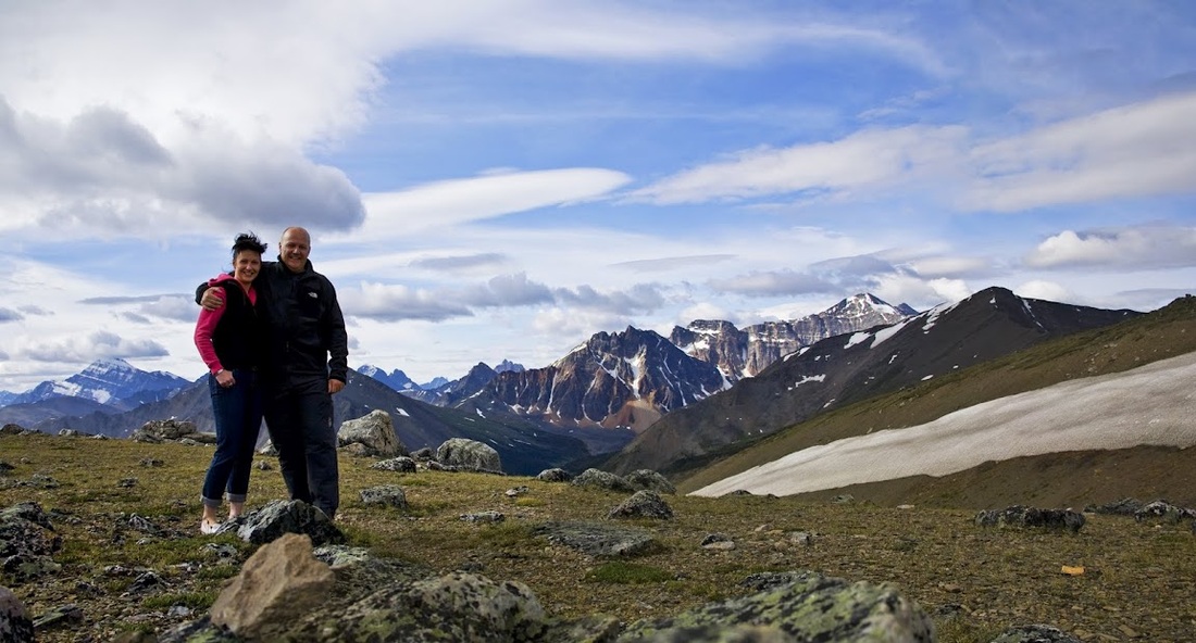
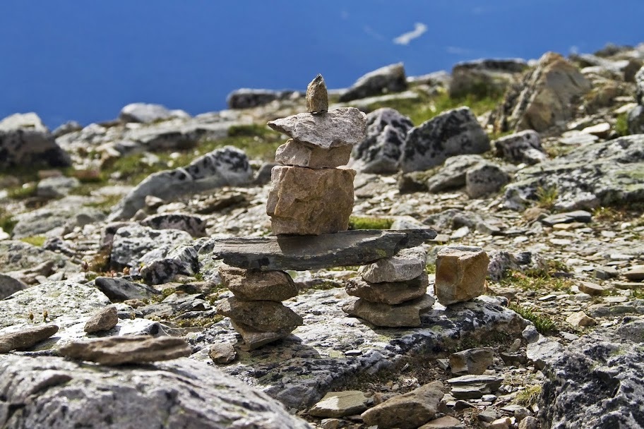
we enjoyed a lovely long sit down on a large boulder before doing a little construction of our own to add to the dozens that were already there.
We saw the usual critters up here including the columbia ground squirrel, a ptarmigan with a small chick, a pika and as always a cheeky chipmunk

we made use of the mountain top cafe before descending, once again we had the gondola to ourselves. As we passed the next ascending car with about 20 people in it we were glad to have enjoyed a VIP experience in both directions
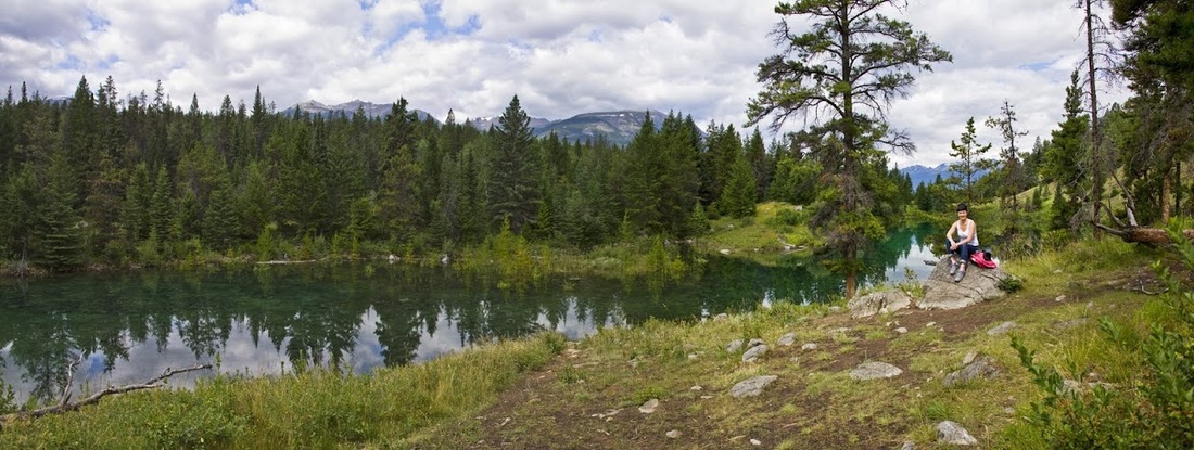
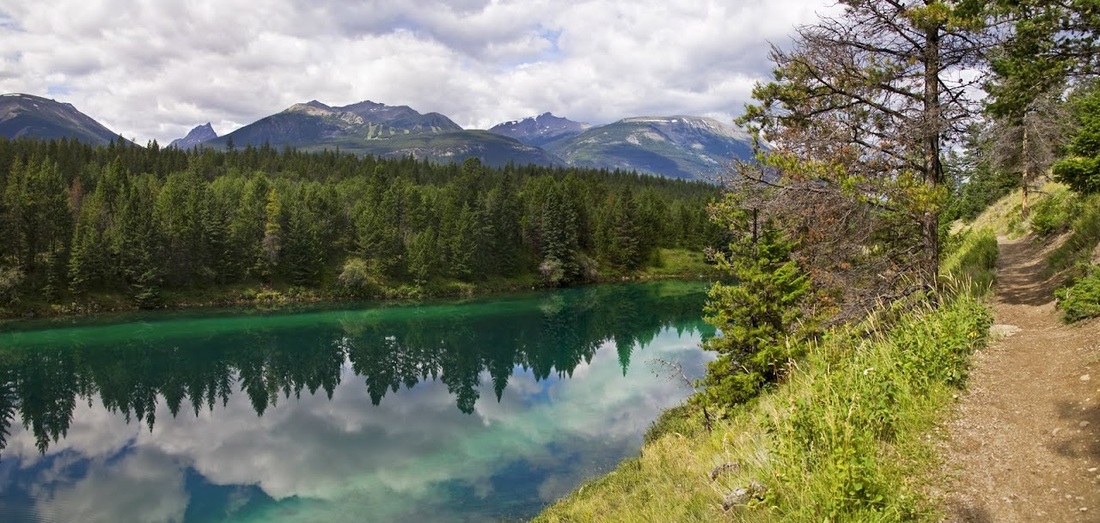
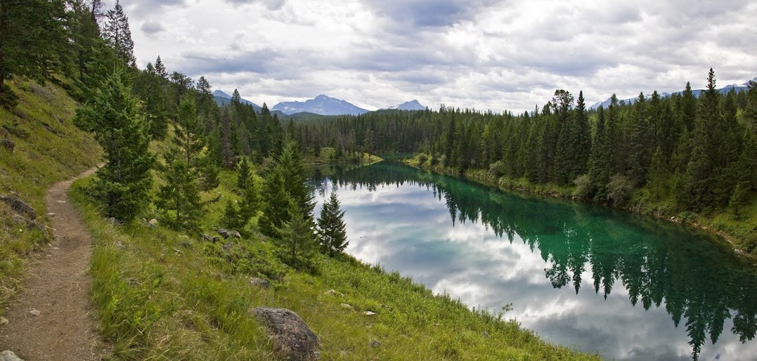
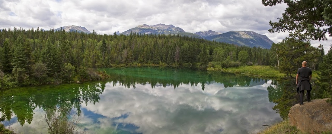
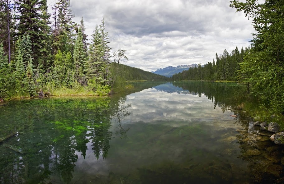
Once back on the ground we set off south to the Valley of the five lakes which is a nice longer hike taking in (as suggested by the title) five lakes. The lakes follow one after the other along a lush green valley accessible from the icefields parkway
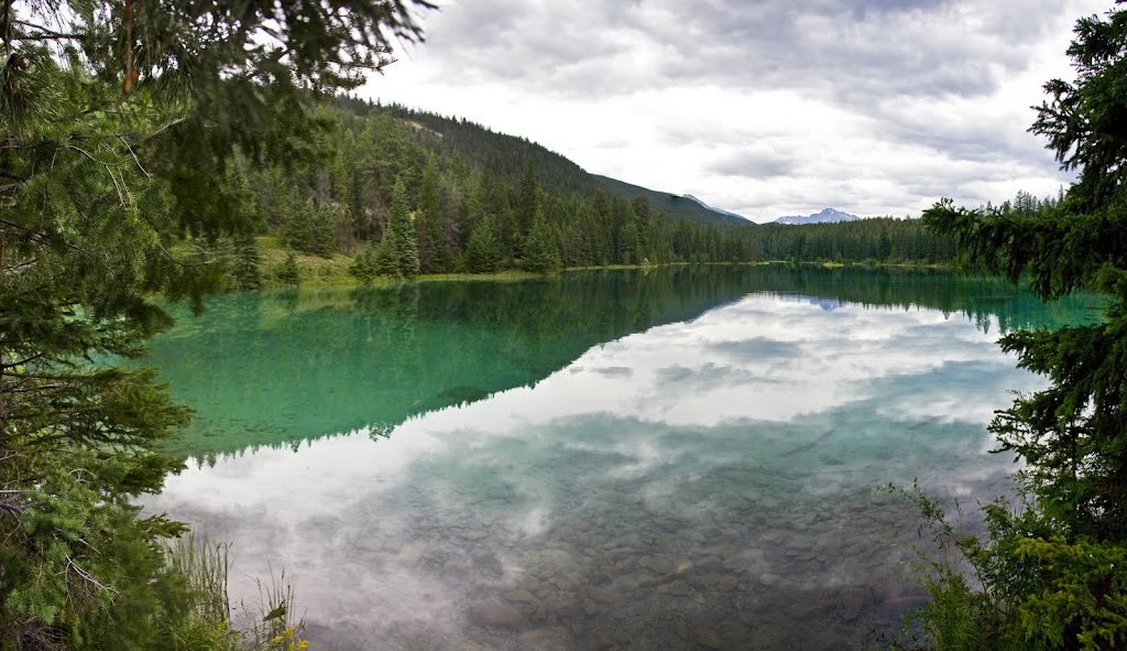
the lakes are beautiful, from a distance they bear the deep turquoise colour associated with all lakes in these parts but close up they are stunningly clear, so much so that we were able to watch a young duckling feeding under about 3 feet of water as we rested part way around the hike.

this was one of the best hikes we did this week, a great easy trail through forest and rugged rocky outcrops and alongside such beautiful waters
I should confess to a bit of a nightmare situation here as part way around the camera card was full, I always carry a spare battery but the cards hold so many images that I never fill them....now it seems I should say, almost never. Fortunately I could erase a number of bear shots as I tend to take a lot of the bears which gave me enough space to carry on clicking along the hike....lesson learned.
it was impossible not to keep on clicking here, the incredible lakes cried out to be photographed and though they may lack the tall mountains around them to really add drama they are still stunning to behold.
I tried to get Sarah to stand on this rock but she was having none of it so I made a rare appearance in front of camera showing remarkable coordination in my clothing selection for the day
we cut across the south end of the 5th lake and headed back into the forest to pick up the home bound trail with only one regret, I hadn't brought my fishing tackle along.
Our next jaunt was north west into British Columbia in an attempt to view Mt Robson, the highest point in the Canadian Rockies, there was a lot of cloud around but it was a great journey out there with numerous stops at lakes along the way. An immediately apparent benefit of the park is the cafe right at the car park. The park is free to enter and includes fuel,cafe and visitor centre with free maps and other information.
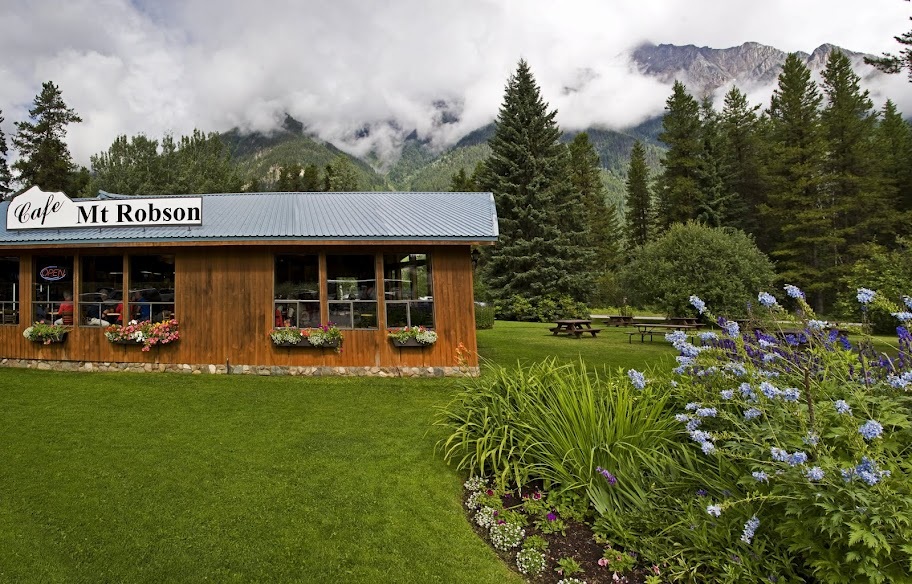
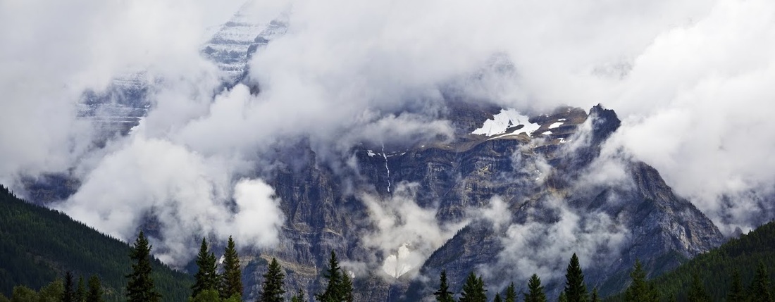
as we walked toward the visitor centre only the base of Mt Robson was visible below the clouds but large areas of blue sky were moving around above and we hoped for the best.
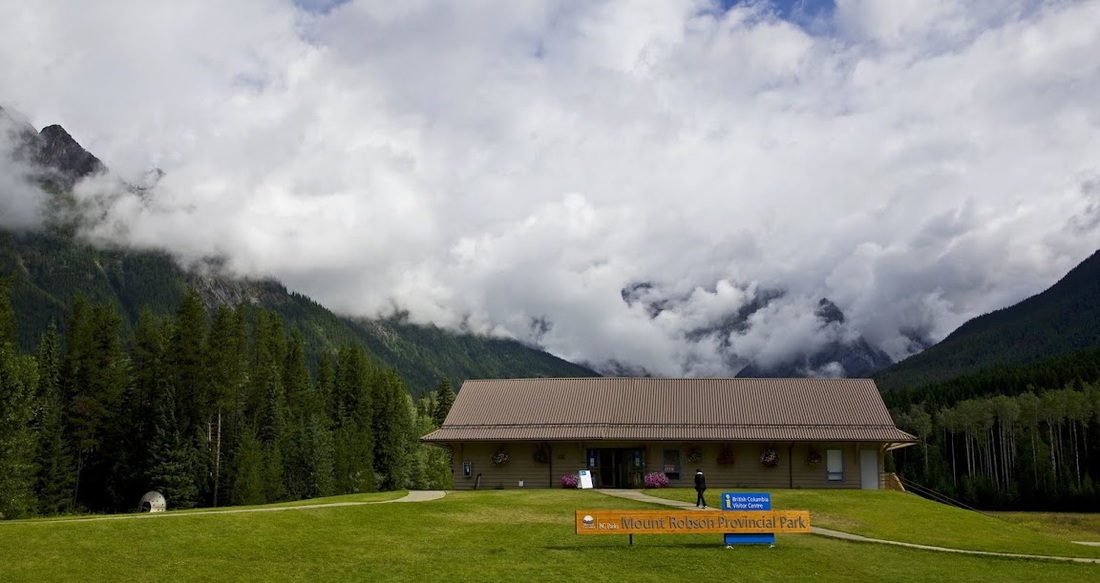
behind the visitor centre is a huge decking area with seating and a great viewpoint of the surrounding mountains. At the opposite side of the road the peaks cleared after about 10 minutes so Sarah an I sat patiently waiting for the cloud to lift from Mt Robson
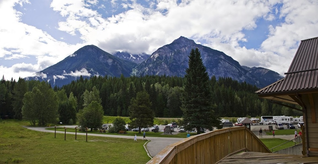
it was nice to sit and watch the humming birds come and go whilst waiting but even after considerable time this was the best view we got of the mountain (very similar to my Mt McKinley experience in Alaska) we still enjoyed the day and the steady journey back to our cabin through the cloud covered mountains.
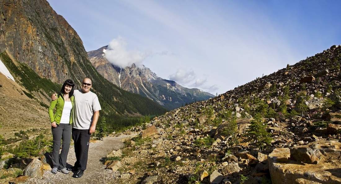
Day 6 saw us with a whole new plan, we realised that staying until Saturday as planned would mean travelling the Icefields Parkway in peak season 'holiday weekend' traffic which could result in significant delay due to the single carriageway and plethora of camper vans, trailers and tour buses. To avoid this we packed up Thursday night and loaded the car ready for a Friday morning departure. Our last planned trip would have been south (toward home) anyway so we just made it a stop off along the way. After having breakfast in Jasper we drove to the small scenic highway 93a that runs adjacent to the Icefields Parkway at its northern end, from here we took the single twisting highway up to Mt Edith Cavell where a short hike from the car park led us to the most beautiful location
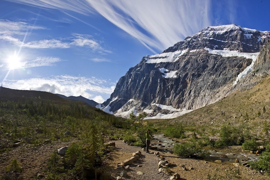
it is a fantastic morning with bright blue skies and wall to wall sunshine, just the thing for viewing mountains and glaciers.
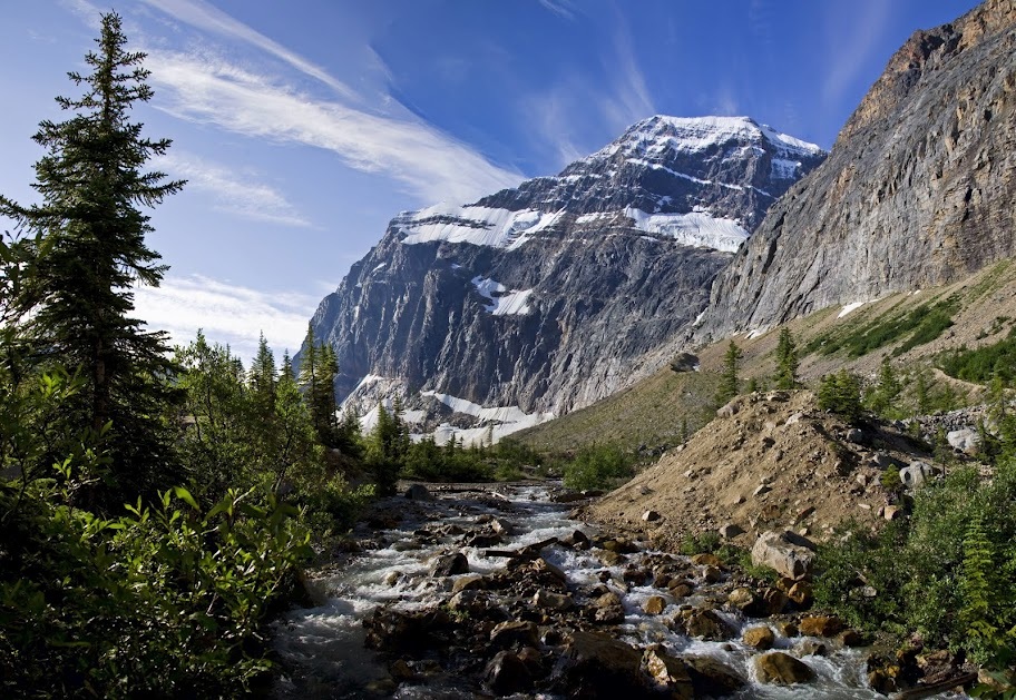
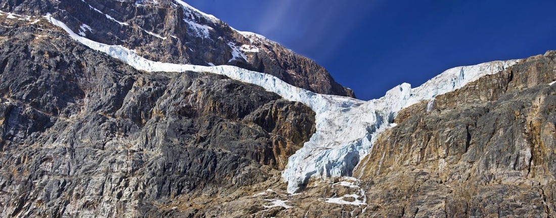
as we close in on the mountain the view of Angel glacier widens to show it's 'arms' reaching to both sides and the waterfalls pouring off it from high above
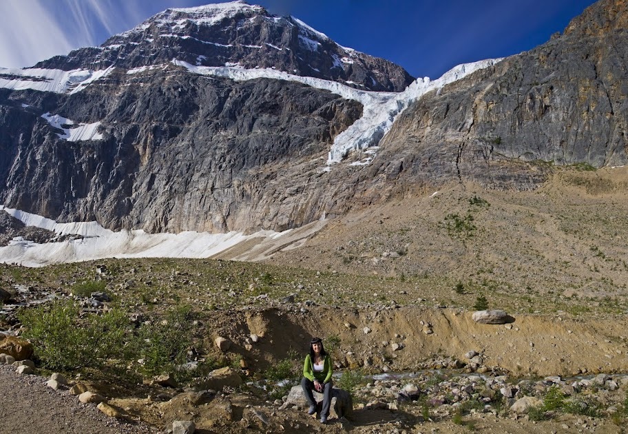
the glacier hangs onto the side of the mountain in its death throes, slowly melting and depositing both water and ice into the glacial lake below
definitely the kind of day to be showing off your new fleece, and if you both have a new fleece all the better. They were actually useful up here as it was still quite cool in the morning air.
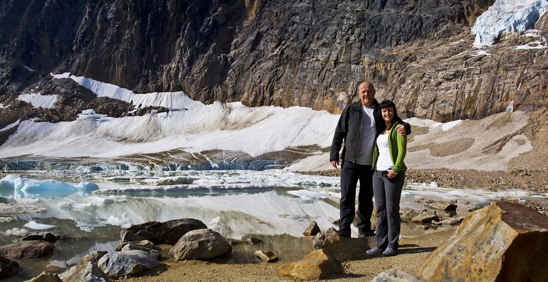
Mt Edith Cavell is a truly beautiful location, named in 1916 for Edith Cavell, an English nurse executed by the Germans during World War I for helping allied soldiers escape from occupied Belgium to the Netherlands. I knew she was remembered in England (with a statue in Trafalgar square I think) but had no idea that such a wonderful location so far from home was also named after her, I wondered what an early 20th century woman would have made of such a memorial.
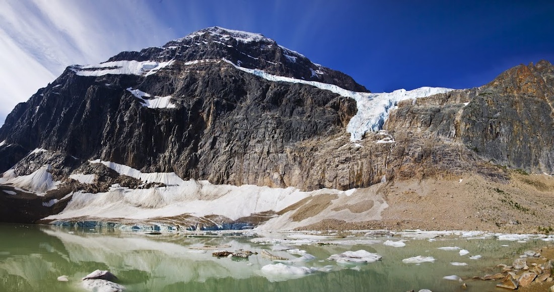
the lake is held on two sides by huge lateral moraines and at the back by the mountain which feeds it, the front is another moraine leaving only a small stream exiting the northern end
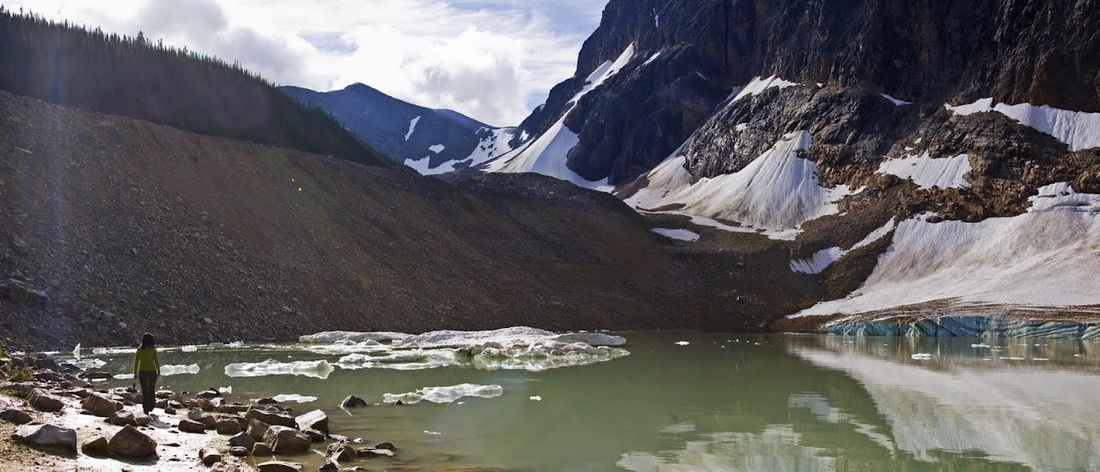
we circled the lake and met a family from Manitoba who we chatted with for some time before grabbing one more shot of this idyllic mountain location

we made our own trail up high onto the lateral moraine to get a great overview of the lake and the small dots that are people down there on the path

we dropped back down to the official trail and followed it past a lovely waterfall back to the car park which now resembled the whacky races as a huge queue of vehicles circled looking for a spot in the small parking area....I'm glad we set off so early.
back at the car we set off for home using the scenic 93a to take us as far as possible before joining the Icefields Parkway, but before we hit the main road we came across a mother black bear and her tiny cub scratching around the bushes, she soon took off into the forest but I managed to grab a few shots of the little cub disappearing into the undergrowth, it really topped off a wonderful week in Jasper National Park.
Leaving early really paid off as we made great time on the road home, we stopped at lake louise for lunch before making the final leg of the journey home, all the time watching thousands of vehicles heading the opposite direction into the mountains.