Belmore Browne Peak - Summer
Date Walked: 6th September 2012
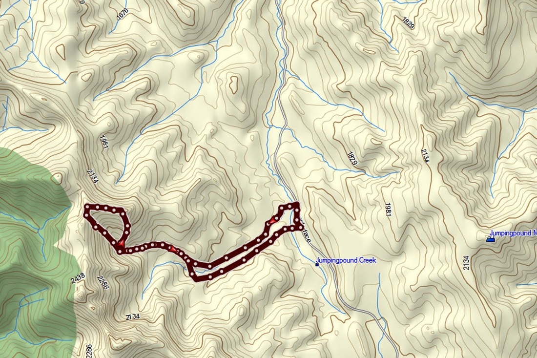
Distance: 7.8 miles (12.6km)
Actual Ascent: 2395 ft (730m)
Time Taken: 4.5 hours
The weather continues to be perfect for hiking of late, 20 degree maximums and cool breezes mean I need little encouragement to get out there. Today I returned to the Powderface Trail for only the third time.
I took the Trans-Canada highway west to highway 68 (Sibbald creek trail) and followed this to it's junction with the Powderface trail which is a gravel logging road. As advised by my guide book I clicked my trip reset in the truck to measure the 14.5km south along the Powderface Trail to the parking area. Unfortunately, on reaching the area there were new logging signs everywhere and a new logging trail carved through the forest. I struggled to find the parking area described in my guide book and drove back and forth a few times trying to locate it. I eventually stopped and took stock of the situation, I could see the peak away to the west (left) so decided to drive back to a point on the road directly in line with it and find some roadside parking there.
I took the Trans-Canada highway west to highway 68 (Sibbald creek trail) and followed this to it's junction with the Powderface trail which is a gravel logging road. As advised by my guide book I clicked my trip reset in the truck to measure the 14.5km south along the Powderface Trail to the parking area. Unfortunately, on reaching the area there were new logging signs everywhere and a new logging trail carved through the forest. I struggled to find the parking area described in my guide book and drove back and forth a few times trying to locate it. I eventually stopped and took stock of the situation, I could see the peak away to the west (left) so decided to drive back to a point on the road directly in line with it and find some roadside parking there.
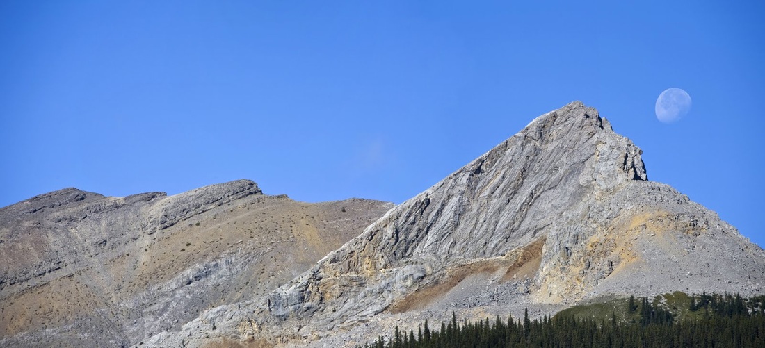
After much messing around I finally settled for pulling off the road onto a high bank to ensure I had left room for any logging trucks that may want to pass. Whilst getting ready I grabbed a nice zoomed shot of Belmore Browne Peak with the moon just dipping behind it, the ascent ridge is the long angled left side seen here.
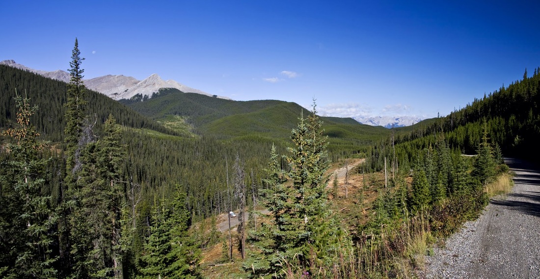
zooming back out shows just how far I had to go before that great looking ascent, being unable to identify the start point from my guide book I headed down the steep roadside embankment to the river which the map showed as heading in the right direction.
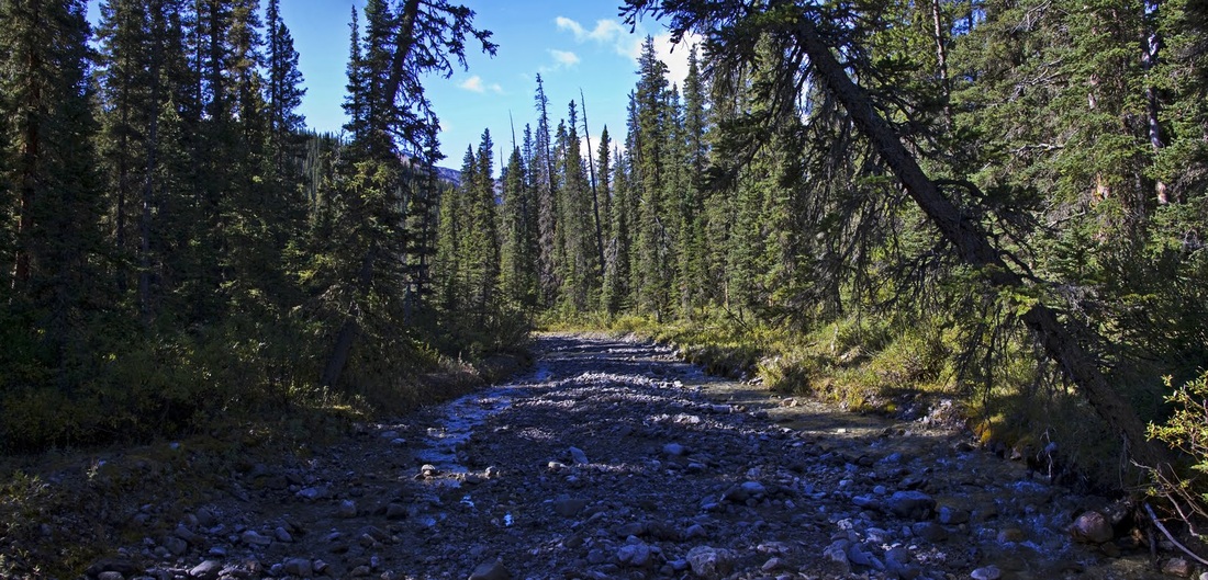
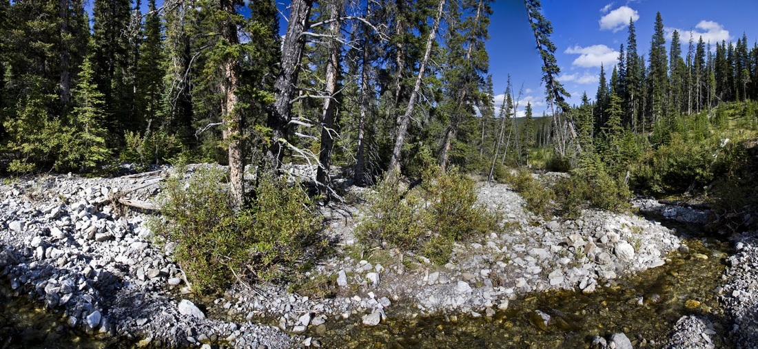
It was great to see the river bed almost dry, this means I don't have to hack my way through deadfall along the banks for hours and can make good time striding along the river heading upstream.
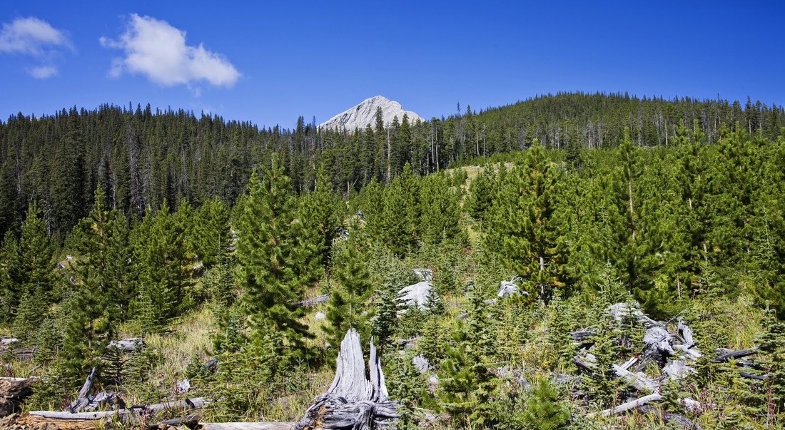
after 2km or so and with a little help from my map and compass, I identify where the trail should be in an area where previous logging had opened out a clearing, looking across the clearing I could just see the peak of Belmore Browne but could not find the trail described. I did come across a huge new logging track and walked along it for about 500 metres where I found the remains of a faint trail heading in the right direction, it had been all but annihilated by the logging road.
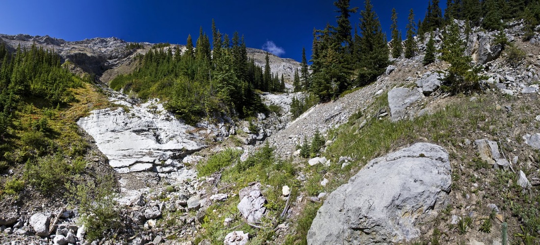
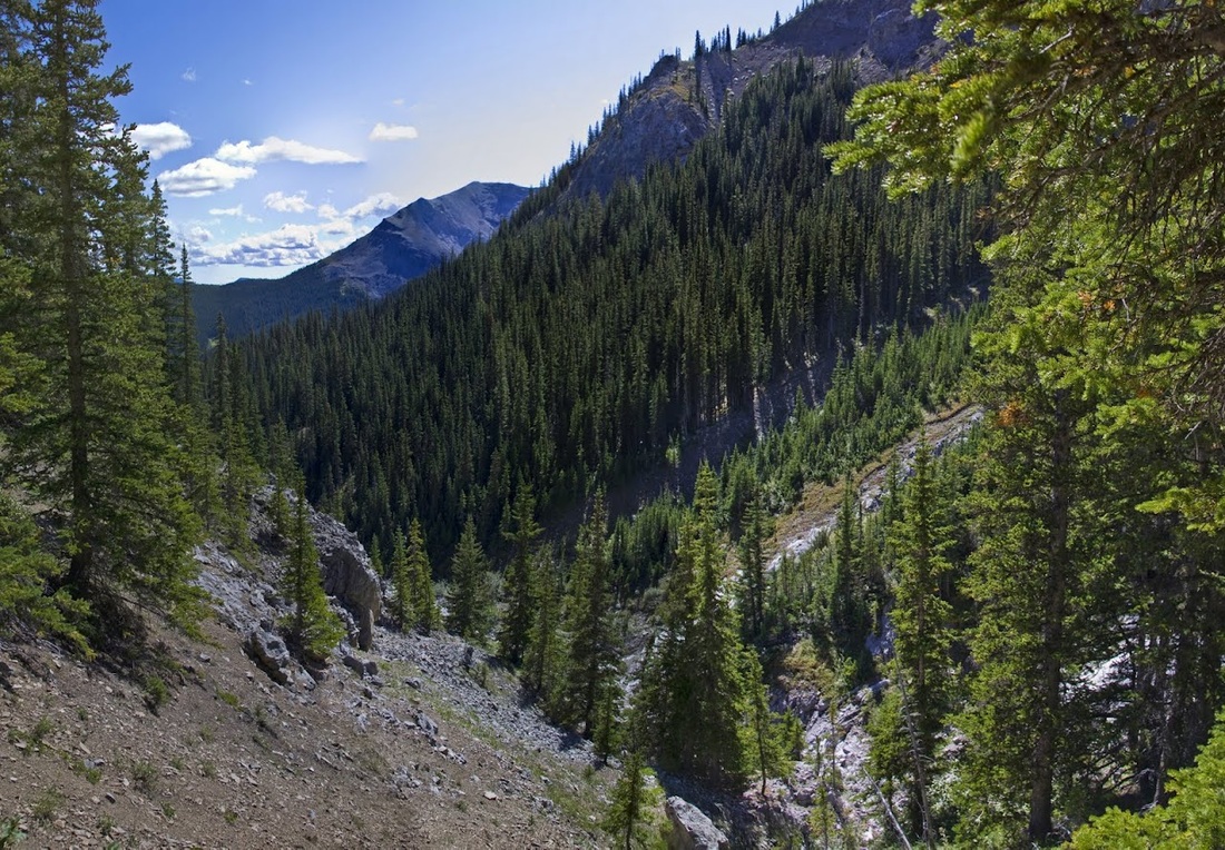
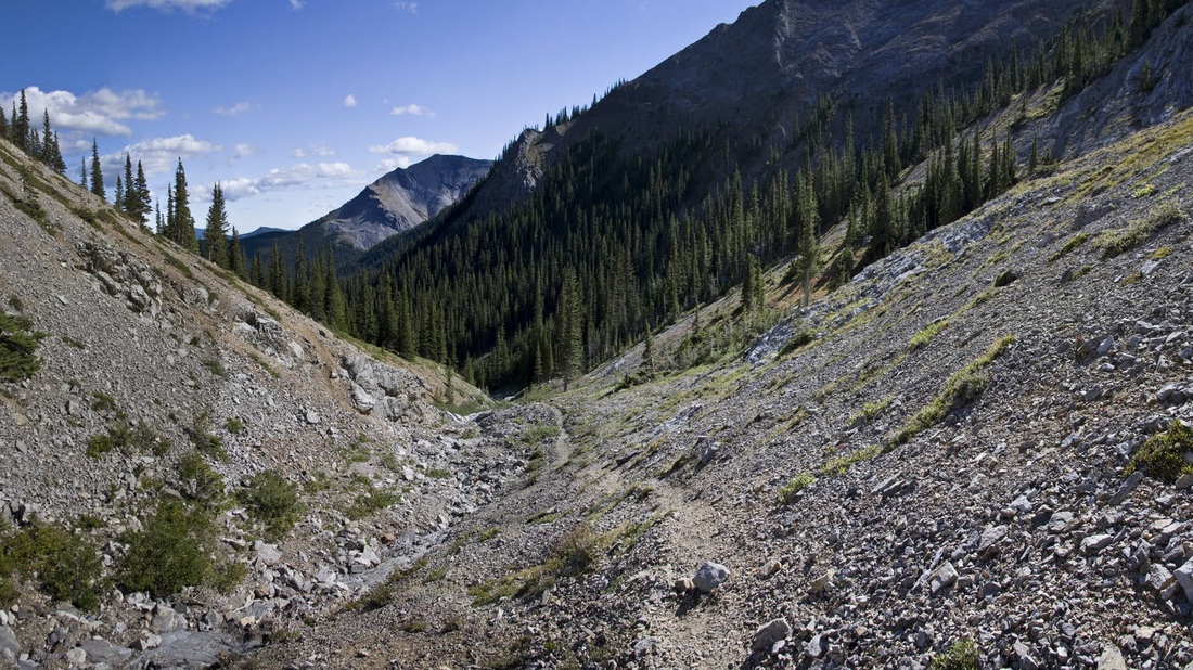
the faint trail passed through the forest and then dropped down into another dry creek bed, this time heading north-west, the going was good along this stretch, easy underfoot with a very gentle incline.
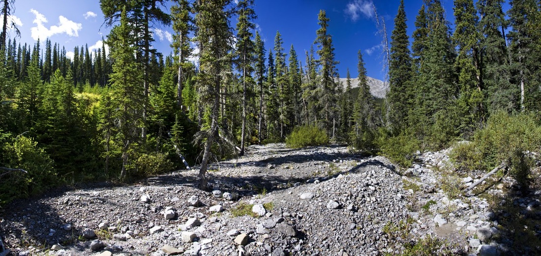
after a while the creek splits and I take the right hand fork as advised by the guide book (which seems to be accurate from here onwards) the creek bed gets progressively rockier from here and strewn with deadfall but is still a pretty good trail.
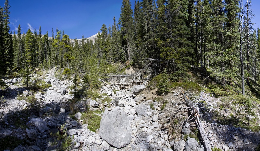
I follow the creek for it's entire length until reaching a dry waterfall, I decide to stop looking for the ascent trail and turn right here blazing my own trail up through the scattered pines
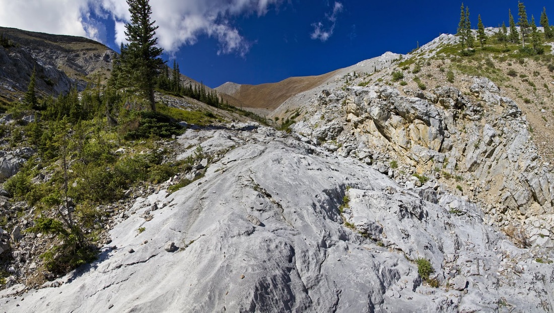
the initial ascent is on small scree up steep slopes but there is little movement in the well packed stones and it is a simple enough ascent to the first step.
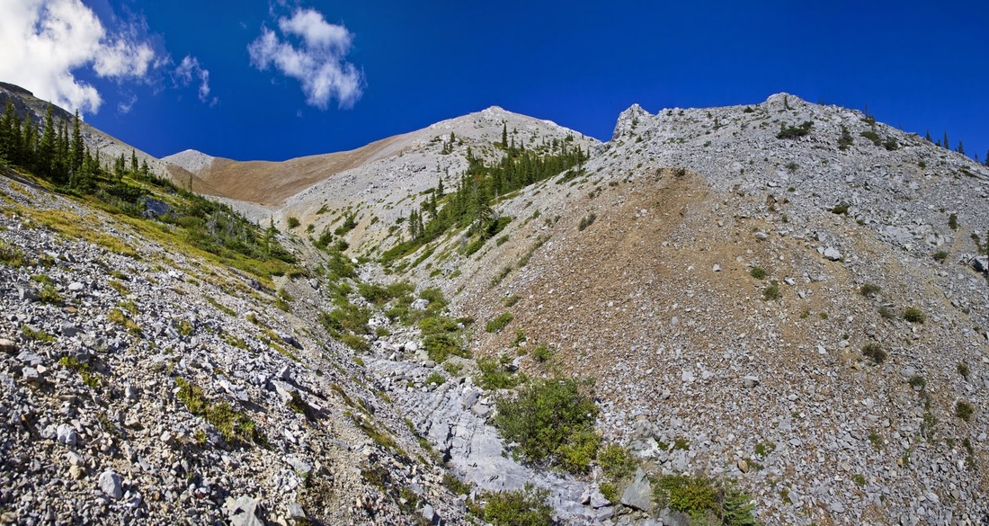
breaking out of the tree line the scree gets bigger but less compacted, self imposed zigzags make the incline easier and occasional long rock slabs provide a nice break from the mobile underfoot conditions.
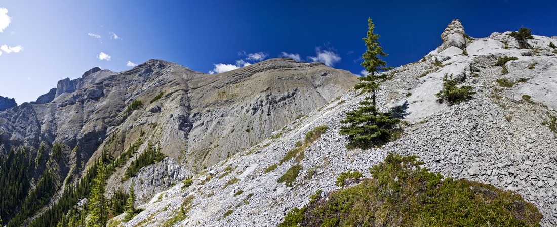
I ascend to a tall pinnacle rock and stop for a 5 minute snack break while admiring the beautiful colours of the rock along the ridge against the blue sky.
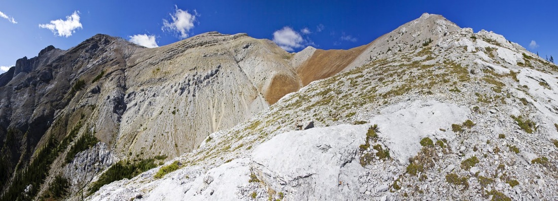
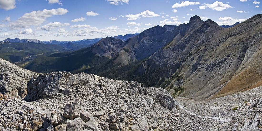
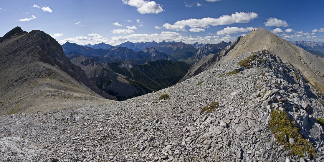
it is easy going along the ridge for the most part, there is a need to keep an eye on footing because of the loose rock but it is a perfect day and I am really enjoying the hike
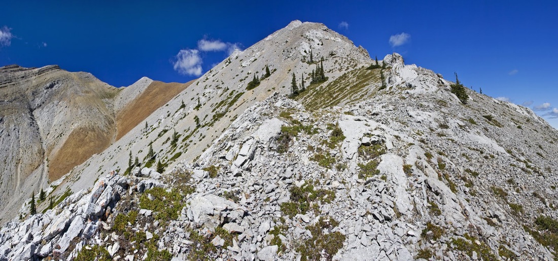
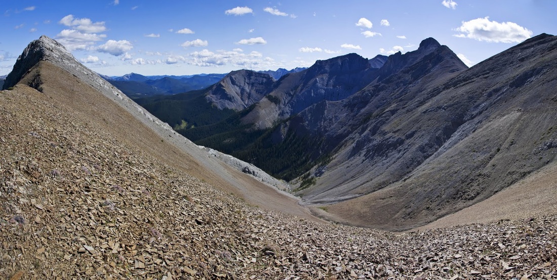
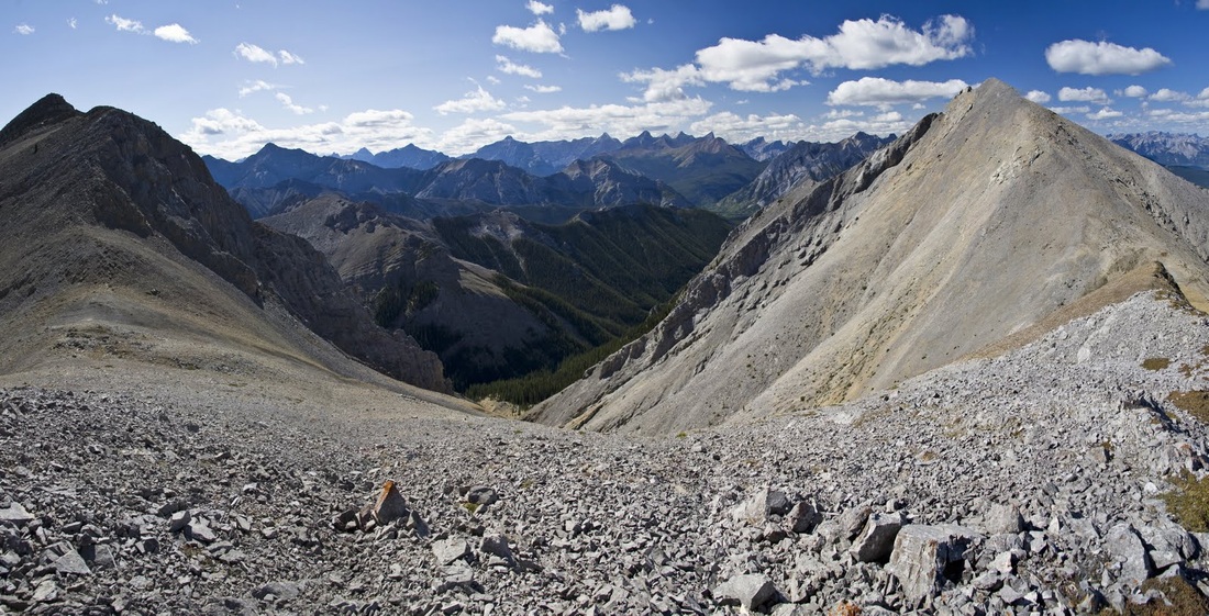
looking back down the ridge shows the extent of the range behind me and (I think) another ascent route for another day (the second spine in from the left)
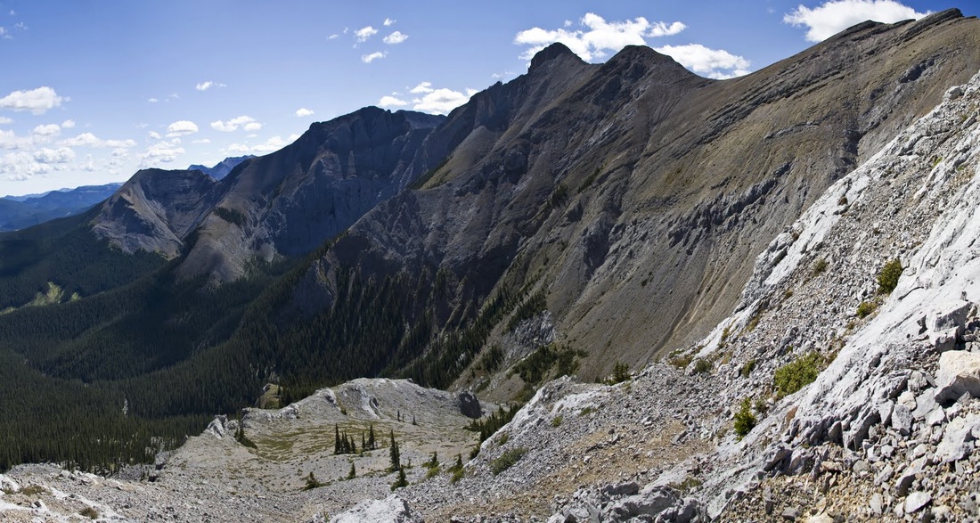
to the right (east) is the now familiar summit of Moose Mountain rising high above the forest, and between here and there the green top of Jumpingpound Mountain that I hiked in spring time
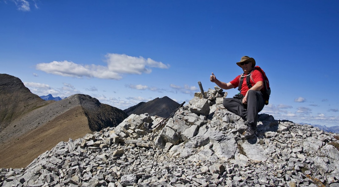
after a very steep final push I see the tiny summit cairn and get a wonderful view along the eastern edge of the Rockies
to the south I can see the Powderface Trail cutting it's way south through the blanket of trees on its way to meeting the the Elbow falls trail
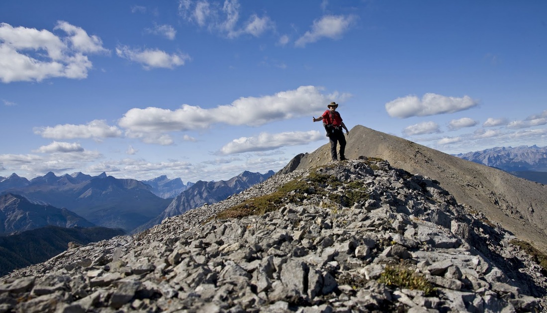
after the requisite summit evidence shot I settle in for a 10 minute lunch and admire the views, I've already decided to head on a little further and make a small circuit using a scramblers ascent path to make my descent.
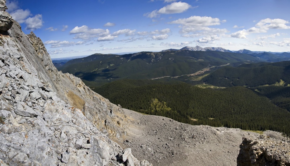
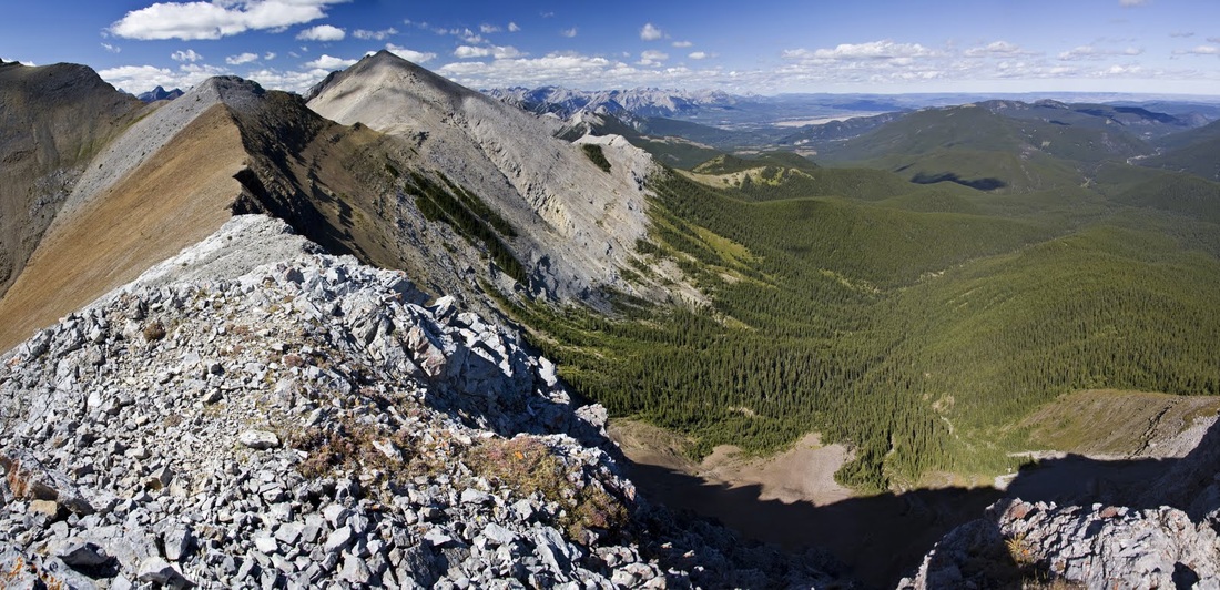
it is fantastic to stand and look along the boundary of the Rockies, to the east is the huge wide open prairie and my current home, Calgary. To the west lies an almost unimaginable expanse of mountains and here am I on the very edge of both.
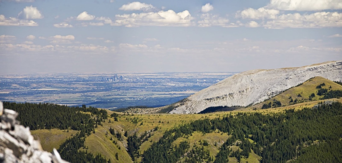
with full zoom beyond the northern summit of Moose Mountain I can see the city of Calgary rising from the prairie, it seems much closer than the drive out here would suggest.
Hands on scrambling is needed to drop down the western side of the summit but it's nothing difficult. Heading across the col I can see all along the deep valley down which I intend to return
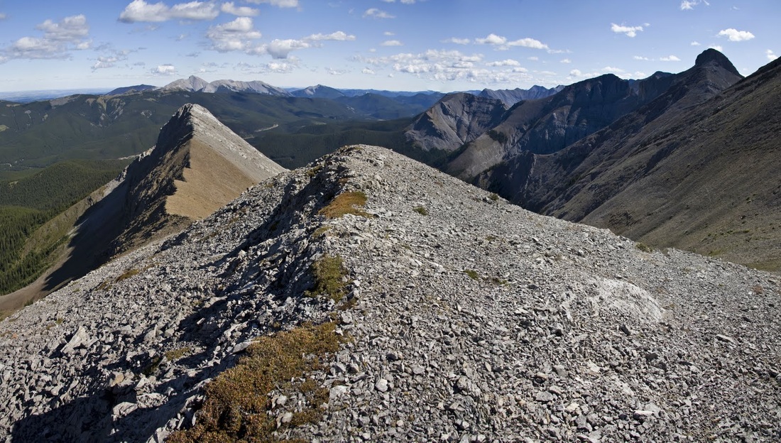
it is an easy ascent to the next little summit but it provides the most spectacular views of the day, the entire horizon bristling with mountain peaks, I'm glad I decided to go a little further.
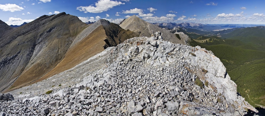
Looking back to Belmore Browne and Moose Mountain beyond, I'm beginning to think it is time I climbed Moose, it must have some incredibly open views for 360 degrees.....so many mountains...so little time.
Behind me here is another peak that I could have made today but it seems silly to chase down as many as possible in one trip when I could come back again from a different direction and have another 'new' hike.
Looking at the two tops of the day and (to the right) the scramblers route along the adjacent ridge which I think I'll tackle from the other end one day and see how far I get.

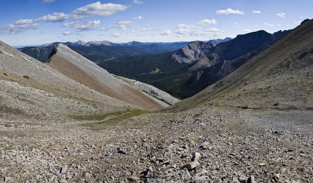
dropping down to the col at the bottom of the scramblers route I get one last look west before turning for home
There is a gentle start to the descent which is pretty much a water run off at this point, the scree is loose and care is required not to go for a prolonged bumslide down here.
there is a short steep section next which must be a really hard ascent, then another levelling where walking is easier for a short time before one more steep drop to the brown scree below
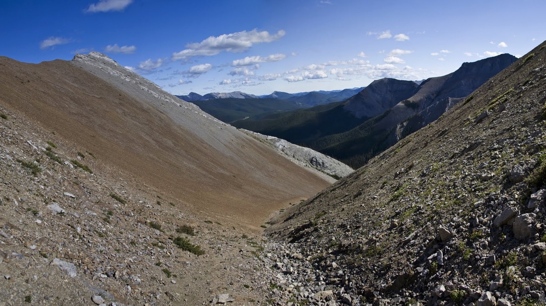
once on the brown scree the footing is much better, the scree more stable and a narrow well trodden pathway provides a perfect trail down beside the water gully
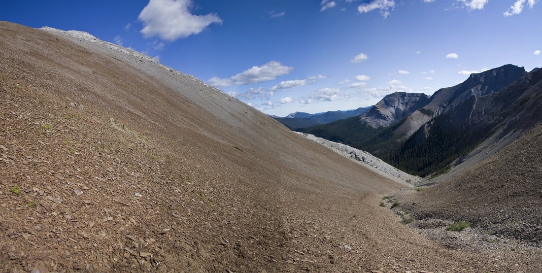
lower down the trail returns to loose stones over rock and real care is needed down the short steep steps toward a smooth dry waterfall below. Looking back up the hill the colours in the rocks are beautiful and complimented by the blue skies are almost perfect.
A last look forward down the trail toward a dry waterfall that drops down into the forest and the creek bed below.
the smooth rock of the waterfall makes a fine seat for a 5 minute rest before the final leg of the route home
I choose a slightly different route out of the gully this time, whilst up top I noted a creek that would return me to the newly constructed logging trail making for a smooth journey out. I followed the creek for 2km until it met the logging trail as planned.
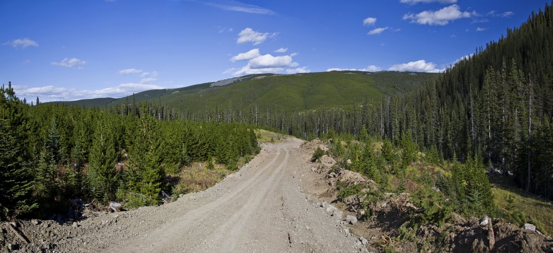
the new logging trail is a hideous scar on a pristine landscape but does make for a very easy return close to the Powderface Trail where I need only scoot up the banking and backtrack a little to my truck.
I followed the Powderface trail south to the Elbow falls trail and then home, safe in the knowledge that I will be back to this area soon to chase up a couple of promising leads.