Canyon Creek (West) Ridge
Date Walked: 15th June 2017
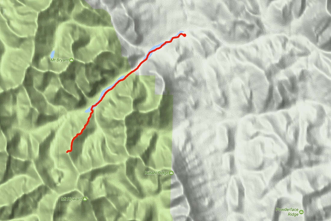
Distance: 9.4 miles (15.2 km)
Actual Ascent: 2254 ft (687m)
Time Taken: 4.5 hours
I set out today to regain that wonderful feeling of being embraced by the Canadian wilderness. The jet lag is almost gone and being surrounded by the solitude of the backcountry is the perfect antidote to the hustle and bustle and emotional drain of our most recent trip to England. I elected to make a nice low level hike along Canyon Creek (West) because I've been away from the hills and the altitude for some time, but after 5km I found an irresistible ridge and the inevitable ascent was made.
Canyon Creek is on the Powderface Trail. To reach the trailhead take highway 66 from its junction with Highway 22 just south of Bragg Creek and follow 66 to its end 28km west. At the end of the route continue straight onto the gravel logging road, this is the Powderface Trail. Follow Powderface for 15km to Canyon Creek, parking is on the east side of the road before the bridge.
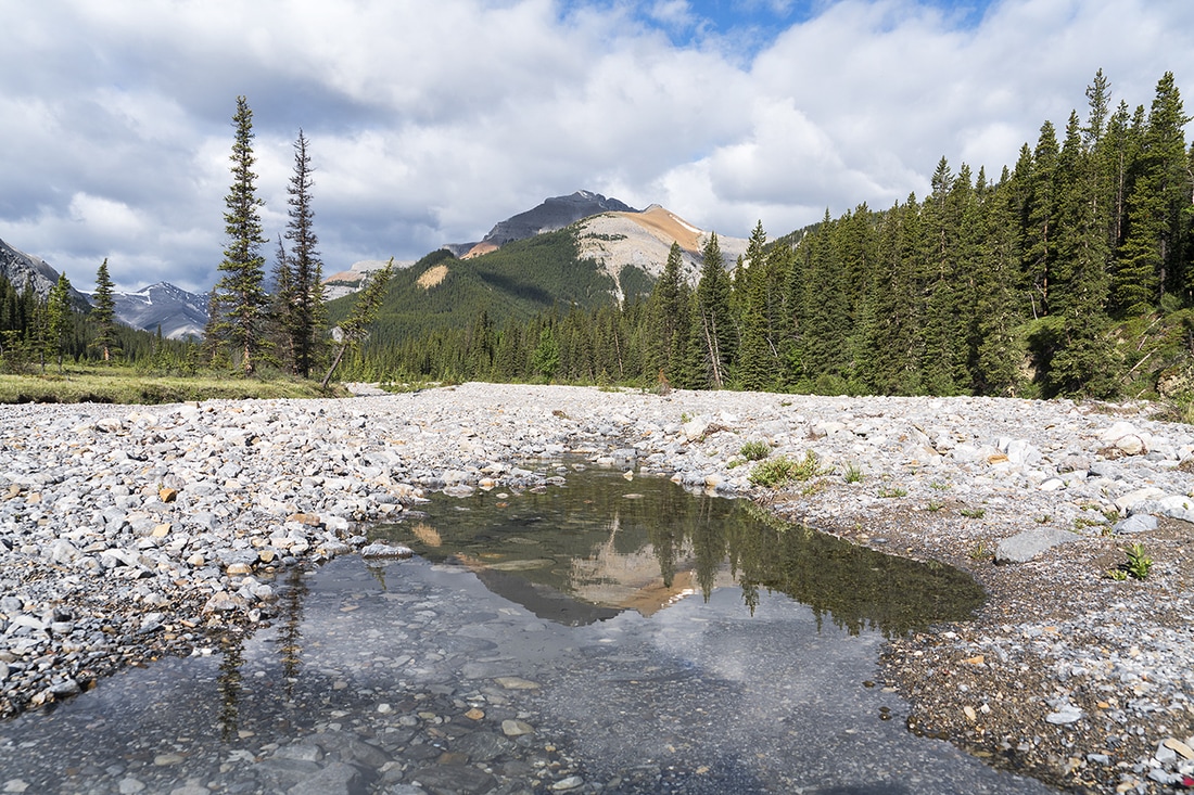
The hike is a simple affair from the start, just follow Canyon Creek in a westerly direction and enjoy the beauty and solitude of the area almost immediately. The almost dry creek bed makes for easy going and occasionally provides a nice pool as in the shot below of Mt Bryant reflected. My hike today is toward the distant grey mountain on the left side of the shot.
Canyon Creek is on the Powderface Trail. To reach the trailhead take highway 66 from its junction with Highway 22 just south of Bragg Creek and follow 66 to its end 28km west. At the end of the route continue straight onto the gravel logging road, this is the Powderface Trail. Follow Powderface for 15km to Canyon Creek, parking is on the east side of the road before the bridge.
The hike is a simple affair from the start, just follow Canyon Creek in a westerly direction and enjoy the beauty and solitude of the area almost immediately. The almost dry creek bed makes for easy going and occasionally provides a nice pool as in the shot below of Mt Bryant reflected. My hike today is toward the distant grey mountain on the left side of the shot.
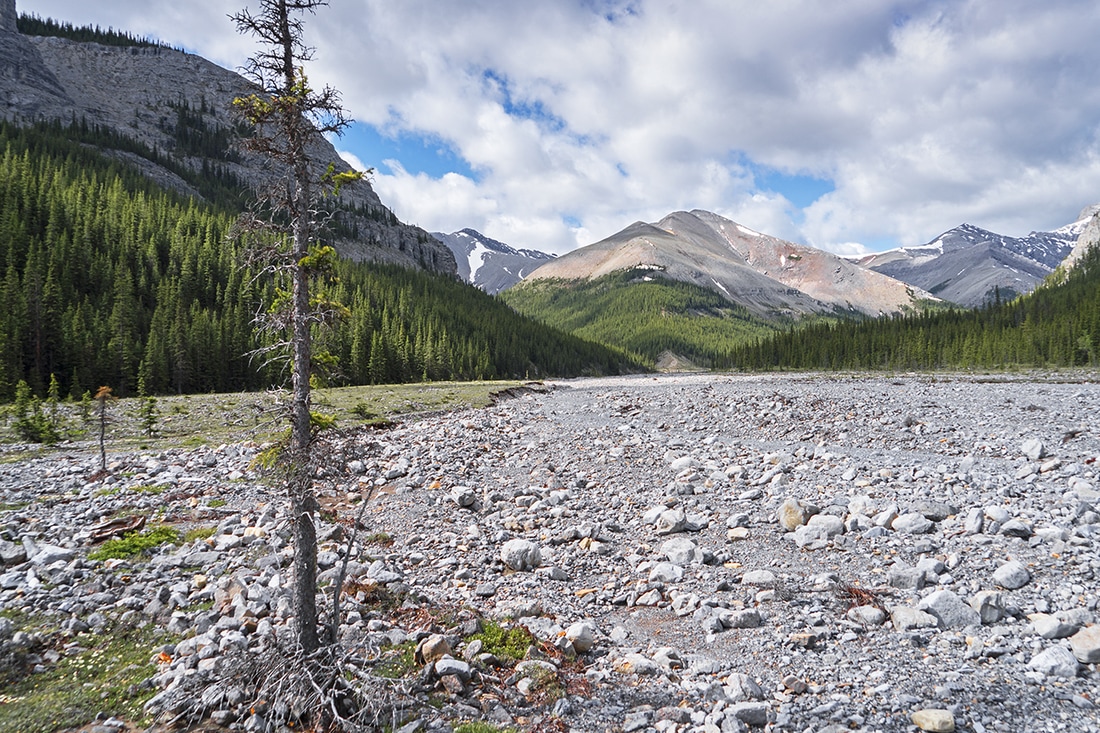
The creek bed is wide and meanders through dryas flats where walking is made easier by the tight packed beds, ahead on the left is the northernmost end of Compression Ridge, I find myself looking for ascent routes even though I intend to stay at low level today. I have not explored the west fork of this creek so collecting information for future hikes would be the order of the day.
A few km's into the hike the creek bed narrows and forest encroaches on both sides, a series of crossings are required to remain on track but they are easily made through shallow water replete with stepping stones.
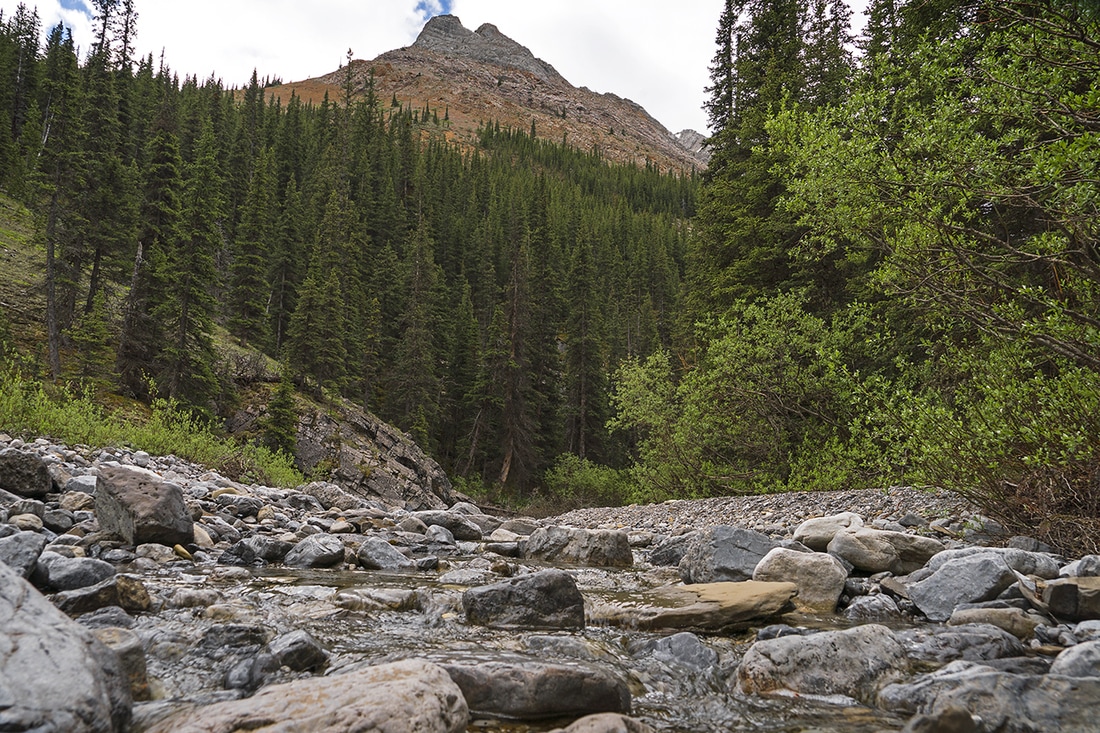
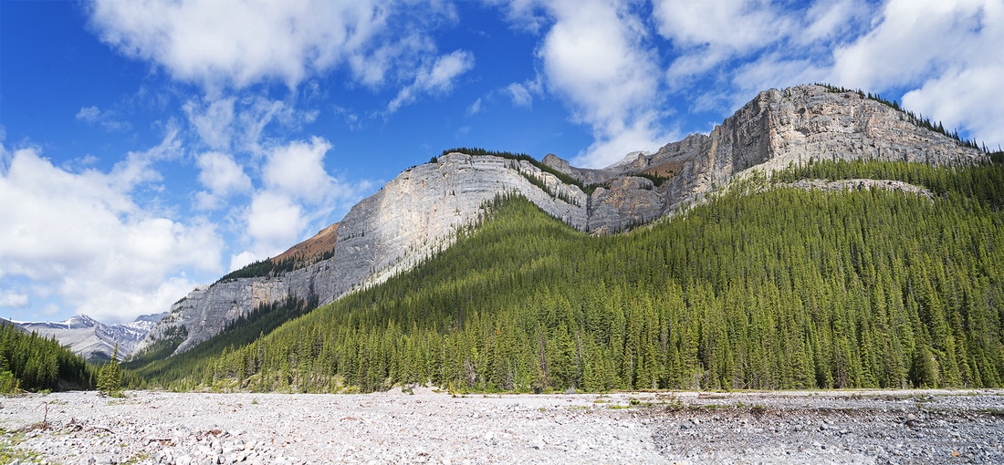
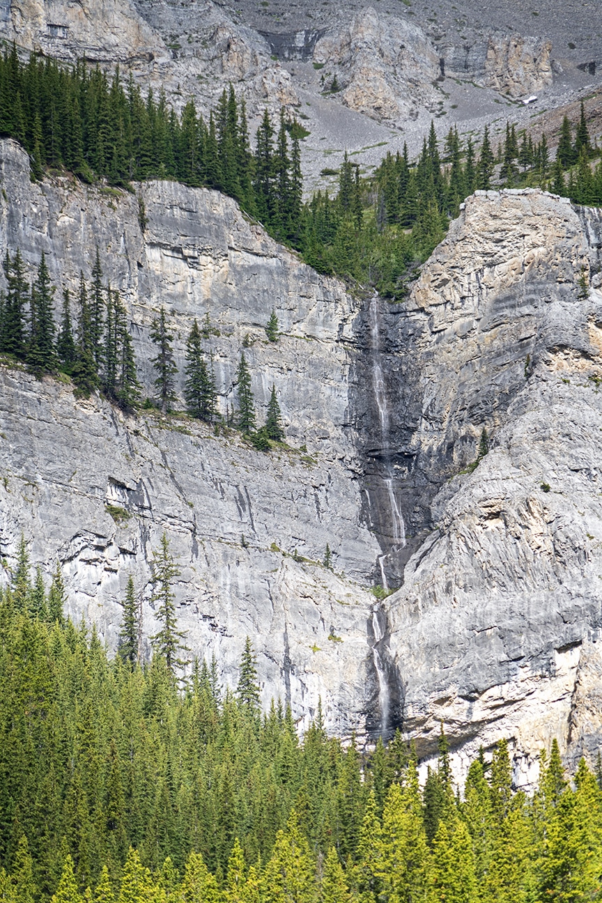
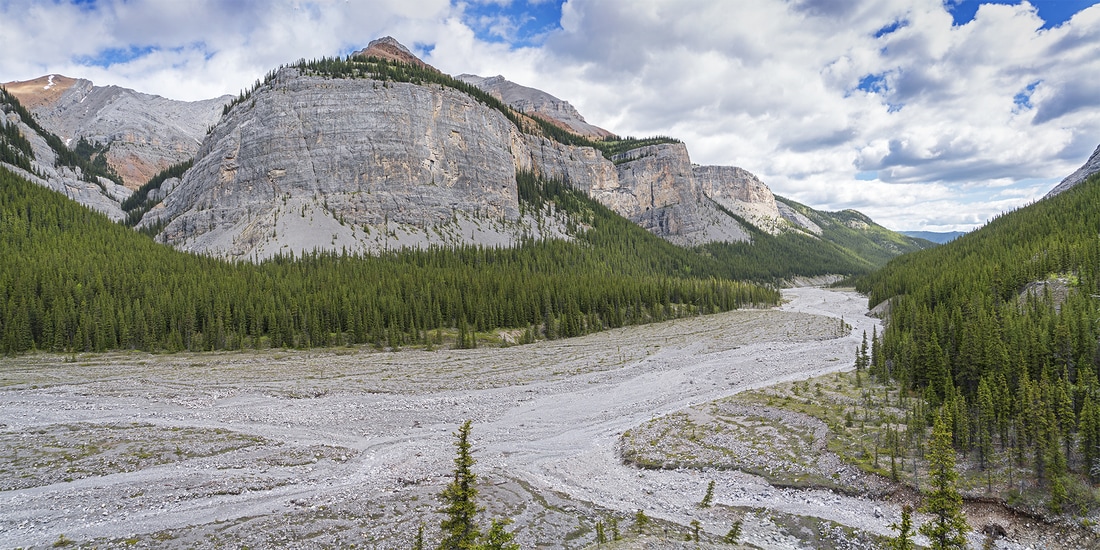
After a short time passing through the tight bend in the creek bed, it opens out again to reveal the towering cliffs on the south end of Mt Bryant which dominate the right side of the creek for several kilometres. In the centre of the image below is a huge waterfall with a drop of hundreds of feet but it is dwarfed by the cliffs down which it cascades. (Click either image for a larger version)
|
|
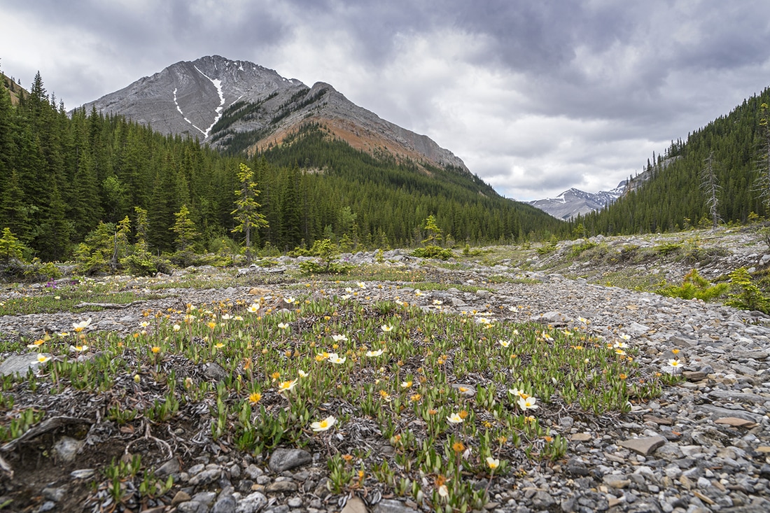
As I progress and round a curve toward the south west I see a round topped ridge ahead, there's also a sharper ridge further away that catches the eye. I estimate the first ridge to be about 6km (from the start of the hike) and the second about 8km. There was no way I'd make the second and ascend it today, but the first one....tempting.
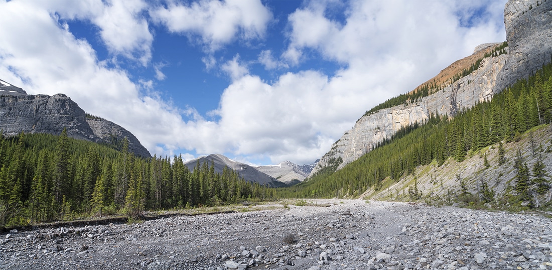
Rounding another curve and the creek bed opens out to show the colourful round topped ridge and a very clear ascent route looking right toward me, who could resist.
Not me obviously, as I very soon find myself looking back down the creek along the huge walls of Mt Bryant. The initial ascent is made much easier by a narrow winding trail, though it is clearly infrequently used it makes navigation through the short forested plateau much easier than it would otherwise have been.
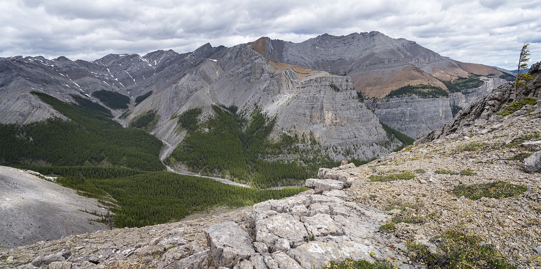
After the straightforward trek through the forested plateau there follows a steep ascent that lifts me quickly to a wonderful viewpoint. From here the high points of Compression Ridge sweep down to it's own sheer cliffs mirroring those of My Bryant opposite.
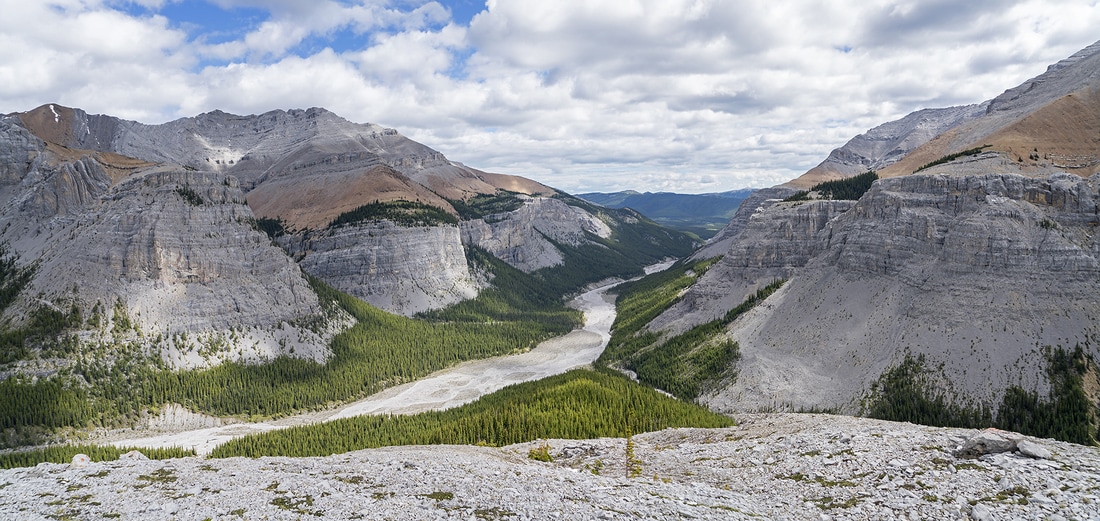
Compression Ridge sweeps south hiding a lush green valley and an interesting looking ridge that rises up from the valley and joins the southernmost flanks of the massif. I find myself contemplating an ascent (for another day) as there is clearly some scrambling to be had further along.
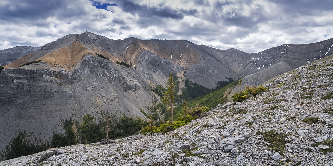
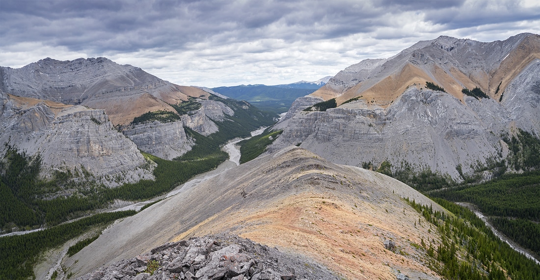
As I rise to the top of my little unnamed ridge I see another connection heading south toward Mt Howard, looking at the map puts the summit of Mt Howard about 3km from here making it a 10km hike from the start point, though it would be a long and strenuous day that is definitely another potential hike from here.
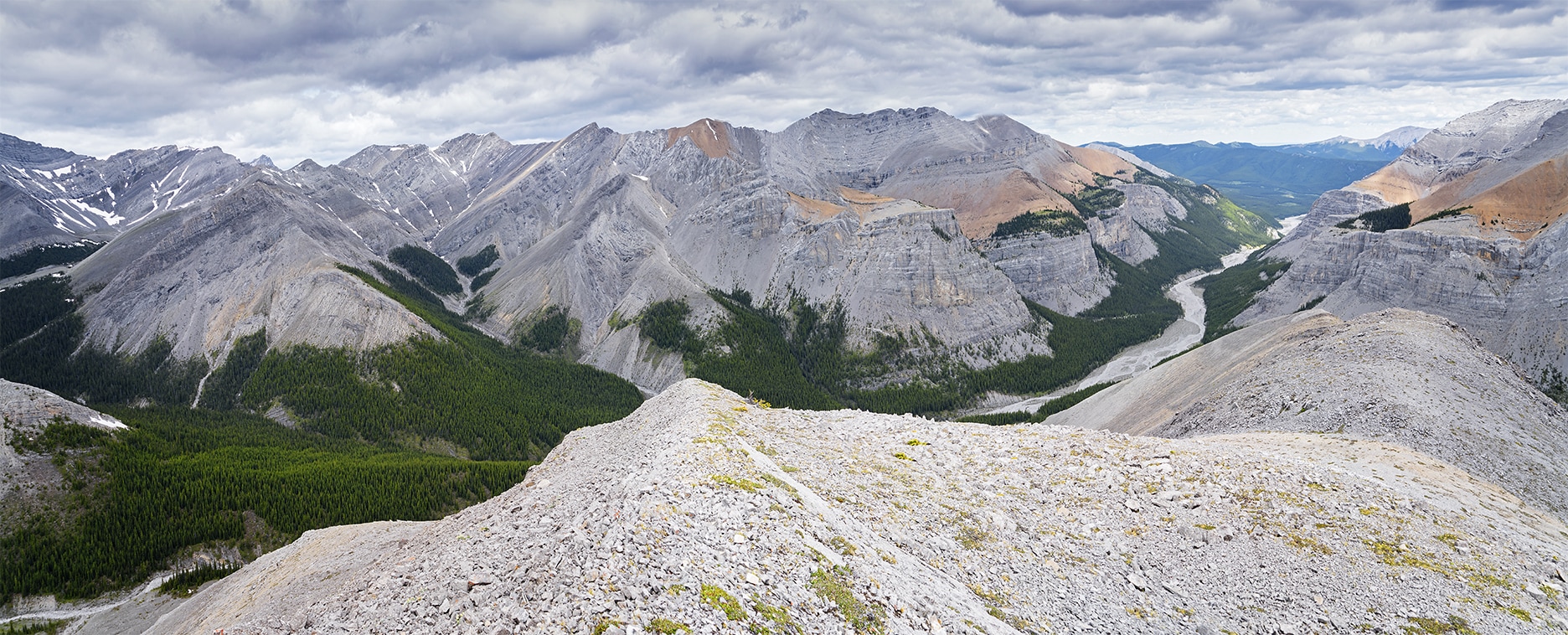
To my right Canyon Creek swings away around the Mt Bryant massif, as it does it provides more routes to more ridges and summits on both sides and perhaps an alternative route onto Mt Bryant itself.
There's one final steep pull up the last lump along the ridge, from here I can look back along Canyon Creek all the way to to Moose Mountain just poking it's summit above the distant horizon.
To the north across Canyon Creek is a cloud filled sky overshadowing the vast array of peaks that puncture the green blanket of forest that sweeps through the valley below.
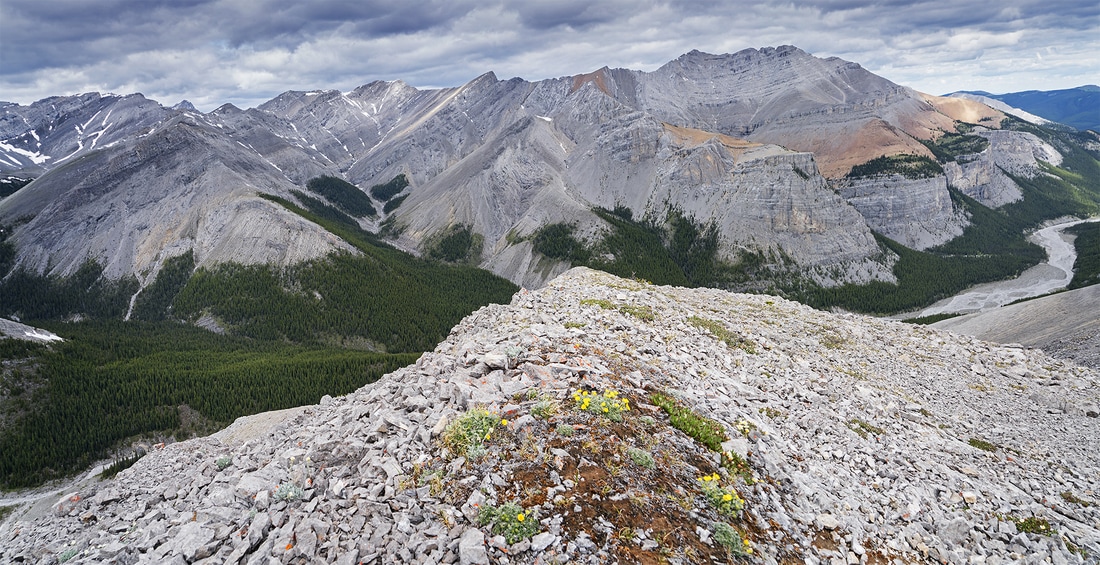
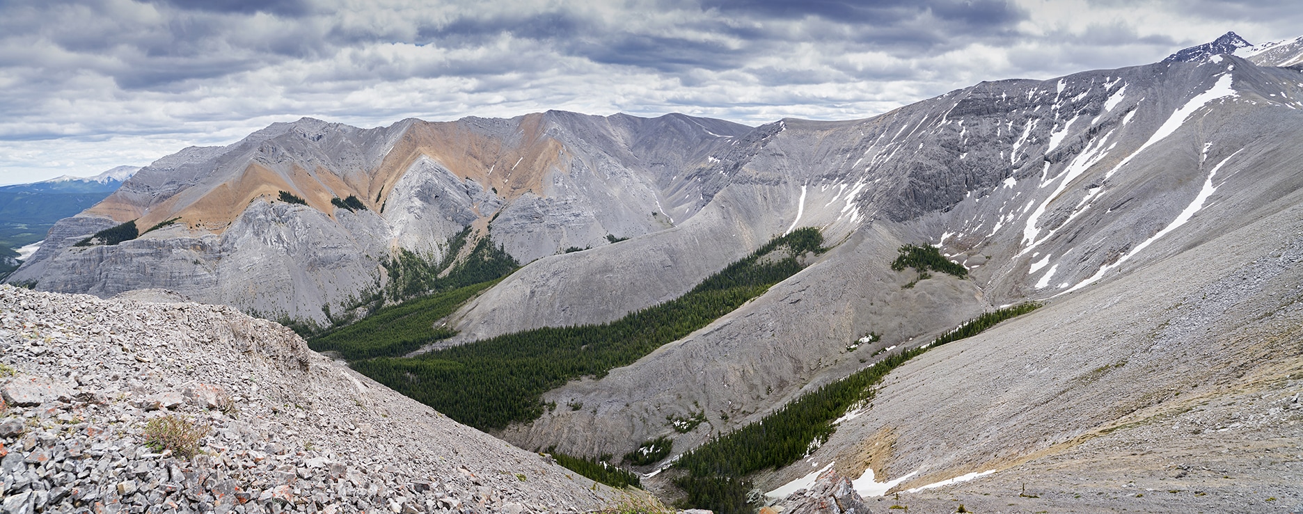
To the west are the bulwarks from which all of these ridges diverge. The last remnants of snow scattered along the summits ensuring the ribbon of Canyon Creek has a steady flow of cool clear water heading east.
From this little summit I can see almost all of the hike as well as the spectacular scenery that it provides. I'm so glad I decided to plod up here today.
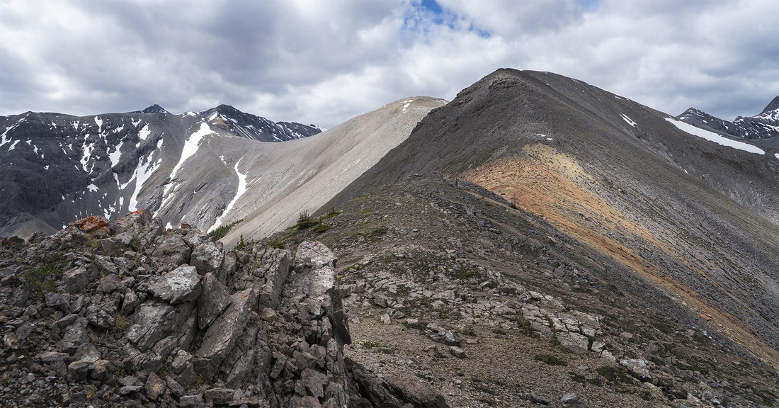
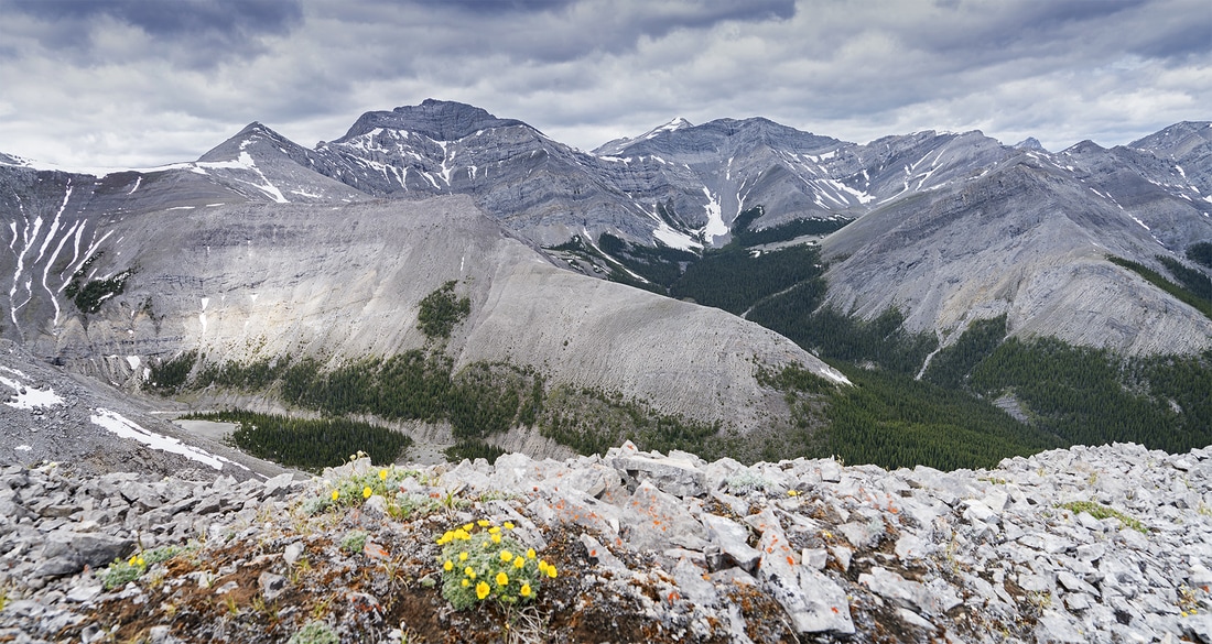
The valley hidden behind my little ridge has two good looking ridges rising out of it with steep scrambles at the end to reach a connecting ridge, there is such an abundance of hiking opportunity from this relatively small area it beggars belief.
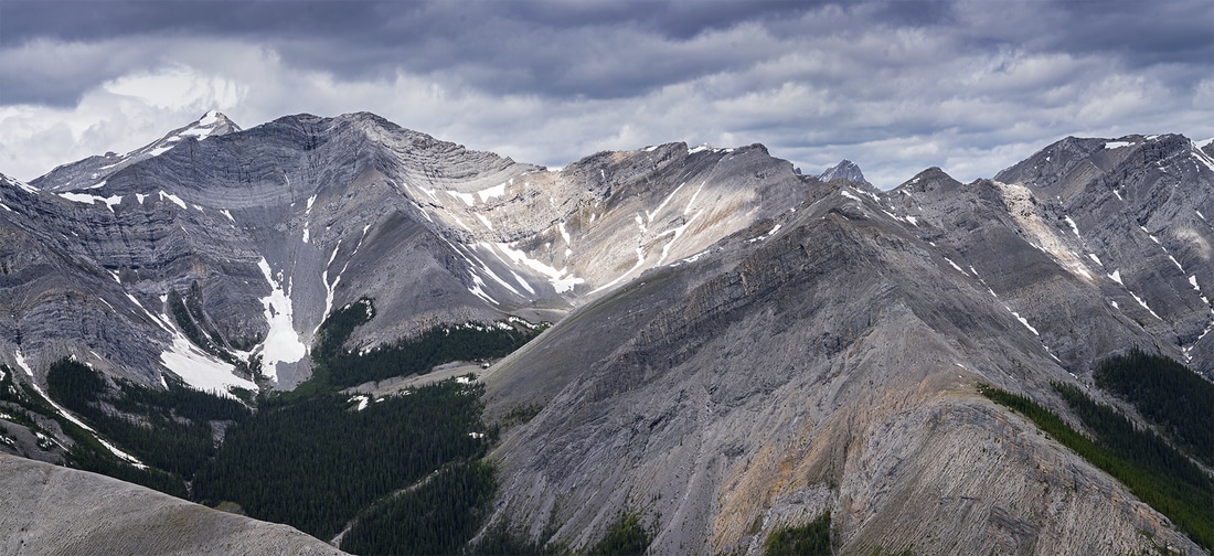
As I sat drinking in the wonder of these breathtaking foothills the sun broke through to the west proving a beautiful splash of light across the two most prominent ridges
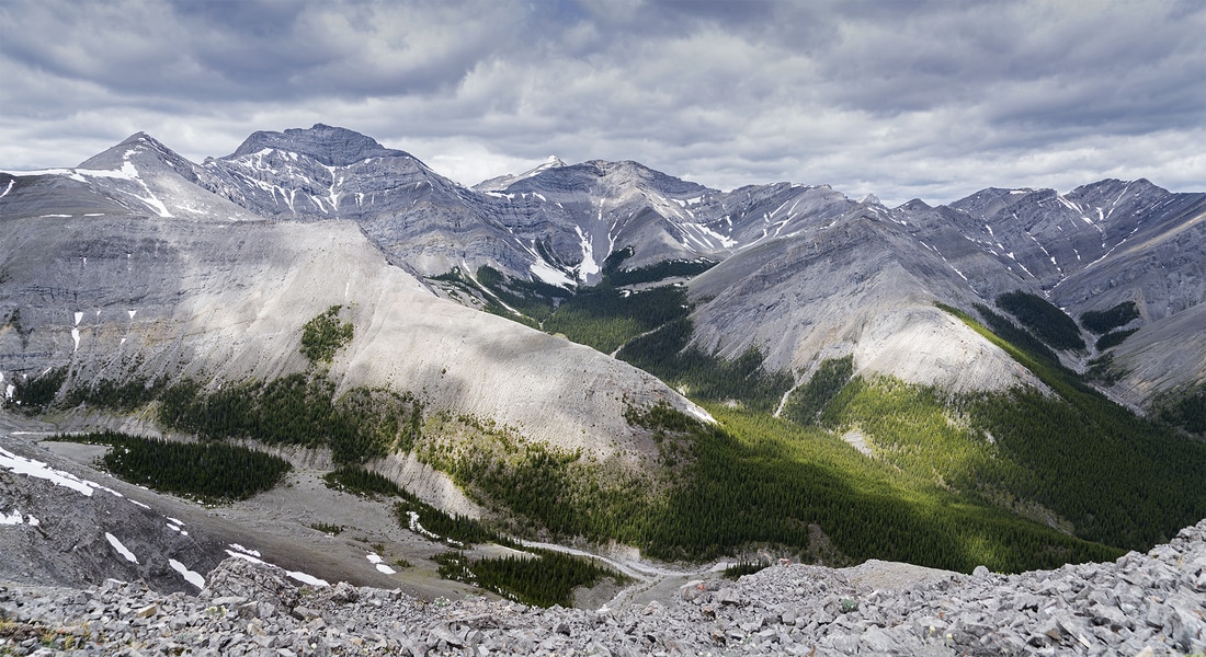
Following the ridge up from the lower right corner of this image leads you to a dip at the top, behind which is the tip of Mt McDougall over 5km away.
I'm so glad I decided to make the ascent of this little lump of rock, the views from it are spectacular, even the waves of fatigue caused by the remaining jet lag couldn't dampen my spirits as I looked around at 360 degrees of mountain tops. It won't surprise anyone to hear I'll be coming back this way later in the year for a look at some of those surrounding lumps.