King Creek Ridge - Summer
Date Walked: 16th July 2013
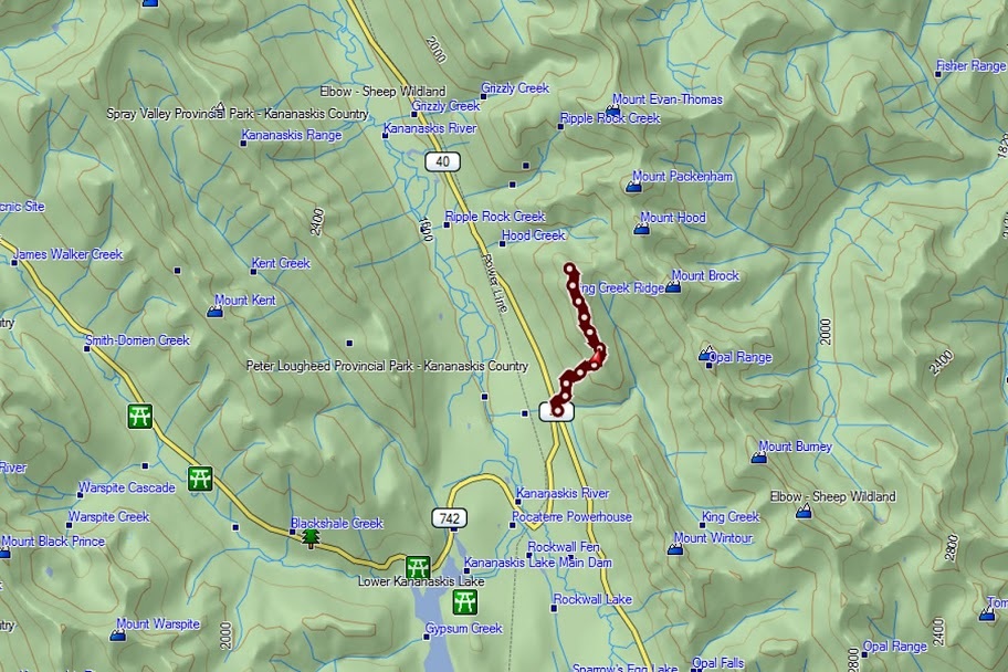
Distance: 4.8 miles (7.8km)
Actual Ascent: 2421 feet (738m)
Time Taken: 3.5 Hours
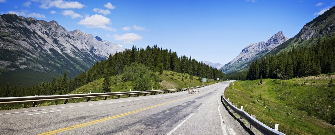
After volunteering for flood clean up for 3 weeks I have finally called it a day as Calgary gets back on its feet, there are large paid work crews out there now and the rebuilding stage has begun. Part of that rebuilding was getting highway 40 (Kananaskis Trail) open again, it had taken a hell of a beating in the floods with numerous bridges washed away, sections of road missing entirely and thousands of tons of debris burying the highway in places.
The construction guys have really pulled out all the stops and have reopened the northern end of the highway so Kananaskis Lakes can be reached by car again, the rest of the highway will take much longer so the winter gate at Highwood Pass is closed off for the foreseeable future.
Fortunately King Creek Ridge is just north of the winter gate, with beautiful blue skies overhead I made my way along highway 40 over temporary bridges and huge stone infill patches in the road to the King Creek car park. Unfortunately that has been mostly washed away so the gates are closed but there is ample roadside parking here, so after maneuvering past the Rocky Mountain sheep (that seem to be ever present at this road junction) I parked out of the way and prepared myself for my first hard hike in weeks.
The ridge is well known for it's ascent with the initial 'steep section' climbing 671 metres in one kilometre. But first is 0.5km of wonderful cool dark forest where, perfectly shaded, I make my way up a constant steady ascent peeking out at the blue skies ahead through occasional 'windows' along the trail.
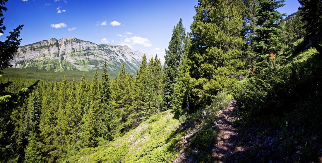
The trail weaves in and out of the trees, turning back on itself in a series of switchbacks that abruptly alert me to the heart pounding ascent that has begun. I take every opportunity to rest in the shade before gritting my teeth and making the 'steep section' in a prolonged drag toward the tantalising ridge ahead.
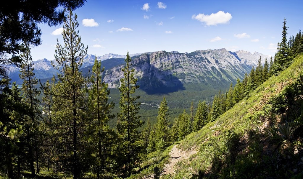
As I make the final leg I stop again in an attempt to breathe like a normal person, the views across the mountains are getting better with every metre and even though I haven't hit the top of the nausea inducing slope yet I am reminded of the stunning beauty of the Canadian Rockies.
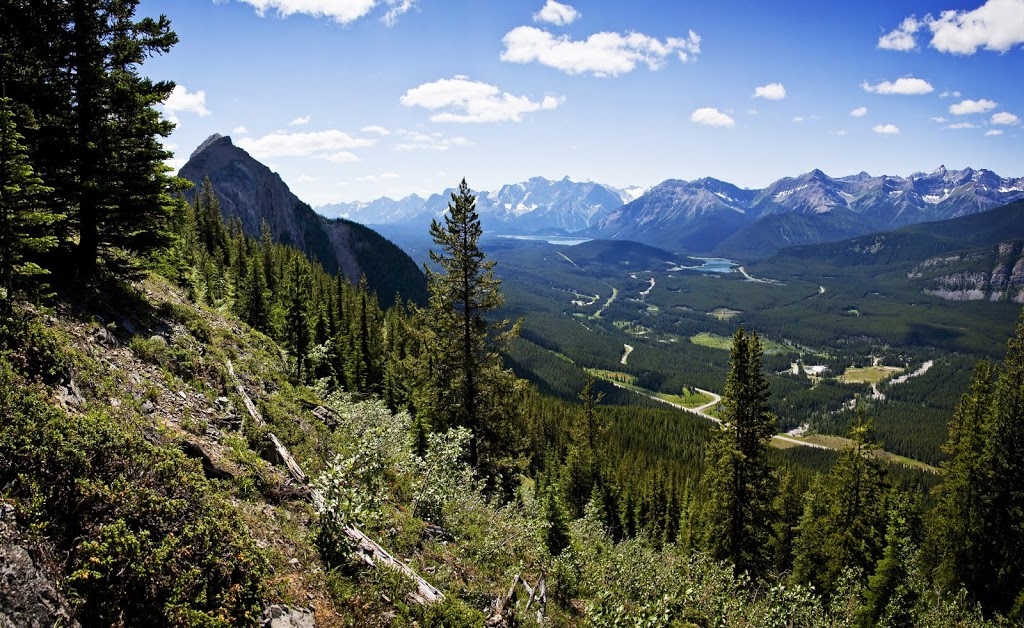
When I finally make the ridge at it's southern most point I am greeted by the lush green meadows of the Opal Range opposite contrasted against the grey peaks that scrape the skies just below 10,000 feet (2996 m)
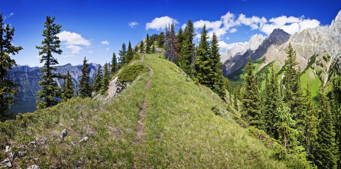
There are still pine trees swamping the ridge at this level but the scenery visible through them is mouthwatering, it is another 800 feet (240 m) of ascent to the summit but that is spread across 1.5km so it is time to reap the rewards of the earlier effort in a long slow enjoyable hike north along the ridge.
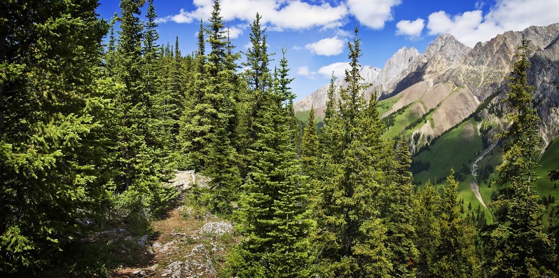
The trail is well defined as it weaves it's way along the ridge, though it would be impossible to go wrong without it as the ridge leaves little choice of direction.....it's either north or south.
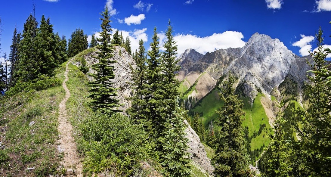
The trail rises in gentle inclines interspersed with larger 'steps' that raise me up in waves, looking to the south from above the treeline the sharp point of Mt Wintour pierces the sky as its flanks plunge steeply into forest laden valleys below.
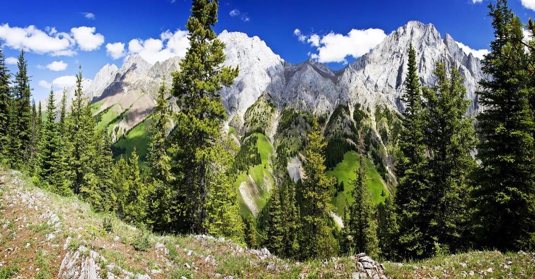
The hike along the ridge is magnificent, wildflowers poke out from every direction and mountain peaks reach up on all sides funnelling me north toward the summit of this spectacular ridge.
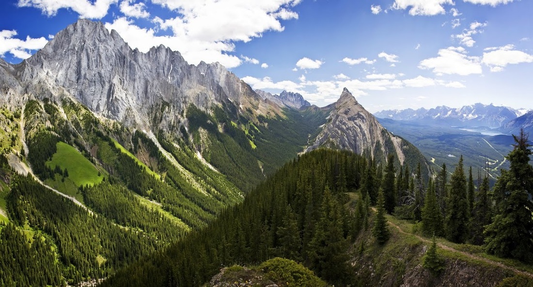
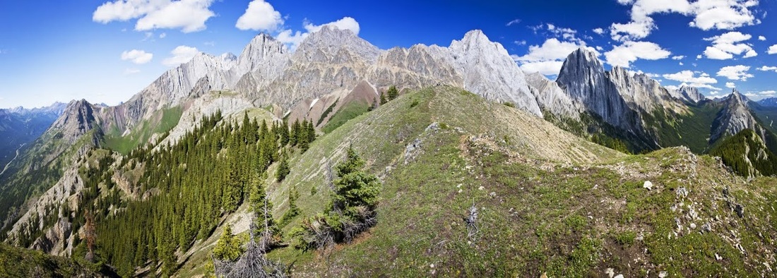
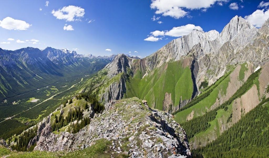
More 'waves' lift me ever closer to the target but I am drawn to look backward as often as I look forward. The Spray Range to the North East of Lower Kananaskis Lake and many of it's hidden glaciers are now visible to the west (right of photo). moving left directly between Mt Wintour and the Opals is the 9937 feet (3029 m) peak of Elpoca Mountain.
Along the final push to the summit that well worn trail evaporates and the views open out to the most incredible scene. It seems strange to me that I am absolutely knackered, that initial ascent is a real killer. I feel like I've walked forever yet can still see my truck at the junction below.
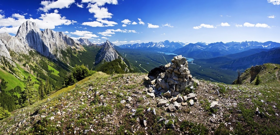
When I make it to the summit I drop my gear and flop down against the summit cairn when a little chipmunk dashes out of it and across my outstretched legs, it takes a look at me and then dashes back in again before commencing to threaten me continually from the safety of his cairn. It made me laugh how unimpressed he was with my size advantage, the one minute video below shows a summit panorama whilst he continues to threaten me from his hiding place.
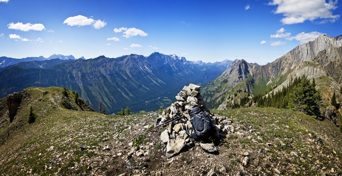
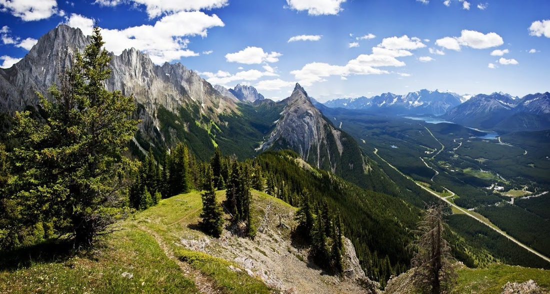
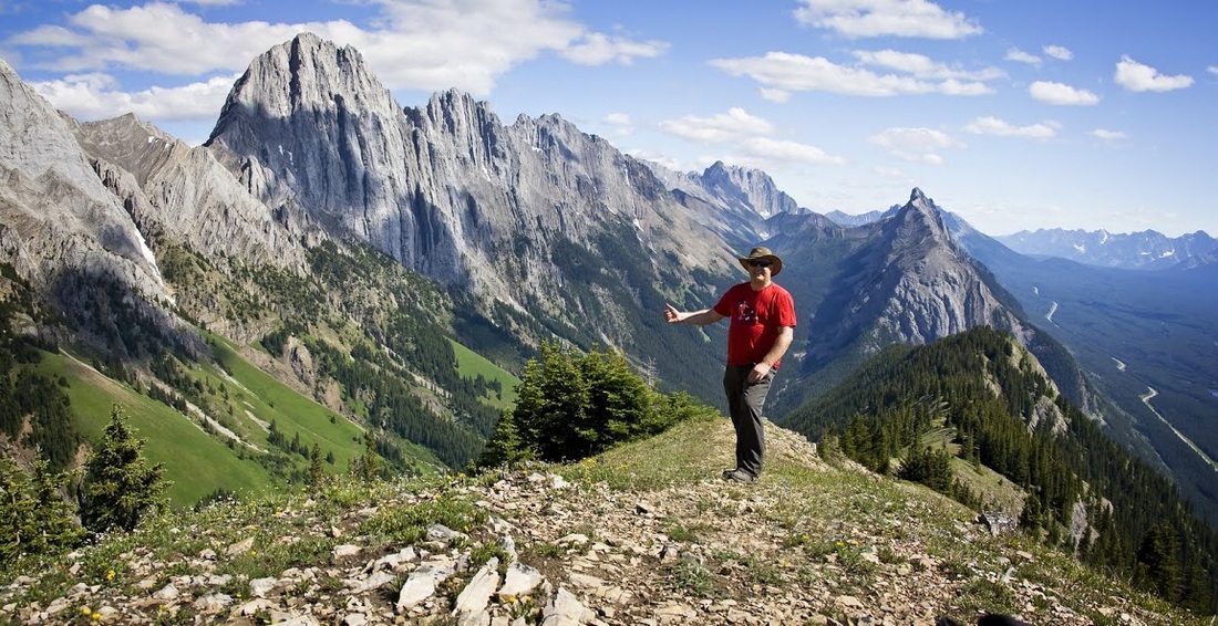
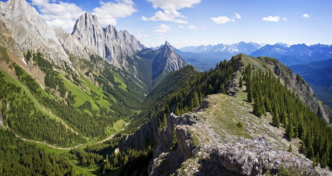
After poking a peeled banana into the hollow where the noise is coming from I leave the vicious chipmunk to his rantings and wander out to the western outlier where I can get a shot of the ridge. The ascent can almost be seen in full here including that gut wrenching initial drag up the southeastern flank.
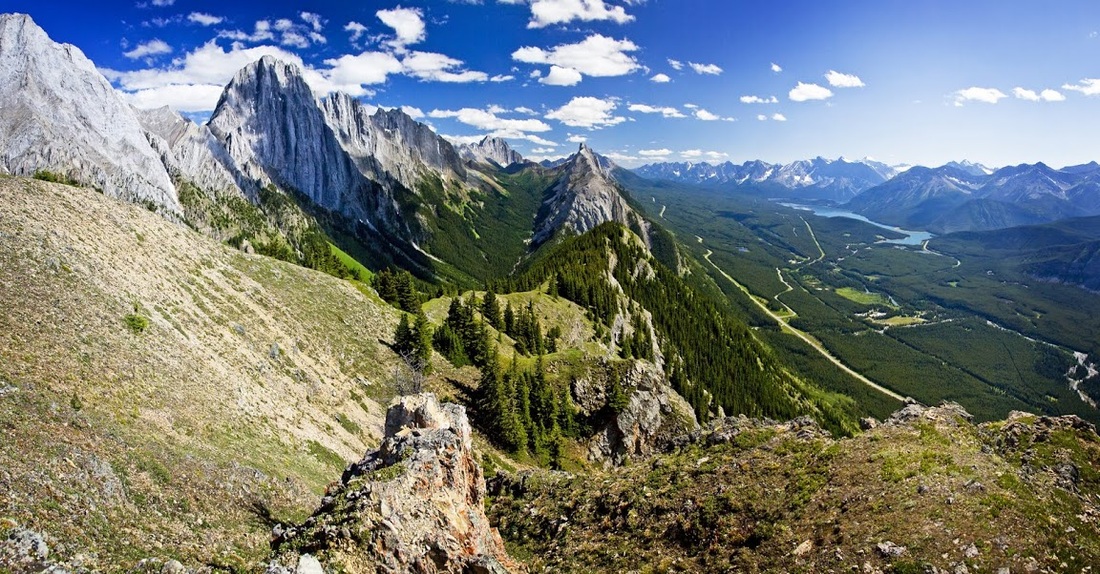
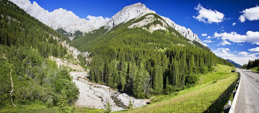
Looking north along the highway The Kananaskis Range towers above the western side of the road (far left of shot) and the Opal range dominates along the east. On the far right of this picture is the summit cairn and the moody chipmunk.....
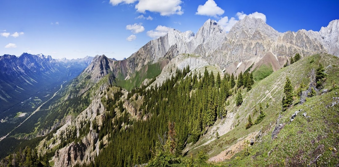
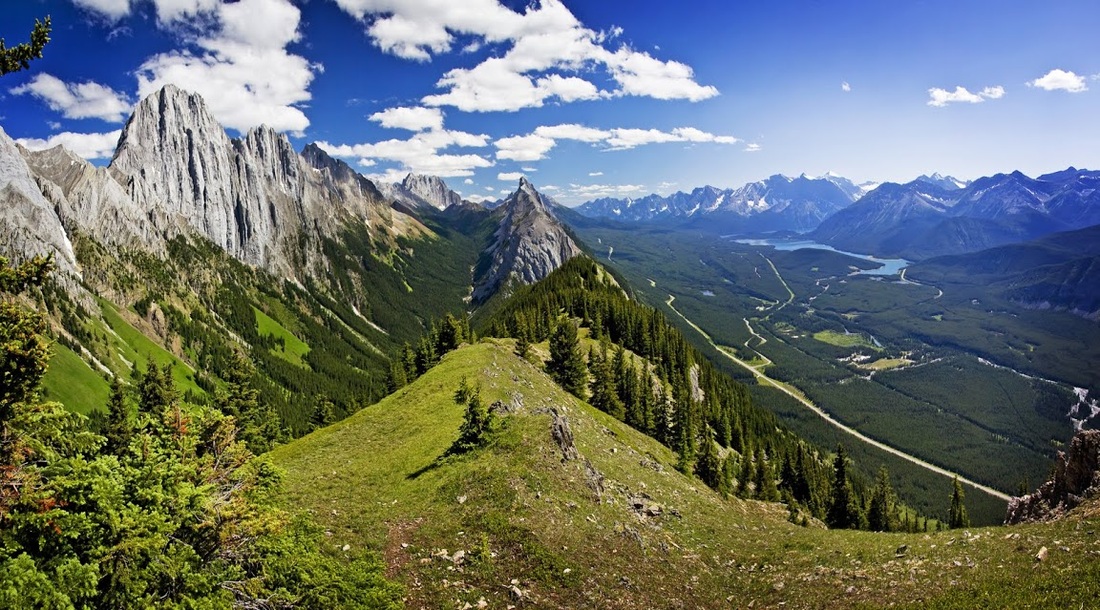
This shot shows a little more than a 180 degree view looking East from the Western outlier, Highway 40 is on the far left of shot, then the Opal Range, my ridge (King Creek Ridge) and along the Opals to Mt Wintour on the far right of shot, an absolutely beautiful array of front range summits and lush green meadows.
Heading back to the summit it is noticeably quiet and the banana is no longer visible in the hollow of the cairn, I imagine a small rodent laid on his back with a large round belly and jowls entirely covered in banana, half awake and half asleep no longer interested in who is making a noise outside.
I use the summit cairn as a tripod to gather the evidence shot (without a peep from within) and then turn my attentions to the second outlier that requires a short drop down toward the north east.
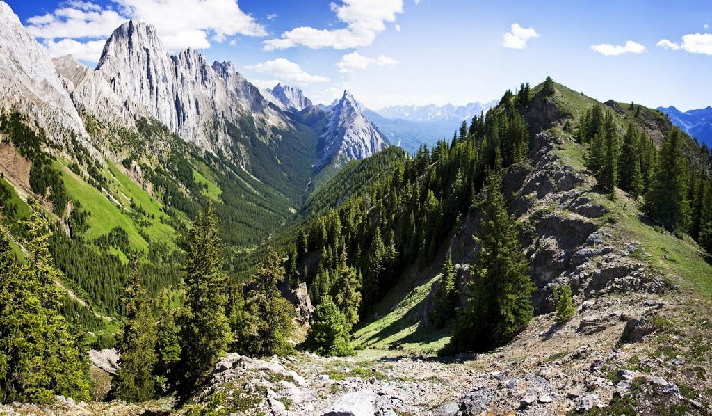
The route is easy going and provides a great view back along the King Creek valley. There is a descent route from here into the valley which allows a walk out along the creek but the notice of the creek trail closure back at the car park means I won't be taking that route home.
At the end of the outlier is a nice rocky nub that requires a little hands on work as you near the top, it is still easy and there is little exposure to worry about.
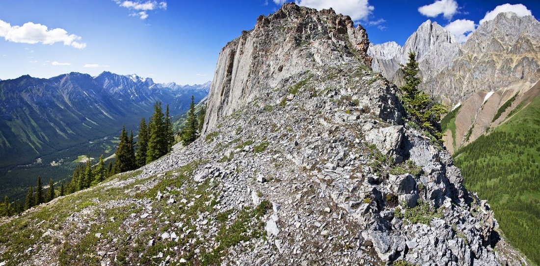
High on the nub I take a break in the afternoon sunshine, I study the folds of the Opal Range and the long raking skirts of green broken by heavy washout areas, I find it impossible not to take a moment to marvel at the absolute beauty of the location.
My final view from the northernmost point of King Creek Ridge looking south along the valley provides what is perhaps my favourite shot of the day, I know that later in life when I can no longer ascend these leviathans I will look back on this one as one of my favourites overall; no matter how many more I climb between this time and that.
The route down was the reverse of the route up and the steep section was perhaps more difficult to descend than it was to ascend owing to the loose gravel on the trial moving underfoot, but eventually I appeared virtually unscathed back at the trailhead looking down highway 40 at my truck and absolutely ready for some air conditioned luxury on the ride home.
This was an incredibly tiring hike considering its short overall distance but it must be one of the most rewarding short hikes in Kananaskis.....though I think I'll be looking for a more gentle ascent for my next one.