Mt Burstall (South)
Date Walked: 22nd October 2015
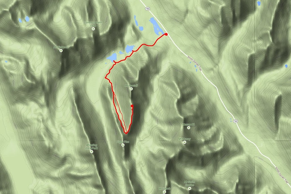
Distance: 10.3 miles (16.7km)
Actual Ascent: 2683ft (818m)
Time Taken: 5.5 hours
Mt Burstall (South) is an uncommon hike that begins in a culvert off the beautiful Burstall Pass trail. Access to the trailhead is via highway 742 about 10km south of Spray Lakes Reservoir where the clearly signed 'Burstall Pass' car park sits directly opposite Chester Lake car park.
Having arisen early I enjoyed a wonderful sunrise as I headed out to the mountains hoping to get another glacier view today. The sunrise lost its colour before I reached the mountains so I missed out on a mountain sunrise shot, but driving down highway 40 I saw a bull moose in Barrier Lake then cursed the lack of light that would have made a nice photo possible and kept on driving. As I made the turn from highway 40 onto the 742 I saw another moose, this time lurking in the shadows on the edge of the forest daylight was still slowly emerging and no photo's were made again, it was beginning to feel like one of those days.
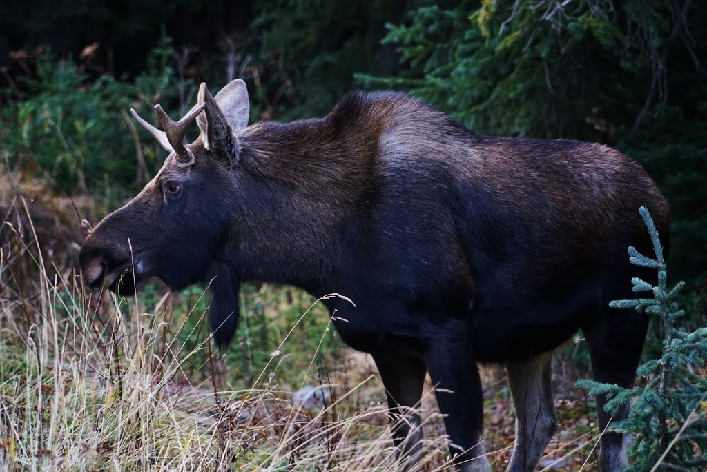
I turned into the car park at Burstall Pass trailhead and was still rueing the lost photo opportunities as I sat on the tailgate pulling on my boots but then a yearling appeared from the forest (you can tell he's a yearling by his antlers) he was in great shape and very big for a yearling, best of all he was happy to pose for photos.
Having arisen early I enjoyed a wonderful sunrise as I headed out to the mountains hoping to get another glacier view today. The sunrise lost its colour before I reached the mountains so I missed out on a mountain sunrise shot, but driving down highway 40 I saw a bull moose in Barrier Lake then cursed the lack of light that would have made a nice photo possible and kept on driving. As I made the turn from highway 40 onto the 742 I saw another moose, this time lurking in the shadows on the edge of the forest daylight was still slowly emerging and no photo's were made again, it was beginning to feel like one of those days.
I turned into the car park at Burstall Pass trailhead and was still rueing the lost photo opportunities as I sat on the tailgate pulling on my boots but then a yearling appeared from the forest (you can tell he's a yearling by his antlers) he was in great shape and very big for a yearling, best of all he was happy to pose for photos.
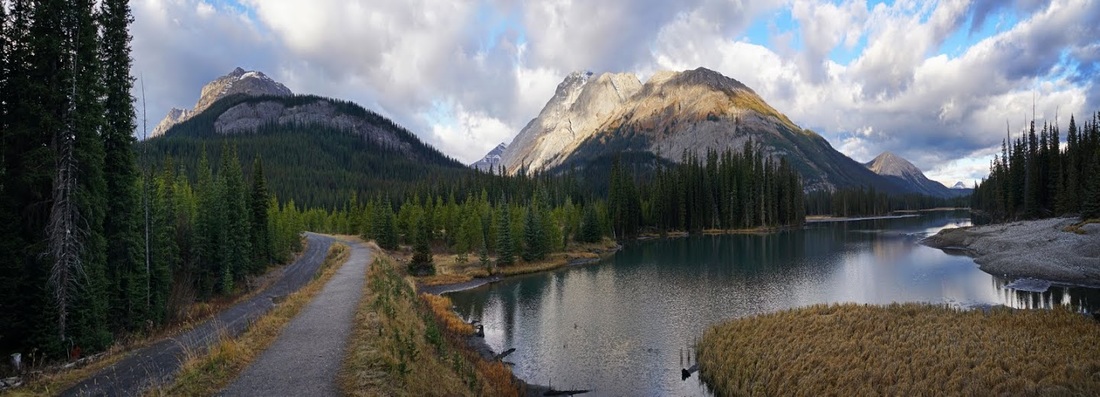
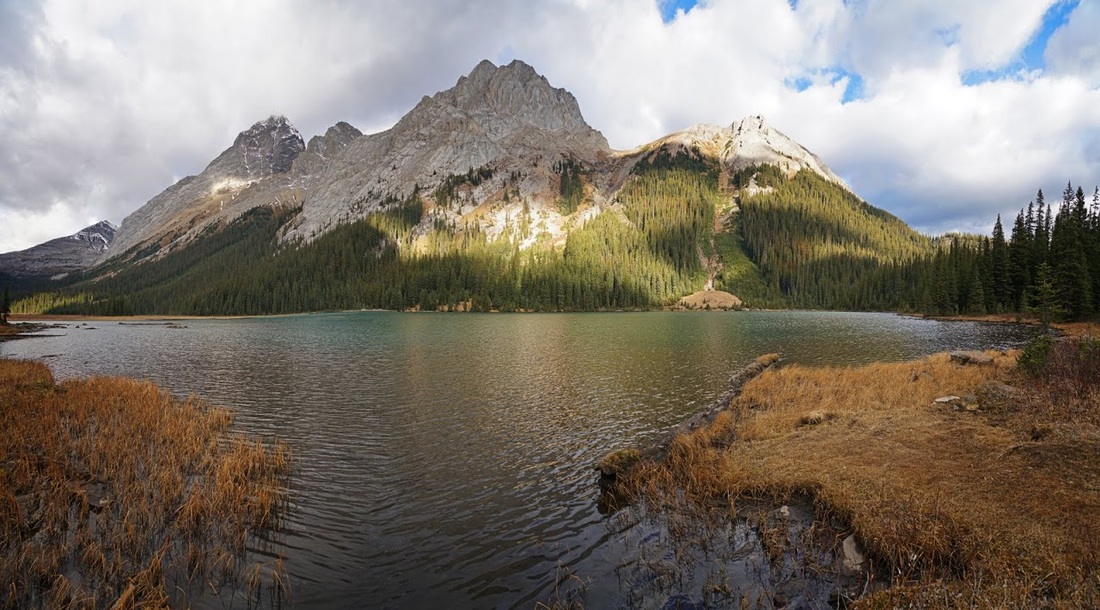
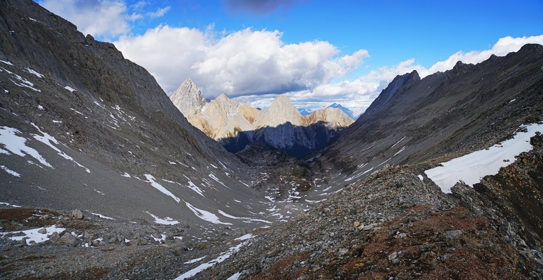
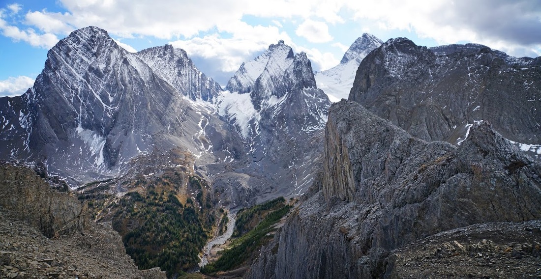
After booting up there's only one way to go and that is across the dam adjacent to the car park where the opening view of the hike is one to remember. Directly ahead of the trail is Mt Burstall (east view) and to my right the rather inappropriately named Mud Lake. Between them are the tall peaks of Birdwood and Commonwealth and that is the valley I'm heading up today.
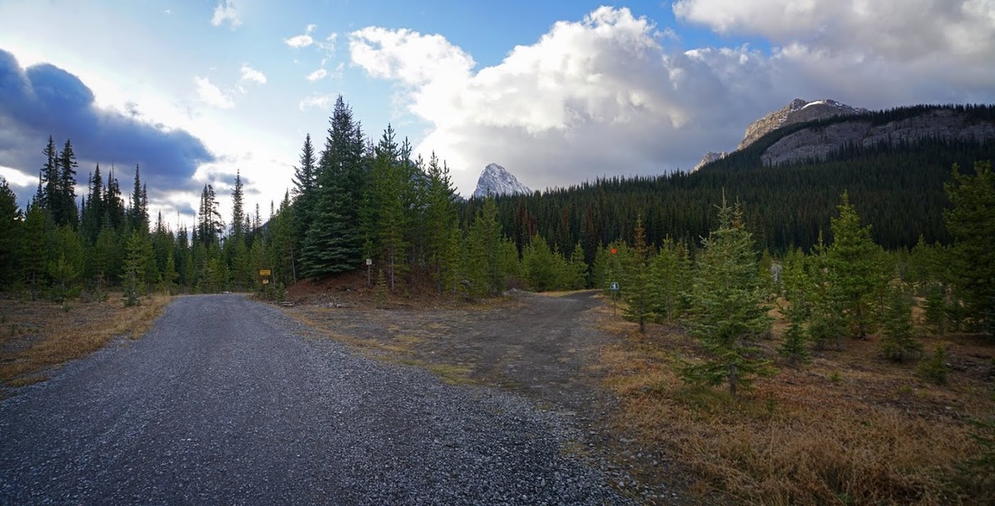
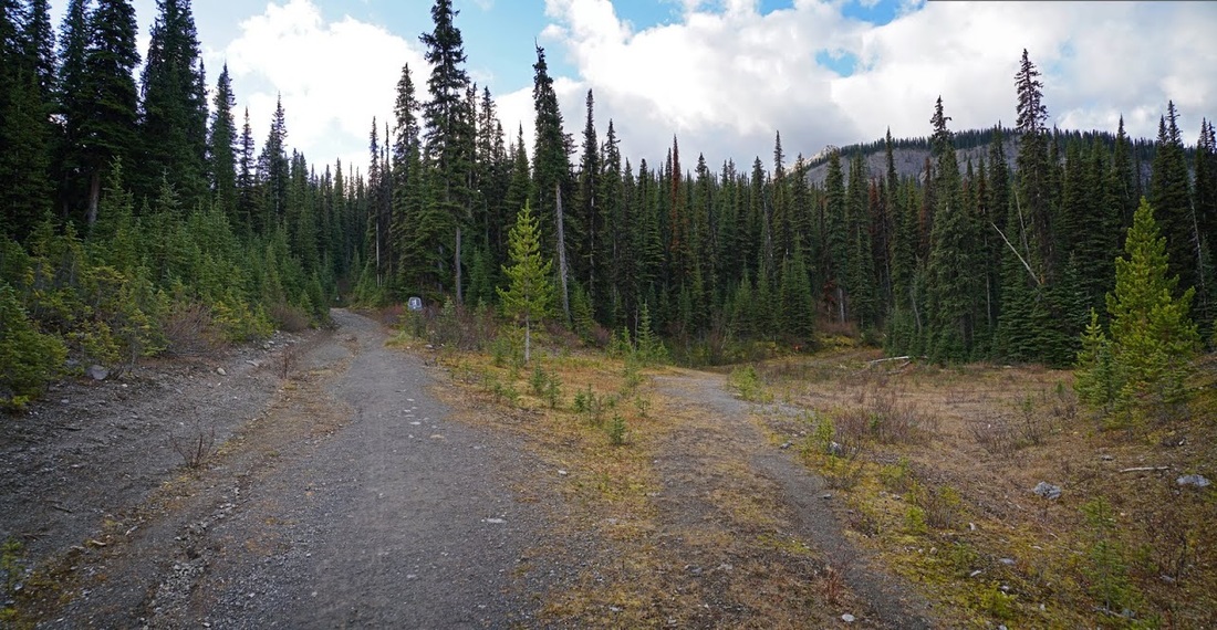
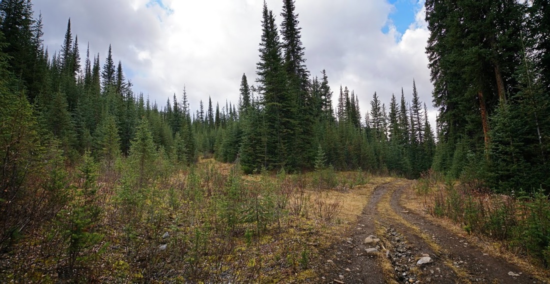
The next three shots are not the most interesting but for those making the hike will be useful in route identification which is why I took and included them. After crossing the dam the track curves left, the next 'Y' junction is where a right turn is required toward Mt Burstall.
Very soon after this right turn you will reach another 'Y' junction where right appears to be taking you toward your goal, this is not the case, stay left here up into the forest.
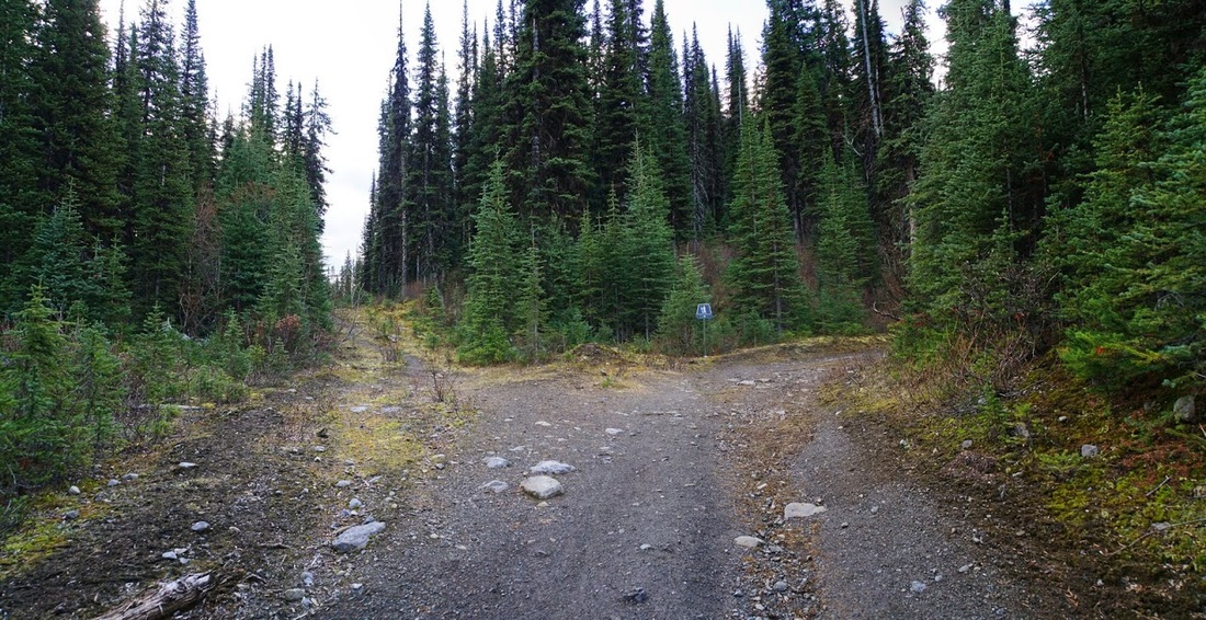
Again just a few hundred metres along another 'Y' junction appears, this time a right turn sets you on Burstall Pass trail and you can forget route finding for a while.
A gentle climb up a long slope accompanied by the sound of water cascading through a nearby canyon brings me to a small diversion on the right side of the trail which leads to the lowest of the Burstall Lakes. There's little water in here today and no sign of wildlife but it is always worth the diversion just to check.
A nice easy hike through the valley should be accompanied by occasional "Yo Bear" shouts as it is a very popular area with both grizzly and black bears. After passing a huge boulder I reach a cairn with blue flagging, this is the route for the difficult scramble to the north summit of Mt Burstall so I keep straight ahead.
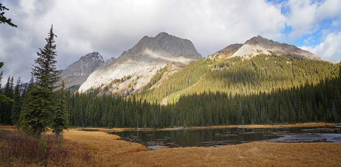
After a while another short detour is called for to check out the largest of Burstall Lakes, a trail on the right hand side leads through the trees down to the lakeside. Again there's no wildlife but I can't complain about the view.
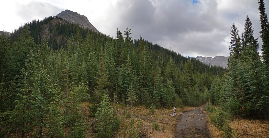
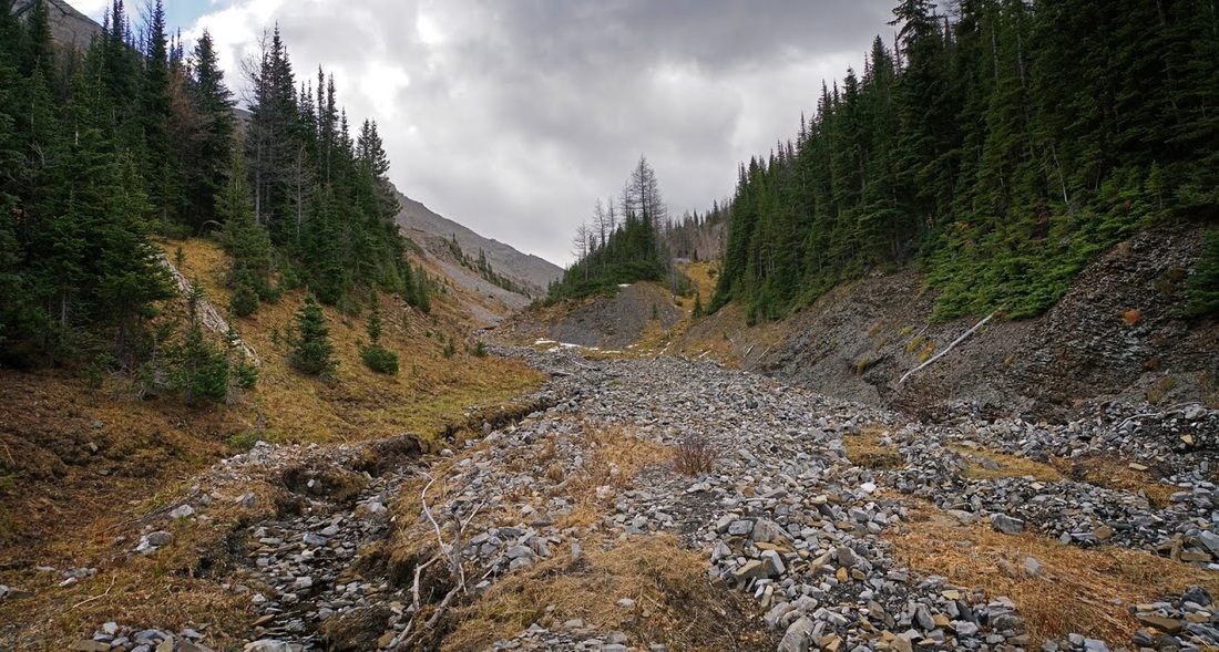
After approximately 3.5km along the Burstall Pass trail you will cross a rocky washout and then reach a 'Y' junction that has no flagging or cairn and could easily be missed. Here a left turn is needed to reach Mt Burstall (South). If you find you have hiked to the concrete bike rack you have gone too far, turn around and return about 200m.
Once off the Burstall Pass trail the route quickly narrows to single track and rises steeply through forest before opening out onto an unnamed creek bed. I suspect the trail ran beside this creek until being washed out as there are occasional bits of trail remaining here and there.
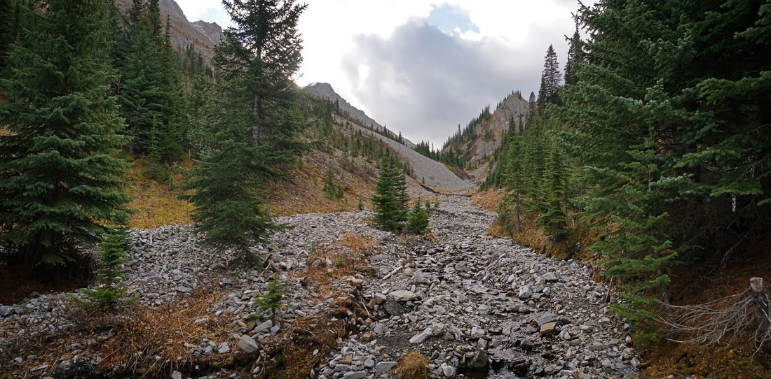
Looking back down the watershed gives a clear sight of Commonwealth Peak as the creek briefly narrows into a more sheer sided little canyon which still bears some parts of the trail.
As I ascend along the creek I see the trail intermittently appearing along the right hand side but as there is little flow today I stick with the creekbed and head into a tight section with loose scree on one side and a sheer wall on the other, again there's no problem today due to lack of water, on wetter days you would need to ascend the scree a little way and traverse a couple of hundred metres on the side slope.

After the tight canyon wall the creek opens out again and levels a bit to a nice hike on easy going, up ahead I see a small cairn and a right turn which ascends into thin trees so I follow that trail. As it turns out I could have just stuck with the creekbed for an easier ascent but I didn't know this at the time.
The ascent continues alongside a steep wall over rubble and through thinning trees, it's not difficult and does provide nice views back down the valley so perhaps it's worth the little extra effort needed to go this way.
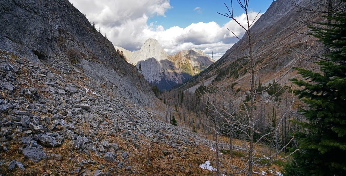
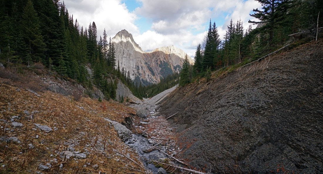
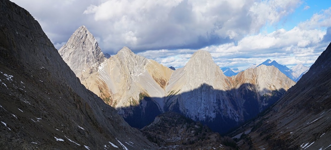
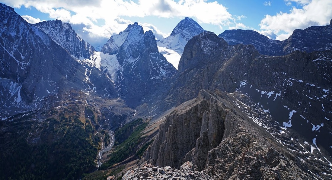
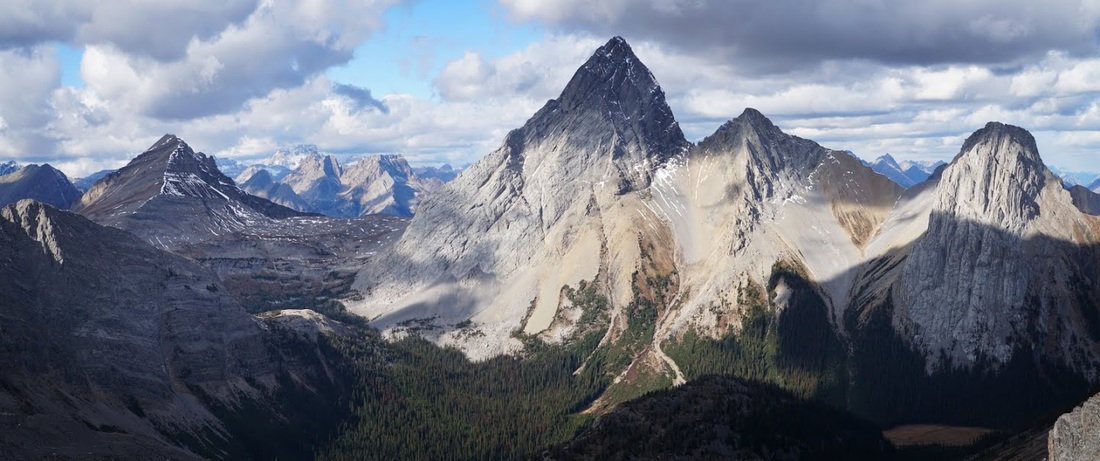
The long valley finally opens out toward the end where glacier scraped rocks are littered with pockets of growth, the view back along the ascent route now shows the towering peak of Mt Birdwood to the left, the pigs tail next and Commonwealth Peak beside that.
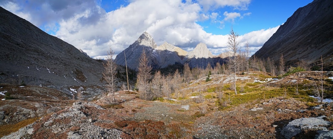
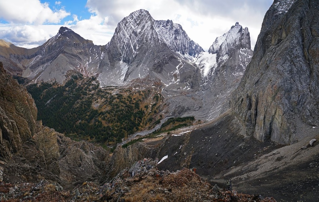
There's still quite a way to the col that sits between Burstall (South) on the left and 'Piggy Plus on the right, the latter of which is a class 4 scramble which I have contemplated a couple of times but decided against each time.
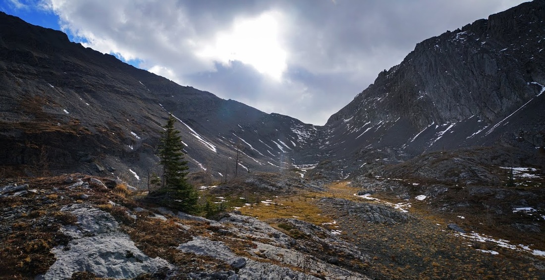
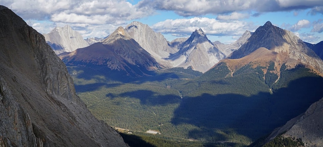
It is a very cold ascent to the col and the jacket is needed in earnest along with the gloves as I pick my way through the boulder field, the cold air is from the glaciers that sit at the other side of the col, the wind whips up and over here bringing the frigid air along with it.
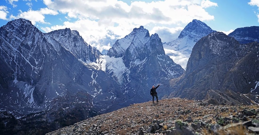
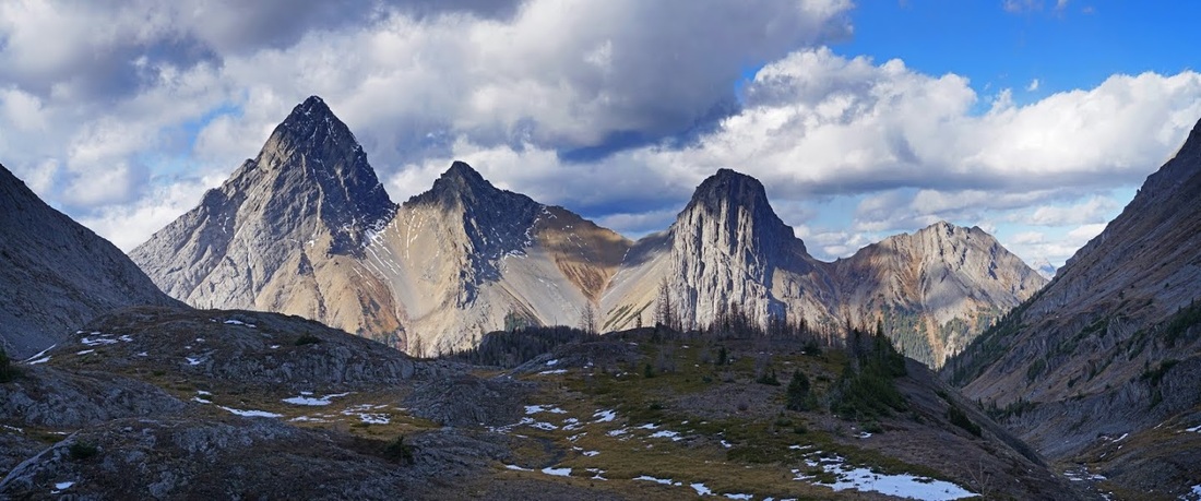
The sun is still trying to reach into the valley that holds the Burstall Pass trail but is warming the peaks of Mt Birdwood, The Pigs Tail and Commonwealth Peak along with the unnamed outlier filling the right of frame.
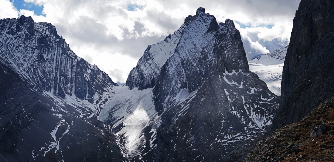
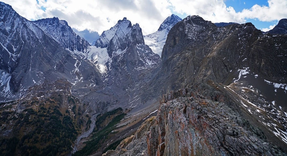
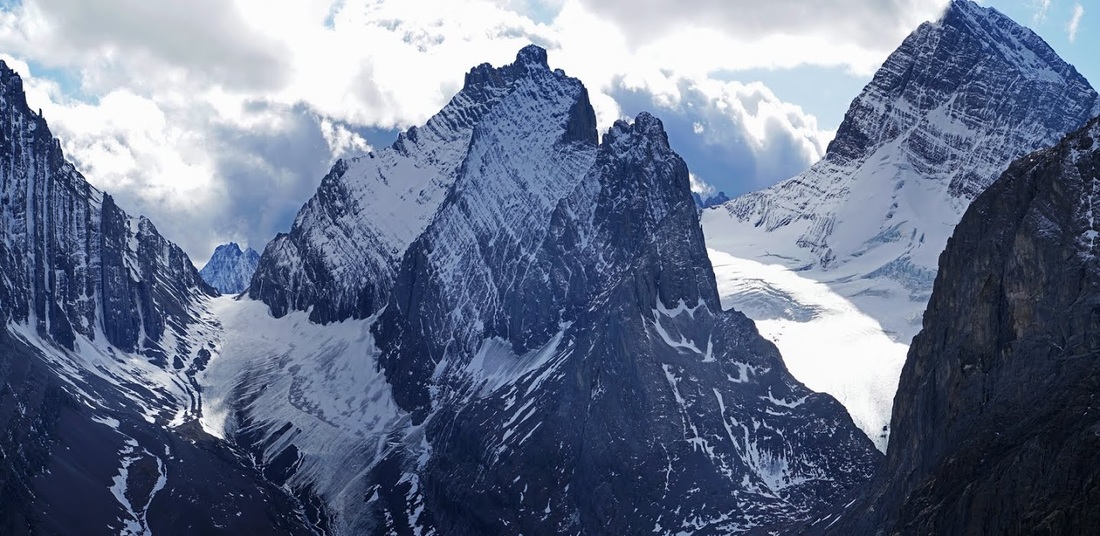
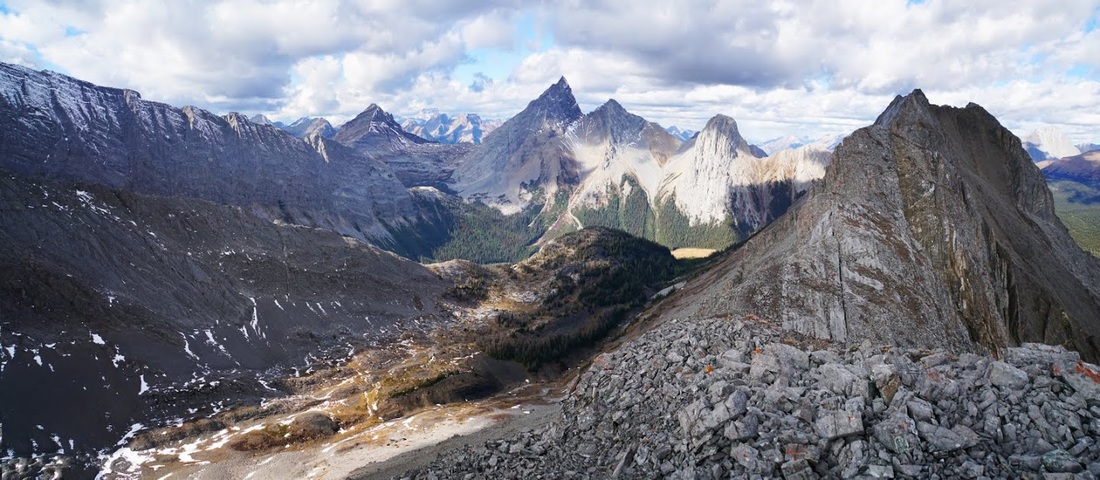
From the col the view is wonderful, French Glacier sits directly opposite between Mt French and Mt Robertson feeding water into French Creek which cuts through the valley back down to the trailhead area and though not visible on the image, in the valley below I see two huge mountain goats in their full white fleeces ready for winter.
I didn't stay long on the col as the wind always whips up through these passes, I turned left and headed along the ridge to try and get a better view through the gap to the west side of Mt Robertson where the much larger Robertson Glacier sits.
The early ascent of the ridge is easy enough but the rock is incredibly brittle and very mobile on the sloped side meaning a high line is needed close to the vertical drop off on the right, it's safe enough but you do need to be watching your footing at all times.
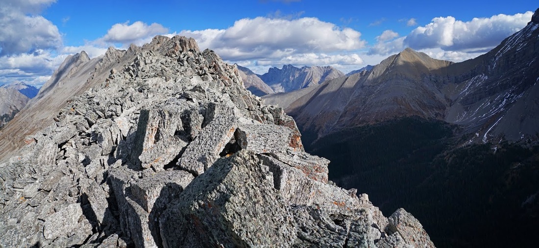
Part way along the jagged ridge a little breathing space appeared and I could get a nice shot of both sides of the ridge and my target lump (the large bulbous outcrop still several hundred metres along) I have to say if you are not comfortable with exposed ridges this will not be for you.
Not only must I stay high on the ridge but on occasion the only way past is to walk a very narrow section of rotten rock which does focus the mind a little as you do it.
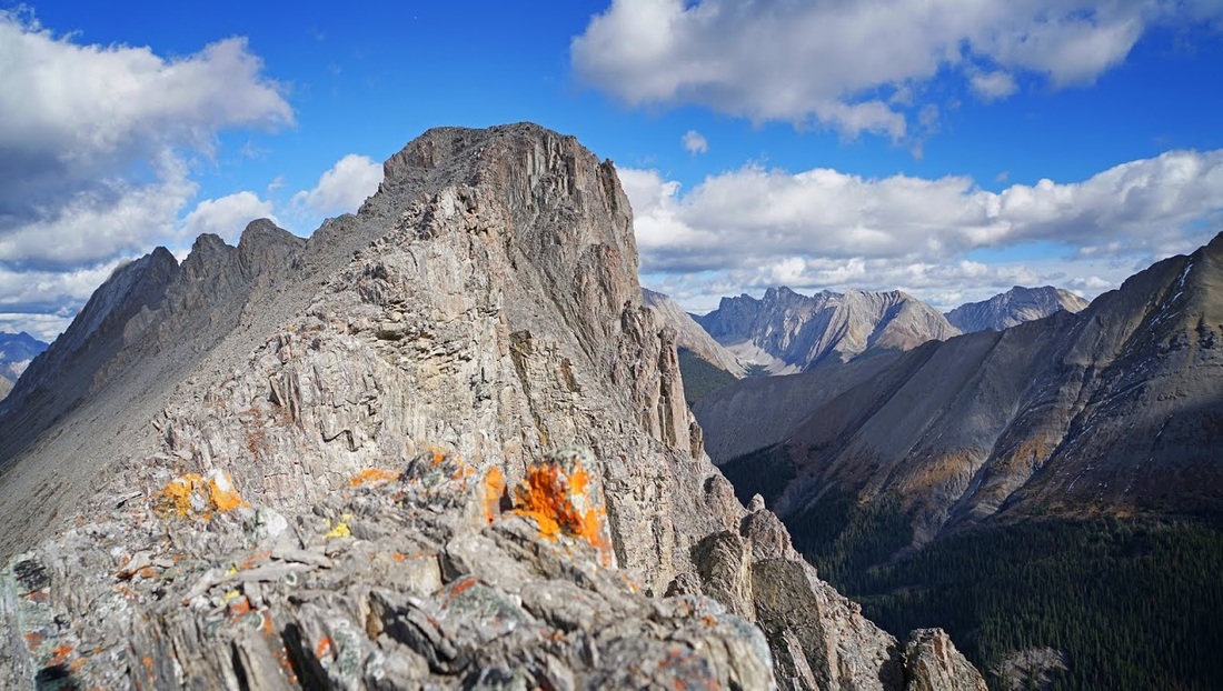
Getting there now although the going is getting much more demanding at this point. I've almost reached the target, the only purpose of this shot was to get that fantastic colour from the lichen up here.
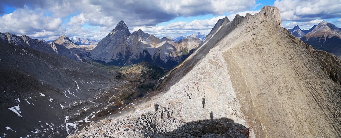
Looking back down to the col along the 'jaggedy nasty' (as Sarah would say) I can now see through the gap to the Robertson Glacier and beyond that to Mt Sir Donald which flanks the west side of the glacier.
From the wide warm comfort of my target point at 9058 feet I can look along the ridge toward the summit (not attainable from the south) and see a world of mountains on all sides.
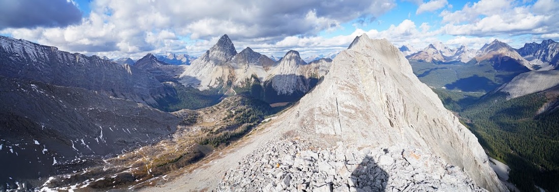
The enormous block of rock that served as my summit for the day not only provided spectacular views in all directions but it also provided warmth. I spent a good 30 minutes laid out up here taking it all in, one of the most stunning spots I've been to in a while.
Whilst laying around in the sunshine I got myself interested in hiking up French Creek and finding a route along the left side of French Glacier to the col there, the reason being the enormous Haig Glacier that is joined to the other side. In fact this really is something I would like to do, there probably won't be an opportunity this year as it will be snowed in soon but it's definitely one to think about for next summer....what a viewpoint that would make.
The views from my perch are sublime, I can see over 'Piggy Plus' to Snow Peak which sits at the top of Burstall Pass (the route in is via the thin green ribbon of forest reaching up/left from the foot of Mt Birdwood)
To the east the large car park for Chester Lake stands out beside the highway, opposite is Mt Chester, The Fortress, and Galatea to name just a few. Chester lake is a nice hike but I've never extended it to the surrounding mountains.
East of Mt French is Mt Murray (right) and behind that in the distance Mt Lawson, Inflexible and Mt James Walker providing the bulk along the Kananaskis Range.
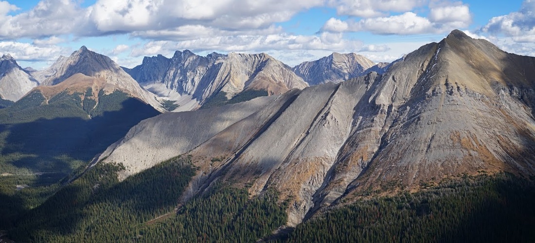
To the west is 'Piggy Plus' and the towering bulk of Whistling Rock Ridge running down to Burstall Pass, I had hoped to get back to Burstall before winter too but with snow showers blowing by all day and significant cooling predicted from the weekend onward I suspect I may be too late for this one too.
Making my way down I took a last shot of that wonderful view, I can still see the two mountain goats on the ledge way below me and try not to think of the last time I saw a string of mountain goats when I took a massive fall which I was very lucky to get away with. I also try to ignore the fall which damaged my knee for a few weeks after seeing a mountain goat on the east side of Galatea, damn harbingers of doom they are.
I almost made it back to the valley unscathed but took a good tumble on the boulder field twisting my left calf and causing some swearing (mostly aimed at those damn goats) luckily it was just a momentary issue at the time and didn't trouble me until later that night after my shower when I limped around the house until bedtime. Strangely enough it felt fine in the morning.
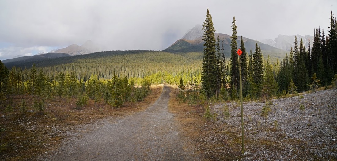
On the way out a huge snow shower passed behind me but I only got a scattering of flakes where I was, almost back at the truck another went in front and missed me again so I guess my luck is still in. Notice the little orange snowshoe signs which start appearing this time of year, it's 8 feet tall and is fully adjustable to double it's height for when we "get a bit of snow" ....sometimes I forget how crazy the winter is out here.
The map below shows my route in via the thicker line, my route out was simply following the creek all the way from the col eliminating the side hill traverse I had done on the way in