Navajo Trail & Canyon Rim - Bryce Canyon - Utah
Date Walked: 11th November 2015
Distance: 3.9 miles (6.2 km)
Actual Ascent: 558 ft (170m)
Time Taken: 2 hours
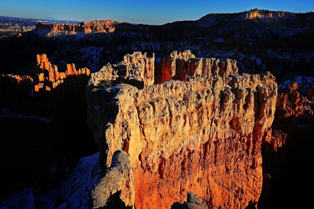
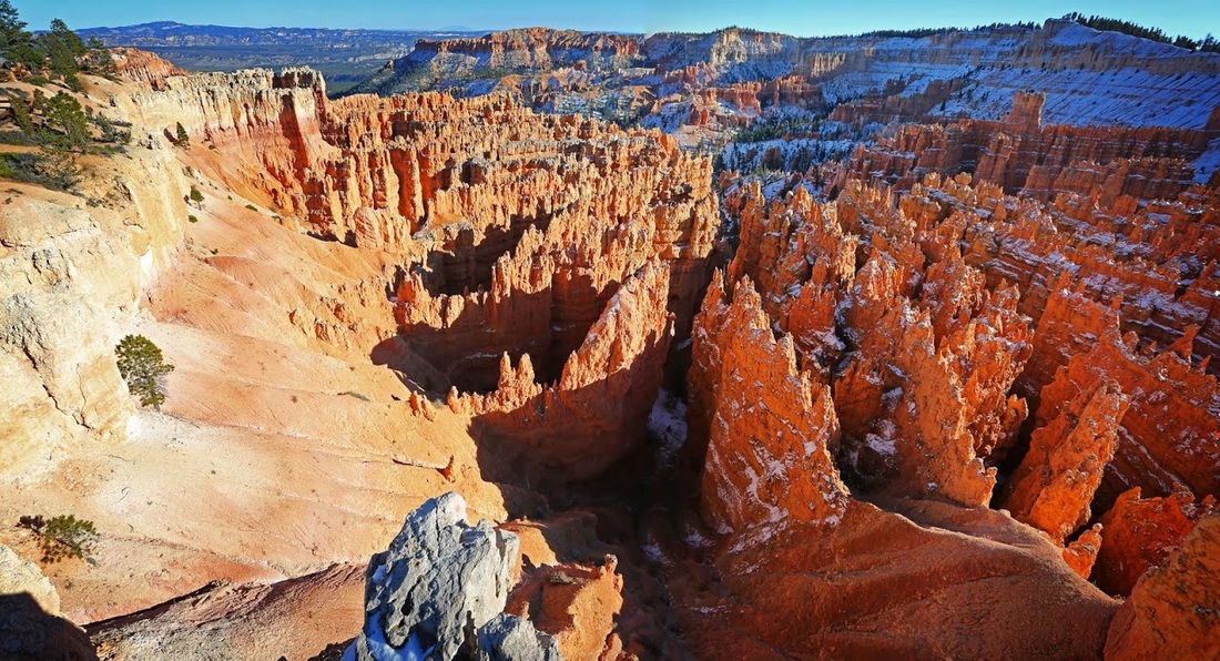
Bryce Canyon is, for me at least, one of the most spectacular places in Utah, which speaks volumes in a state littered with the extraordinary. The name is actually incorrect as Bryce is not a canyon at all but a collection of amphitheatres on the edge of a huge plateau where the view from the rim at an altitude of 8000 feet (2,400 m) is breathtaking in more than one sense.
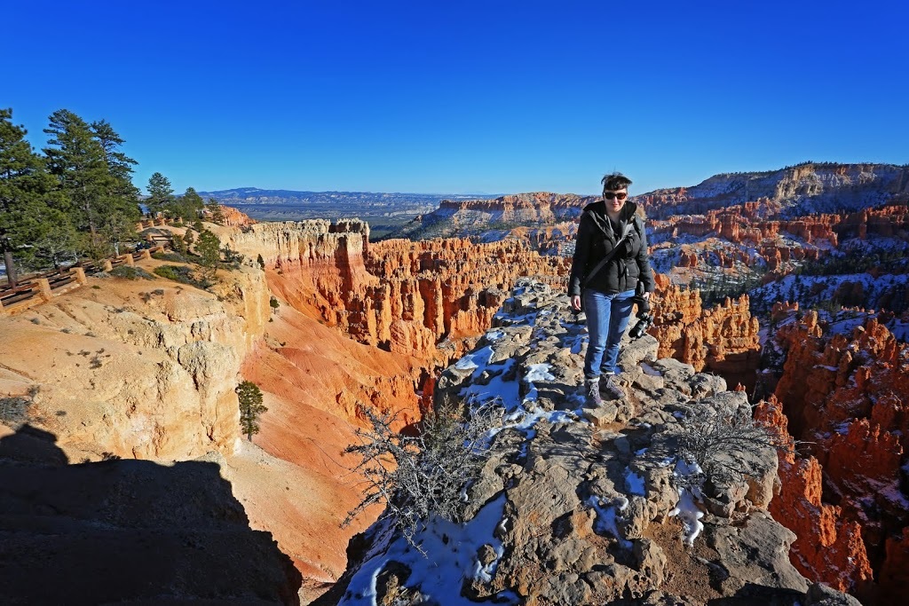
I returned here to share this wonder with Sarah as part of the '2015 foot rehabilitation road trip' and the day started perfectly as the $30 entrance fee was waived for 'Veterans Day' ('Remembrance Day' back home). We started out on the rim close to 'Sunrise Point' which provides an incredible overview irrespective of the time of day.
I returned here to share this wonder with Sarah as part of the '2015 foot rehabilitation road trip' and the day started perfectly as the $30 entrance fee was waived for 'Veterans Day' ('Remembrance Day' back home). We started out on the rim close to 'Sunrise Point' which provides an incredible overview irrespective of the time of day.
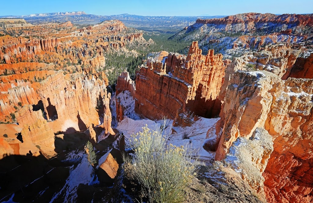
There is a well maintained 'Rim Trail' that stays perfectly close to the edge for the entire hike as it makes its way toward 'Sunset Point' providing so many photo opportunities along the way it's hard to get any kind of stride going before stopping again to take in the giant hoodoos reaching up from the canyon floor.
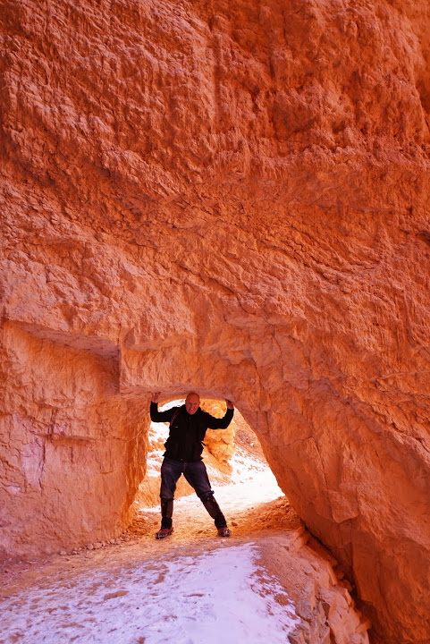
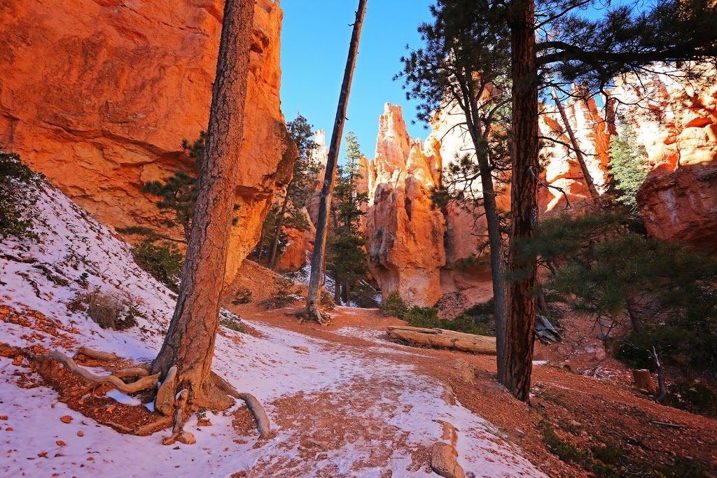
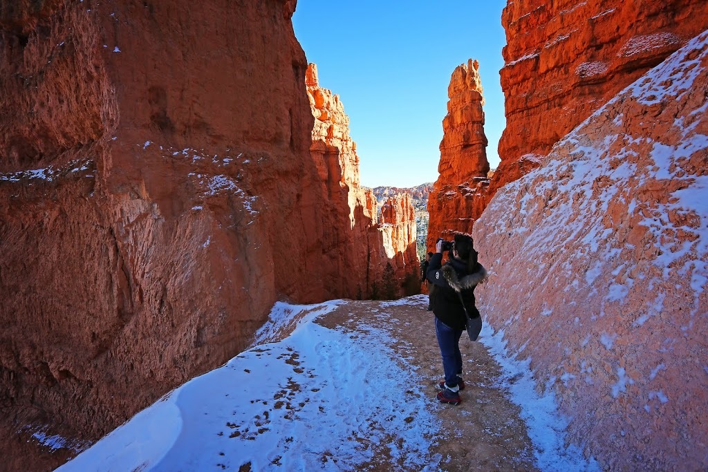
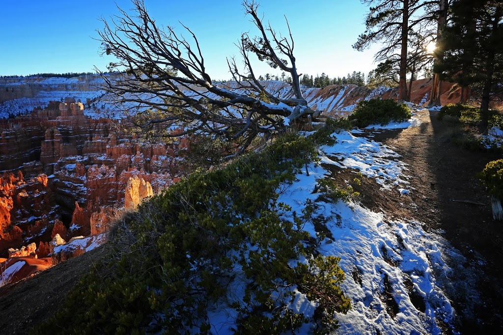
Sunset Point is where the Navajo Trail begins, there's still an amount of ice and snow on the trail but I had considered that and brought along the micro spikes, after a brief discussion about the dodgy ankle Sarah was keen to get going while promising to turn back if conditions necessitated.

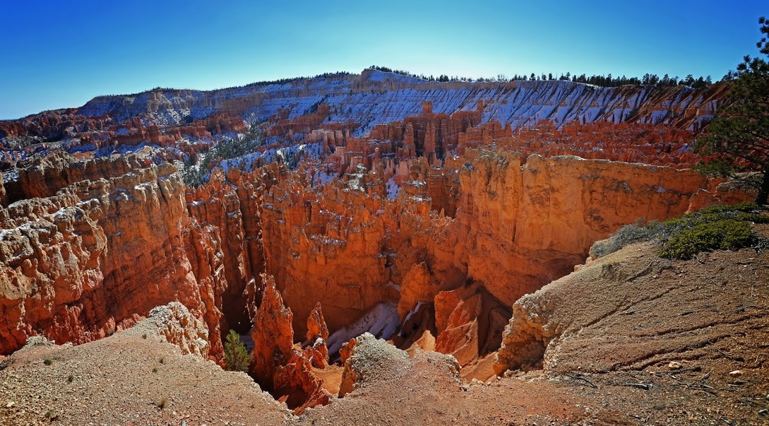
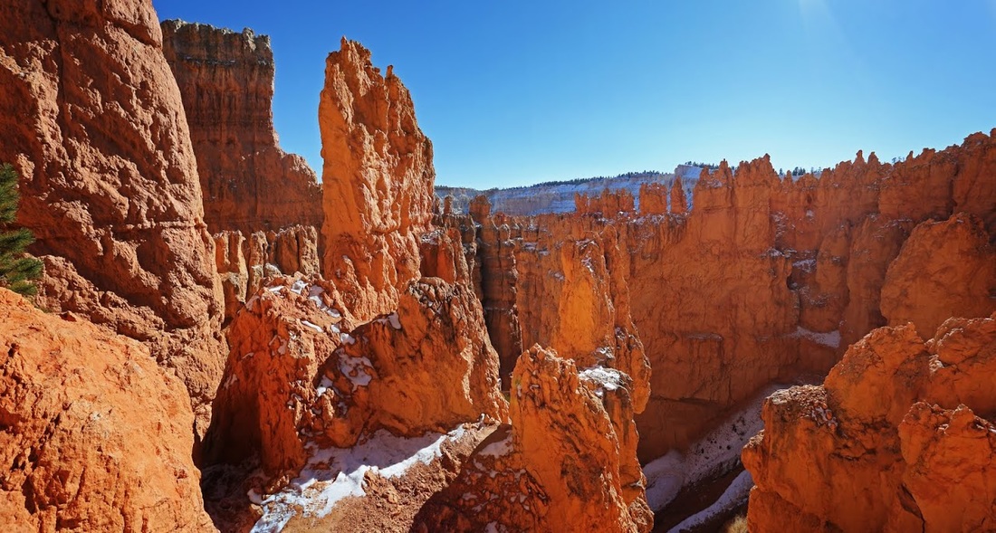
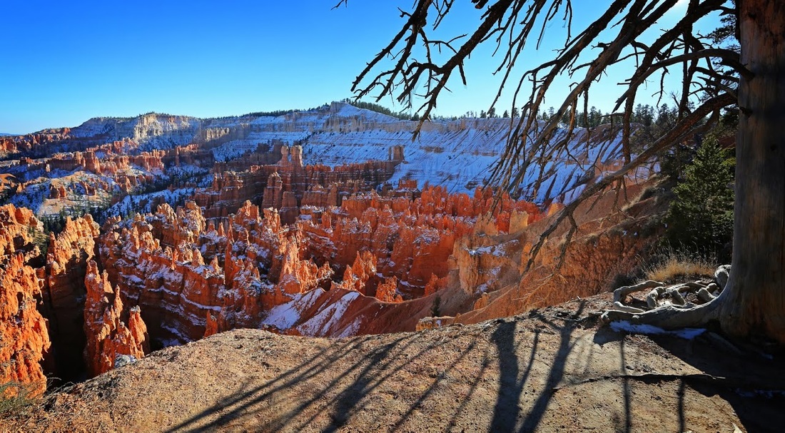
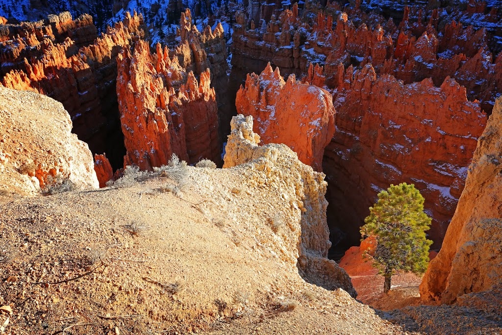
We are soon making our way along the icy trail toward the canyon floor, the light here is bounced from one sandstone spire to another making the most fantastic colour which is occasionally contrasted by a splash of green from the Pondarosa Pine that are dotted around between the hoodoos.
In the sunny areas the ice and snow have melted away but lower down the easy switchbacks that descend into the basin there is still a need for the micros. In a number of places we see other hikers having real problems staying on their feet, the ice and dodgy ankle combination we would definitely not have been able to do this without the micros, so it's worth taking them if you are planning a winter visit.
As we descend the trail makes it's way around and through some incredible rock pinnacles, the temperatures drops considerably (from what was already a cold start) as we go along but the winter sun still warms exposed skin giving a sense of warmth even if it is false.
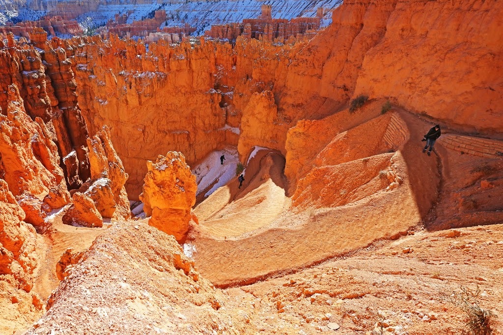
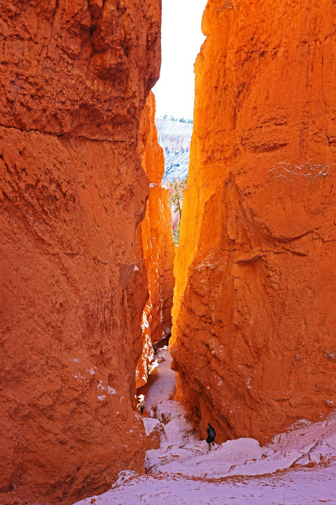
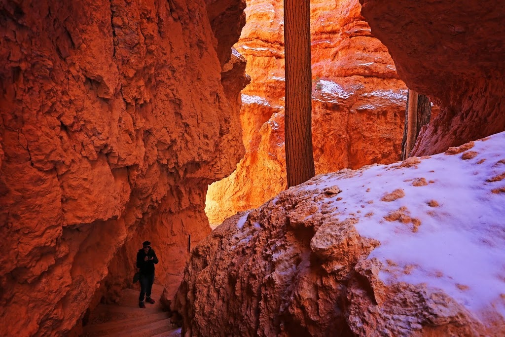
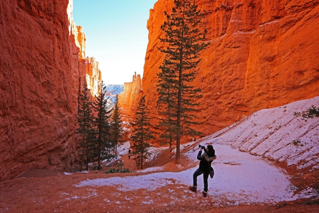
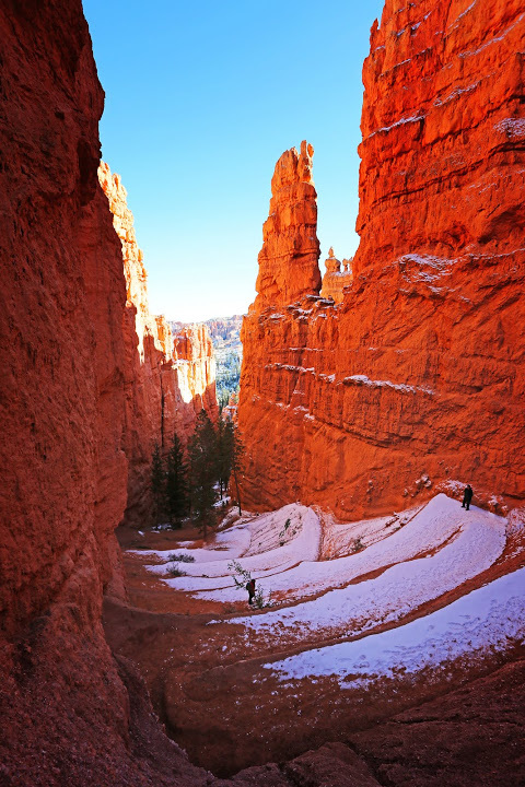
In places the switchbacks are squeezed between towering sandstone walls such that they need to turn and turn again within just a few feet, the dark speck in the image below is an ascending hiker who helps bring scale to the deep canyon.
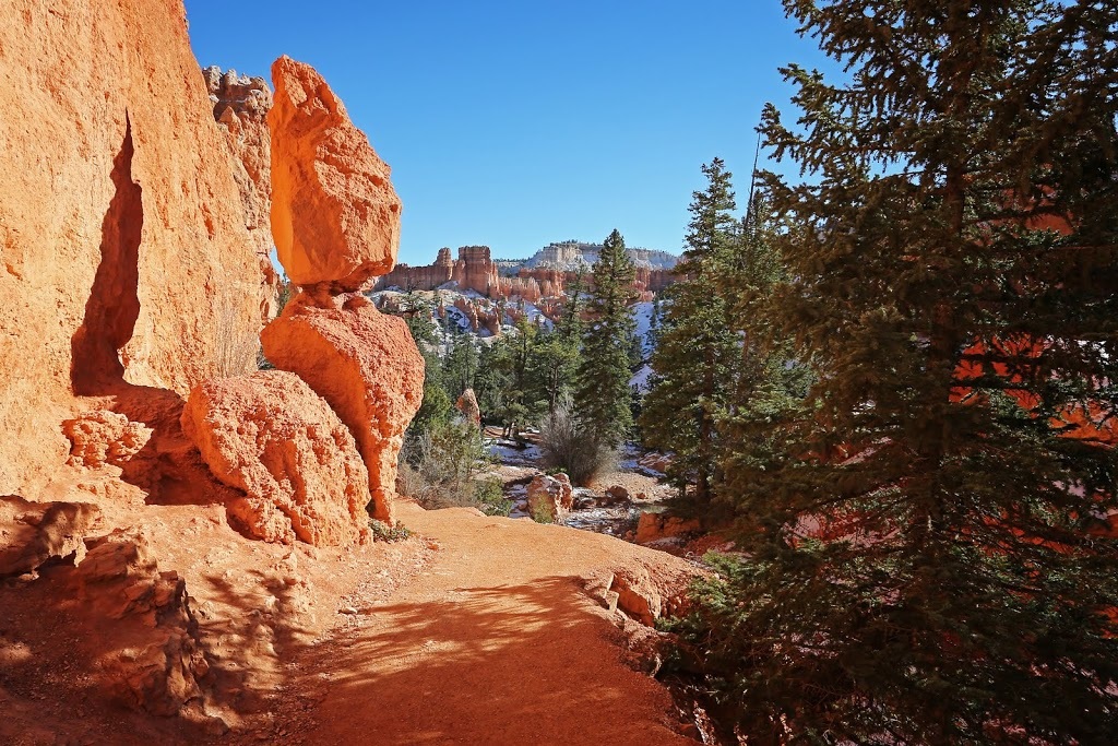
There are plenty of places to pose for photos along the way and various ways to get past the leviathans that attempt to block access to the basin below, the colour variation here shows the difference between bounce light on the left and open shade on the right.
|
|
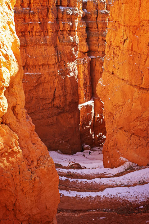
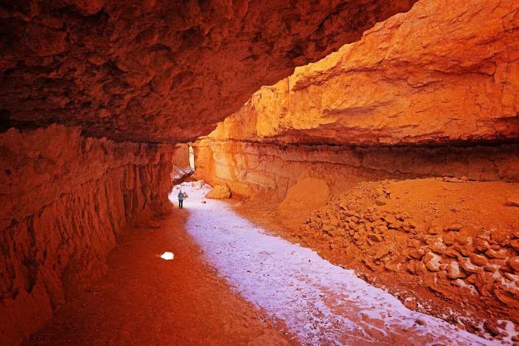
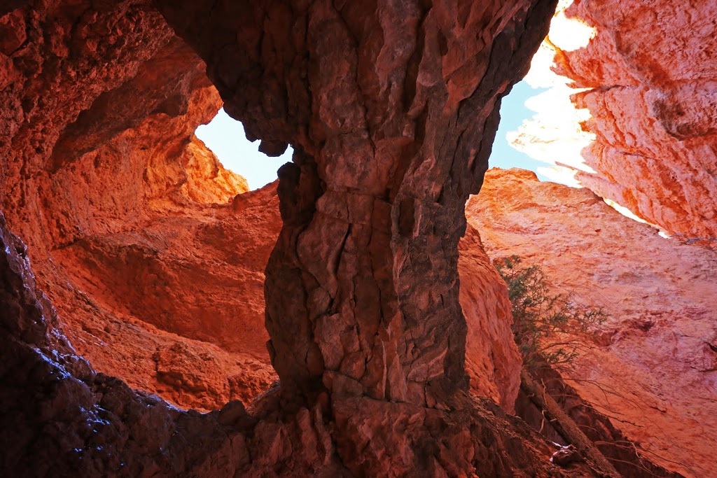
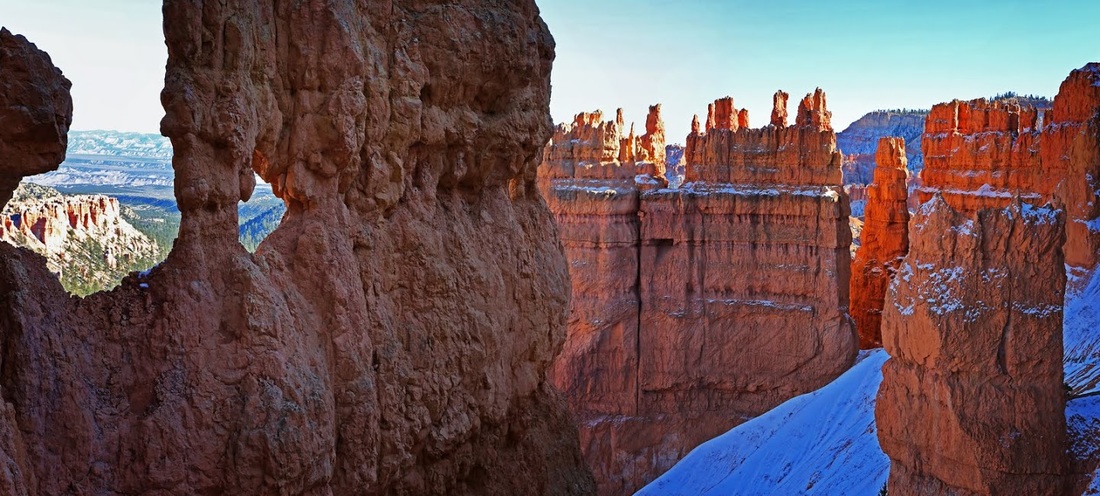
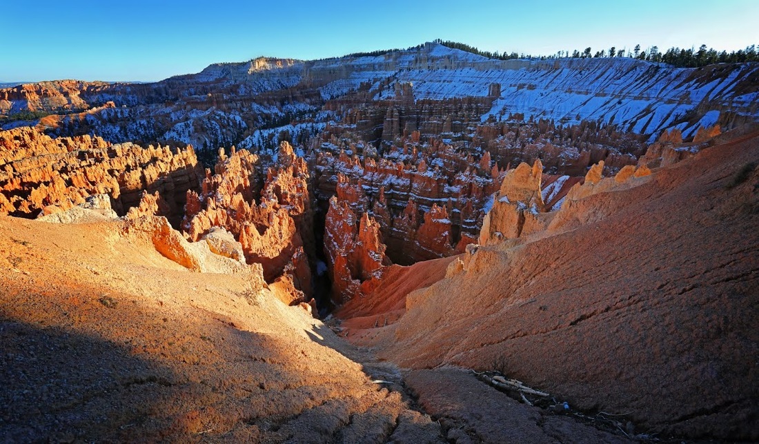
It's a great descent into an ever narrowing slot canyon where thousands of years of erosion have worked their magic leaving behind the most intriguing shapes, offshoots and holes in the porous rock.
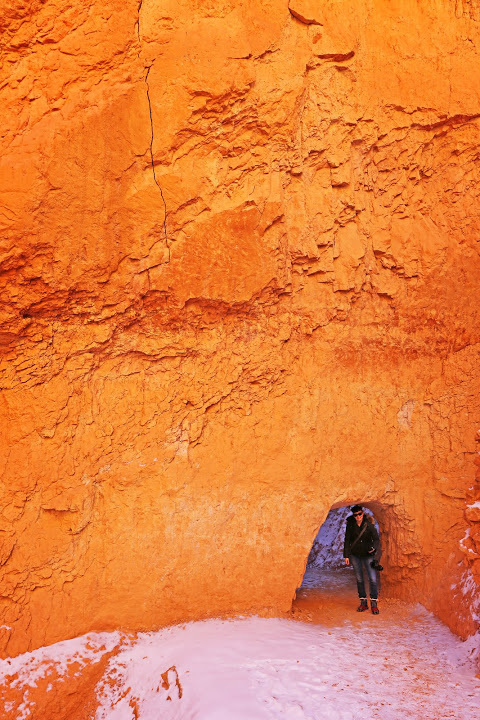
Soon the narrow canyon gives way to a huge undercut that affords protection from any falling rocks which seems to be plentiful if local piles are anything to go by.
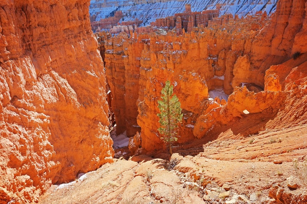
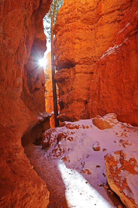
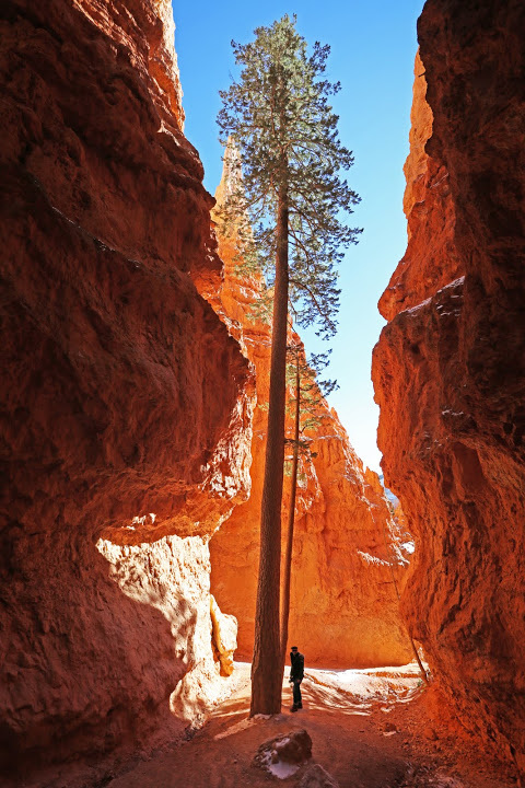
Beyond the undercut the trail narrows again before reaching a tight spot through which the winter sun returns, in the small space available another Ponderosa Pine stretches upward to the light.
A good set of steps have been constructed around the tight turn in the canyon ensuring smooth passage for the tourists that make it this far. I find it odd that Bryce receives less than half the tourists of it's near neighbour Zion National Park, something I believe is entirely down to the 60 mile journey away from the interstate to get here. I'm not complaining, at this time of year it means there's plenty of space available.
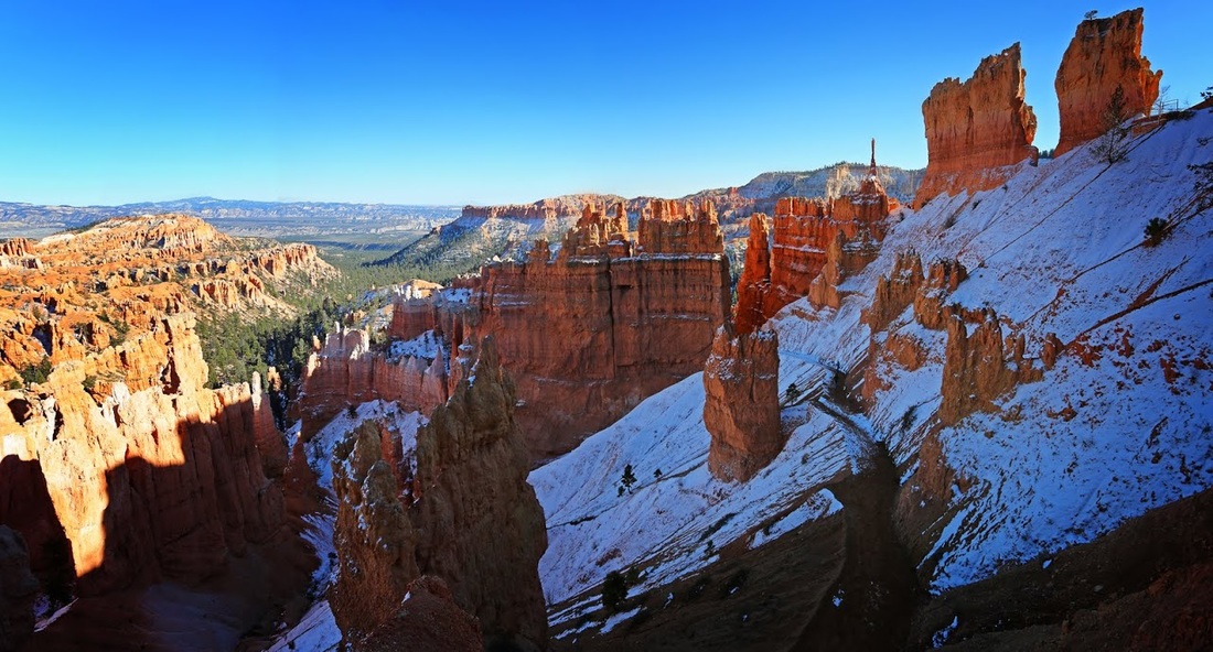
The trail continues much as before but now we are on level ground, the descent is done and ahead we can see the sky opening up into a wider area.
The map shows we have reached the joining of the Queens Garden Loop and Navajo Loop and that we have now walked back to Sunrise Point albeit in the basin below
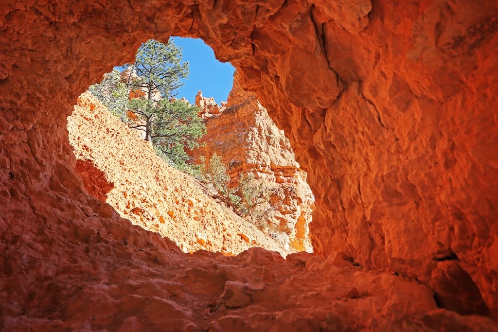
As we pass through the Queens Garden section there are still various windows opened up to view what is ahead, behind and occasionally what is out of reach entirely.
There are a surprising number of trees in the basin once level ground is reached and though mostly invisible from the rim above they appear to be thriving in the 'drought or flood' conditions of the basin.
It's worth looking up once in a while as the basin floor has a number of natural bridges that cross over between hoodoos, I'm pretty sure I would trust them to walk over too, if they were accessible.
The re-ascent is different to the ascent route we took, it's wider allowing longer and more gentle switchbacks, so much so that there seems to be too many to be honest, but then again it does make access/egress easier for those less able (such as the dodgy ankle brigade)
As we reach higher there is still a good wide route through the hoodoos and more gentle ascent. So for those thinking of doing this hike take the loop anticlockwise for the easier re-ascent to the rim ;)
At the halfway point in the ascent is a virtually level area that allows a breather while you keep moving toward the rim, that is if you can keep moving without stopping for more photos
Along the level area are a number of naturally occurring photo spots that protrude from the trail and offer varying views of the stunning surroundings.
As we rise back up to the rim there is an opportunity to look over the level area of the trail, the small black speck against the snow half way back there is another hiker returning with us to Sunset Point.
Once back at sunset point we dispensed with the micros at last and continued along the rim trail to Inspiration point where a shard of rock punctures the air above the basin providing a great photo location though it seems few people actually want to stand out on the end of it.
Sarah did manage to go a little way out on Inspiration Point but got little inspiration from it and instead adopted the "take a damn photo because I don't like it" stance before returning to more spacious ground soon after.
We continued the Rim Trail toward Bryce Point as the sun began to set casting long shadows across the top of the canyon which caused us to consider a retreat to Sunset Point but we decided to keep walking instead.
It's a lovely hike but with the sun fading fast we were going to have to turn around soon and return to the truck, the shadows over the canyon were already killing some of the colour.
We walked a little further to Bryce Point and caught some more of that wonderful light as it dipped behind the rim, all the time looking down on a myriad of hoodoos, each with their own curious attraction
Bryce Canyon is actually much more of a sunrise location than sunset (no matter what they name their points) as the sun floods into the valley from the east filling the basin with light, but still, sunset has it's moments.
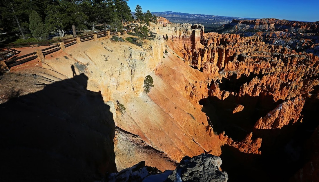
We headed back toward the truck almost matching the movement of the shadow along the basin floor until back at Inspiration Point where a 'shadow selfie' was in order.
We sat together on a bench overlooking the basin, shivering in the cold evening air and talking about the beauty of the canyon and about being there together to see it. We stayed until last light before heading back to the truck and hitting the road to our hotel.