The Pigs Back - Autumn
Date Walked: 7th October 2013
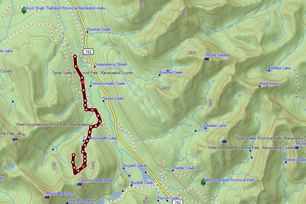
Distance: 10.8 miles (17.4 km)
Actual Ascent: 2322 feet (708 m)
Time Taken: 6 hours
This hike seems to be twice as far as it actually is and feels as if it has twice the ascent than it actually has. In truth it has been a slow year for me in terms of hiking and my fitness has fallen off as a result, but even so this hike was a tough slog on a day of blizzard conditions and grey clouds above.
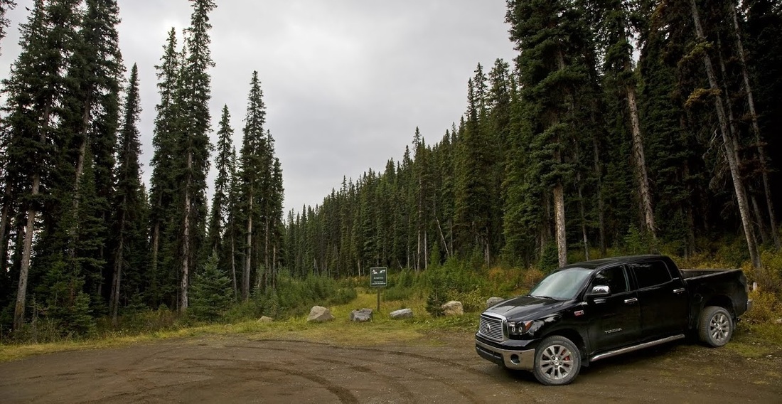
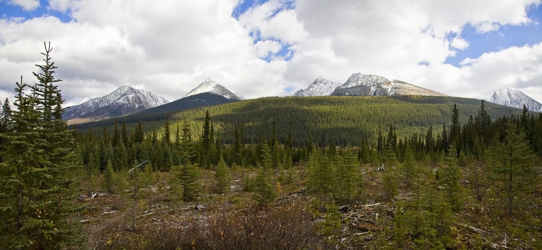
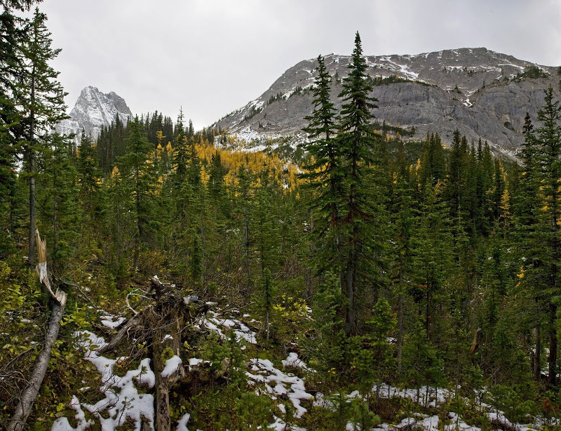
I began from a small car park just off Mt Shark Road which leaves the Smith-Dorrien Trail (highway 742) at Mt Engadine Lodge. I had the place to myself as I expected, leaving my truck which is now sporting winter wheels and tyres I headed off down the cutline on a well trodden trail.
I began from a small car park just off Mt Shark Road which leaves the Smith-Dorrien Trail (highway 742) at Mt Engadine Lodge. I had the place to myself as I expected, leaving my truck which is now sporting winter wheels and tyres I headed off down the cutline on a well trodden trail.
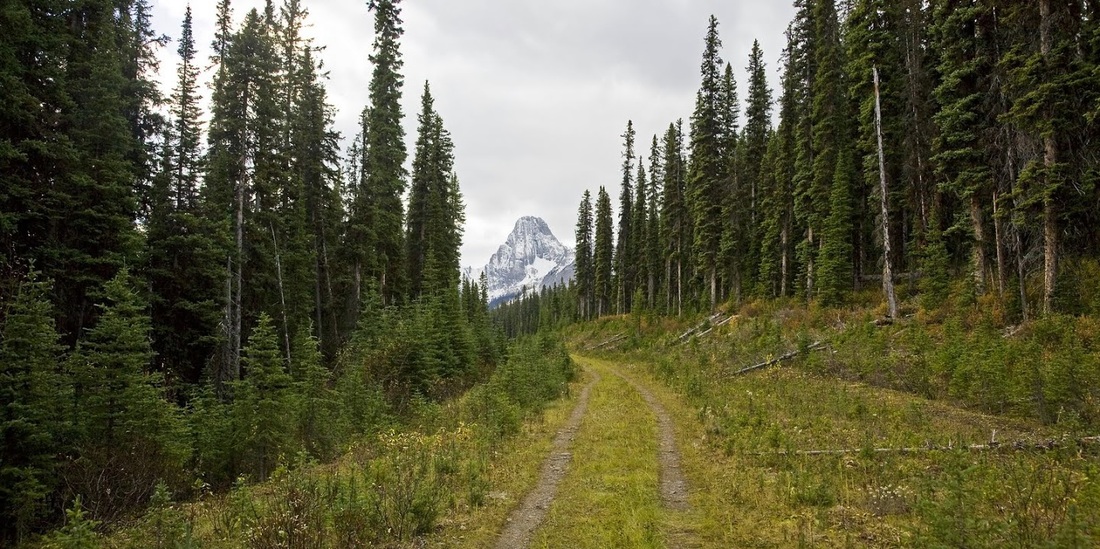
It is easy going along the cutline and Commonwealth Peak is soon in view though some distance away, to ascend my target for the day 'The Pigs Back' I will have to climb to the col between Commonwealth Peak and The Pigs Back.
getting toward the 2 km mark I see the small cairn that shows the junction with the Tryst Lake trail which Sarah and I hiked on my Birthday last year. That turned into a real scramble in places and it made me smile thinking about it as the first snow shower of the day blew through the cutting causing me to zip up the fleece.
A short while later I reach the junction where , contrary to the obvious choice of the right hand trail leading toward Commonwealth Peak, I need to take the left hand one leading away in order to get there....strange I know but take it from me that it is required.
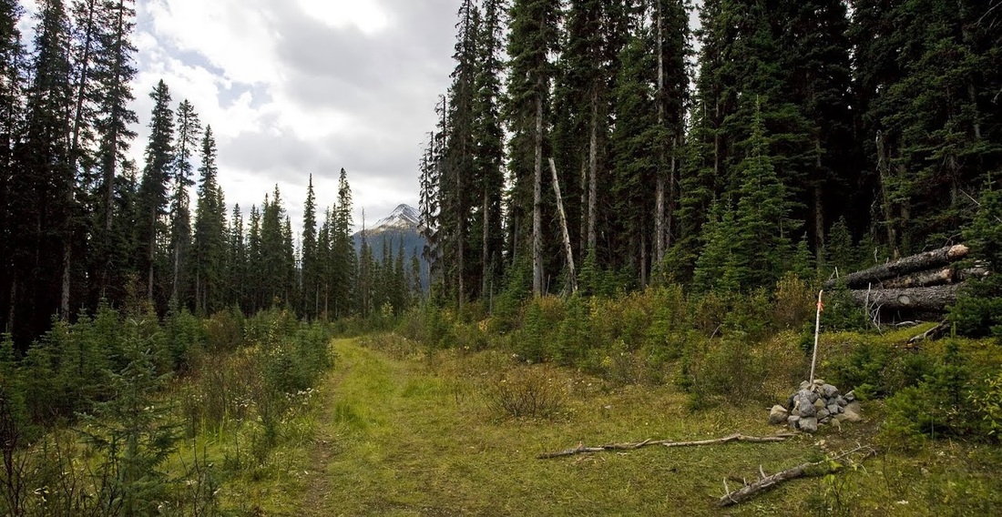
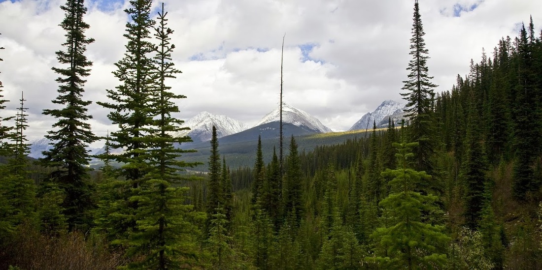
The trail drops down to Commonwealth Creek where a dodgy crossing is made and I escape still dry by some fluke, once over the creek the trail rises again and reaches an open cutblock area where some blue sky attempts to break out.
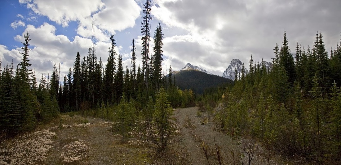
Turning right at the cutblock area I am now heading toward Commonwealth Lake and Peak, it's a steep climb through dense forest but there is a good trail the whole way to the lake.
On arrival at the lake I drop down to the waters edge to take a look at the spot where I crashed through the ice in February this year when I first set out to climb the pigs back. Needless to say, being chest deep in a mountain lake in February was enough to bring that day to a swift end.
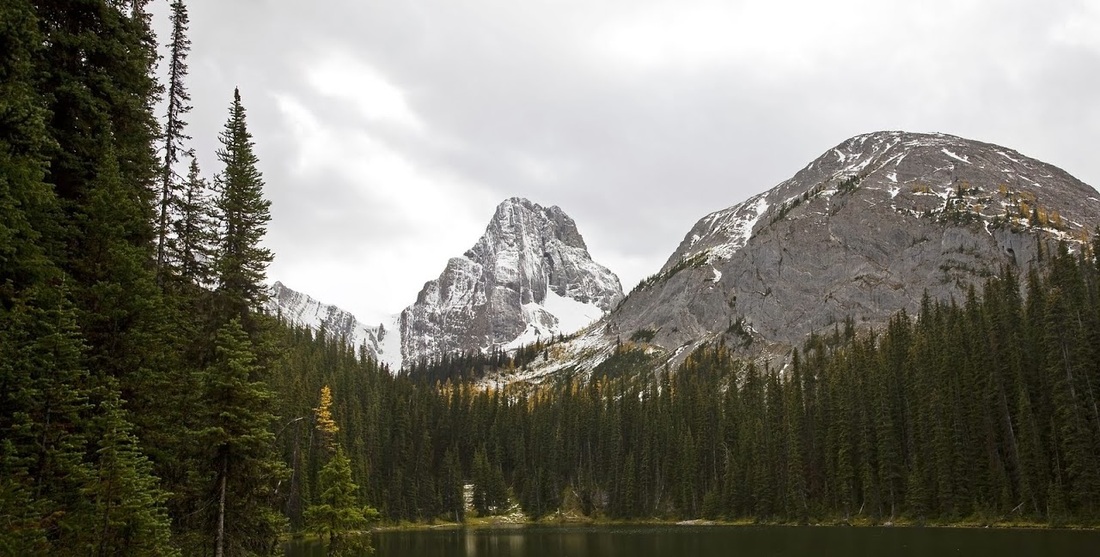
Across the lake I can now see my target sitting in front of Commonwealth Peak, from here it becomes obvious why I have to walk around the base to the far side before ascending.
Across the lake I can now see my target sitting in front of Commonwealth Peak, from here it becomes obvious why I have to walk around the base to the far side before ascending.
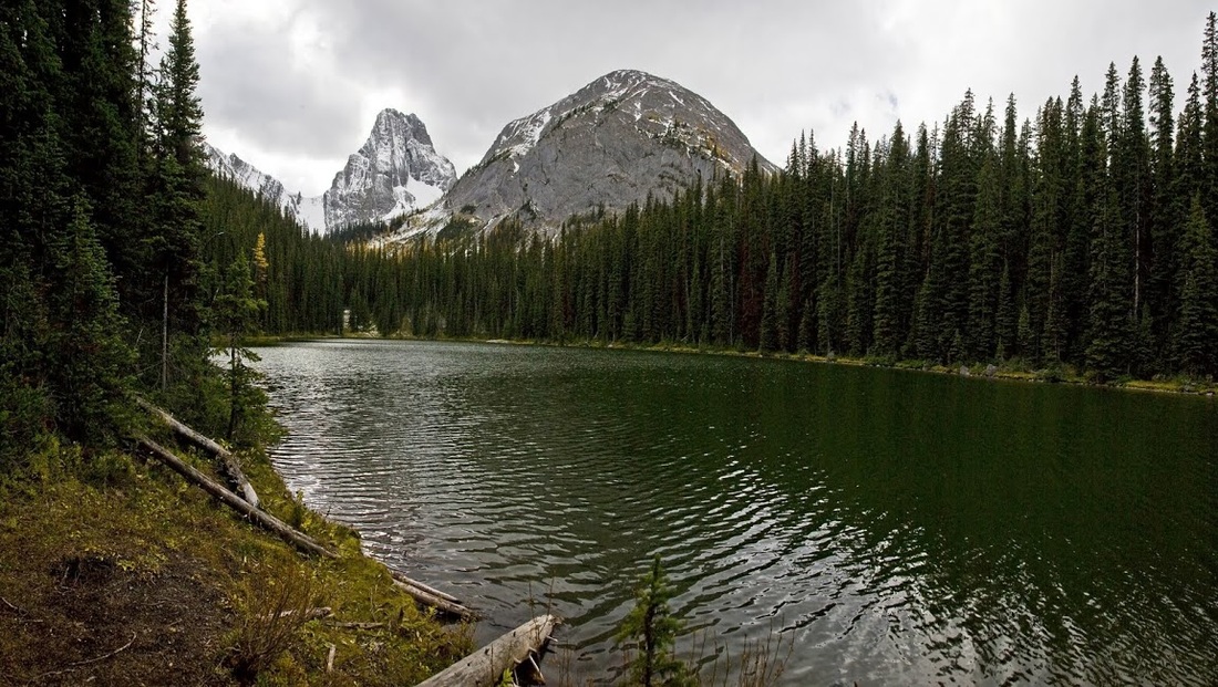
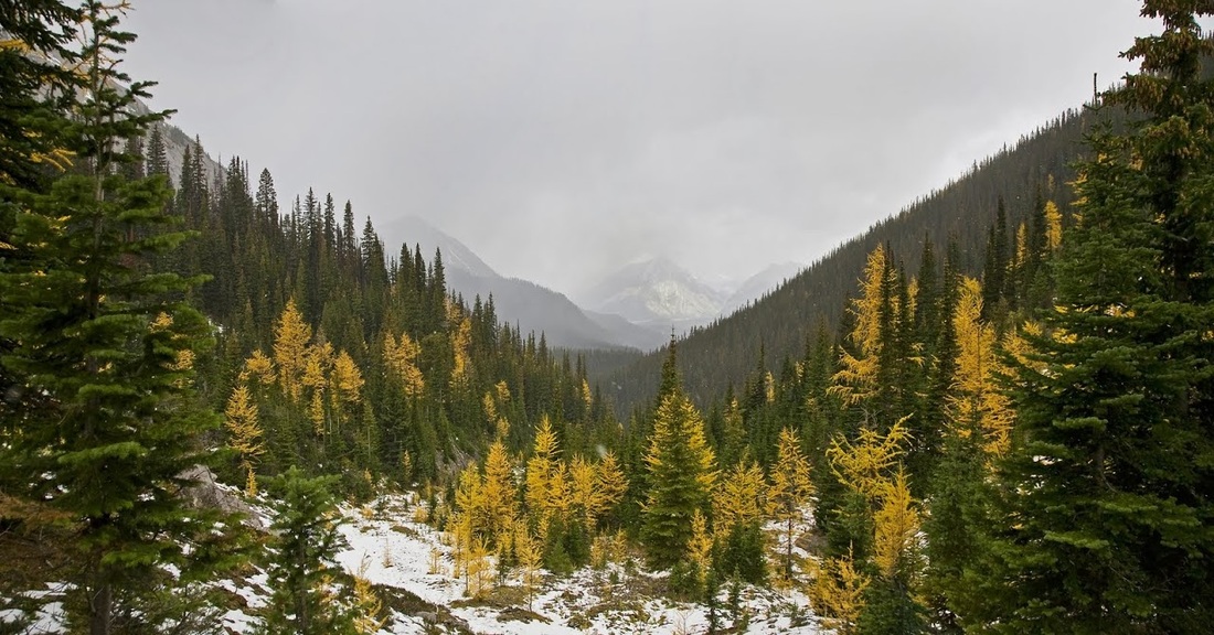
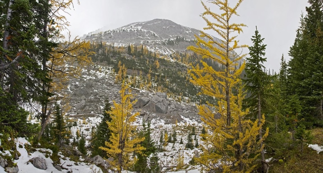
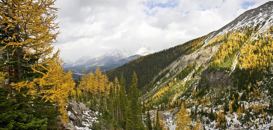
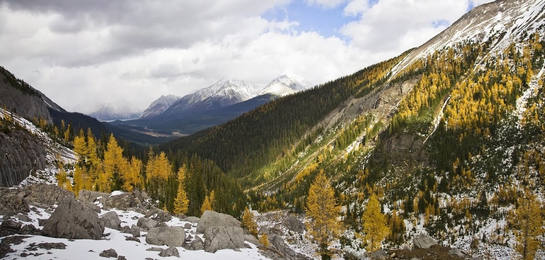
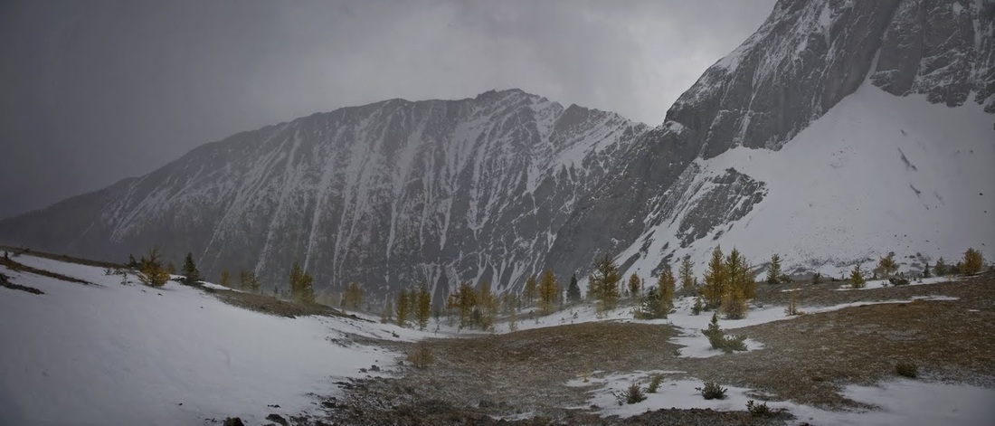
from close to the Southern end of the lake I see the beautiful golden hues of autumnal trees spreading up the flanks of The Pigs Back along the route I presume I need to take.
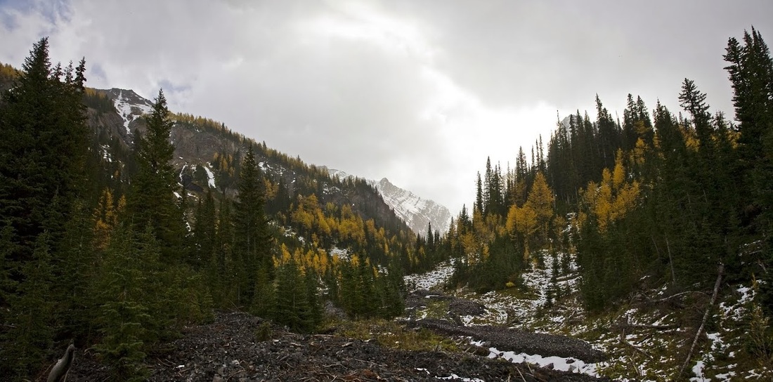
The trail only runs a very short distance from the end of the lake before disappearing, it doesn't present any hardship in terms of route finding as the mountain is directly ahead but the underfoot conditions are much more difficult here
I work my way into a nice gully that acts as a water run off in the springtime, the footing is better here and the ascent is straightforward.
The snow continues to blow through in waves leaving spots all over my photos initially making me think my sensor needed cleaning. The trees look beautiful and how I wish I had some blue sky to compliment these wonderful colours.
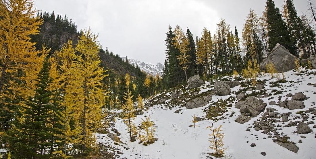
Turning to look back toward the lake shows the snow further along the valley, it is getting much steeper now and I'm beginning to wonder if it will be worth the effort today.
The Pigs Back peeking through the trees, it was here I noted that I need to descend into a valley and then reascend to start my climb up the pigs back....I hate that!!
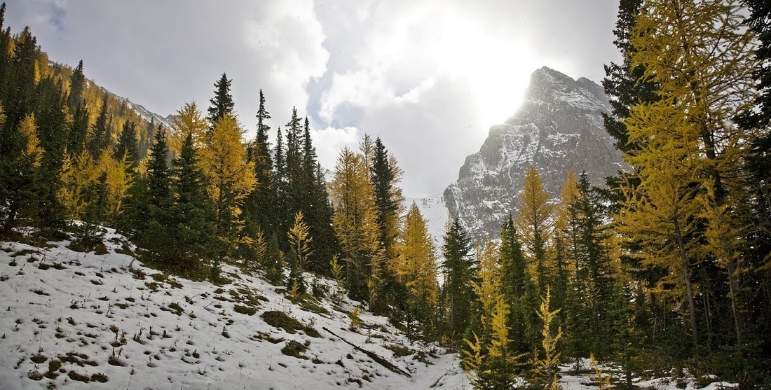
Ahead the sun almost made it around Commonwealth Peak and a hint of blue sky gave me just a little more hope that I might yet find some good shots here today.
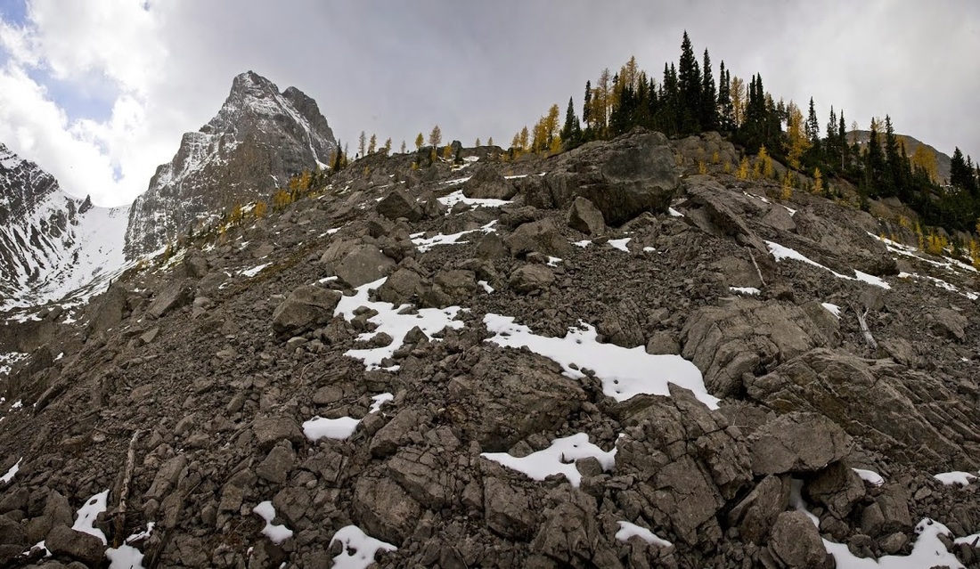
As I begin my ascent I quickly realise I've started too early, the loose steep rock is a real pain and I now know I should have gone much closer to Commonwealth Peak before turning right to ascend from the southernmost end of the pigs back.....too late now though so I press on up the boulder field.
A little burst of light across the valley illuminates the beautiful autumnal scene and provides a glimpse of the potential of this area photographically.....but not today :(
Turning back to the ascent I'm beginning to think it was a good thing coming this way, I think I may be cutting a piece off the already long hike
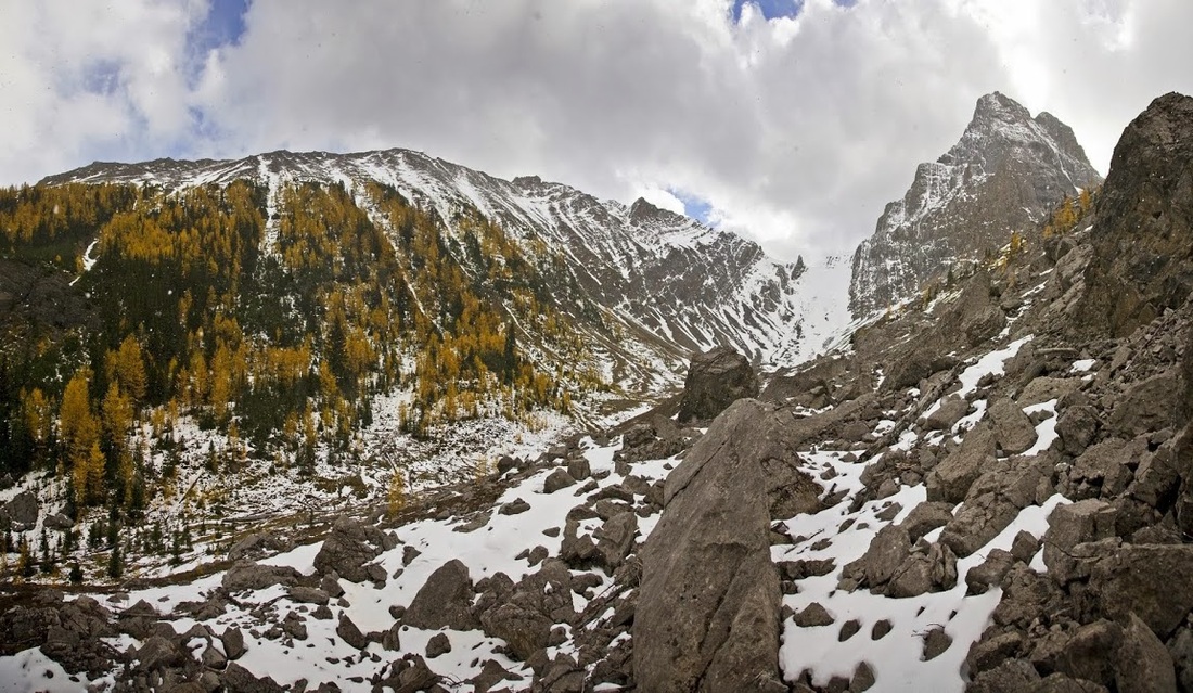
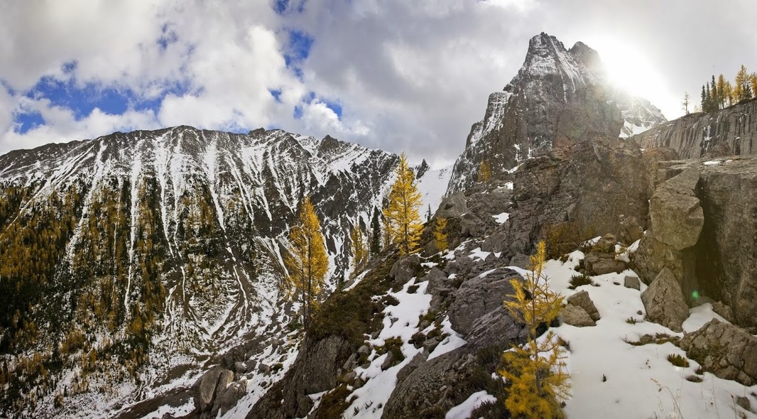
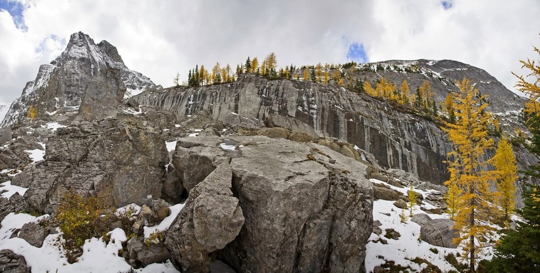
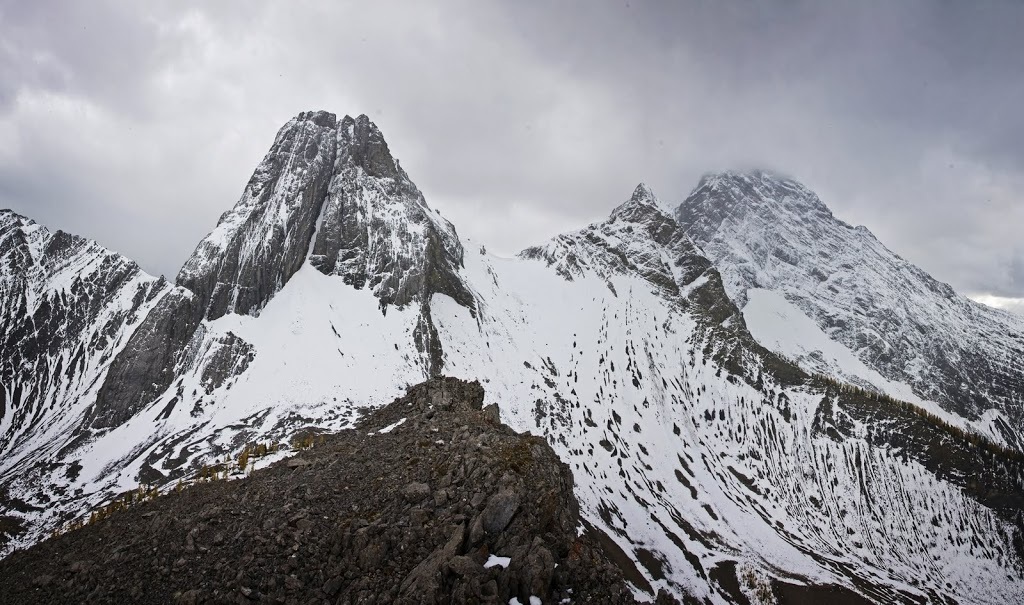
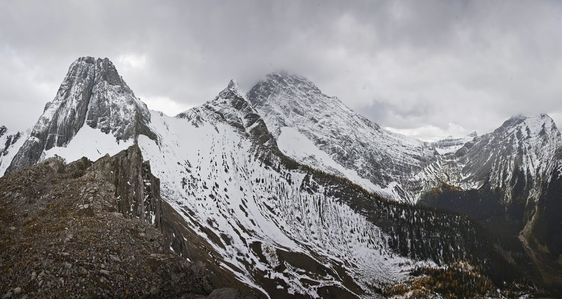
As I reach the first ridge and scramble over it, the sun once again appears behind Commonwealth Peak and illuminates the sheer wall of rock that prevents me heading directly up from here (the top of it can be seen on right of this shot)
The snow is a pain in the butt and is making it bloody cold up here too, even so the views are still wonderful but how good would they be with that blue sky, sickening.
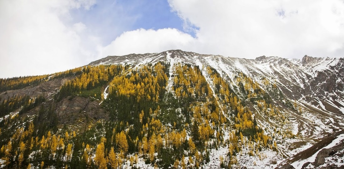
I begin making my way around the rock wall and thinking to myself that I've just worked really hard on a massively steep ascent for no reason at all, I could have followed the watershed right up to Commonwealth Peak and then made the ascent.
Almost around the wall now and the sunlight gives another glimpse of what I'll be missing today, with the naked eye there is more detail in the far distance here but the camera struggles to see through the snow showers
At long last I get above that damn wall and begin the final ascent, my lack of hill fitness is definitely showing now as I huff and puff up the final slopes
I was surprised to see such a sheer vertical drop off on the west side of the pigs back and gave myself a couple of feet of safe distance to allow for the gusting wind. Here I dropped my rucksack and utility belt and made the final push with a bottle of water in my pocket and my camera in my hand.
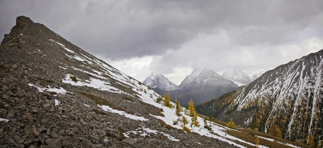
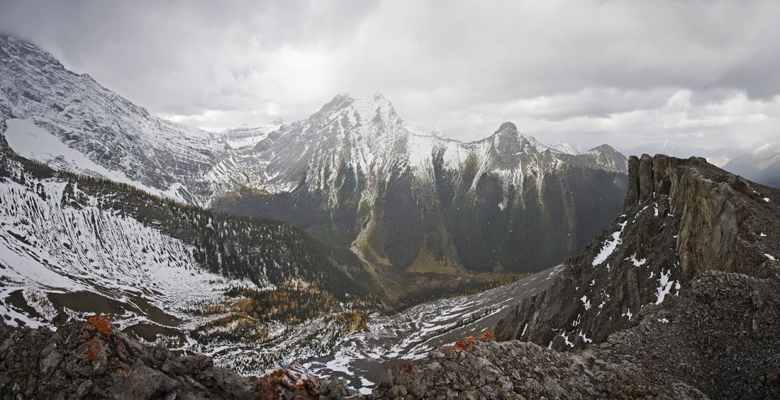
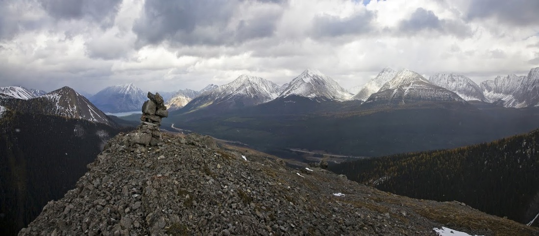
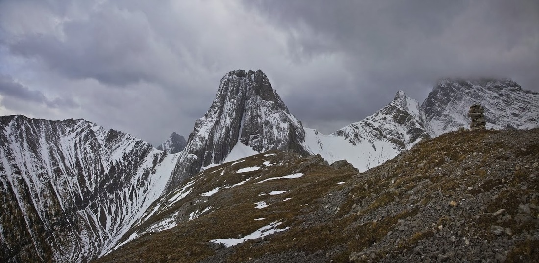
The first view as I come over the top of the pointed ridge is a skyline of summits in all directions....and all washed out by snowstorms, I'm beginning to think I may have to make this hike again.
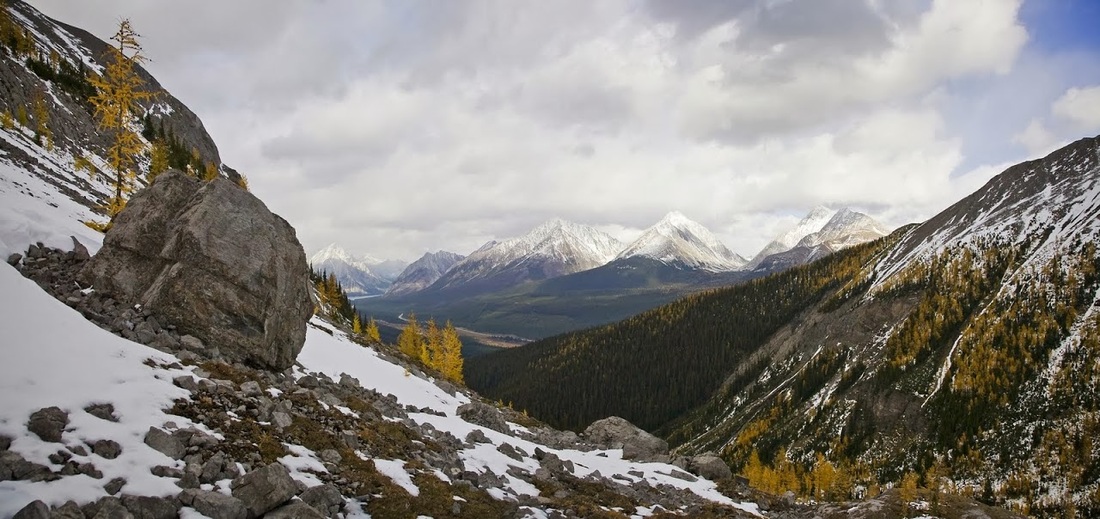
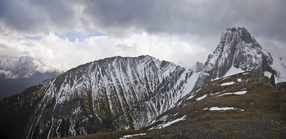
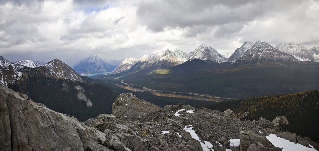
looking back along the ridge to the south shows Commonwealth Peak not quite so dominating now, just behind here is the wonder that is Burstall Pass, that I hiked last year, it is actually possible to make a loop here around these peaks and onto the pass but it would be a long day.
looking west from the edge of the ridge I try to work out the potential descent route to commonwealth creek but it looks very wet and boggy down there and with light fading fast I decide to stick to the trail I know on the way out.
looking southwest I can see Smuts Pass that goes through to Birdwood Lakes, and for the fitter hikers offers the potential to go around Mt Birdwood and onto Burstall Pass
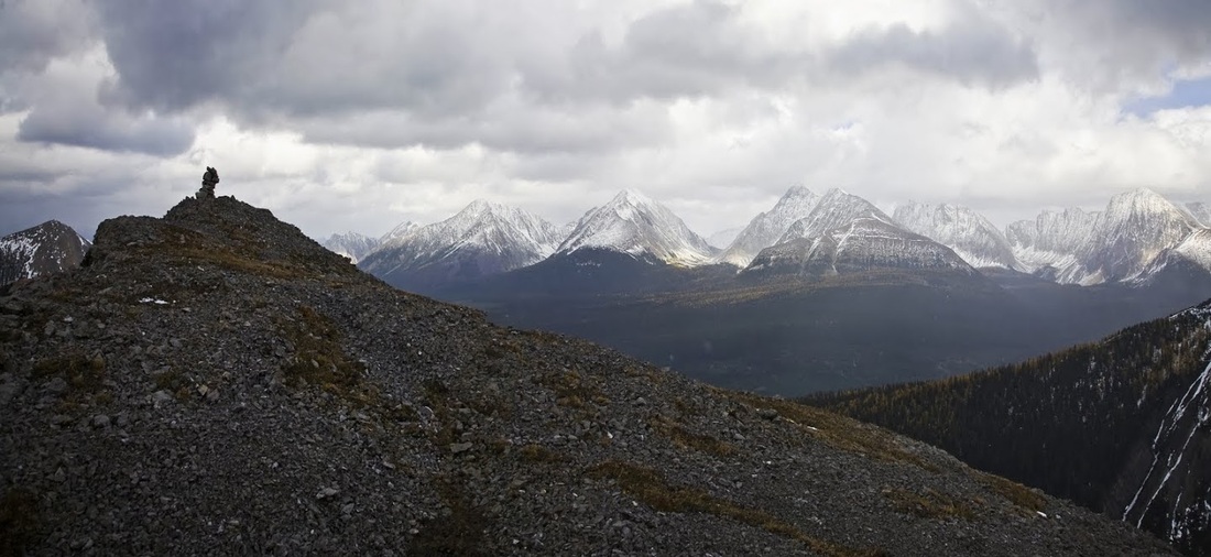
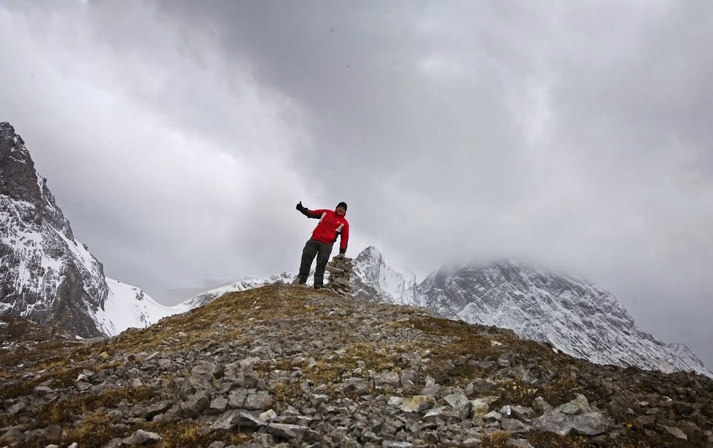
As I look along the ridge I see another cairn and though the snow persists I decide to make the additional hike along the top as far as that cairn for my 'evidence shot'
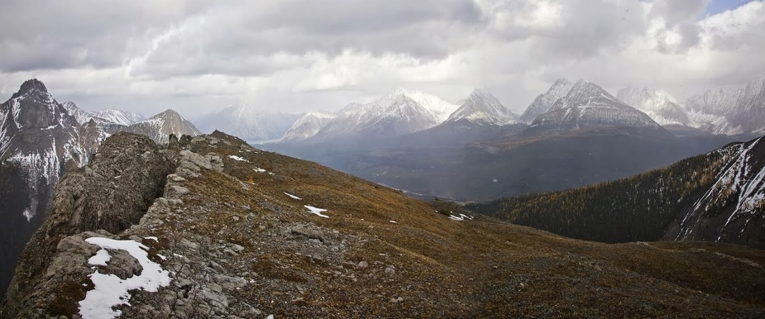
It's pretty much a level wander along the top and its nice to be free of my bags and just strolling on flat ground over to the final spot of the day, the gps reads just a little over 8.5 km
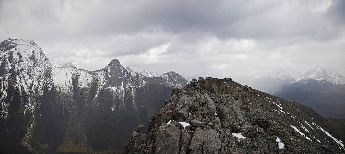
The lump opposite is named 'The Fist' and from one point on the road below it really does resemble one, from here it really does not. Behind the fist is Tent Ridge which remains one of my favourite hikes here, just for the spectacular views
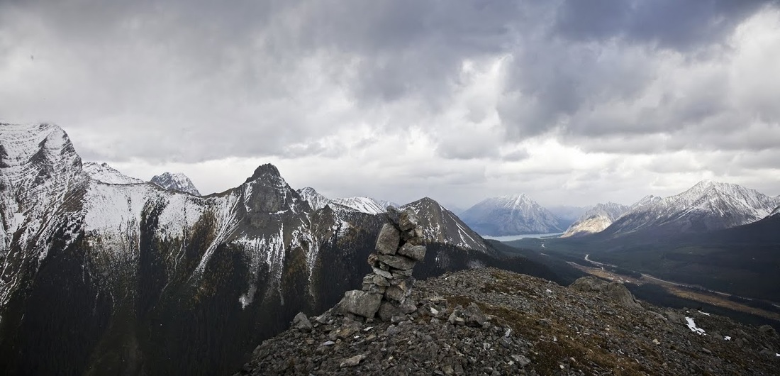
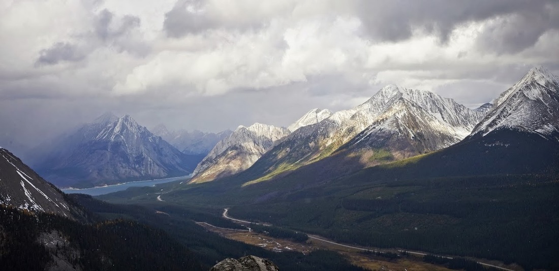
A look back form the final cairn as a little blue sky helps brighten the shot, I believe this ridge could rival tent ridge for views on a better day.
The snow really starts to hammer down as I wait around hoping for a clearing in the cloud, temperatures have plummeted and I'm glad I brought along the coat,hat and gloves today
I'm not sure why I was so wonky in this shot, I think I was using the cairn to stabilise myself against the wind gusts and it was a bit low for the purpose.
beyond the cairn the ridge falls away to a little point, I deliberate about going down to it and decide that as I'm here I have to, I would have done it if the skies were clear and its only another few hundred metres
From the point the view is actually pretty good, even with the cloud, the light across the valley is beautiful and Spray Lakes Reservoir is still visible as is Mt Nestor on the opposite bank
After this I decide to call it a day and get going as I only have two hours now before sunset (I started late today and days are shorter now which I forgot) Heading back past the furthest cairn as a real blizzard blows through.
As I drop down to my bags the wind is whipping snow in all directions and sleet is pounding my head, it stays that way for most of my descent until I hit the valley and get tucked into the trees. As I make my way past the lake and through the forest it is getting very dark and the howling of the local critters keeps the hairs standing on the back of my neck.
To cap off the day as I attempt to cross Commonwealth Creek I slip on a wet rock and fall forward, luckily I plant a walking pole firm enough to prevent a full bath but I'm in the creek to my knees. I make the final 3.5 km soggily slopping along with one broken walking pole, it is now dark and there is a single wolf howling frequently nearby.....I feel like Liam Neeson in that movie 'The Grey'
Ultimately I make it back to the truck unmolested, though I confess to having two bear bangers in hand the whole way. All in all this was still a great hike but I might have to do it all again just to get those views in better conditions.