Utah Road Trip - 4791 Kilometres
After our July road trip to San Francisco Sarah was itching to do another one but we were unable to exit the country as we were awaiting our residency documents from Immigration Canada (a strange situation where they take away your visa but don't issue the residency card for three months) this left us unable to leave the country until now.
So, on receipt of our new status planning began for a trip to the beautiful desert parks of southern Utah and before I knew it I was heading south again. Sarah decided to fly to Salt Lake City and meet up there so she didn't 'lose' 4 holiday days just travelling there and back.
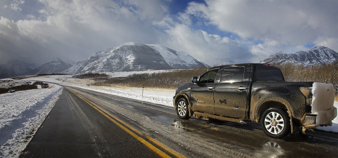
Conditions were perfect as I made the first leg of the journey through the prairies of southern Alberta and I was soon looking at Chief mountain shrouded in snow clouds. Chief Mountain sits just across the border in the Glacier National Park and is a sign that the border isn't far away. After crossing the border the journey continued to Great Falls Montana where I stopped for my 1st overnight stay.
So, on receipt of our new status planning began for a trip to the beautiful desert parks of southern Utah and before I knew it I was heading south again. Sarah decided to fly to Salt Lake City and meet up there so she didn't 'lose' 4 holiday days just travelling there and back.
Conditions were perfect as I made the first leg of the journey through the prairies of southern Alberta and I was soon looking at Chief mountain shrouded in snow clouds. Chief Mountain sits just across the border in the Glacier National Park and is a sign that the border isn't far away. After crossing the border the journey continued to Great Falls Montana where I stopped for my 1st overnight stay.
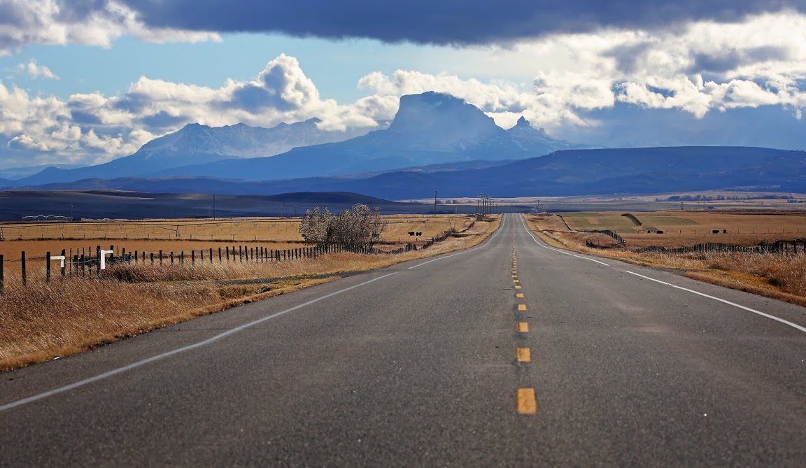
Day 2 was another long day on the road with no stopping other than to refuel both myself and the truck. The snow stayed alongside me once again all the way down to Salt Lake City but, as the shot of I-15 south below shows, the snow stayed on the mountains and the roads remained clear except for a few flurries along the way. On arrival in Salt Lake City a winter weather advisory was issued so I had a nice steak dinner and an early night ready to collect Sarah at the airport in the morning.
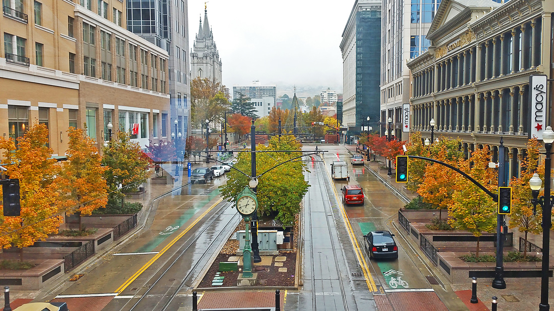
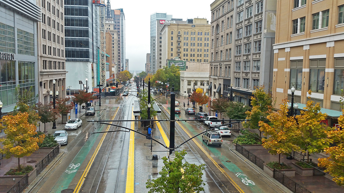
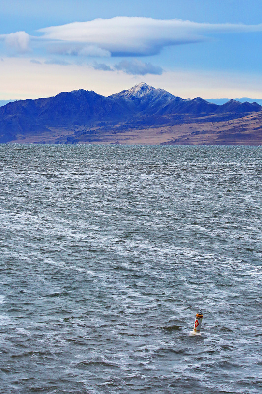
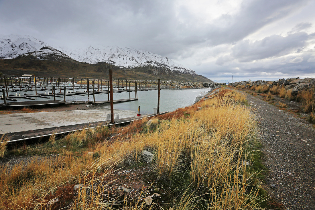
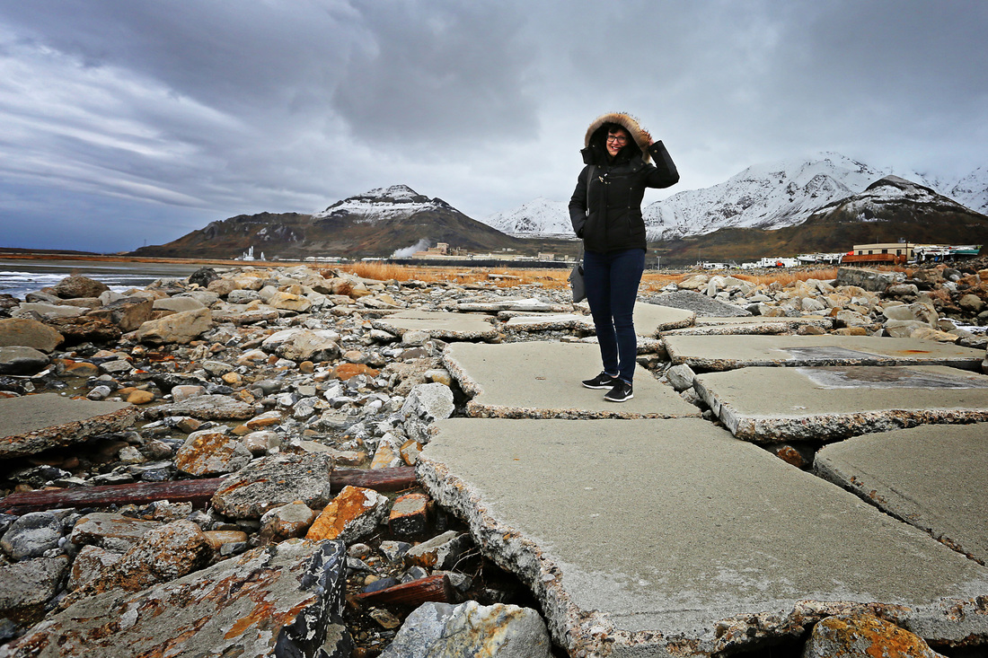
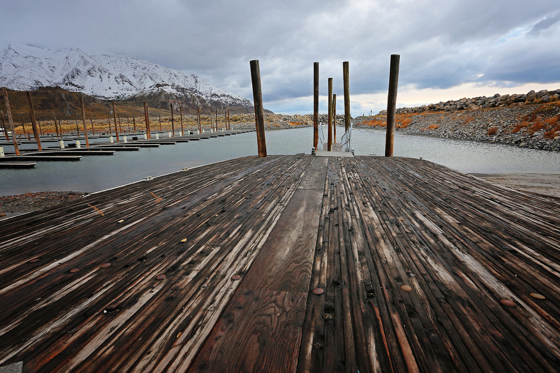
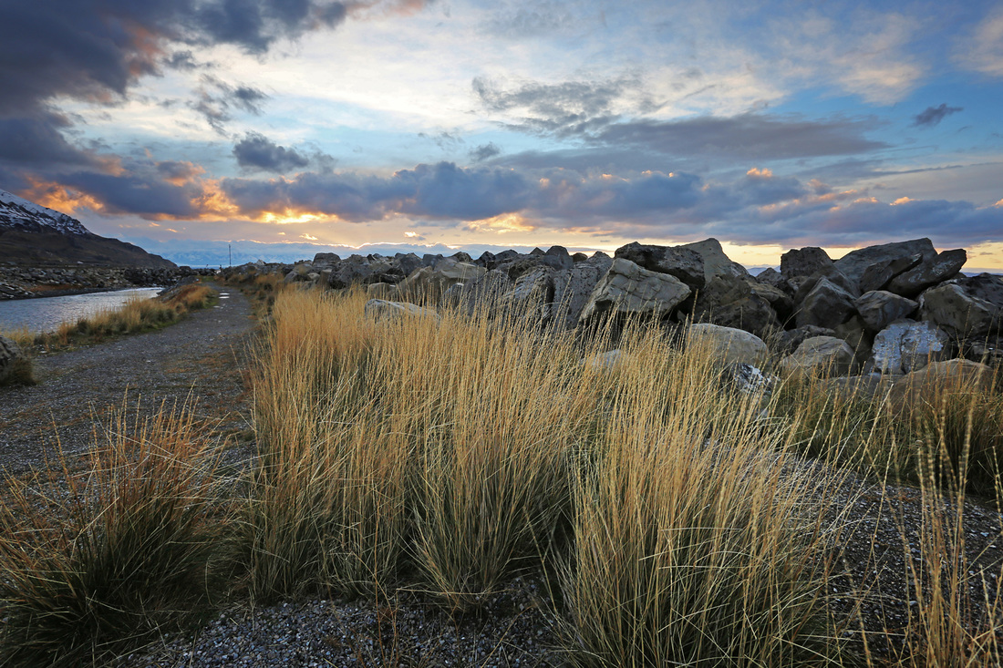
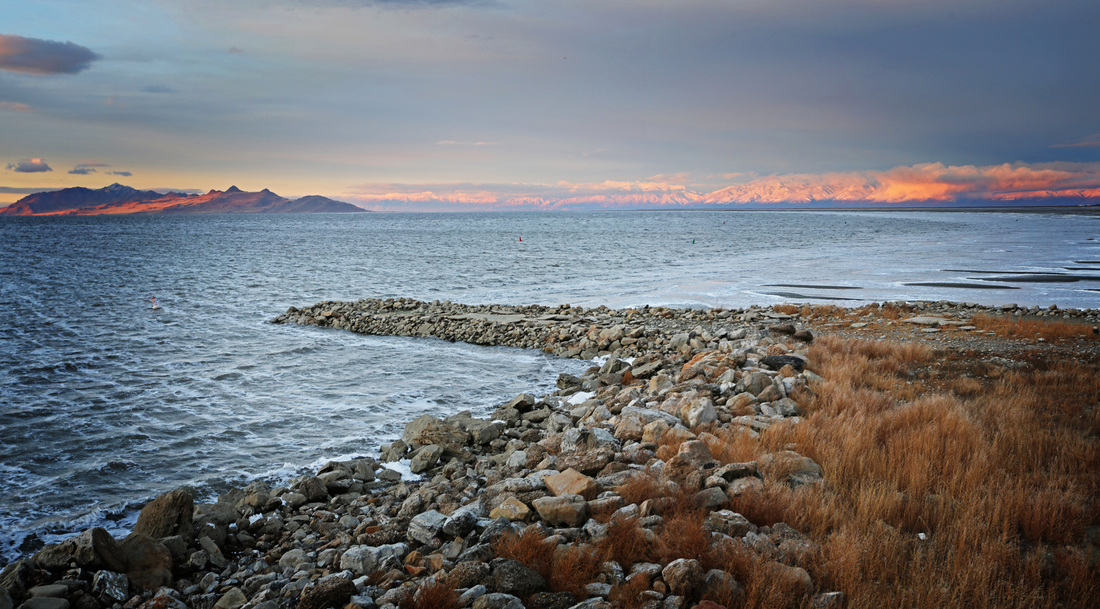
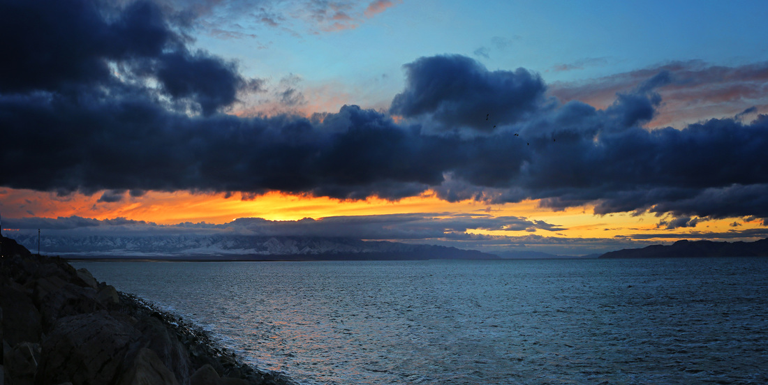
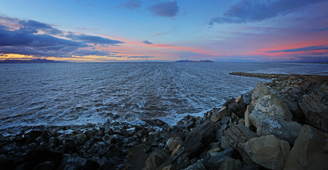
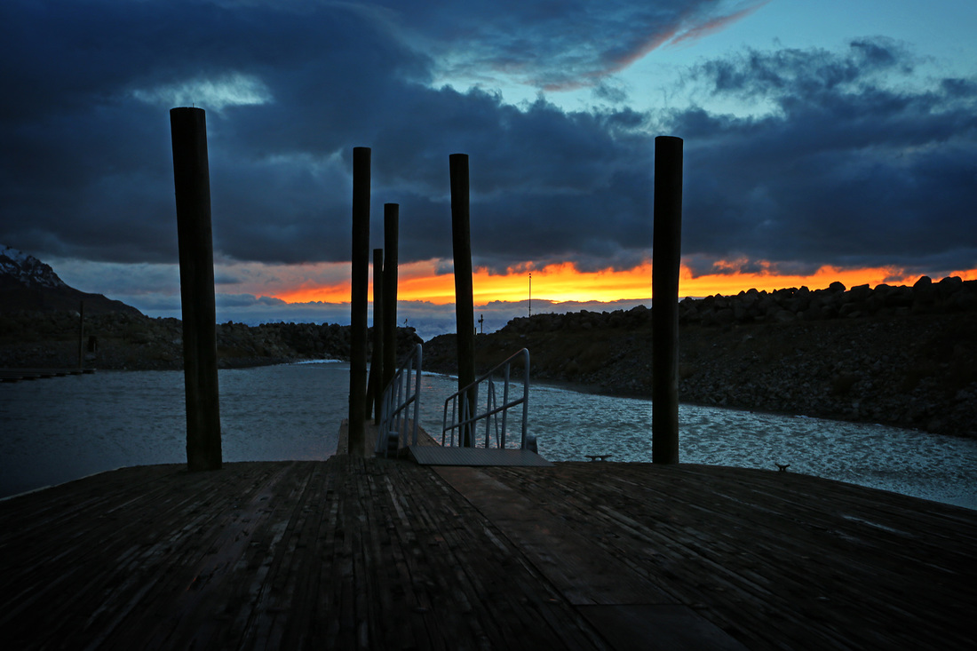
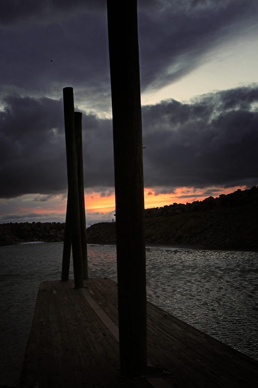
After collecting Sarah at the airport at 08:30 on the morning of day 3 the winter weather was really kicking in with very cold temperatures and snow ruining any chance of our planned visit to Antelope Island, instead we went into the city and indulged in some retail therapy, the weather promised to improve for the next day so it was no big deal. We returned to the hotel around 3pm and had a coffee in our room until the sky seemed to clear a little, we didn't need any more of an invite to get outdoors so we jumped in the truck and made the short journey west to the Great Salt Lake Marina which sits on the north side of I-80 about 12 miles west of the city. Though it was cold and blustery we really enjoyed getting out and were rewarded for our efforts with a glimpse of sunset. The main shot below shows the storm clouds over Salt Lake City and the small white speck in the top right is a plane leaving the airport there. The gallery shows more shots from the day with captions.


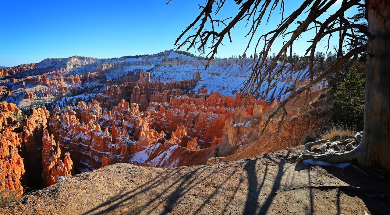
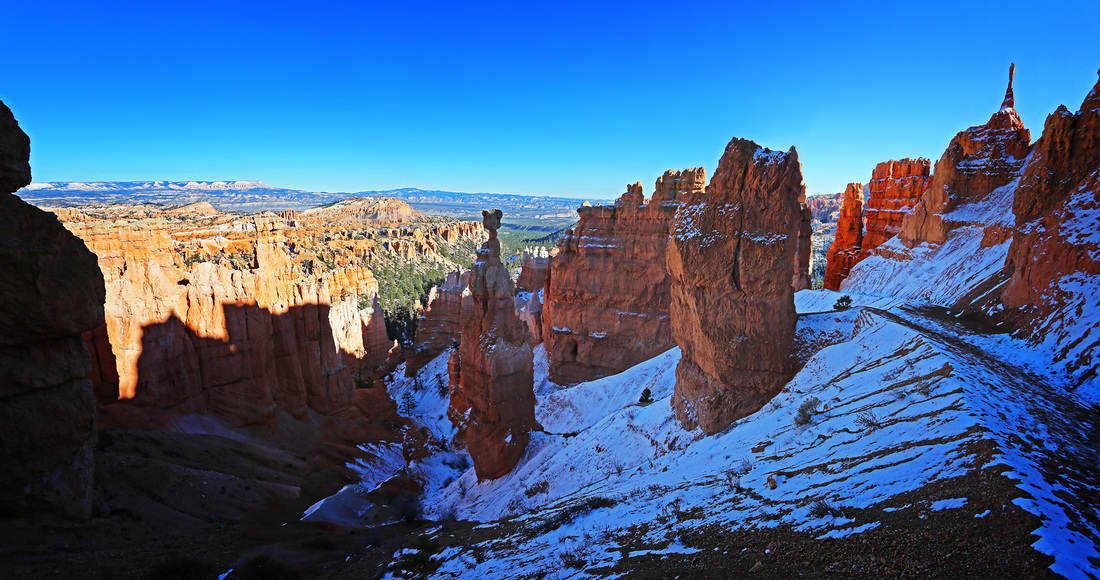
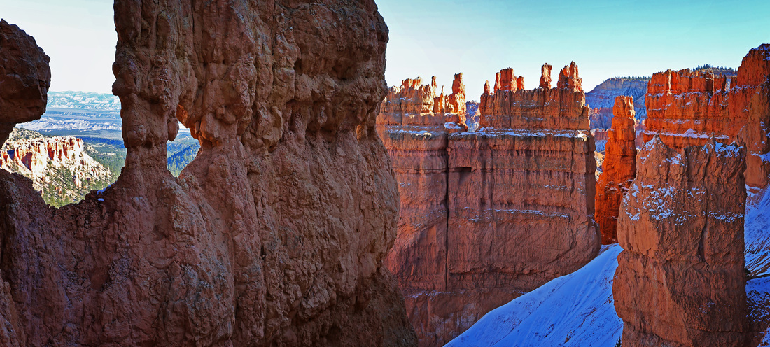
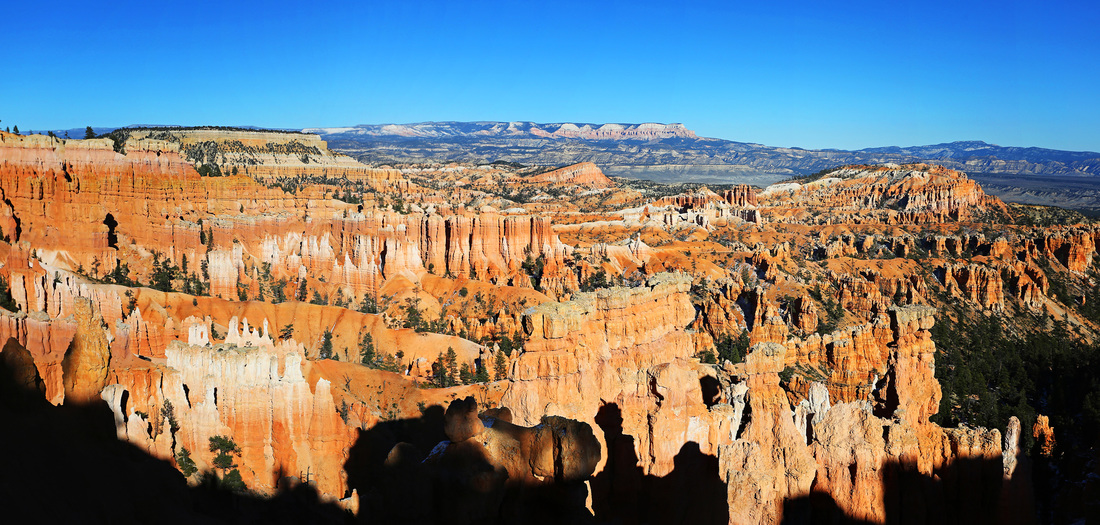
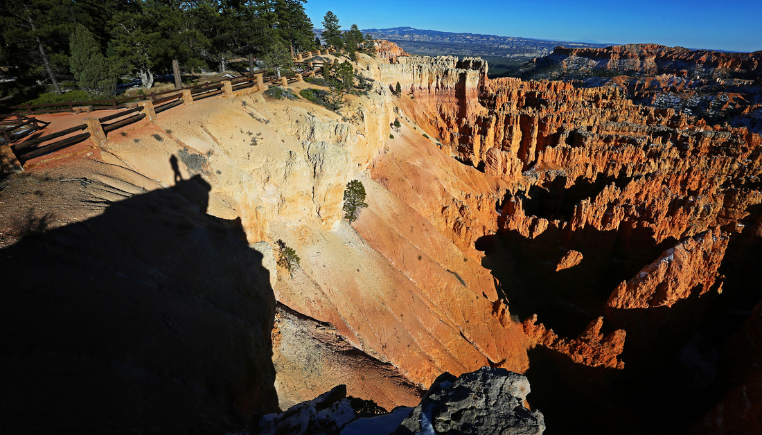
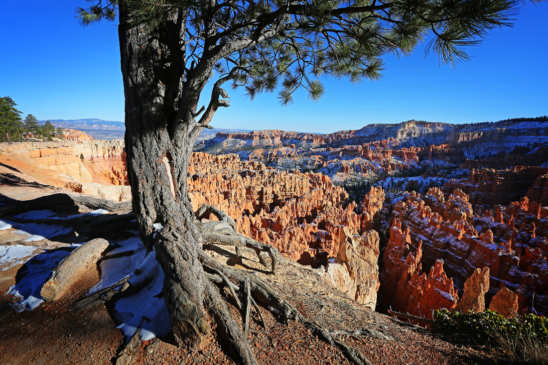
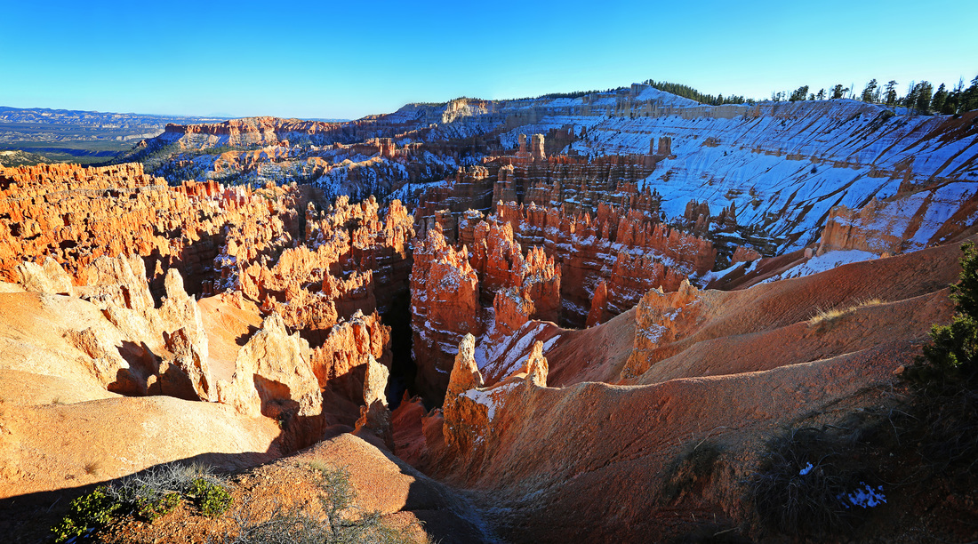
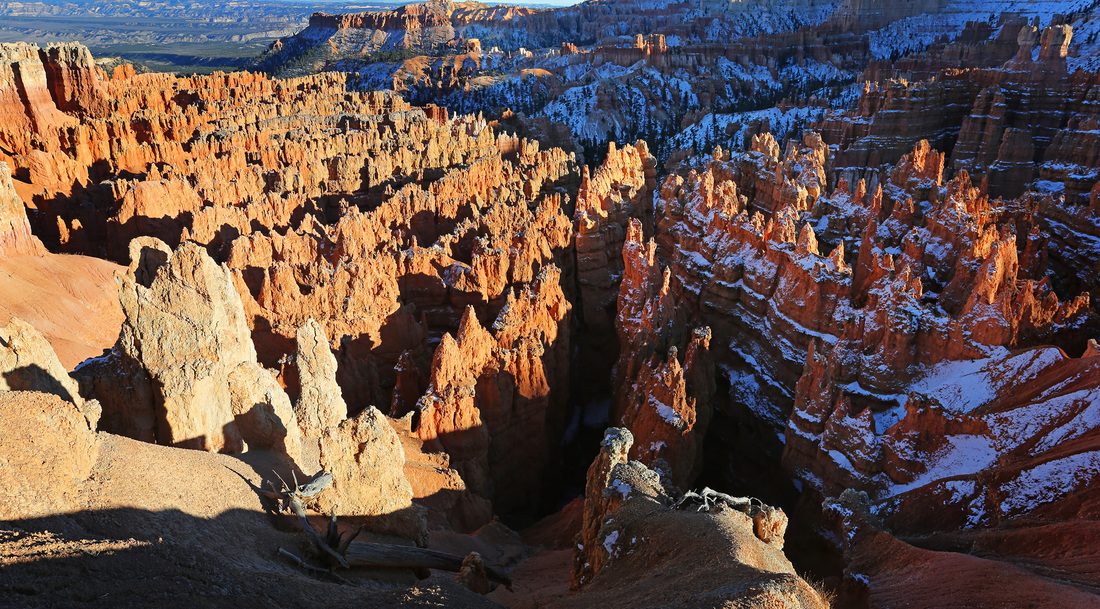
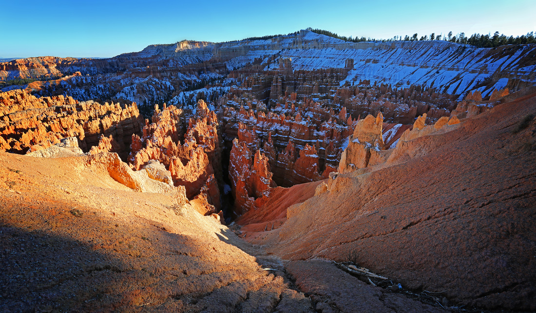
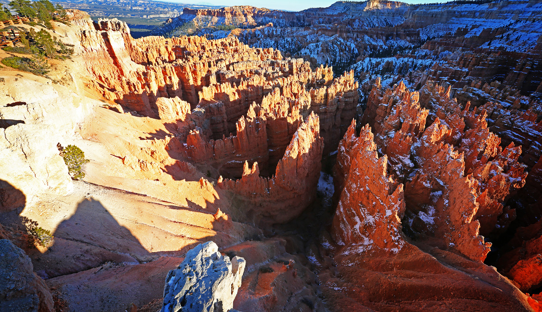
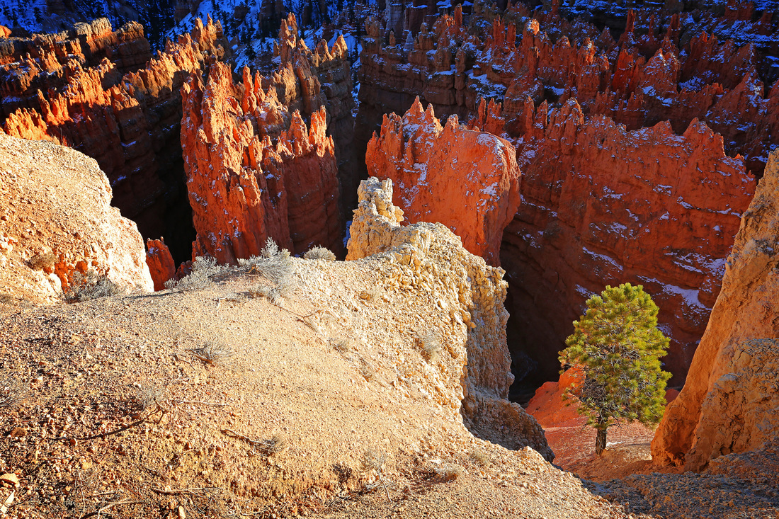
Day 4 saw us up and about early in anticipation of our goal for the day, Bryce Canyon. I find it incredible that Bryce receives less than half the number of tourists of its near neighbour Zion National Park, the only explanation I can think of is that Bryce is much more remote, for me it is worth every one of the 60 miles off the interstate to see this spectacular amphitheatre. Perhaps the truth is that Utah just has so many parks that the more remote ones just don't fit peoples schedules, maybe this is even more of a reason to go there, but don't expect to have the place to yourself, Bryce still receives 1.5 million visitors per year.
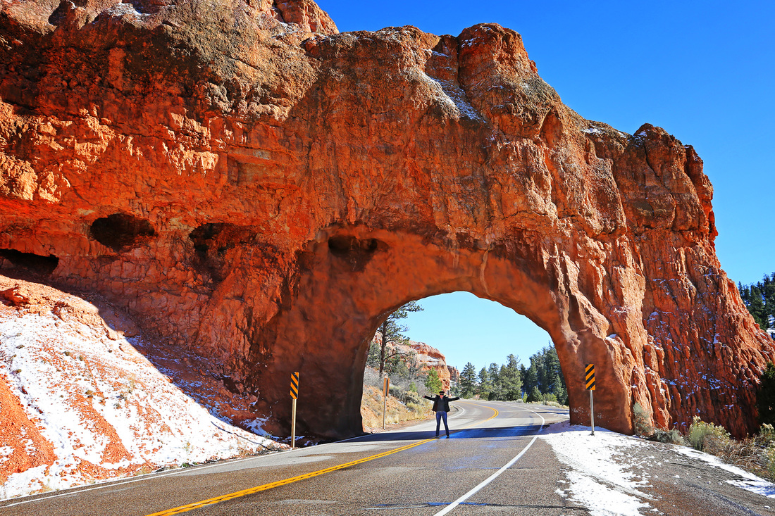
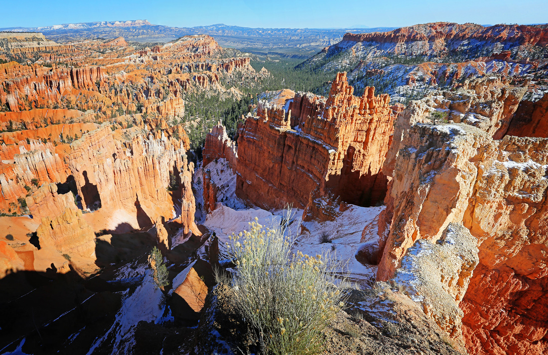
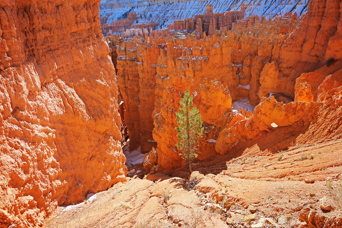
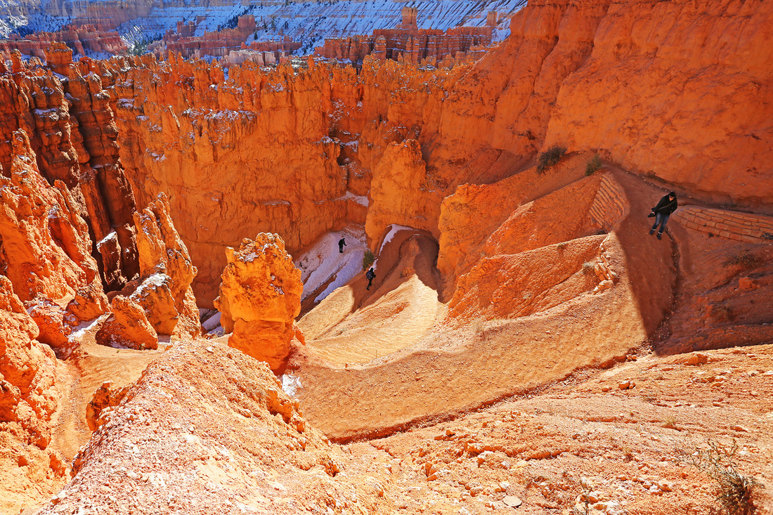
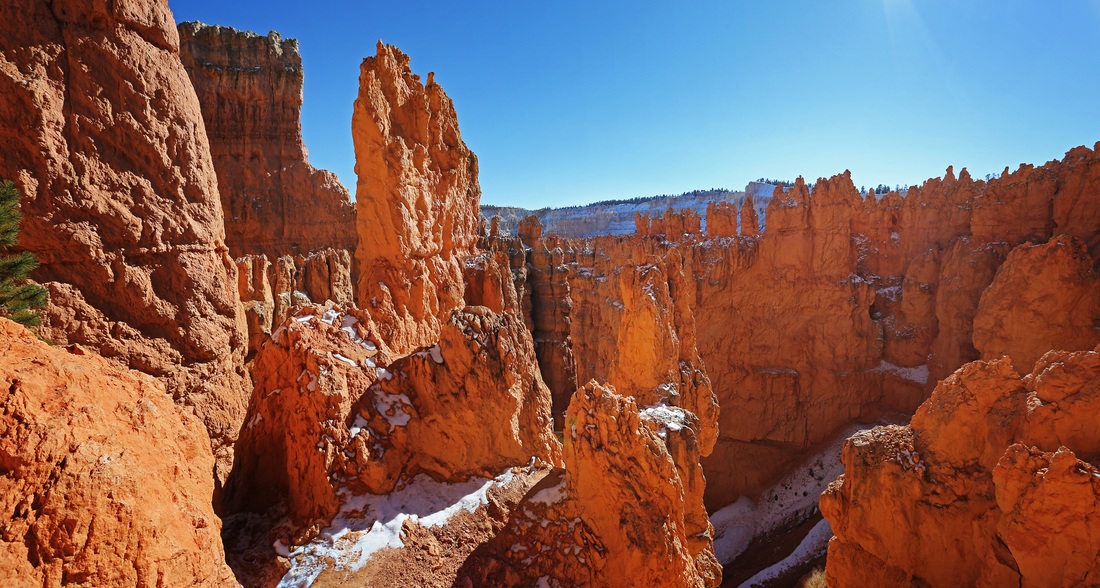
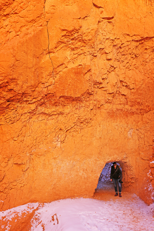
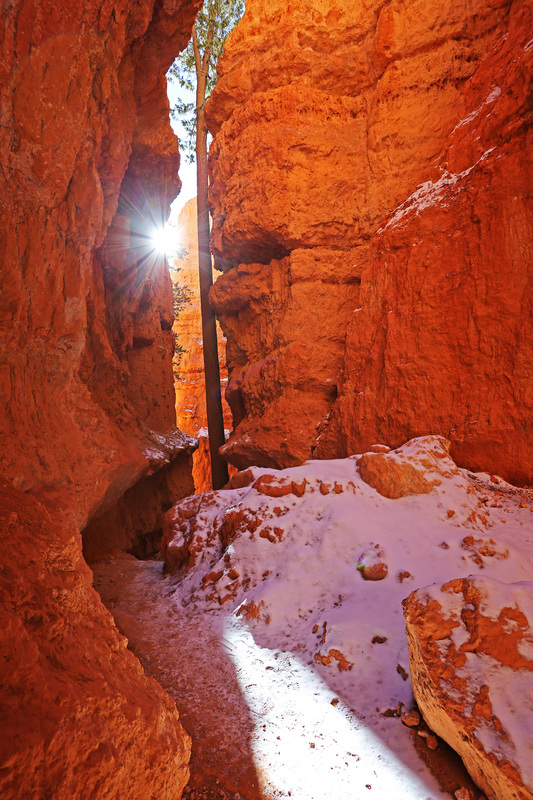
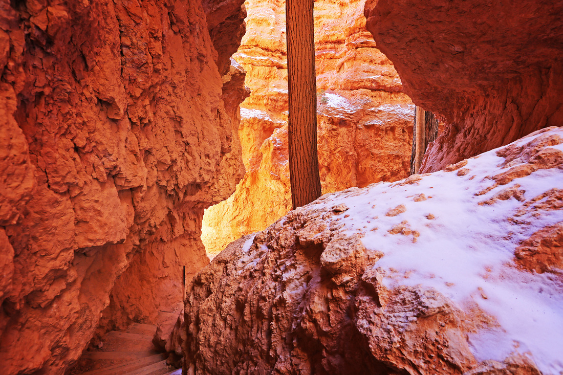
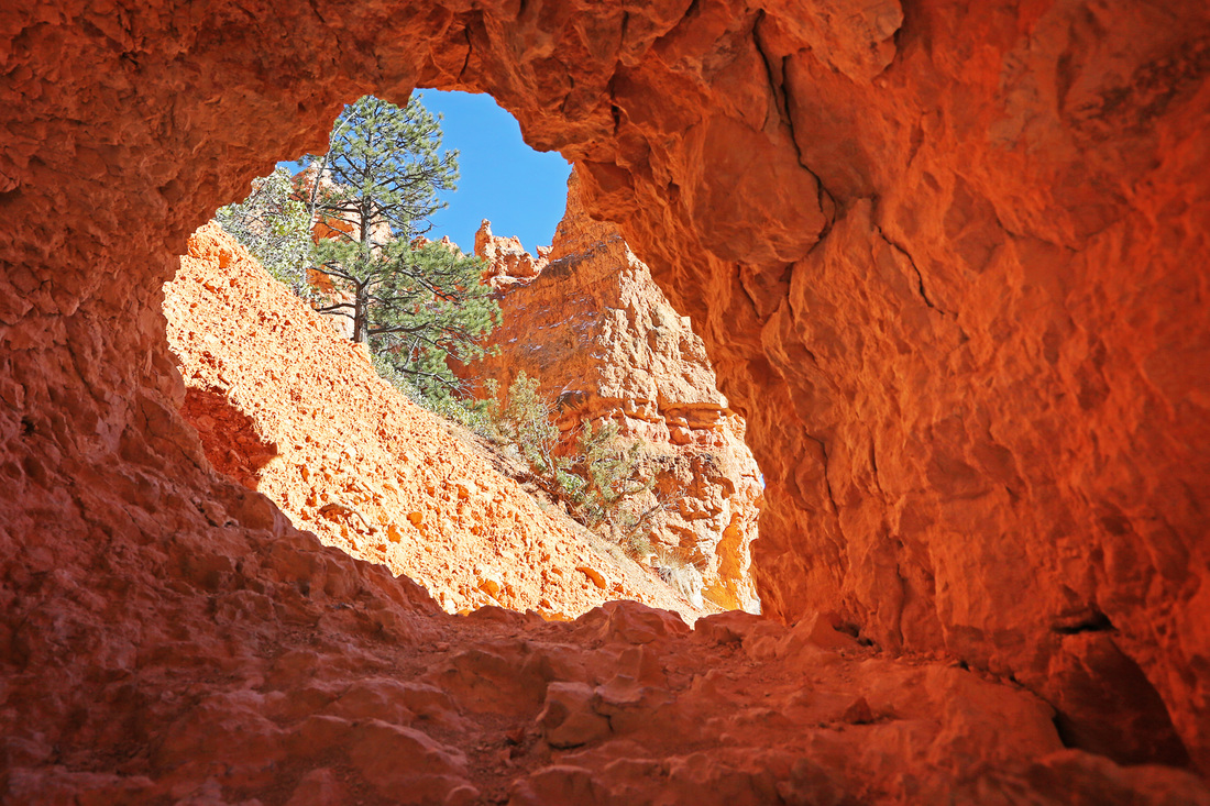
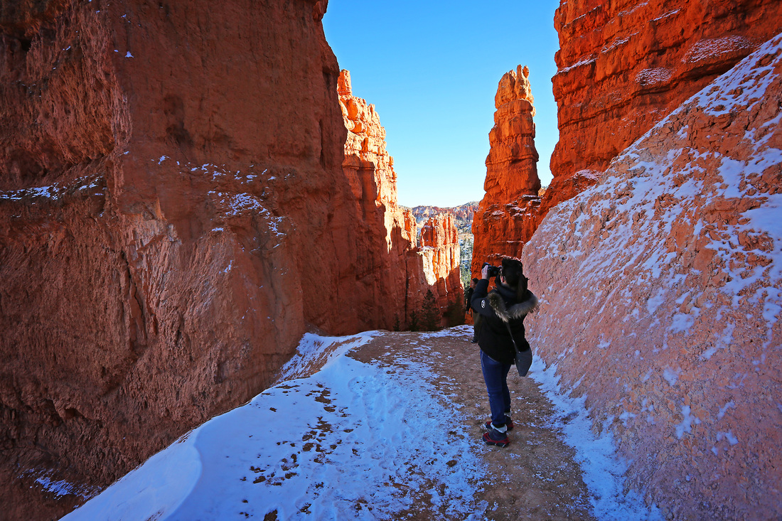
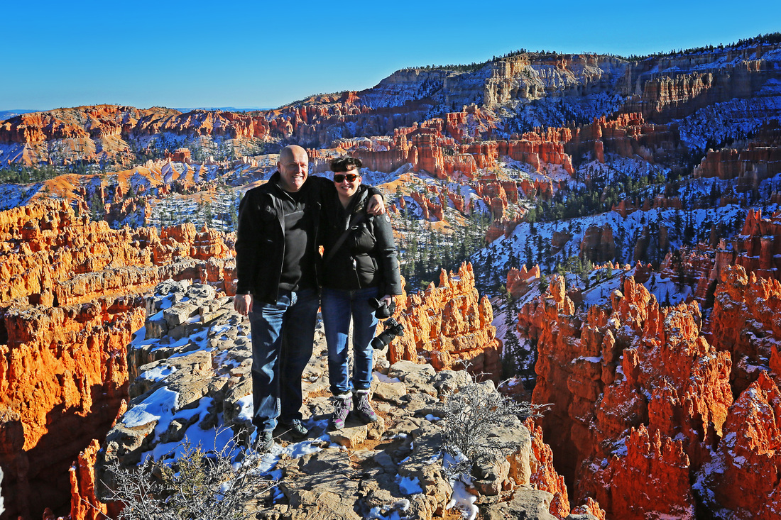
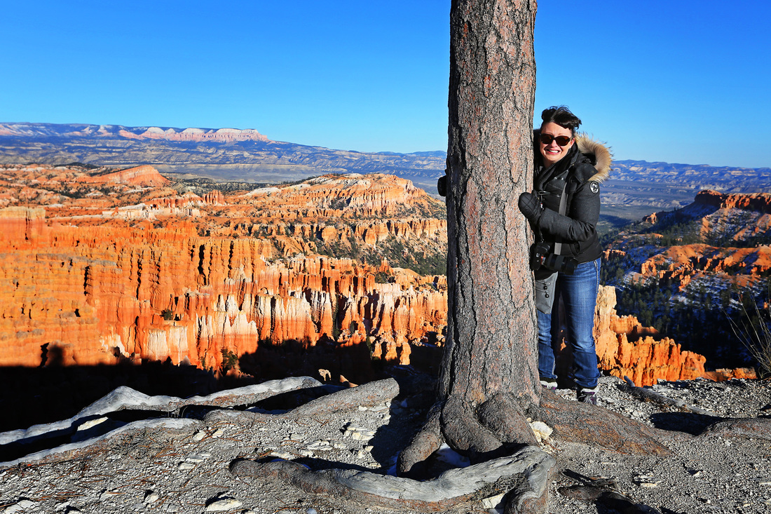
Between the interstate and Bryce canyon is the small town of Panguitch where we stopped for a sandwich before following highway 12 through Red Canyon where we stopped again, several times to wander around the hoodoos there. Once at Bryce (where we gained free entry due to it being memorial day) we hiked the canyon rim, inspiration point and sunset point as well as the Navajo trail through the bottom of the canyon weaving our way through the hoodoos. Finally we sat on a bench at the rim and watched the sunset over the canyon before making the short journey onward to the town of Kanab on the Utah/Arizona border where we stopped for the night.
Between the interstate and Bryce canyon is the small town of Panguitch where we stopped for a sandwich before following highway 12 through Red Canyon where we stopped again, several times to wander around the hoodoos there. Once at Bryce (where we gained free entry due to it being memorial day) we hiked the canyon rim, inspiration point and sunset point as well as the Navajo trail through the bottom of the canyon weaving our way through the hoodoos. Finally we sat on a bench at the rim and watched the sunset over the canyon before making the short journey onward to the town of Kanab on the Utah/Arizona border where we stopped for the night.


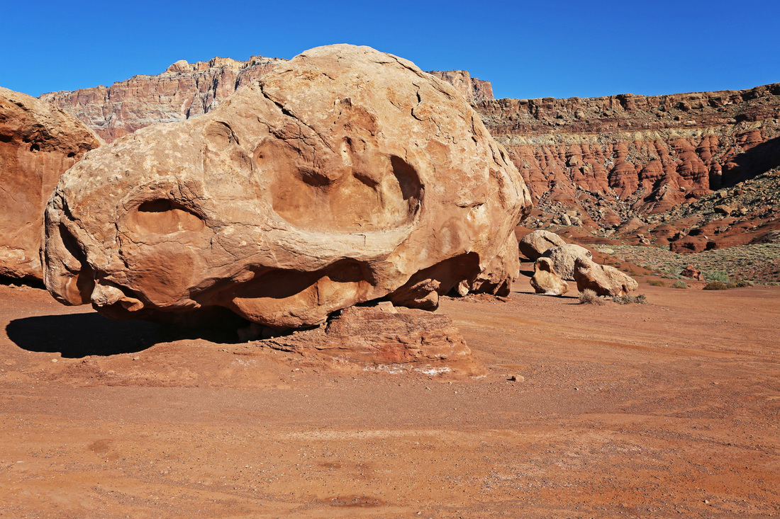
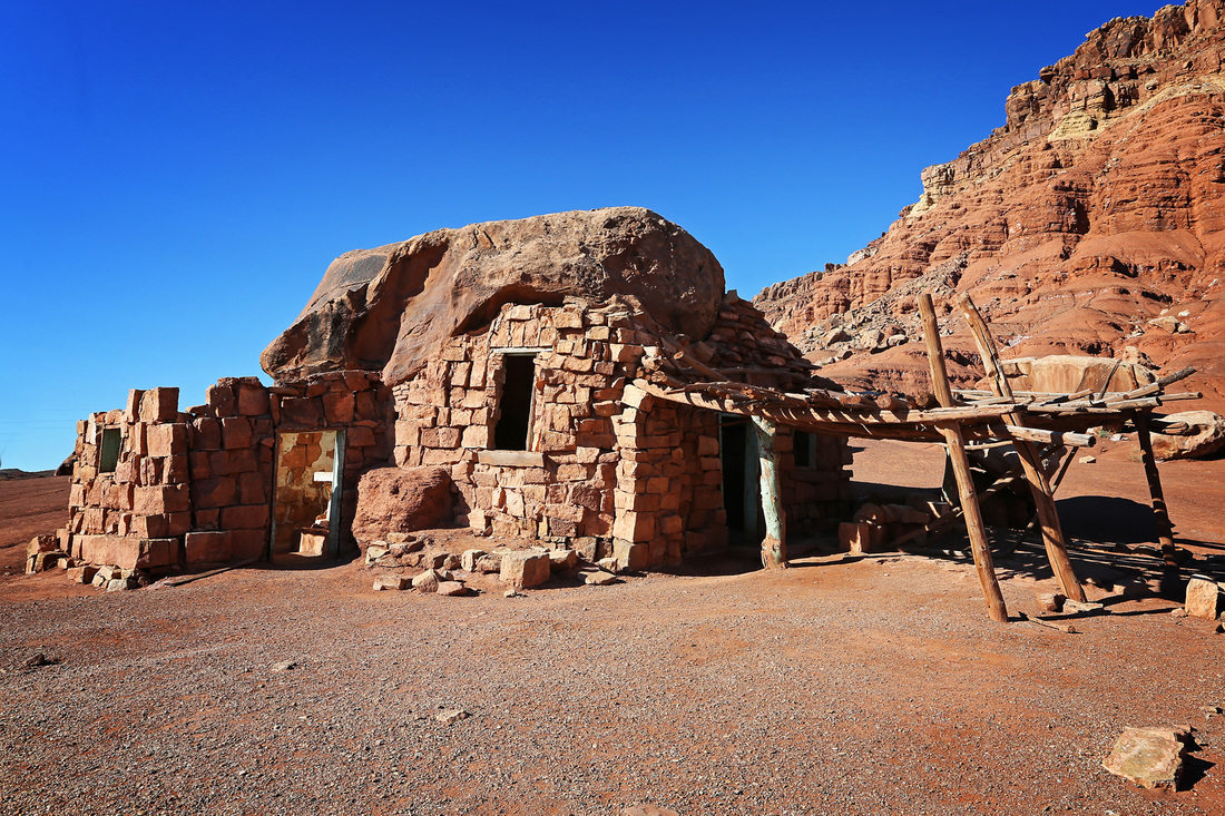
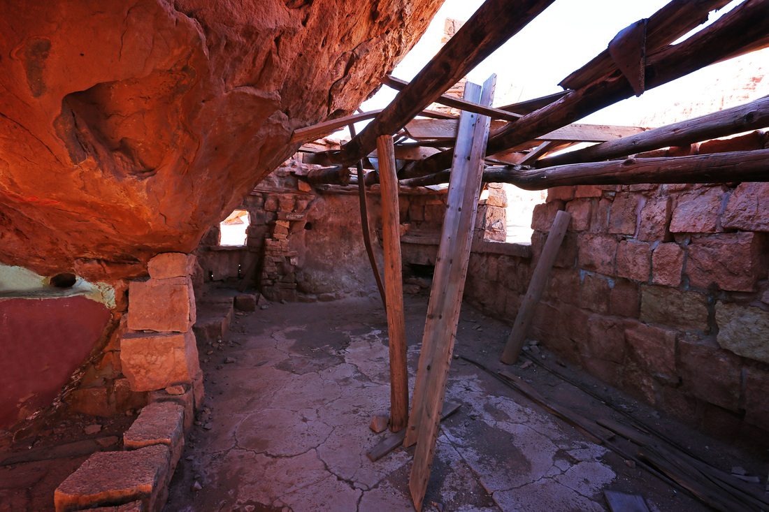
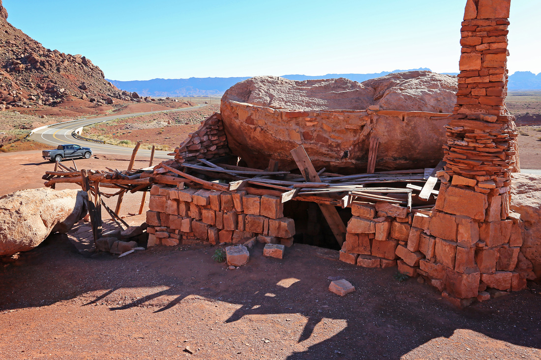
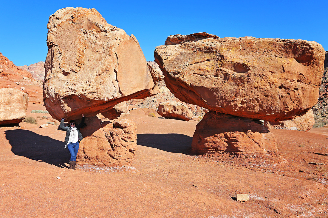
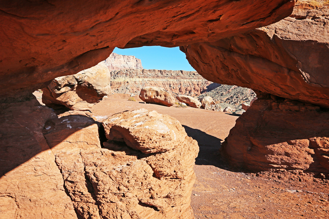
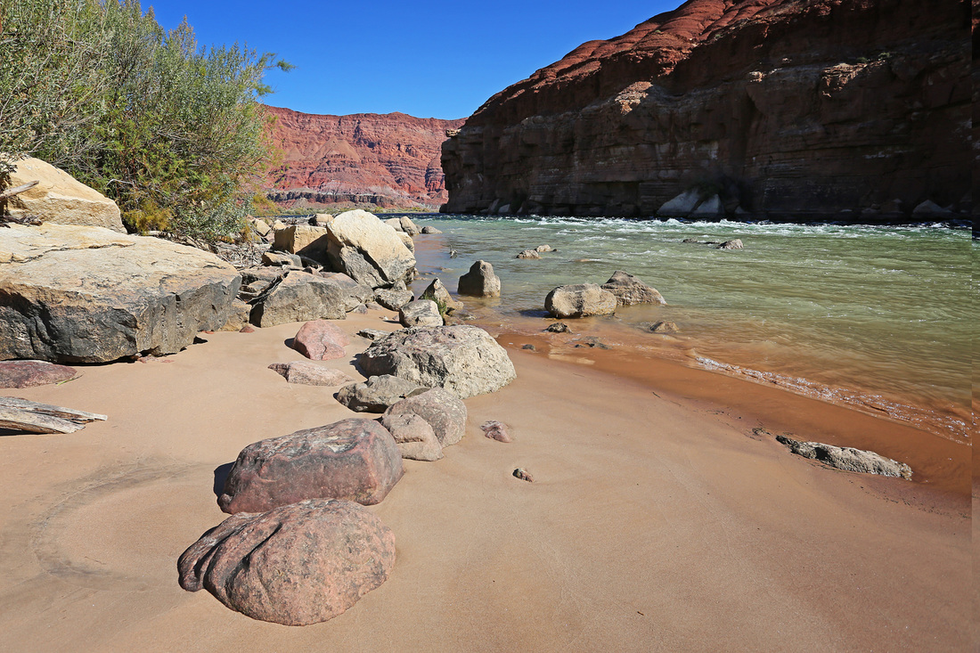
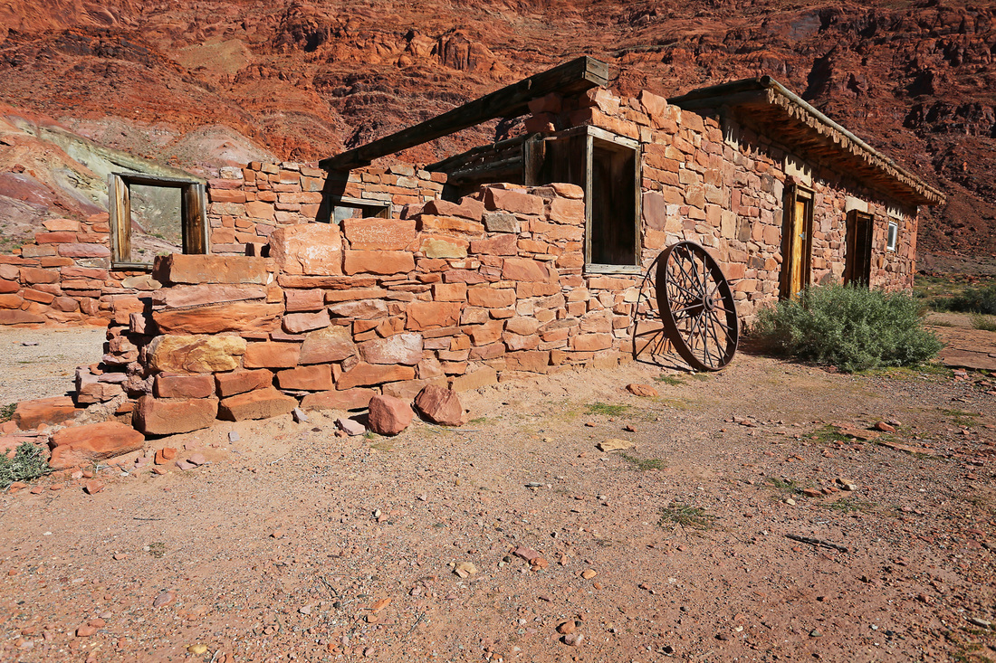
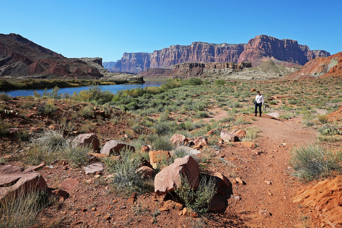
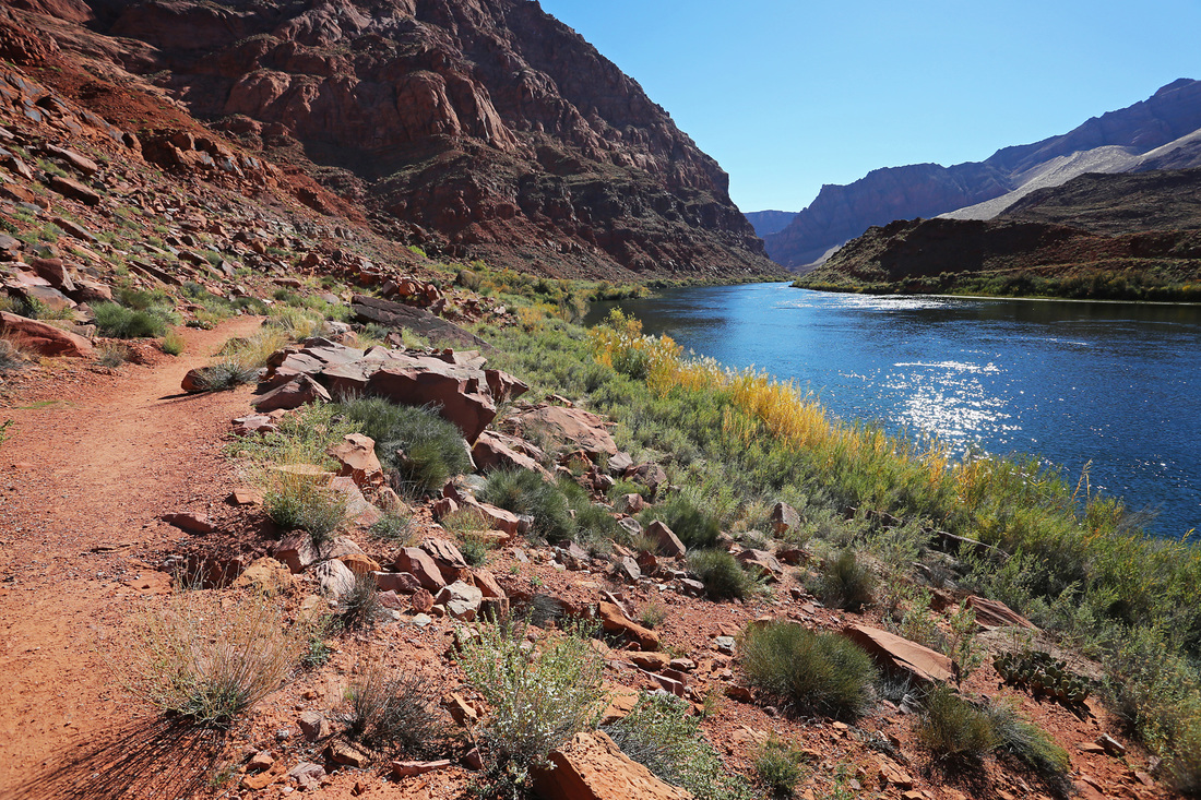
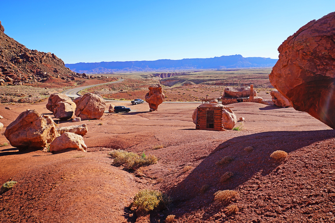
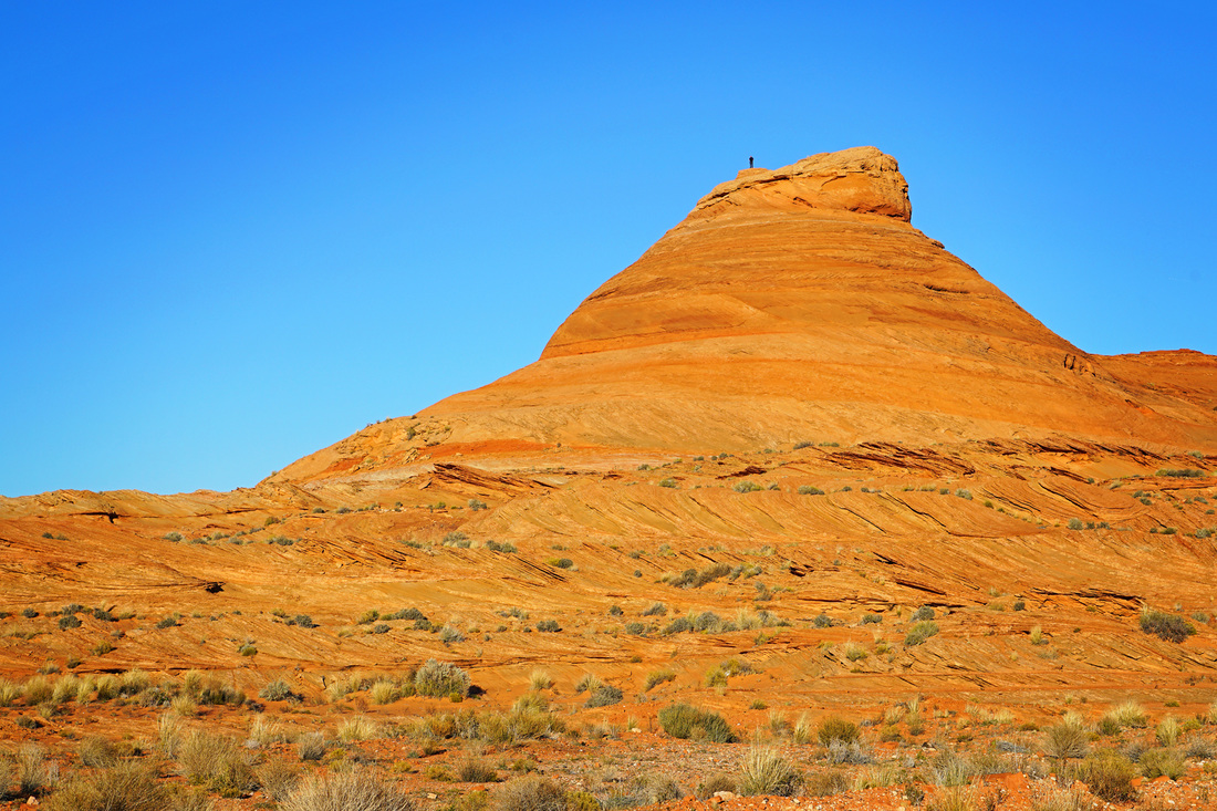
On day 5 we had hoped to visit 'The Wave' rock formation in Vermillion Cliffs National Monument in northern Arizona but a permit is needed to do so and with a 4 month waiting list we weren't getting one (we just don't plan that far ahead) Instead we went to Marble Canyon via Lees Ferry road and took the 'honeymoon trail' down to the Colorado River where we hiked beneath the Vermillion Cliffs beside the river. Just before taking the turn for Lees Ferry we stopped off at a strange roadside place called 'Cliff Dwellers', this was not the usual cliff dwellings you might expect. It was in fact houses built underneath large boulders which resulted in the boulders making up most if not all of the roof.

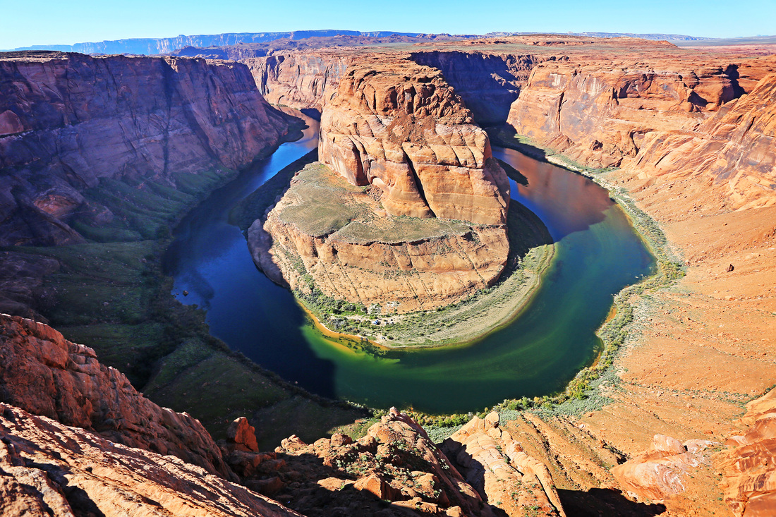
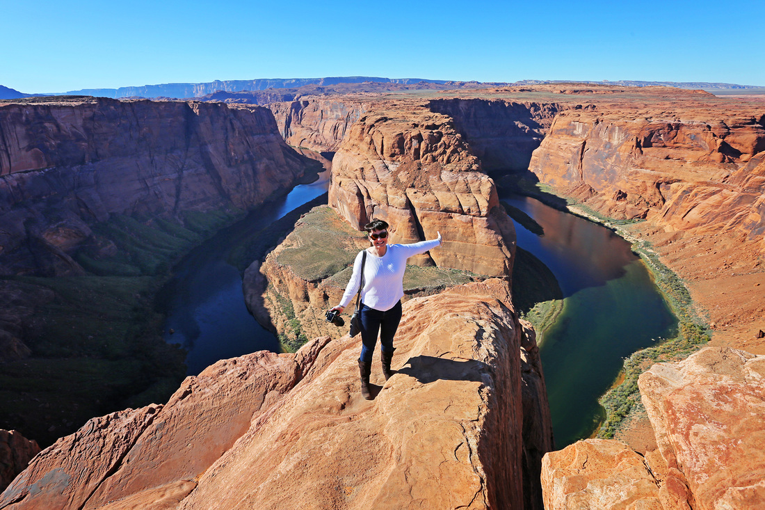
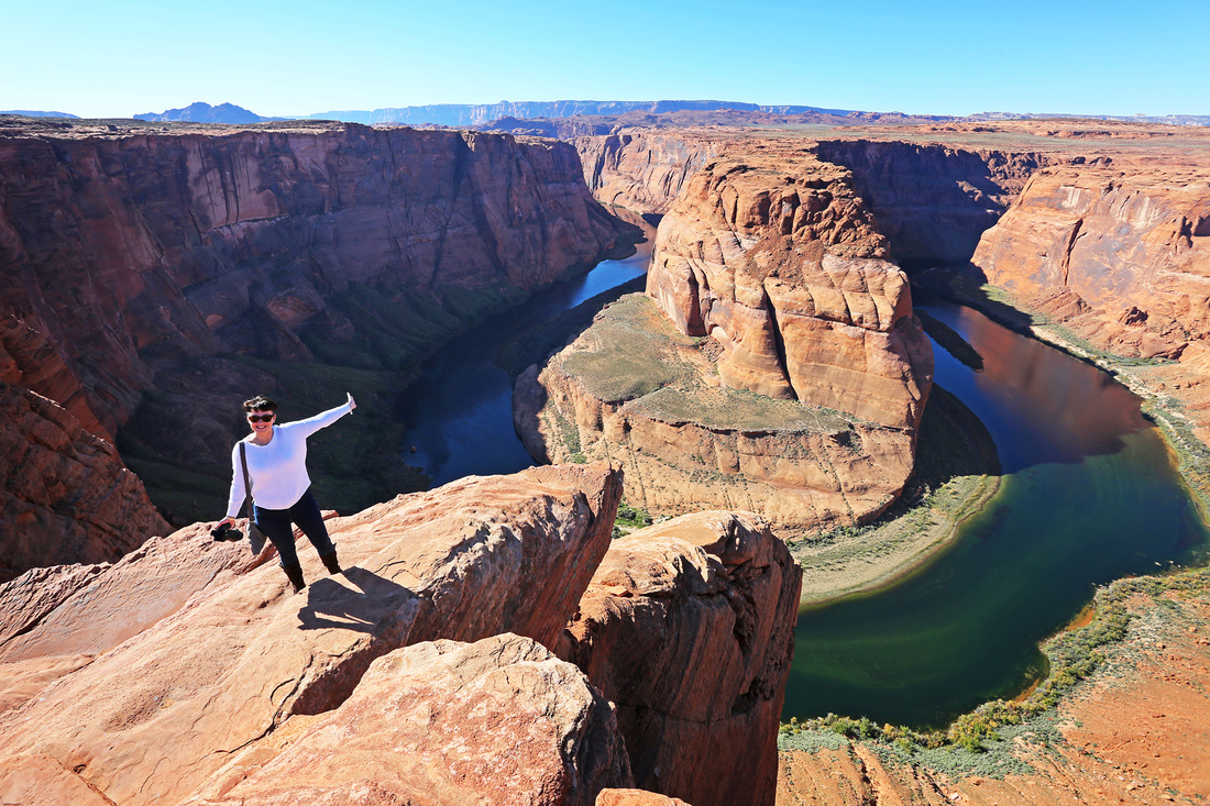
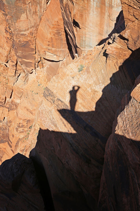
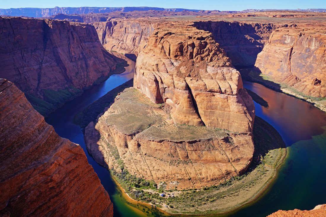
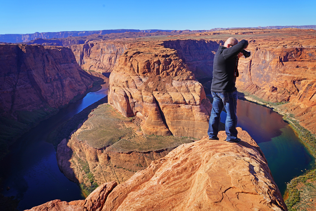
From Lees Ferry we returned to US 89a and then onto US 89 heading east toward the town of Page in northern Arizona but before arriving in the town there was just one more stop off I wanted to make. Just 2 miles west of the town is a parking area for a short walk across the desert to Horseshoe bend, the walk itself is short and easy on a wide trail and the viewpoint high above the Colorado river is incredible. This was my 3rd visit to Horseshoe bend and I still hope it wasn't my last although today would have been much more enjoyable without a group of chinese tourists screaming and shouting at the top of their voices for the entire time we were there.

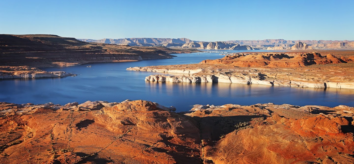
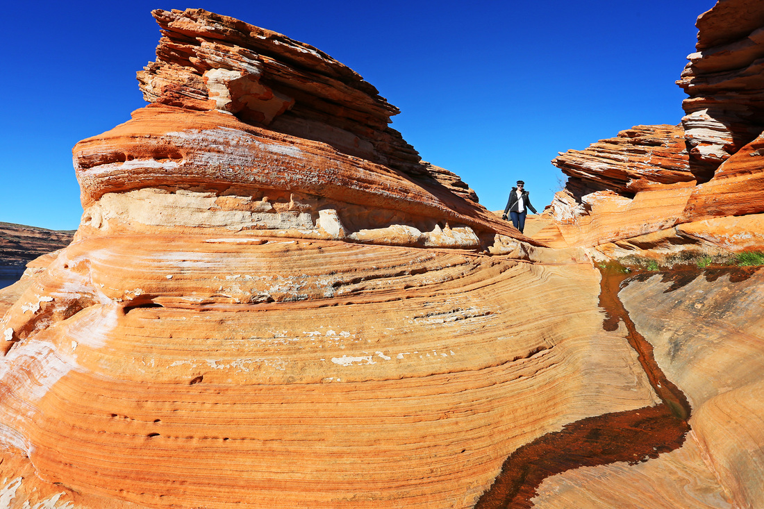
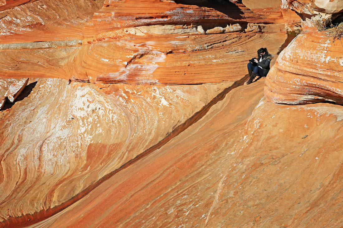
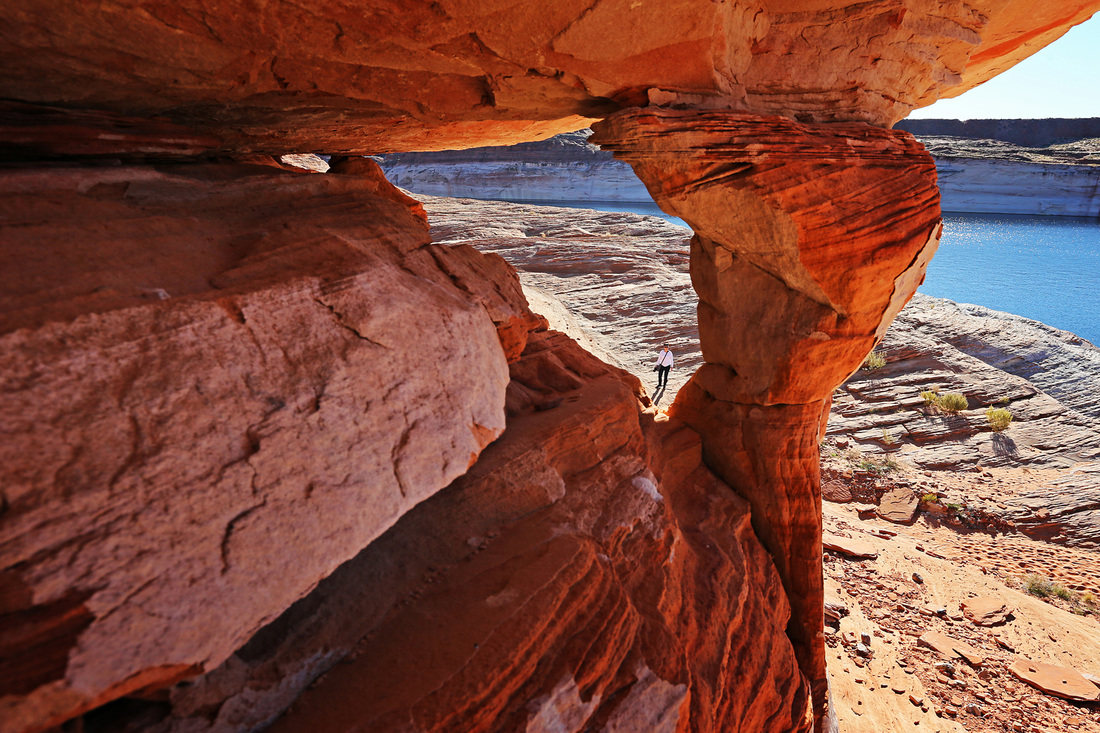
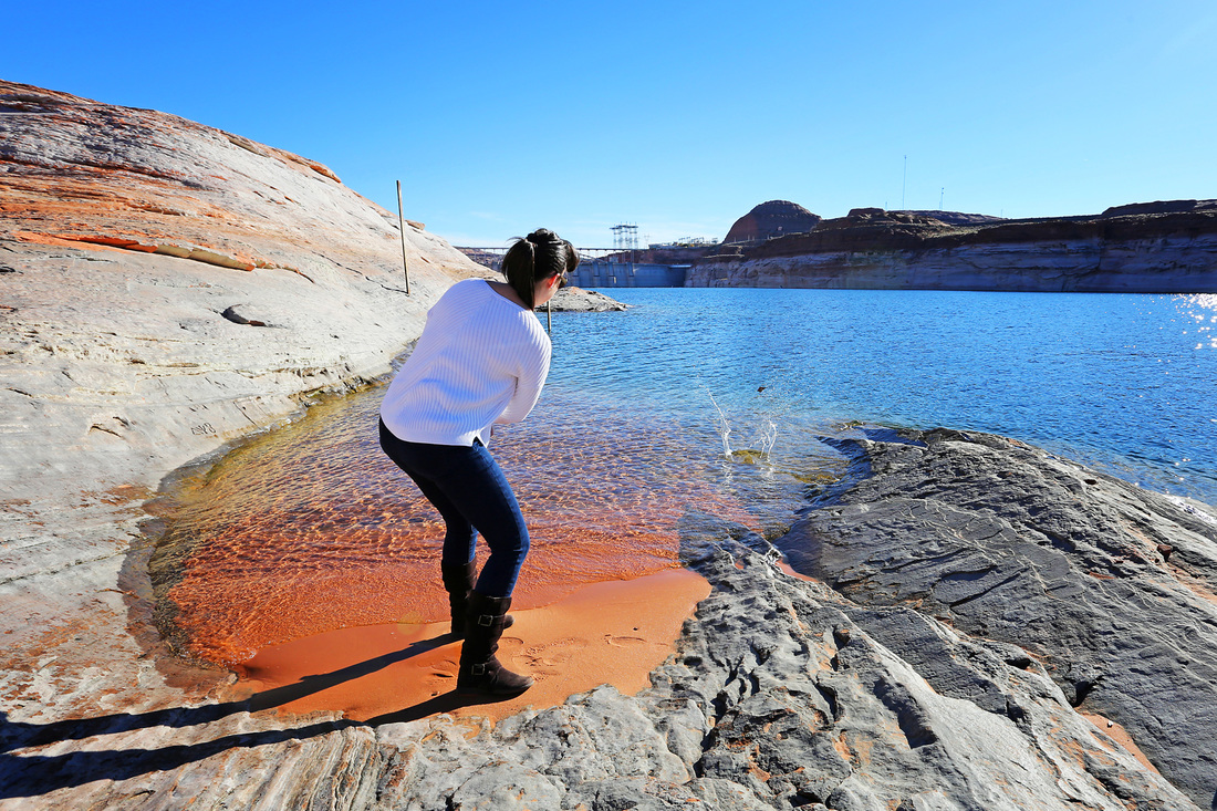
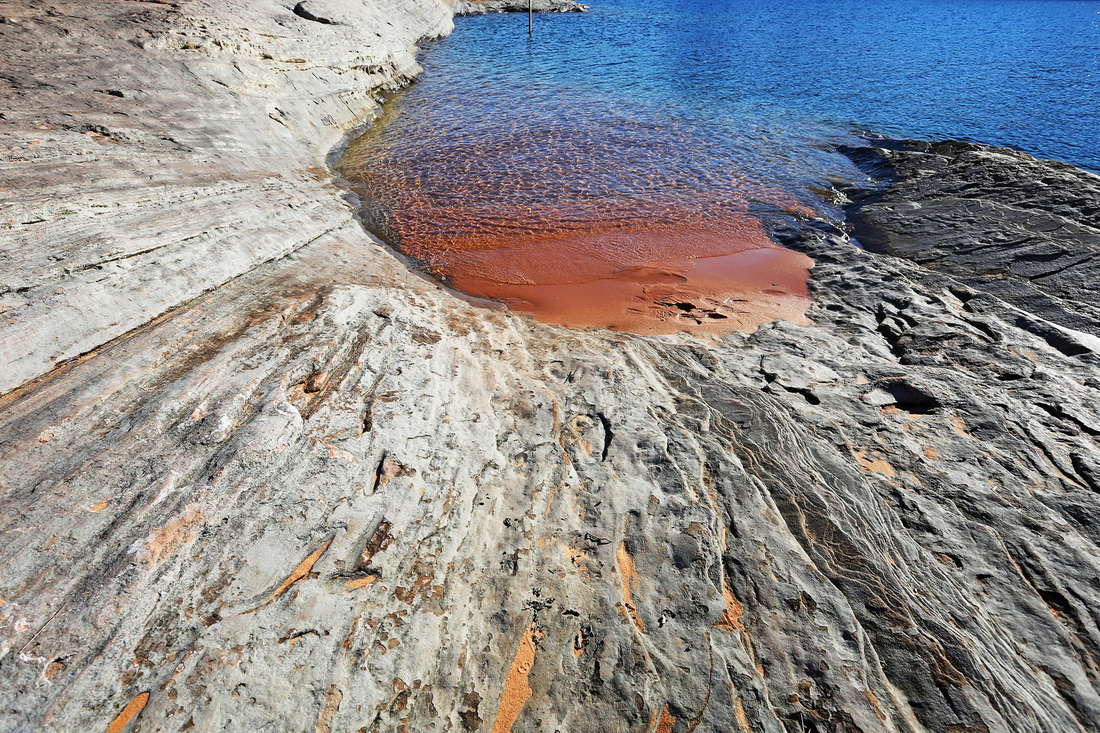
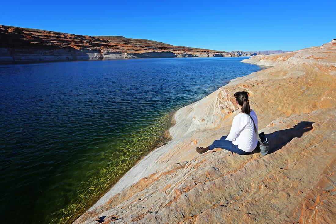
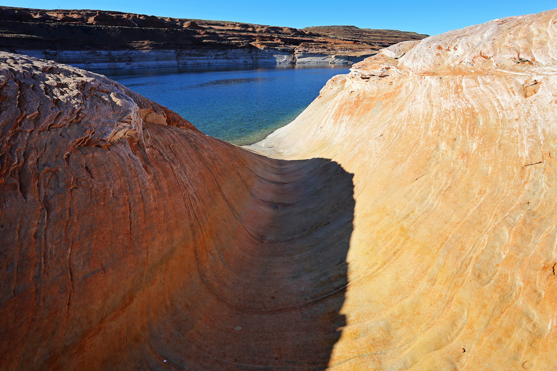
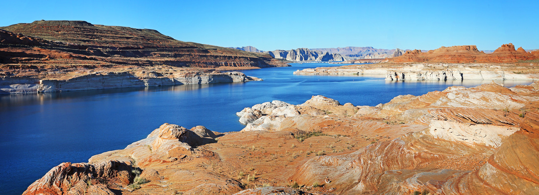
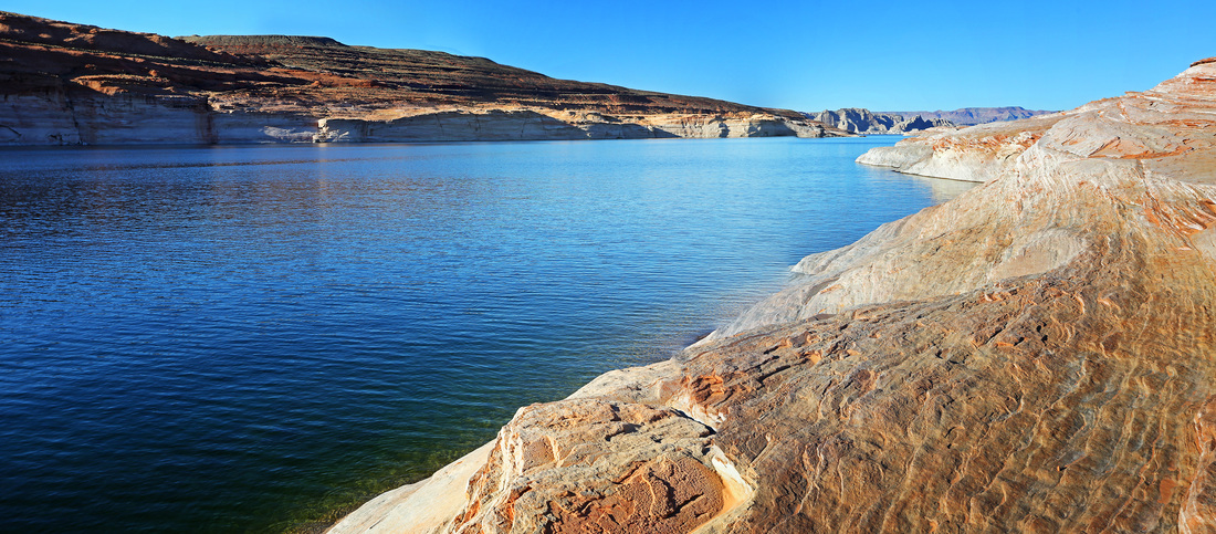
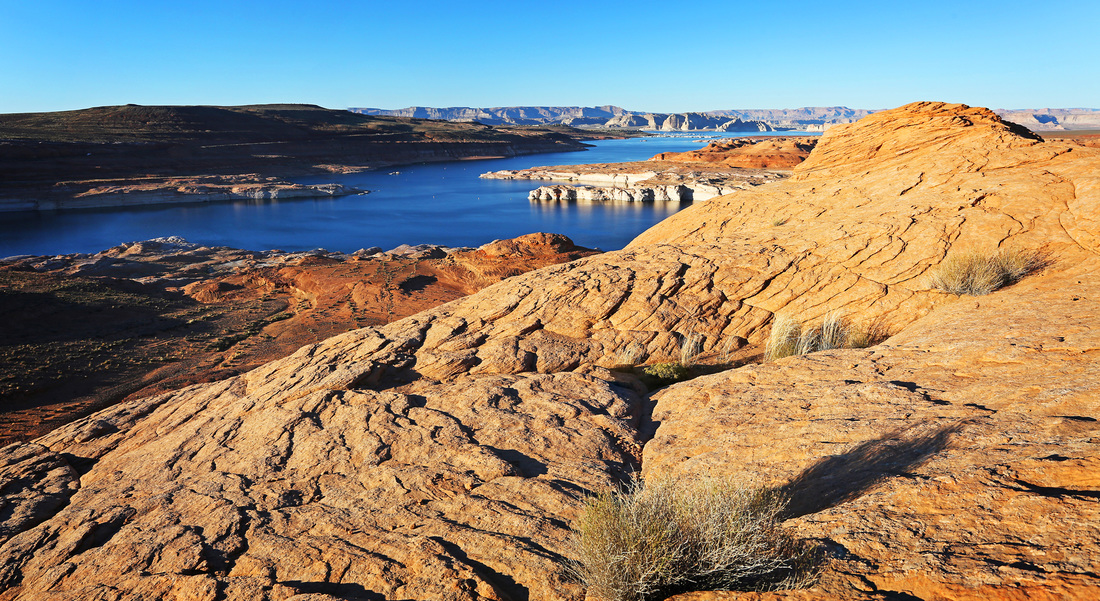
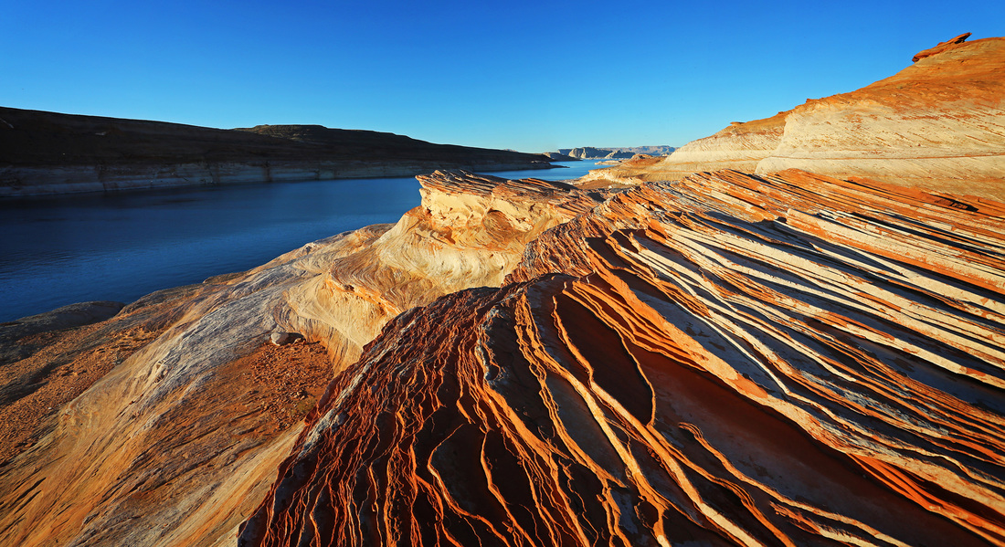
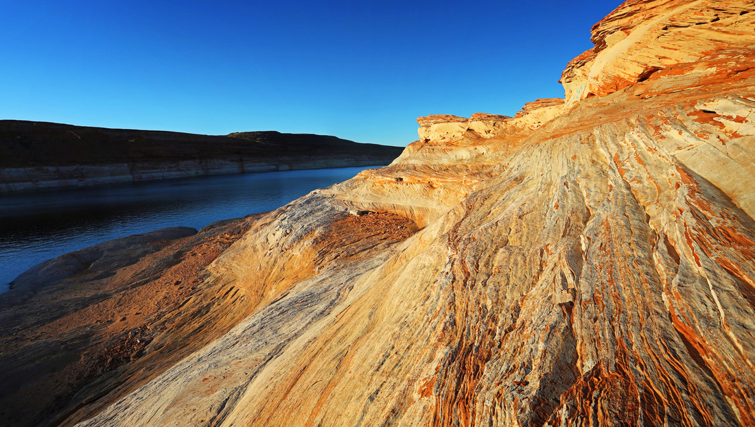
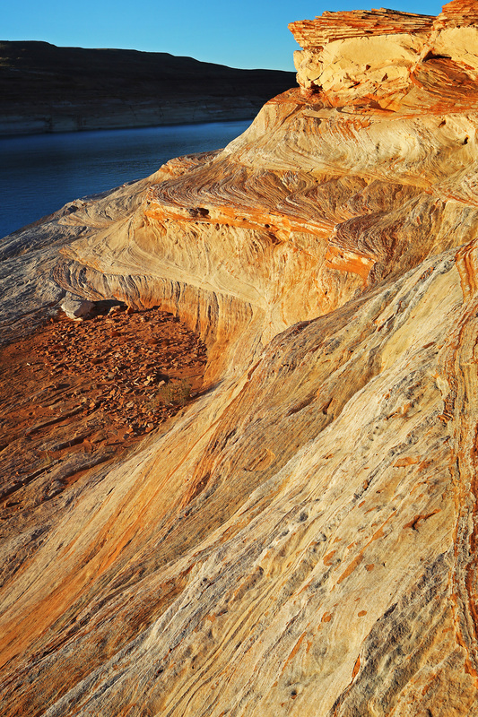
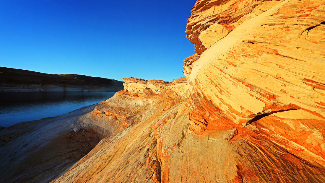
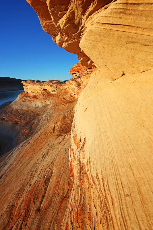
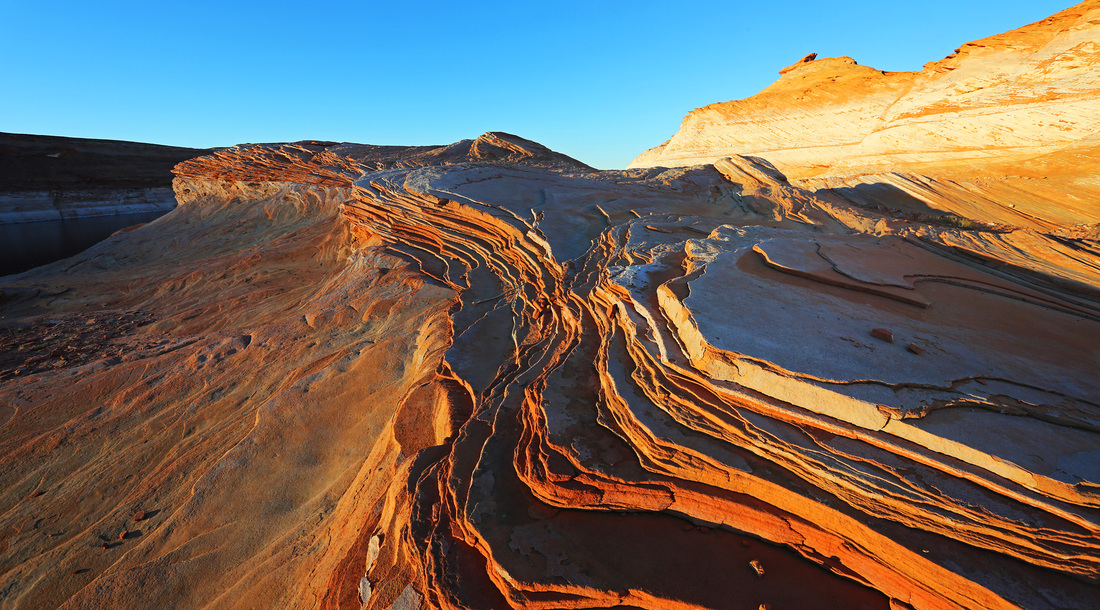
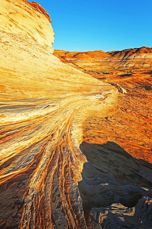
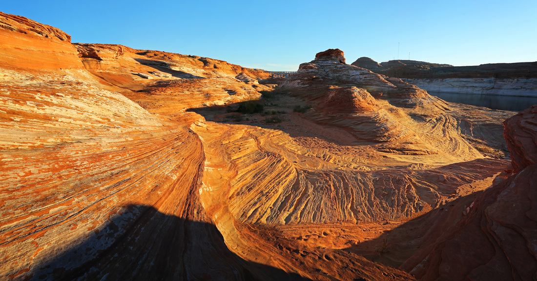
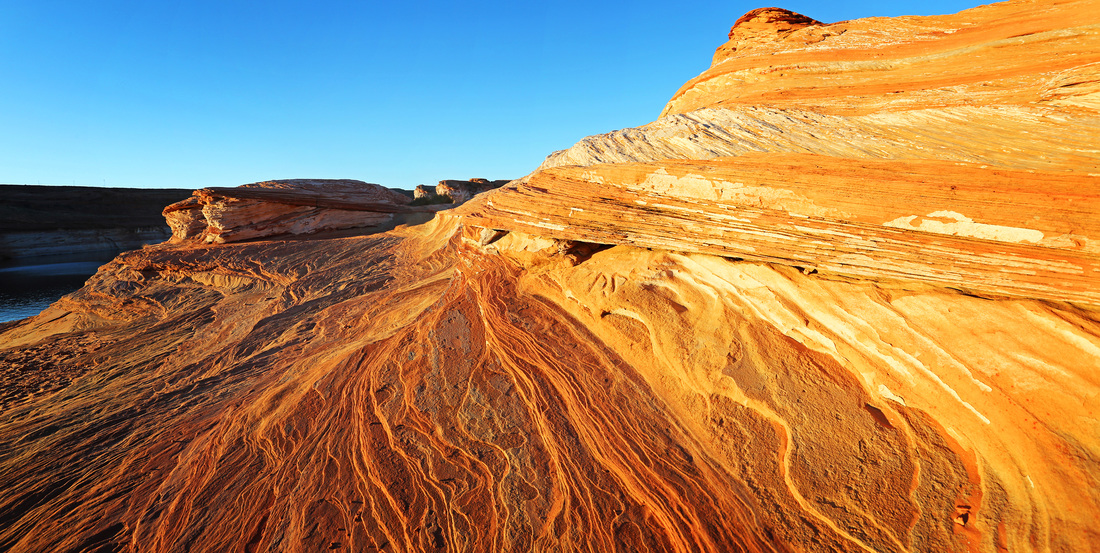
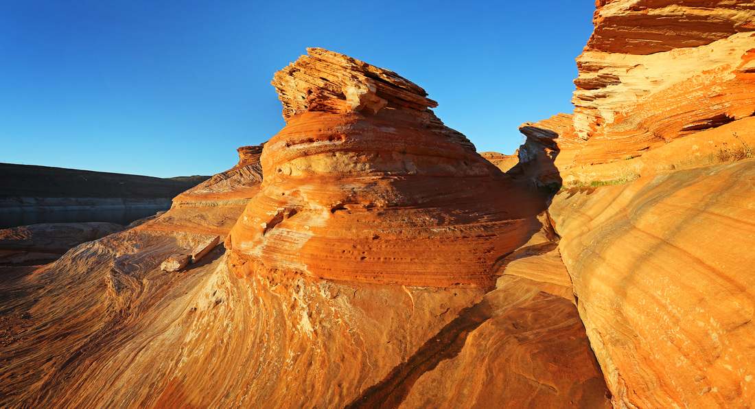
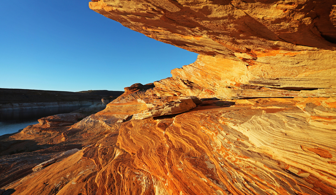
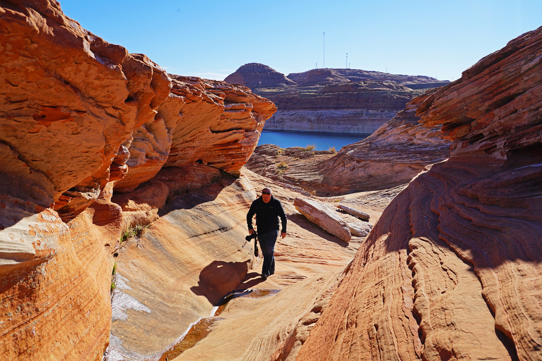
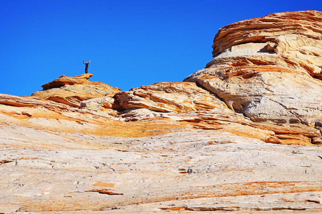
After arriving in Page we drove past the hotel first in order to get to Lake Powell for sunset, again it is a place I've visited before but it's a first for Sarah and I really wanted her to see it. The lake straddles the Utah/Arizona border and you could spend a week here and see 1% of it. With 3000 miles of shoreline at 186 miles long and up to 25 miles wide it is an enormous body of water, the second largest man made reservoir in the USA and absolutely beautiful. We arrived in time to enjoy a walk on the lake shore before sunset, I did some scrambling around while Sarah took a more sedate sit by the water and tried her hand at skimming a few stones. When the setting sun finally hit the rocks the colours were fantastic and I scurried about trying to capture as much as possible in the few minutes available before the long shadows of the north bank blocked out the light. Our hotel turned out to be very close to a chinese restaurant so dinner was sorted pretty quickly after check in.


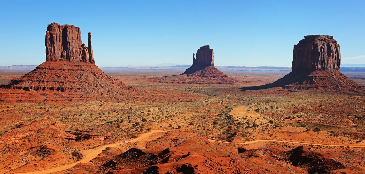
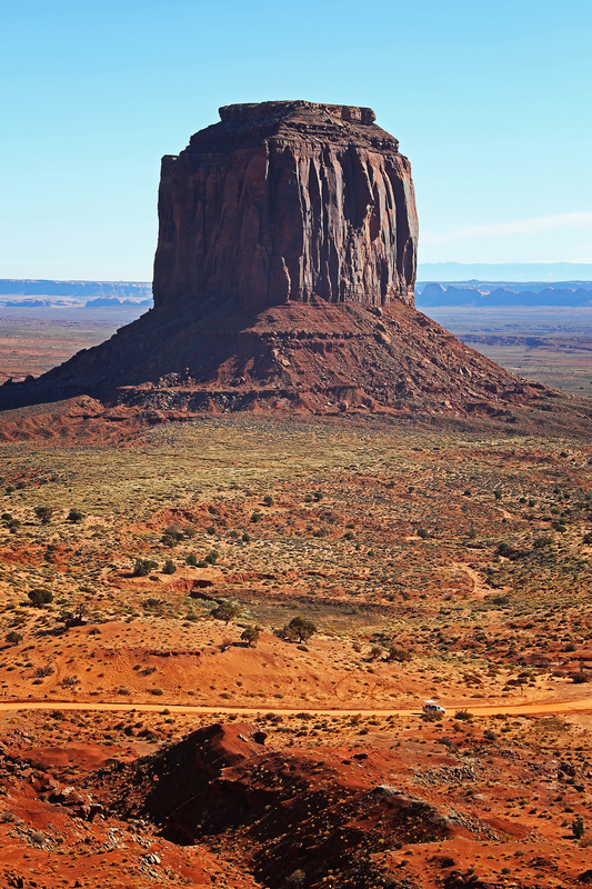
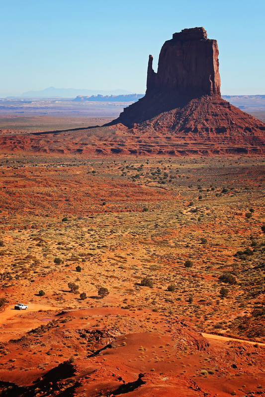
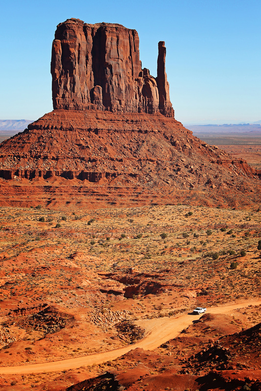
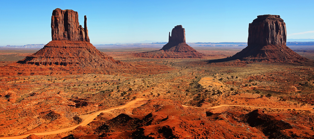
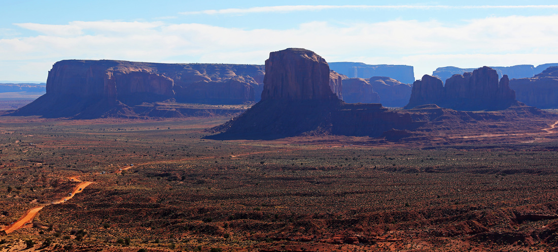
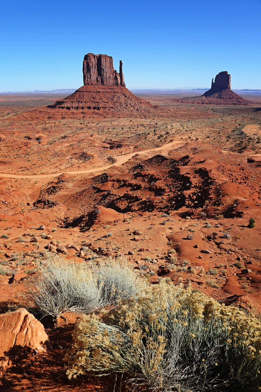
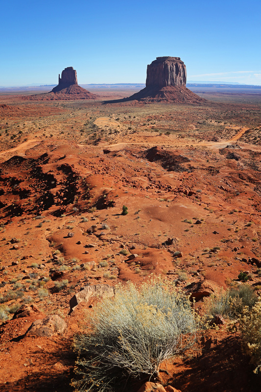
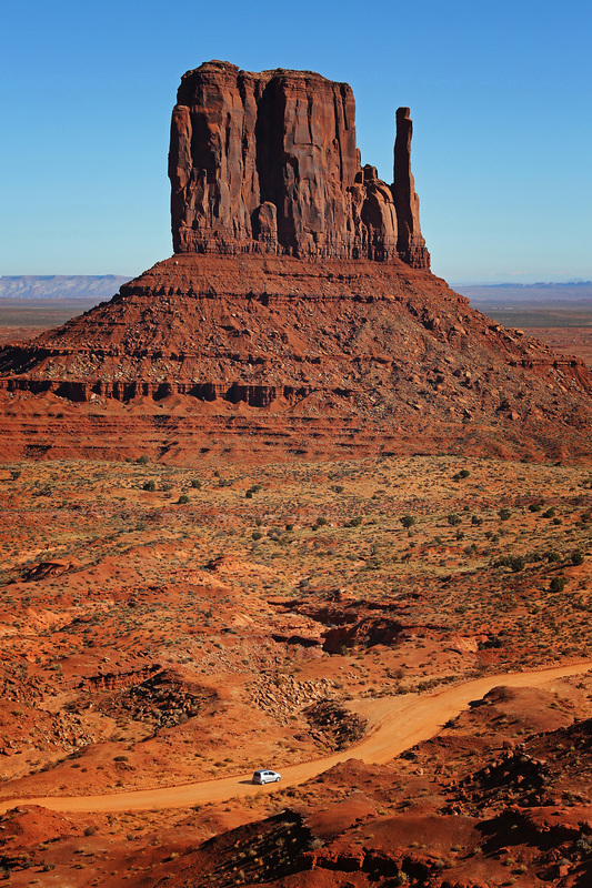
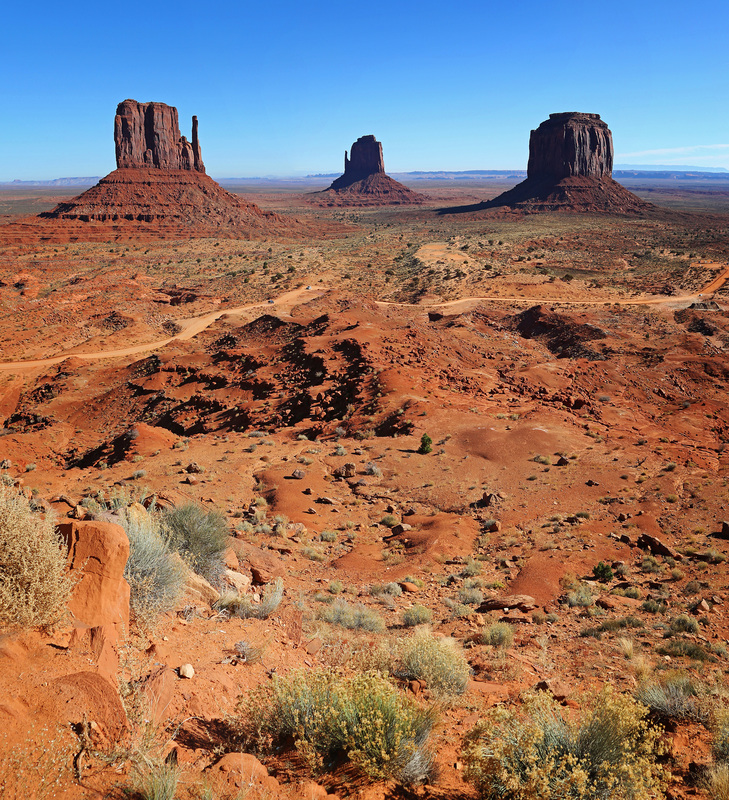
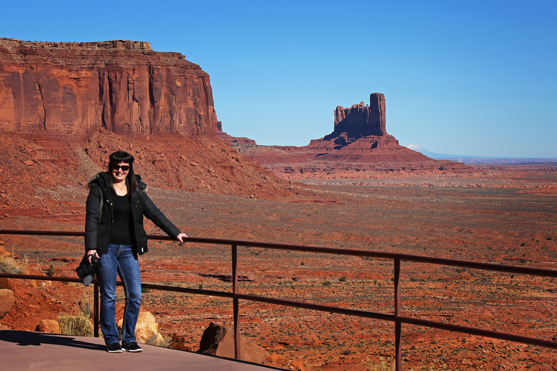
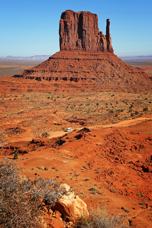
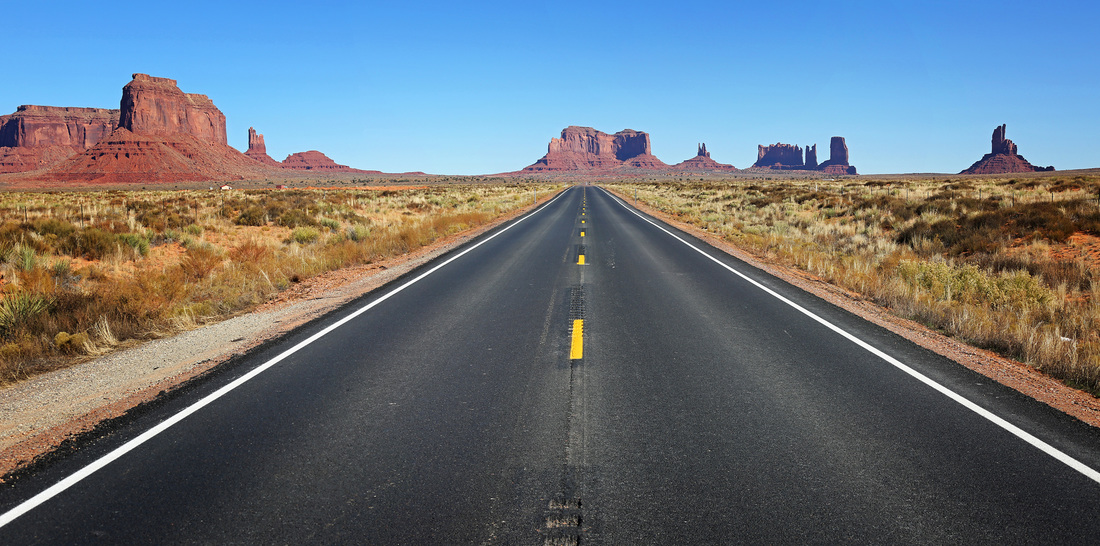
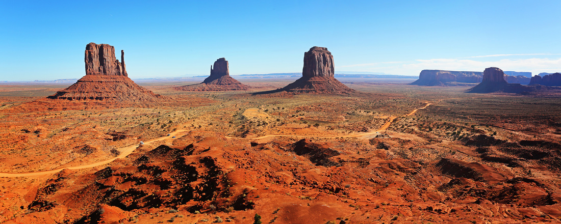
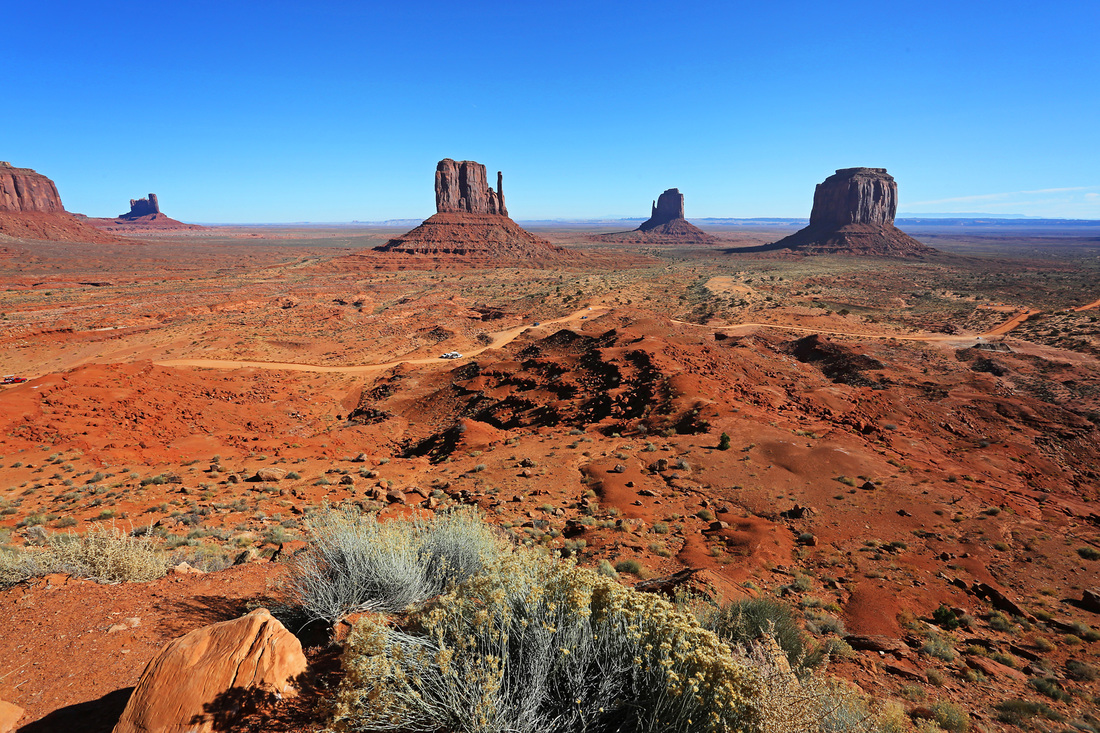
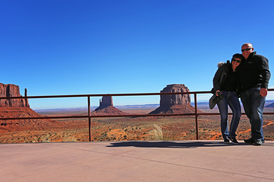
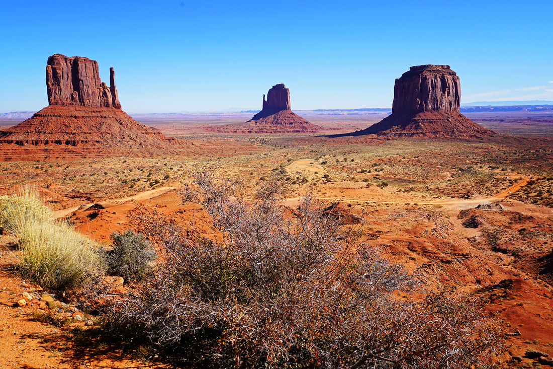
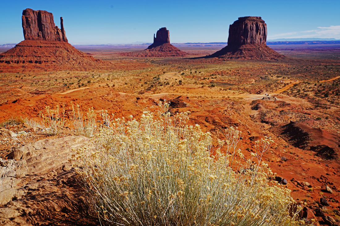
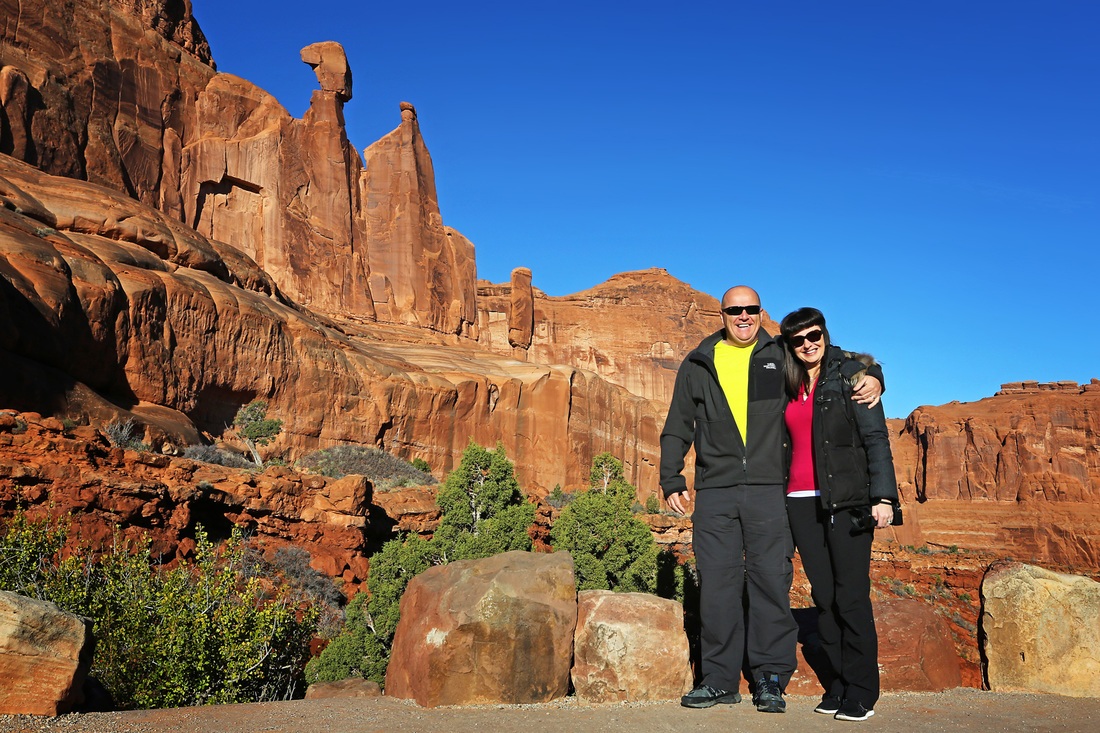
Day 6 was another day of covering ground as we headed out of northern Arizona and back into Utah via the awe inspiring towers of monument valley on highway 163 north. This is the place where so many westerns were made including a number of John Wayne films where it is said he insisted on using the location. It makes a fantastic break to the journey and has toilet facilities and a restaurant where we had lunch before continuing on northward toward Moab.
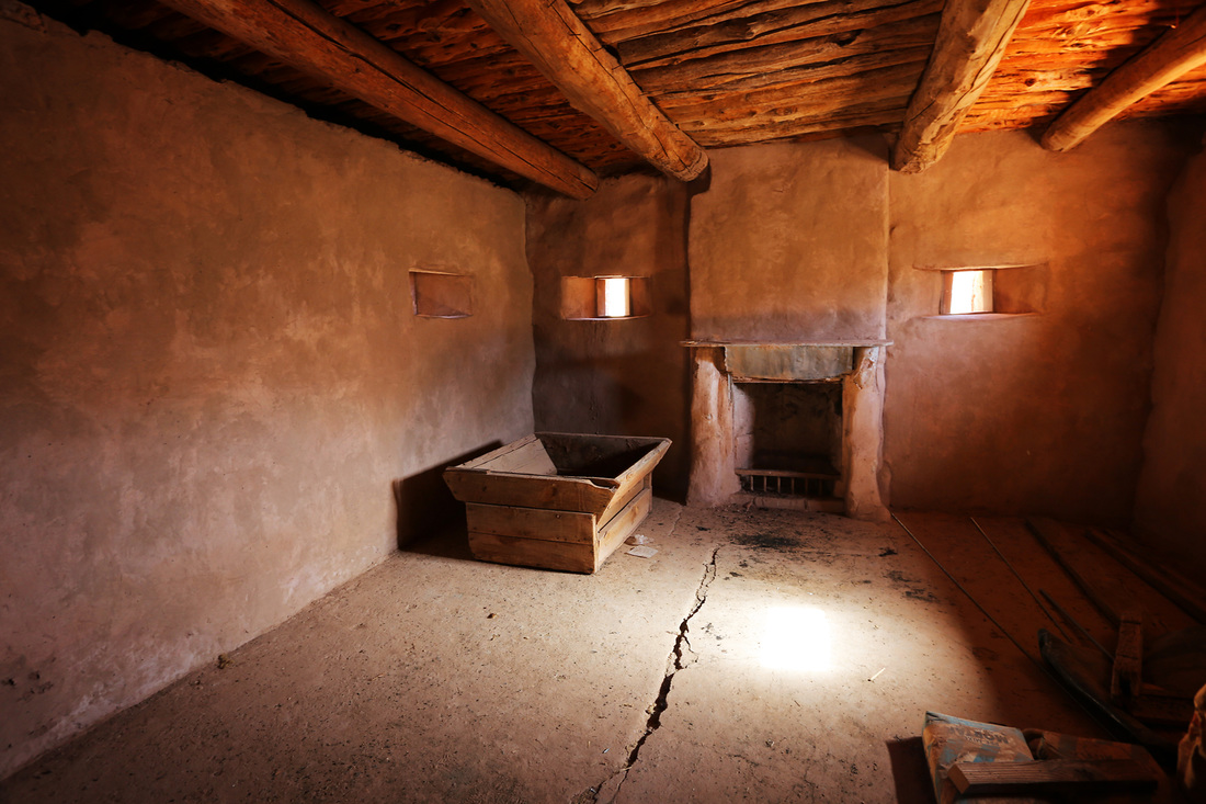
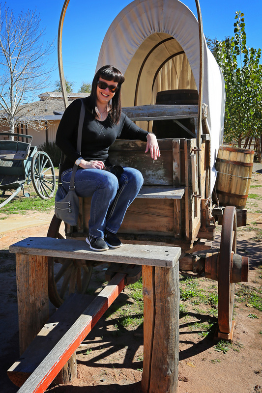
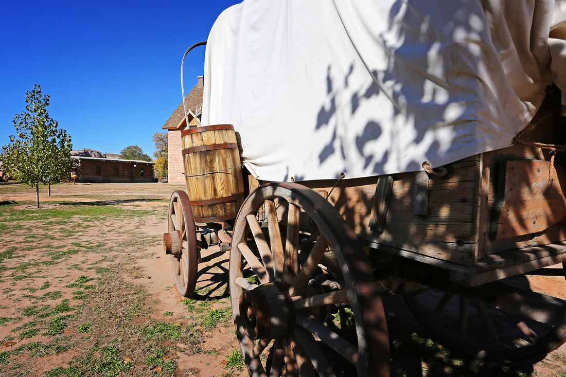
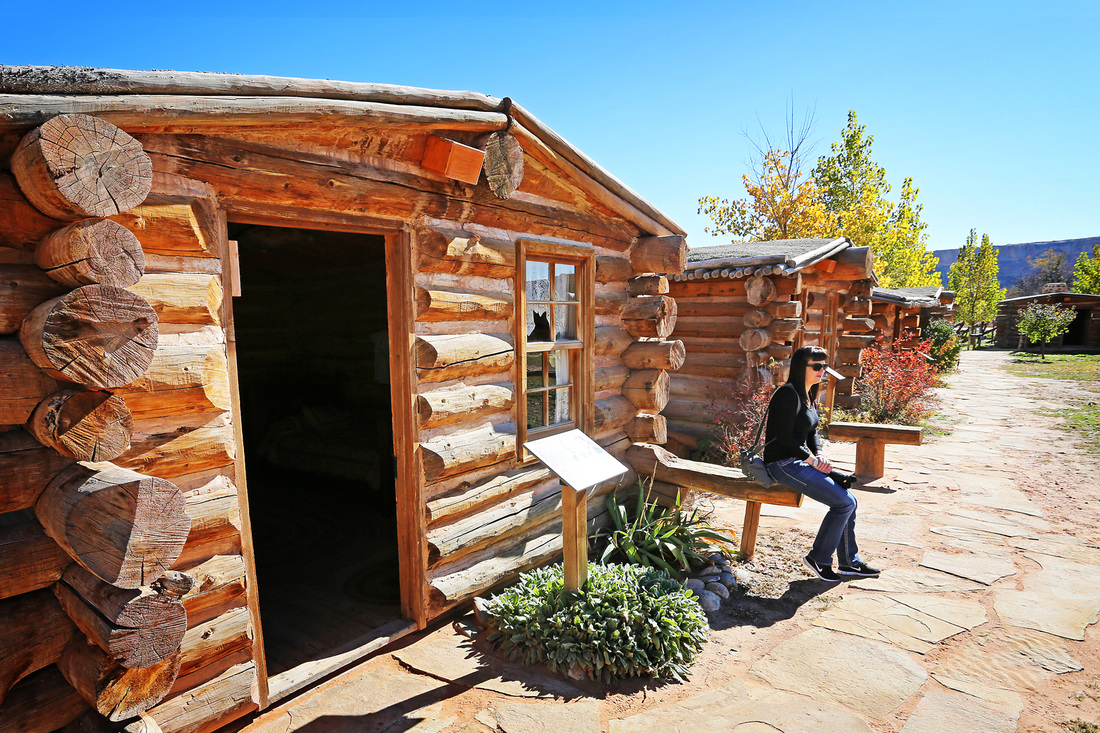
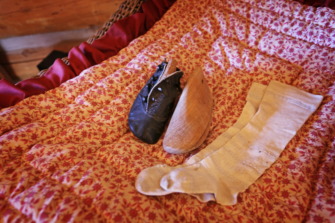
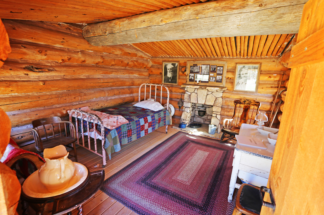
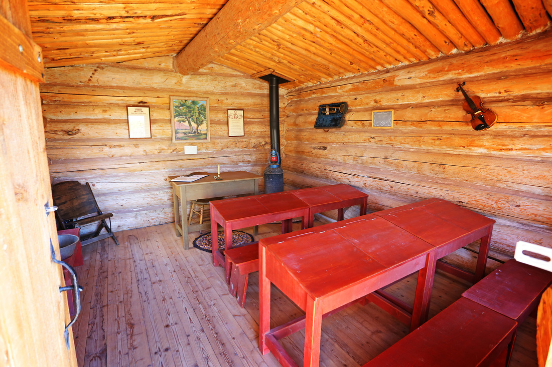
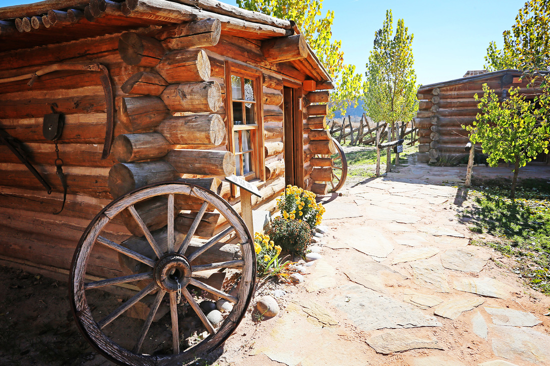
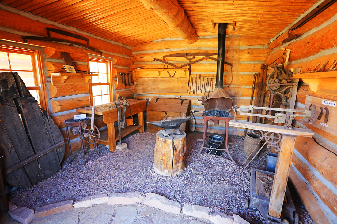
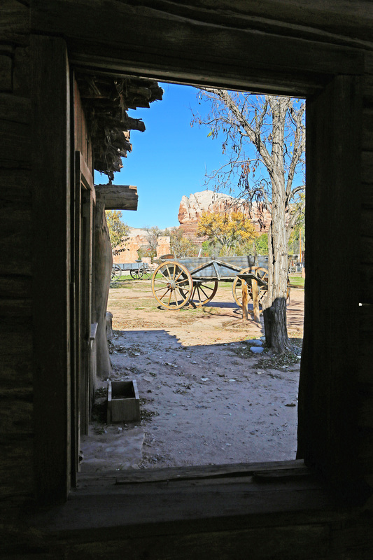
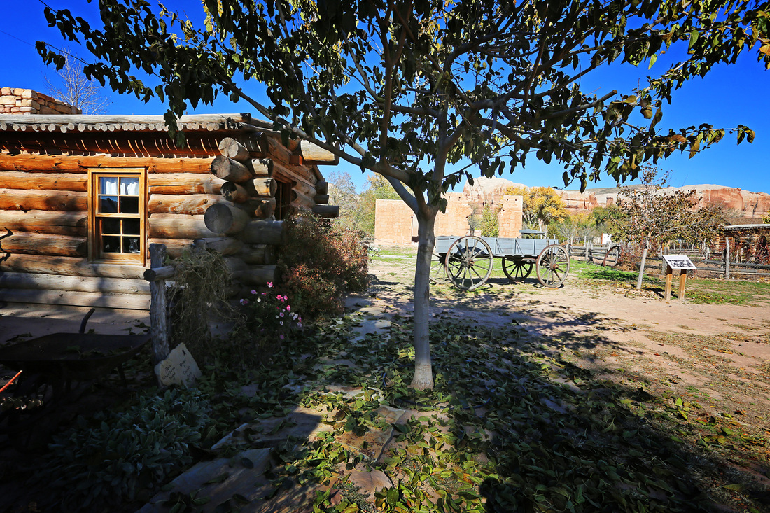
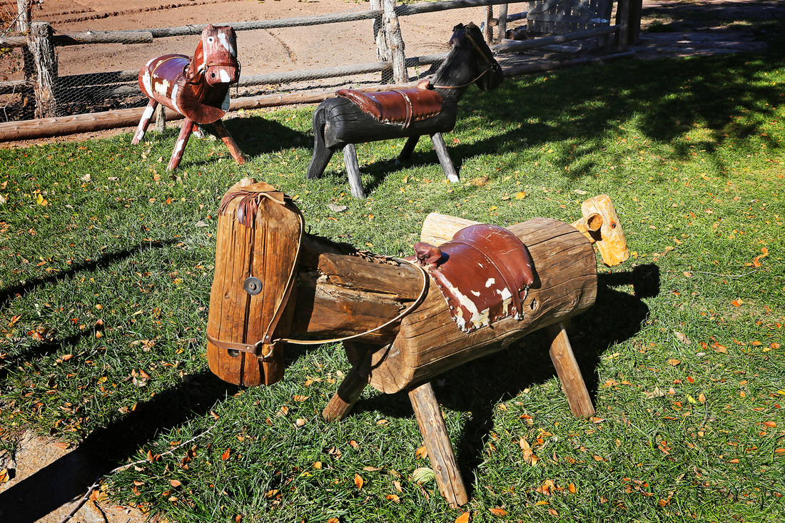
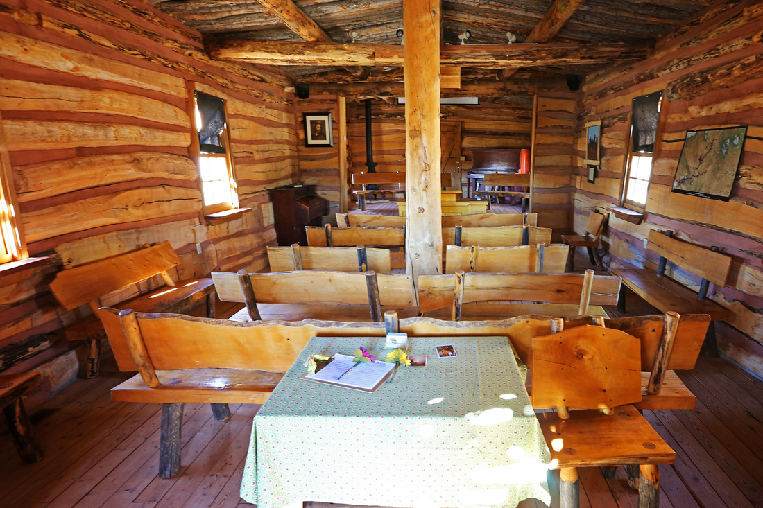
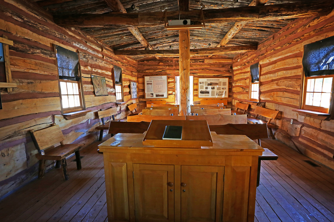
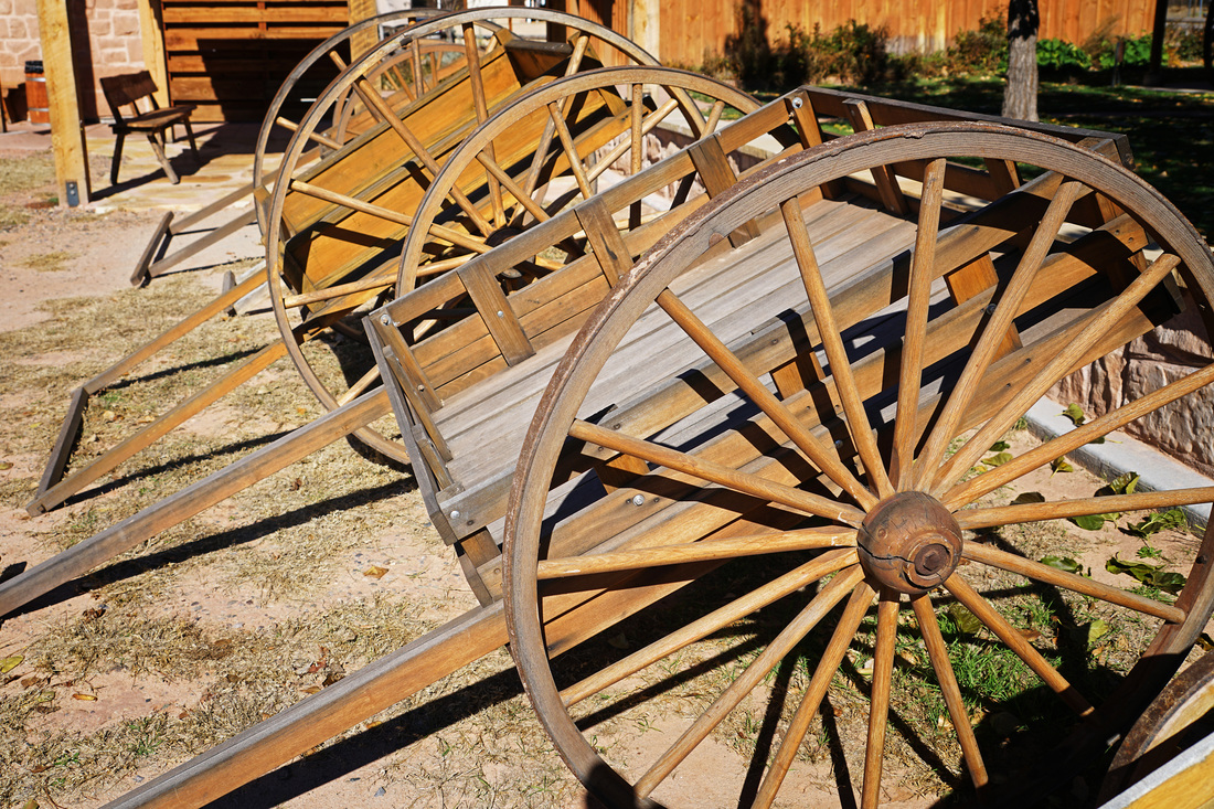
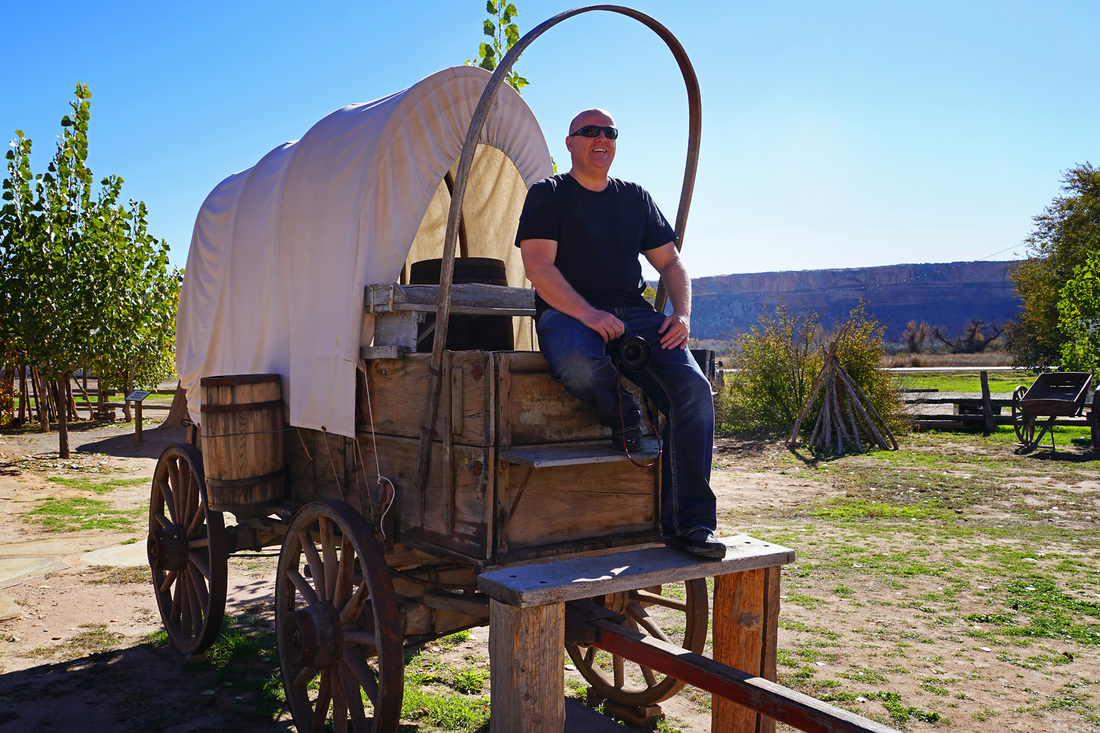
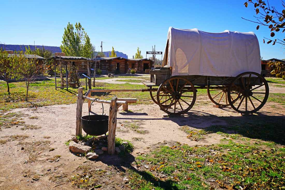
Another short stop off on the road to Moab was Bluff Fort where we saw how early settlers lived and enjoyed listening to some of the stories written by those early settlers read by their ancestors. The stories are recorded and you can press a button to hear them as you look around the replica cabin of that family. Some of them are heartbreaking. Bluff Fort really is worth the stop off if you are on the road to Moab, the people of the town have made a great effort to bring the past to life here and seem to be succeeding very well. After Bluff Fort we stopped again in Monticello for a bite to eat before making the remainder of the trip to Moab and and after a brief walk around the town we settled into the hotel.


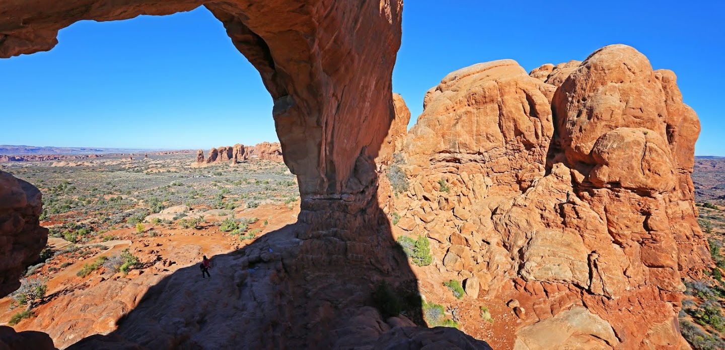
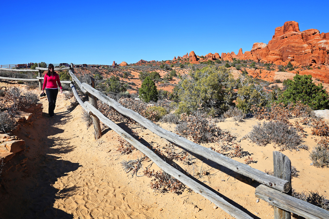
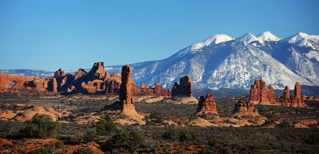
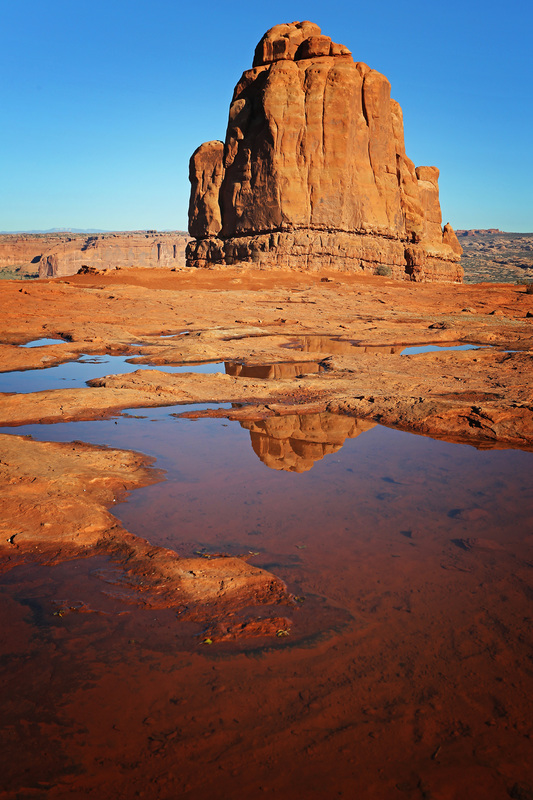
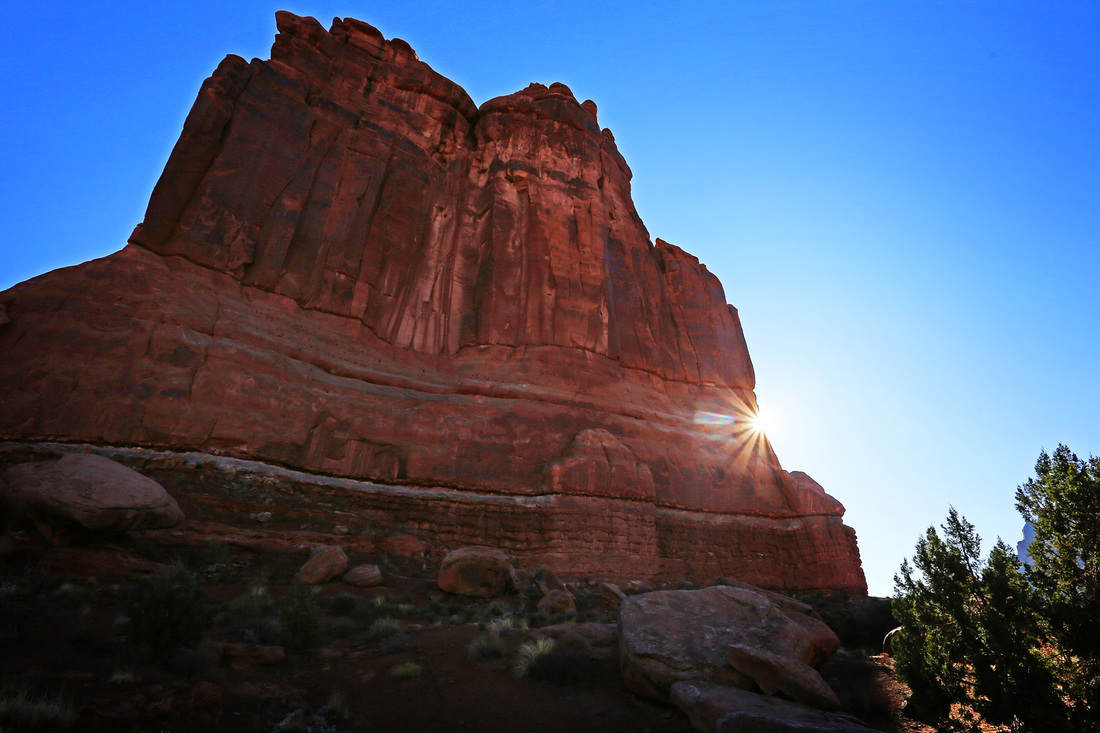
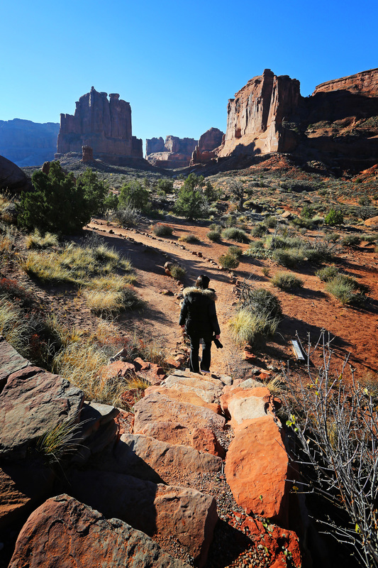
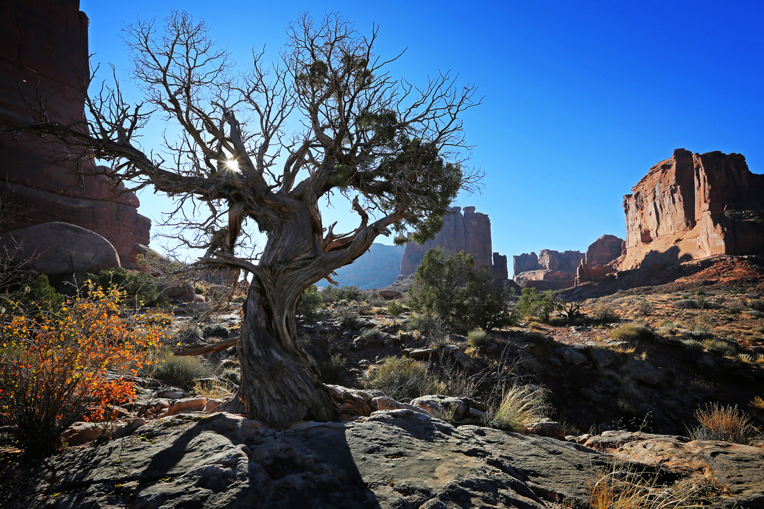
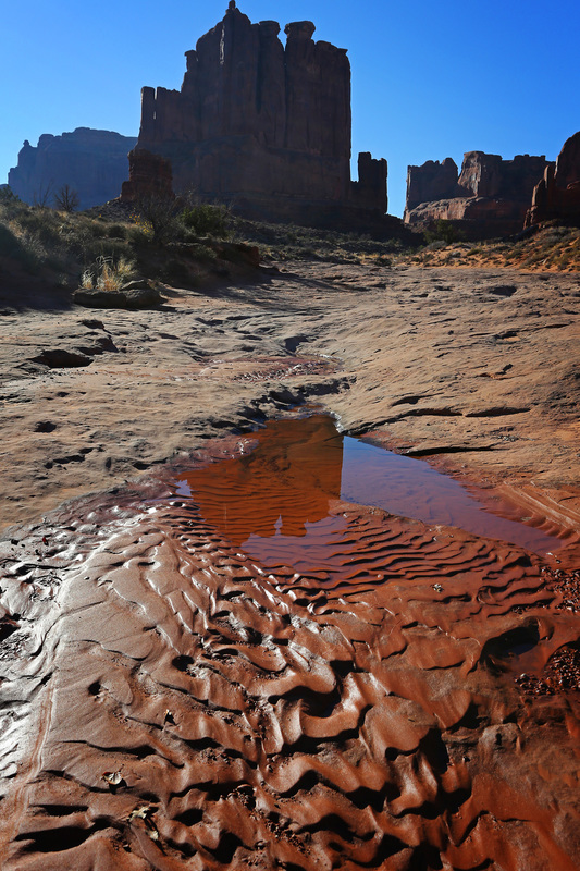
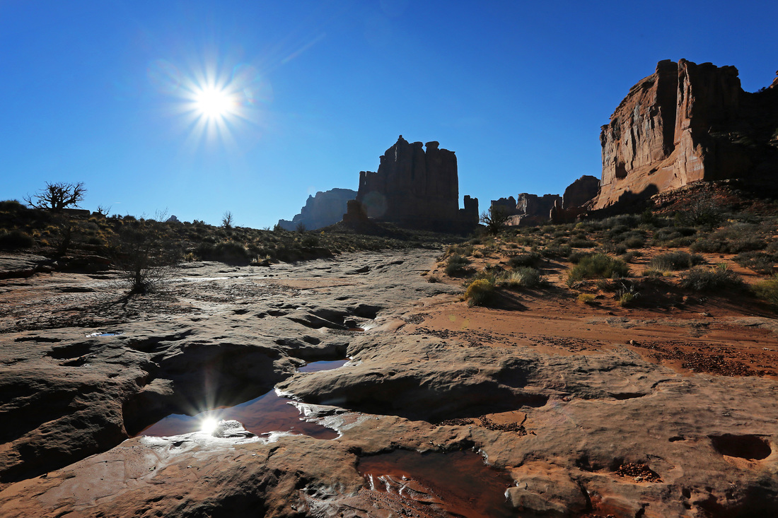
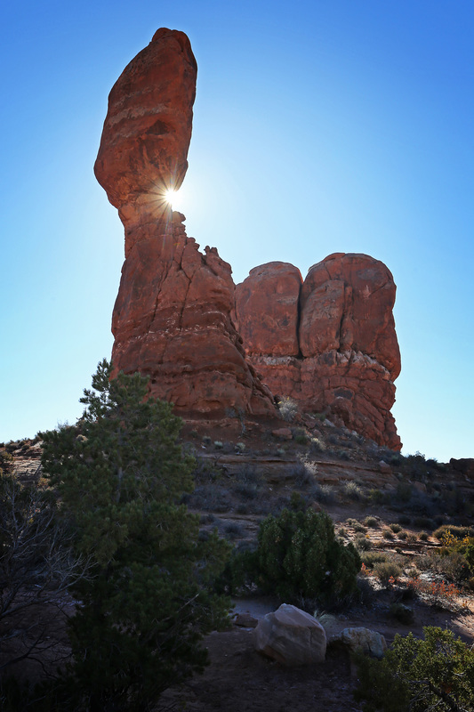
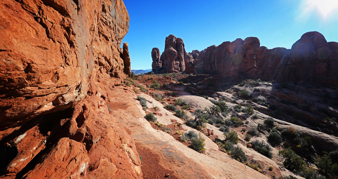
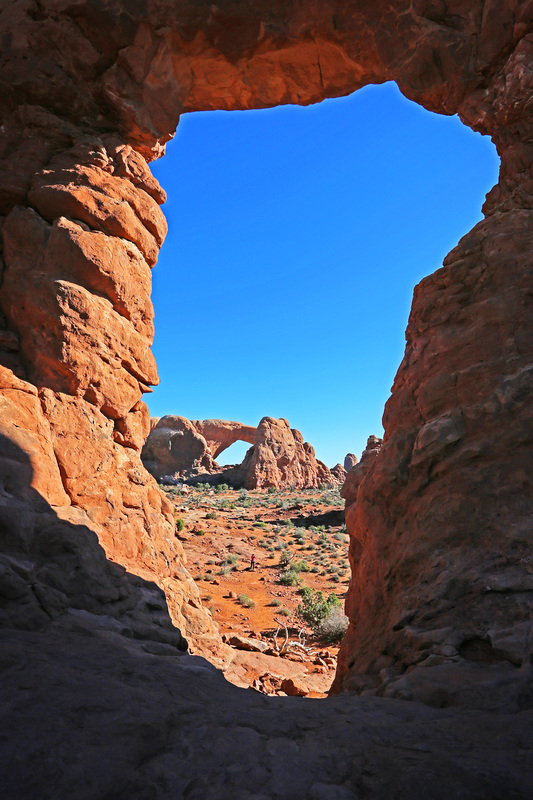
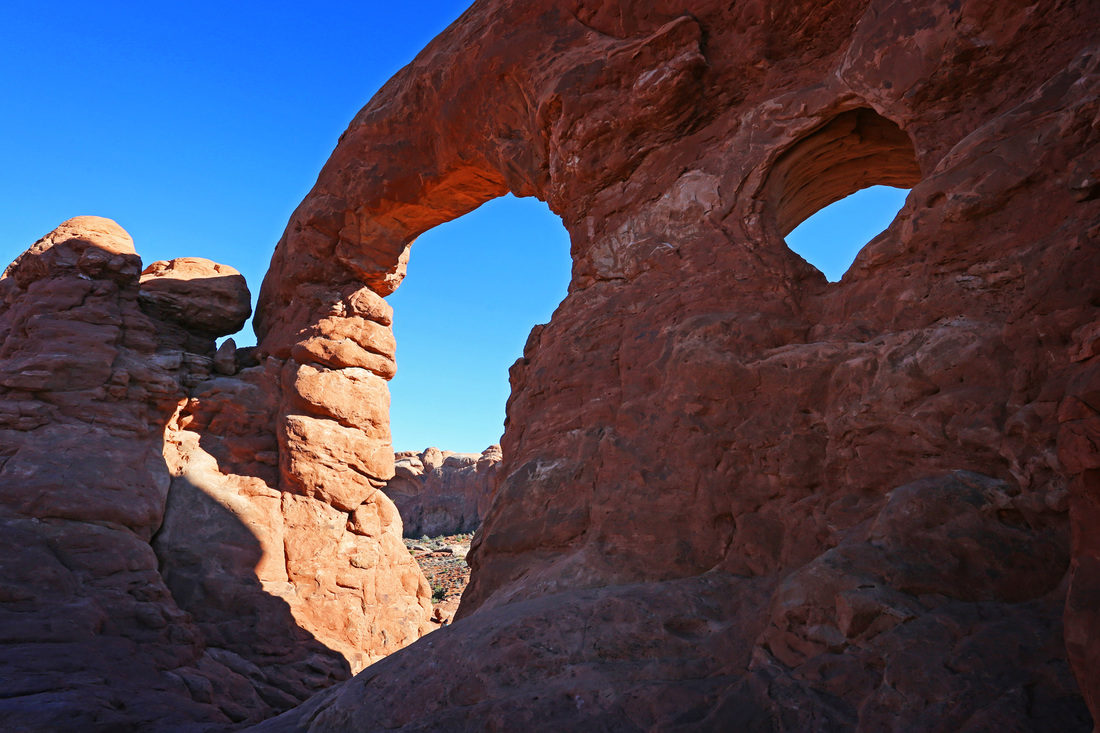
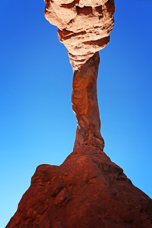
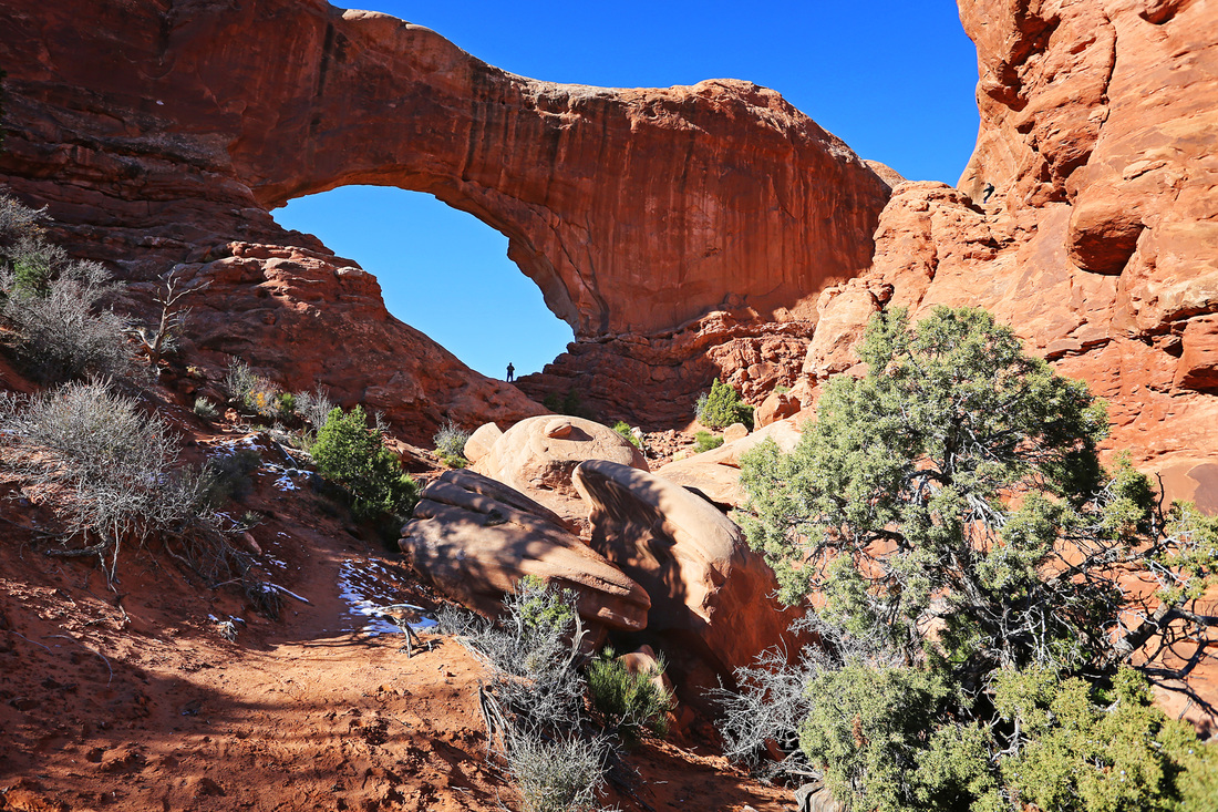
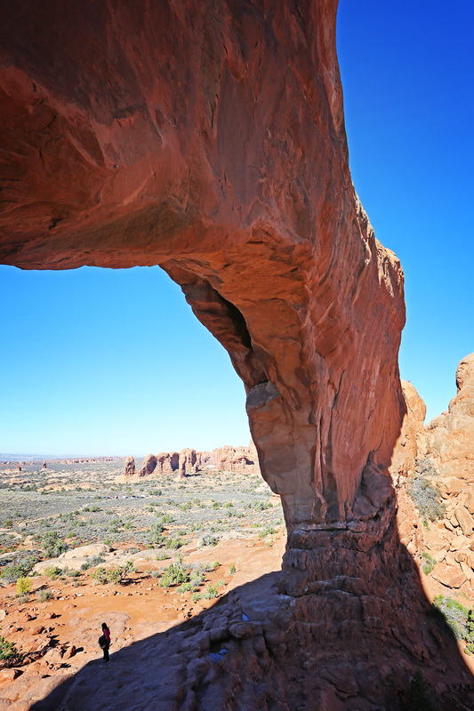
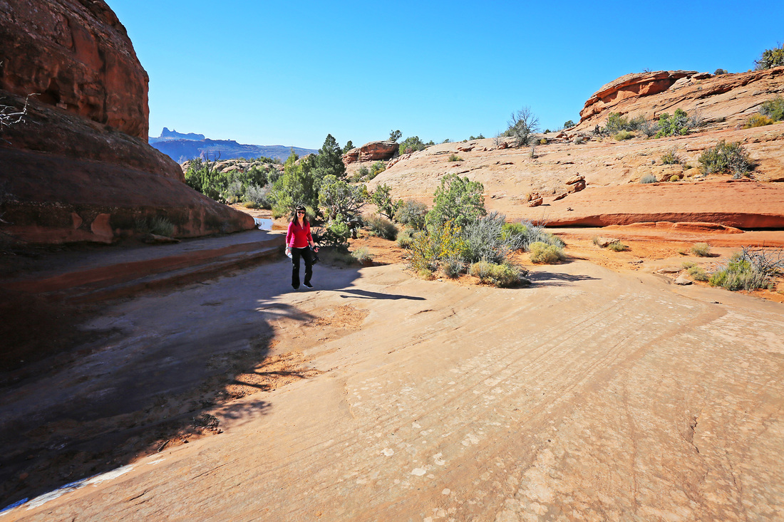
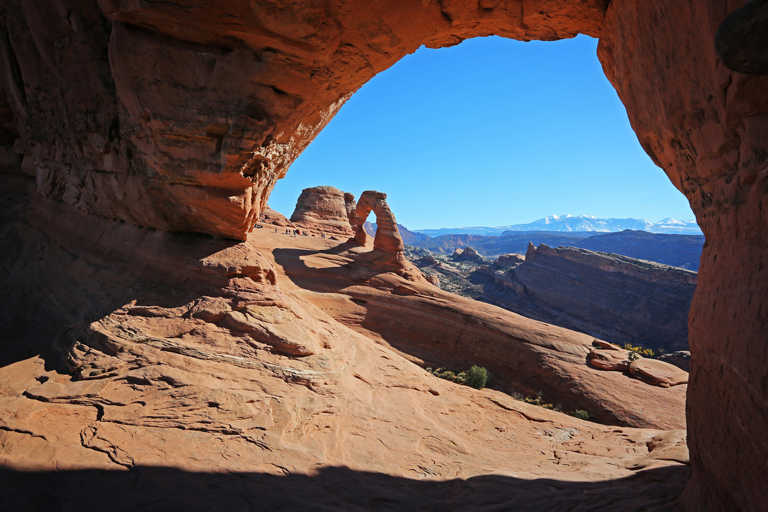
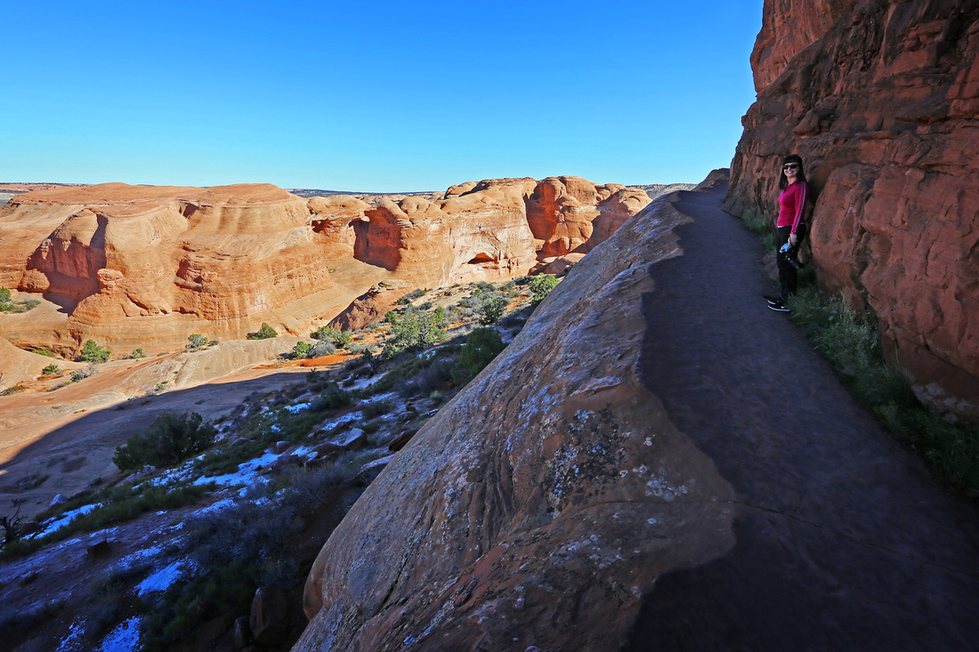
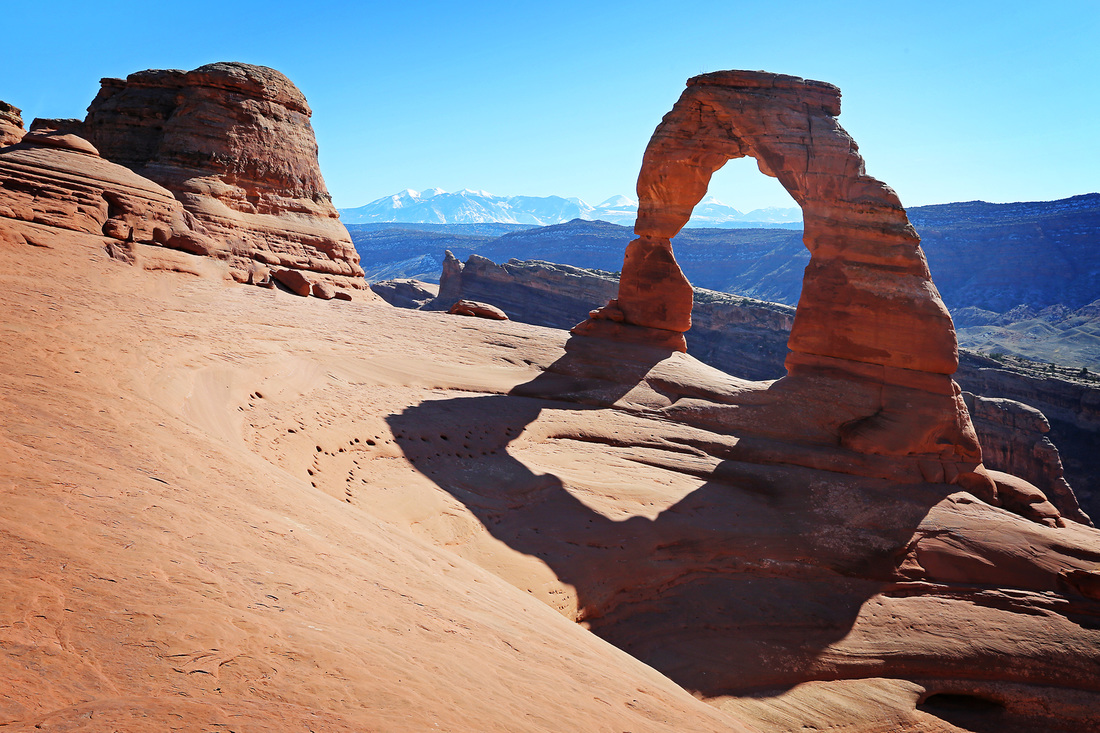
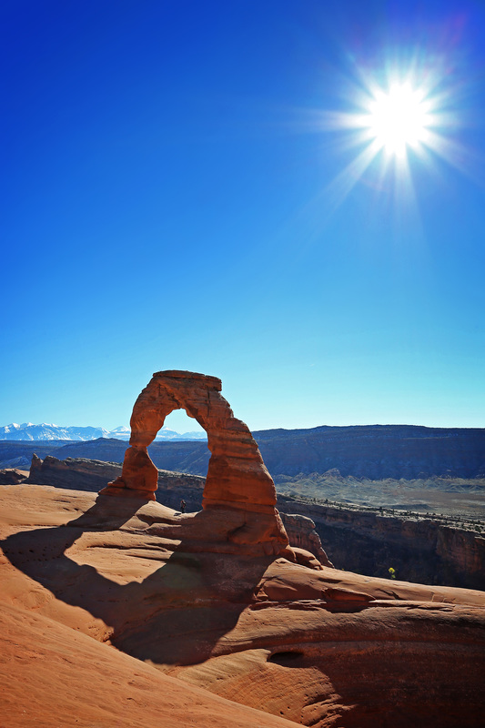
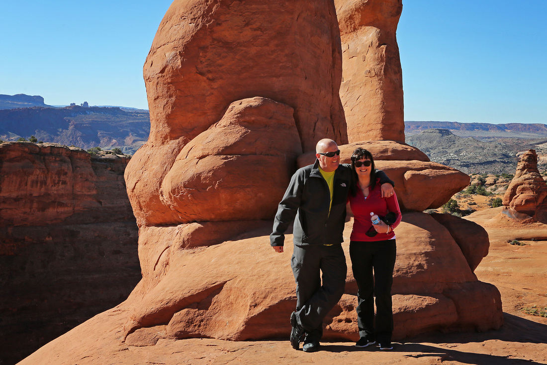
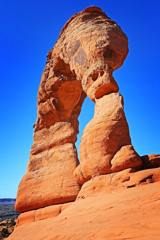
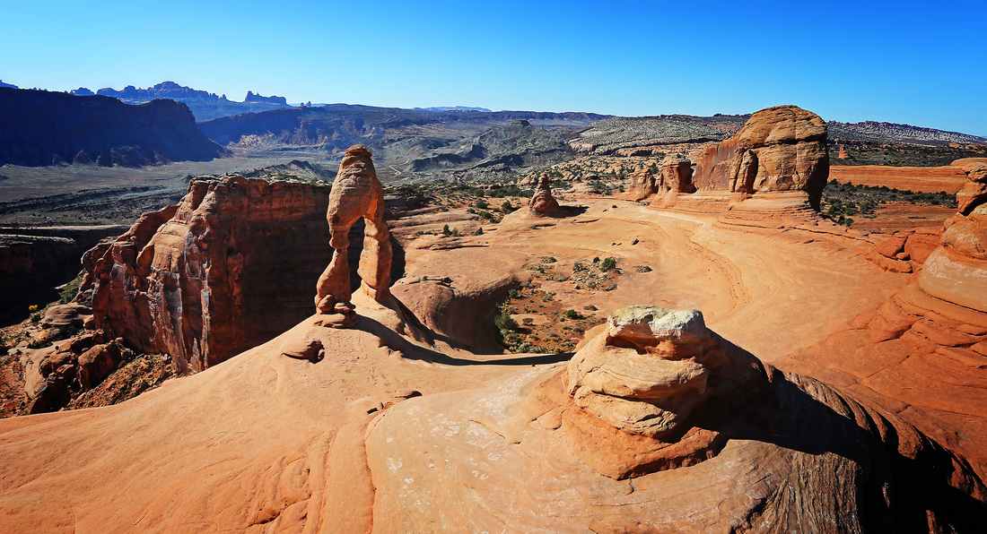
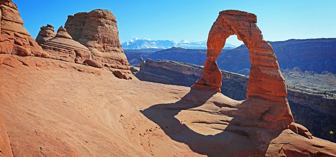
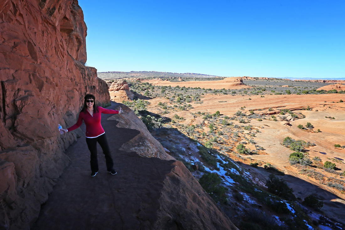
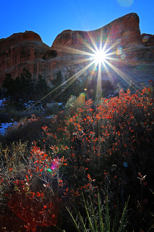
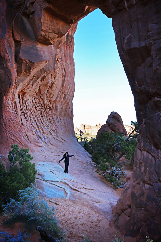
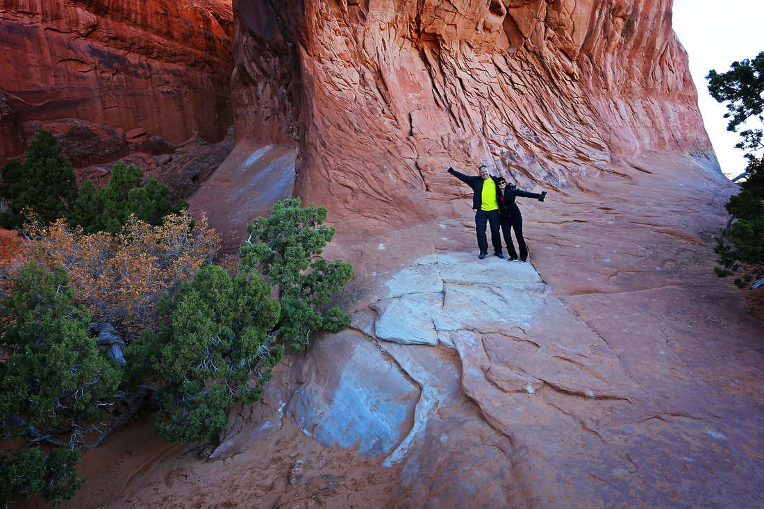
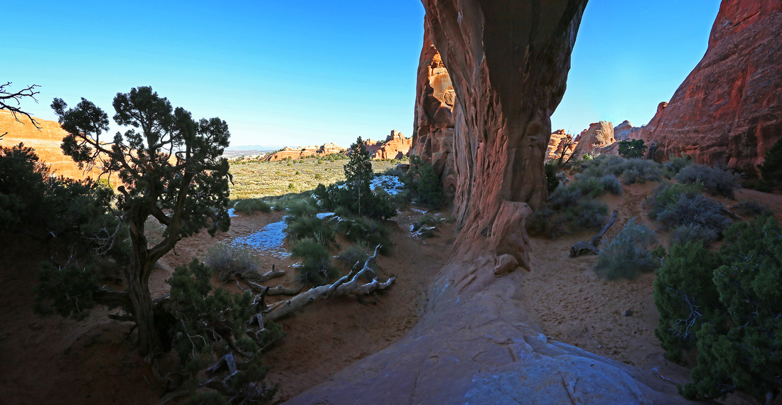
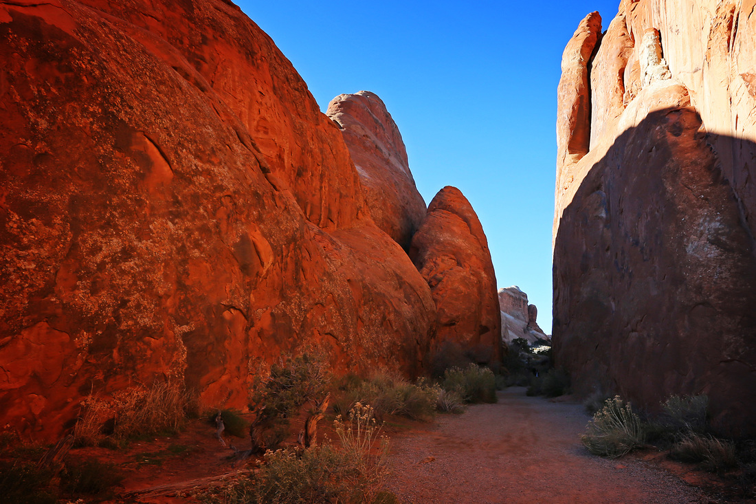
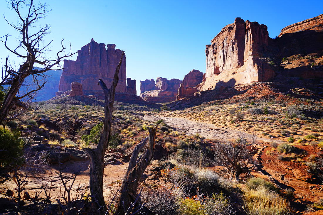
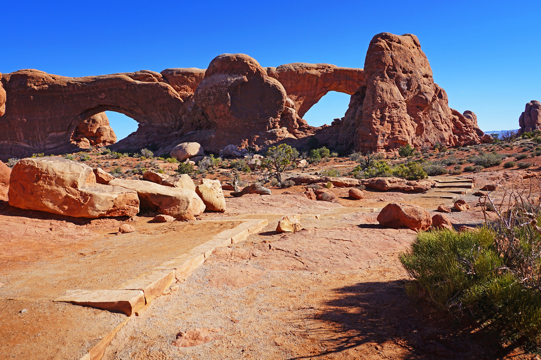
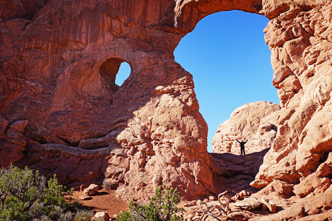
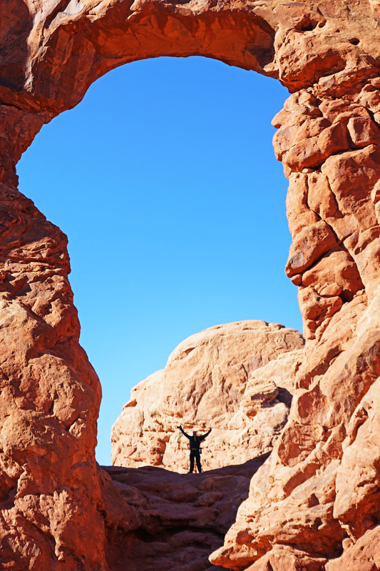
Day 7 saw us hitting another one of the main points of the trip, Arches National Park. Just a five miles north of Moab on US 191 is the entrance to one of the jewels of Utah. The entrance fee is good for a week and it would take a week to see it all if you undertook just a handful of the hike here. Sticking with our 'done in a day' theme we stopped off at all the major attractions of the park, hiked two of the moderate trails and dozens of the small trails along the way. By the time we were watching the sunset over the weathered stone Sarah had seen enough and I caught her snoozing back in the truck when I returned from a scramble up some nearby rocks. It was a fantastic day in a really impressive park, the main hike to Delicate Arch is a 'must do' if you come to the park, it's not easy even though the going is over good ground but once there you'll forget the grunt up the rocks and just sit and stare, Arches is a place I would recommend to anyone, in fact the whole Moab area is. At the end of the day we ate at a lovely place in Moab and returned to the same hotel for one more night.


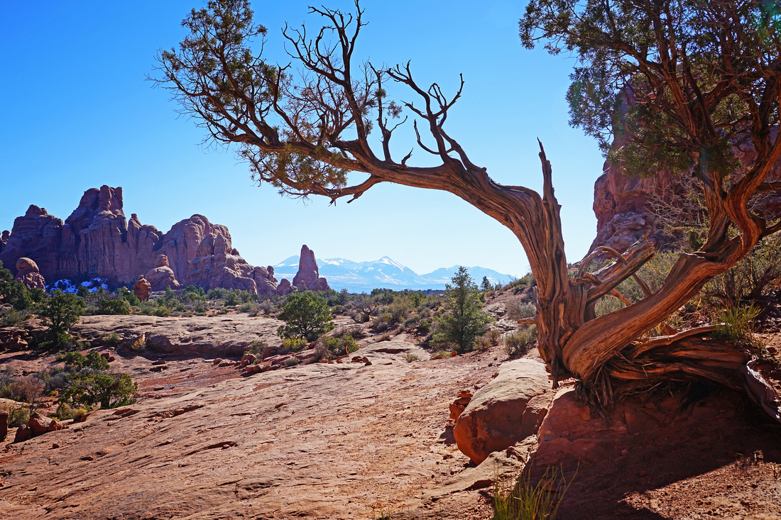
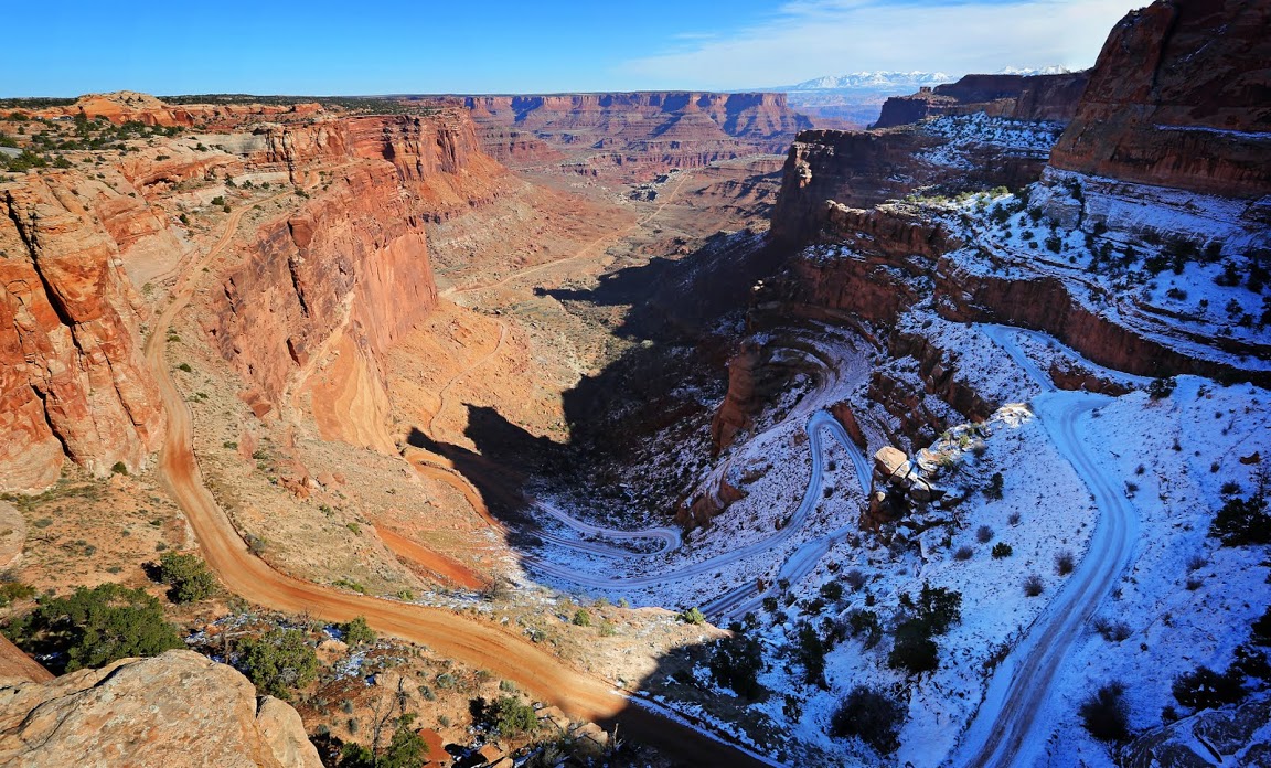
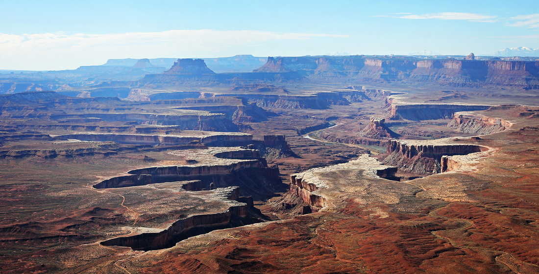
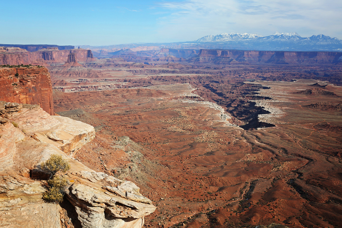
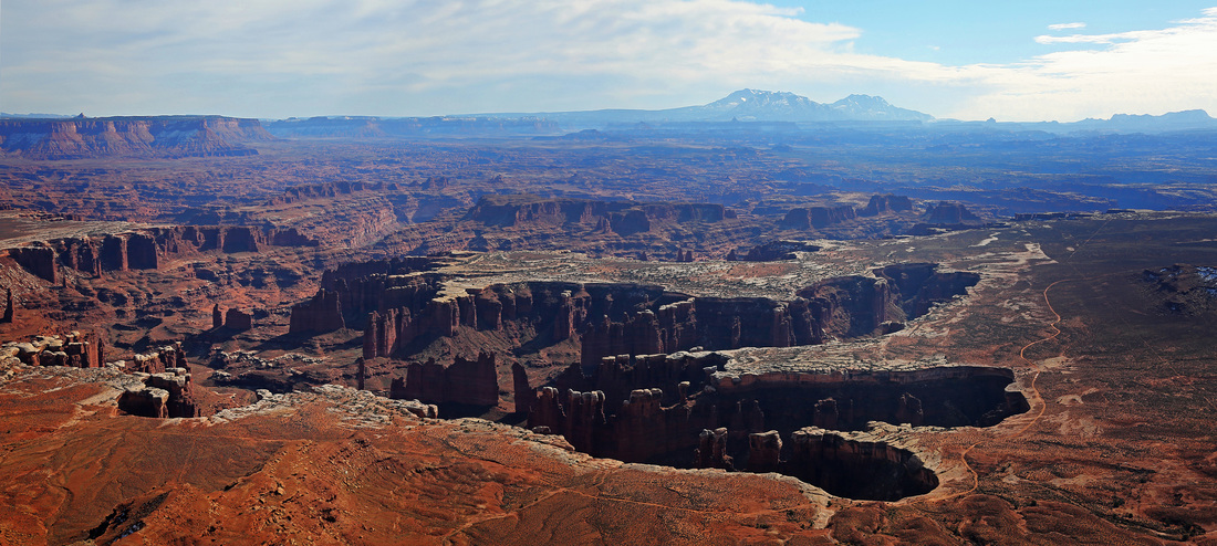
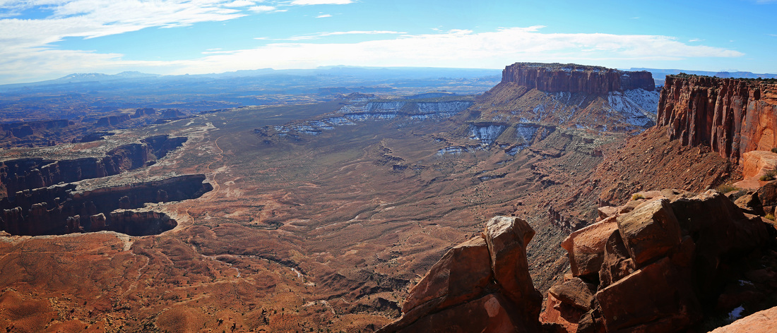
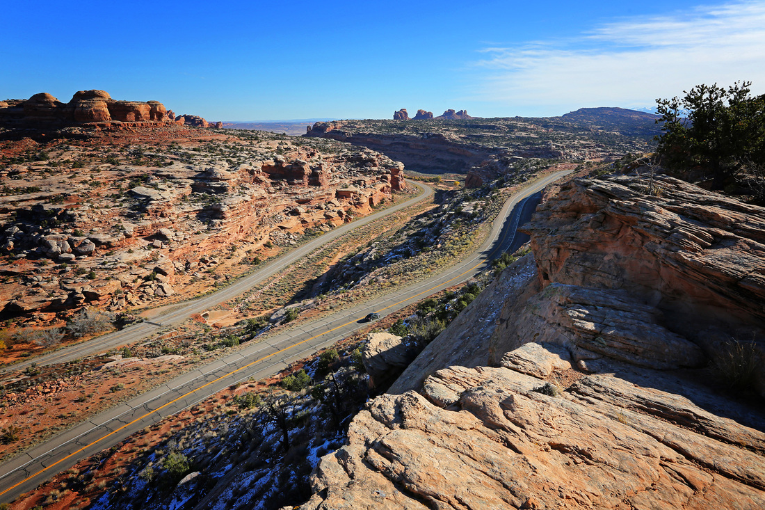
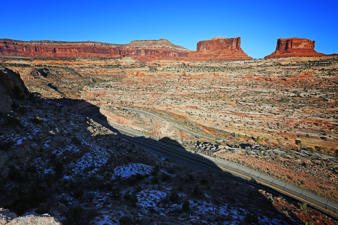
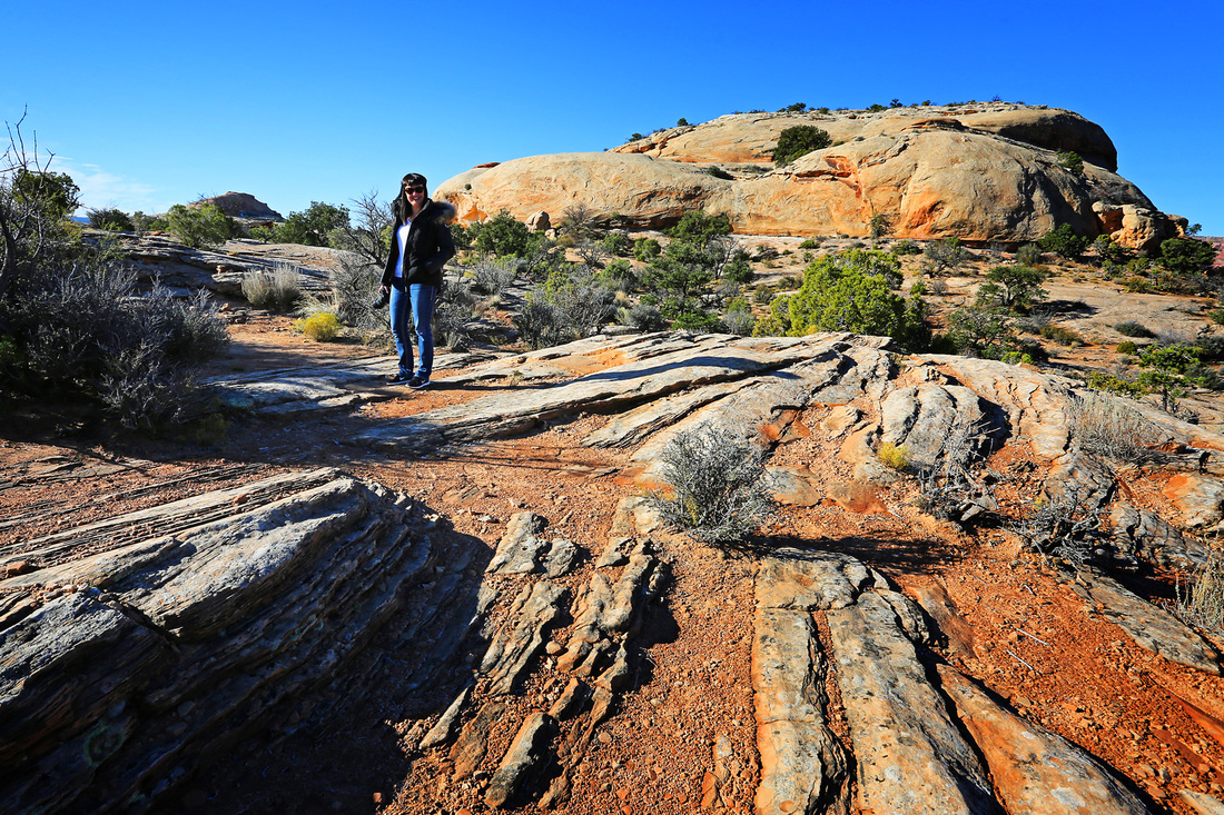
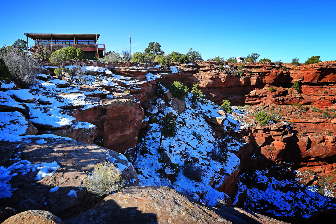
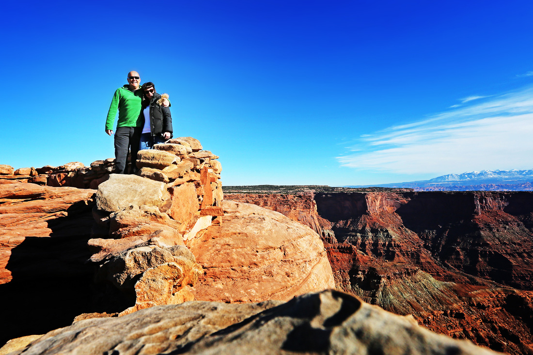
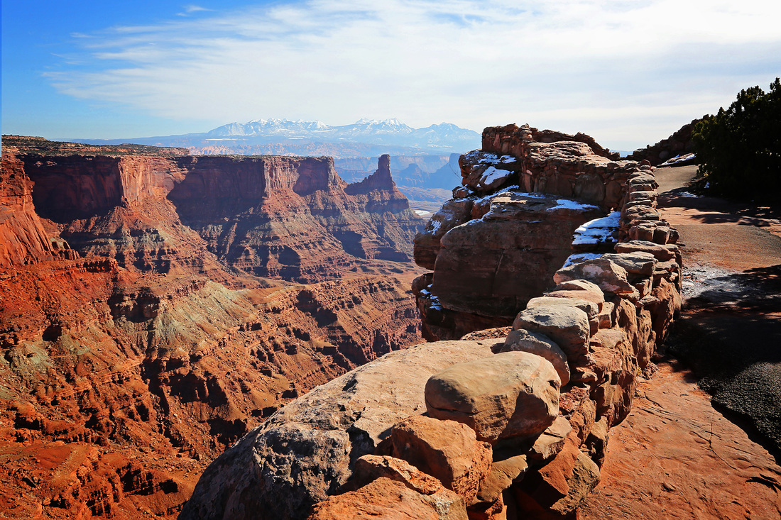
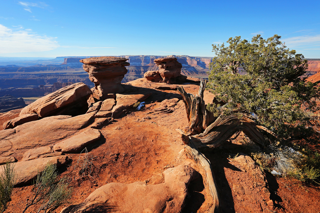
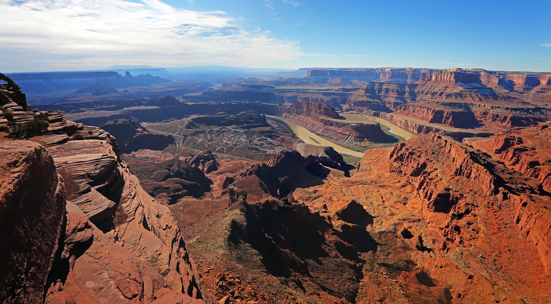
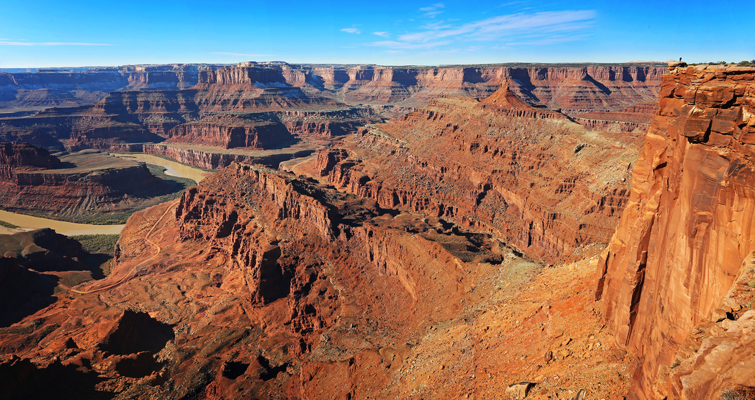
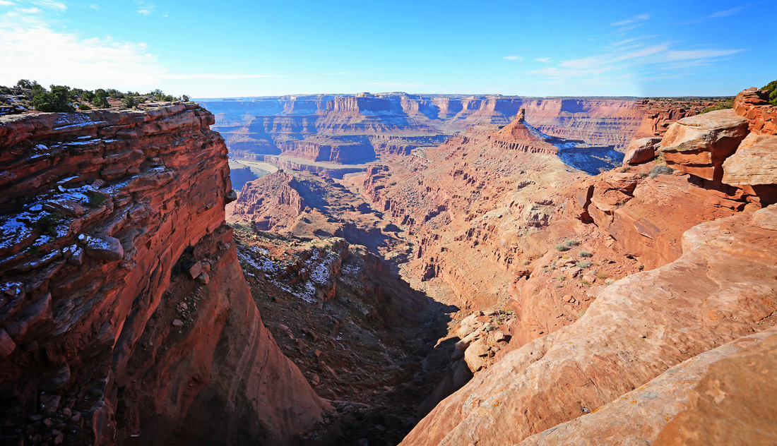
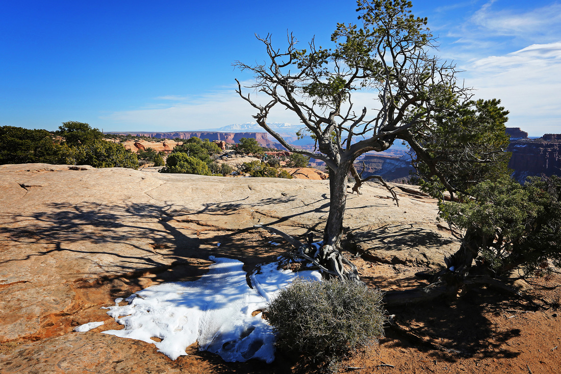
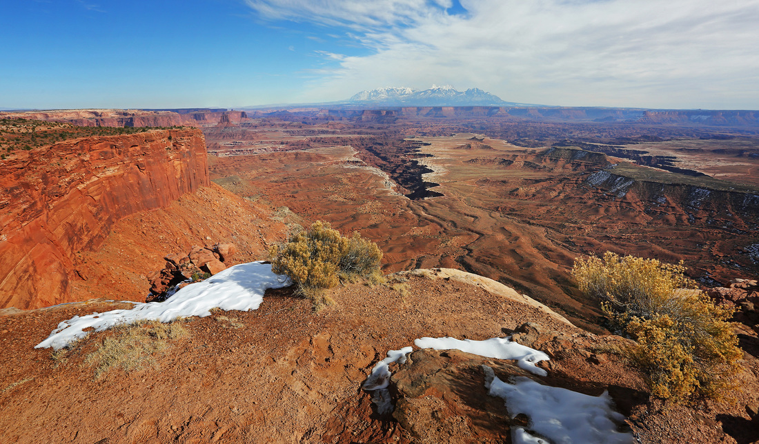
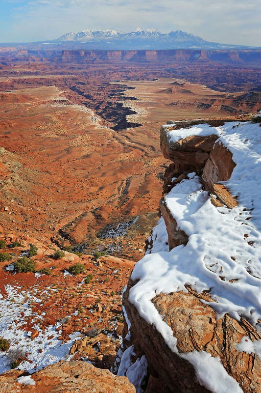
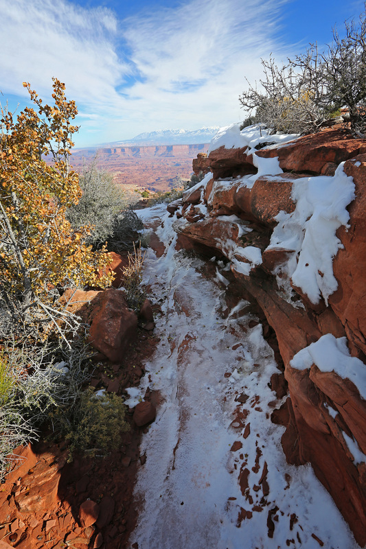
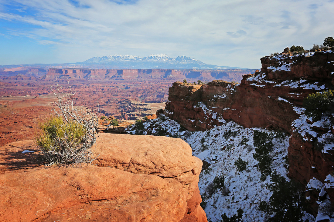
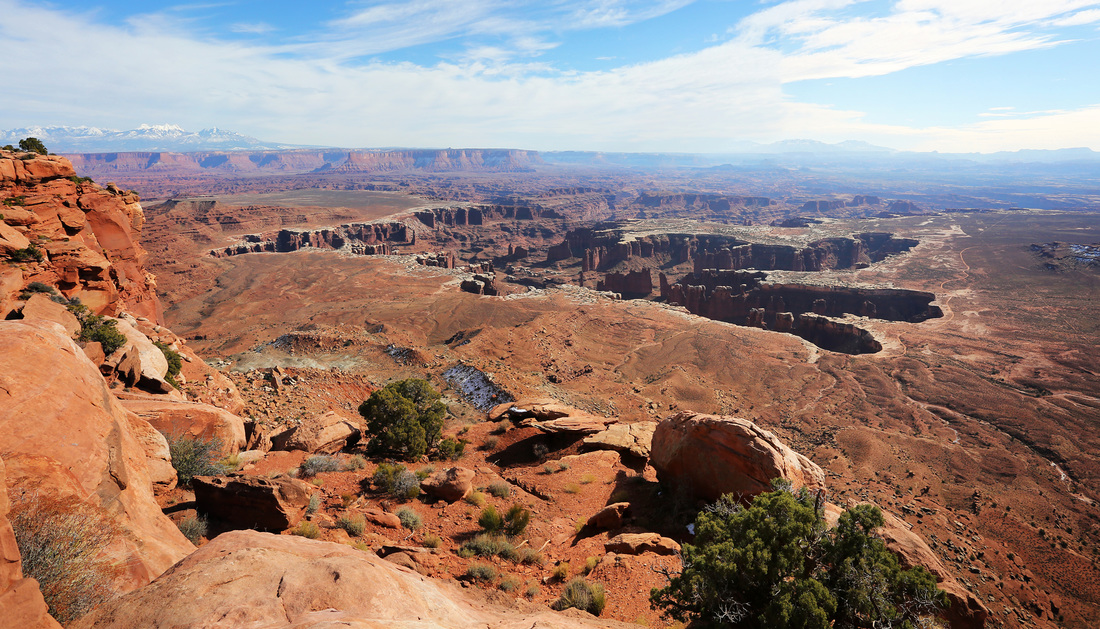
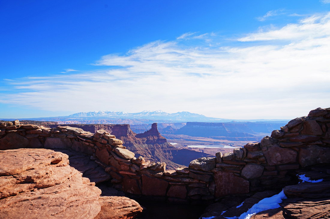
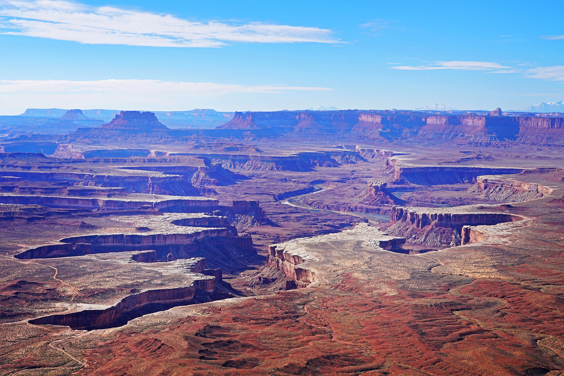
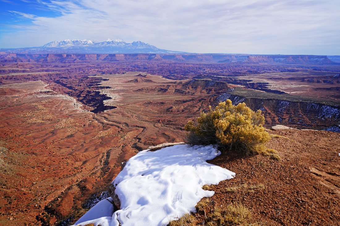
Day 8 was our last in the southern desert parks of Utah, we rose early and headed north to Canyonland National Park calling in at Dead Horse Point along the way. The park is well paced for us and allowed us to commence the return journey to Salt Lake City and drop in here on the way. I don't think the northern part of Canyonlands is a scenic as the southern section but still enjoyed the park they know as the "Islands in the sky". After visiting Canyonlands we continued north on US 191 to the town of Price where we stopped for our final overnight together before Sarah flew home.

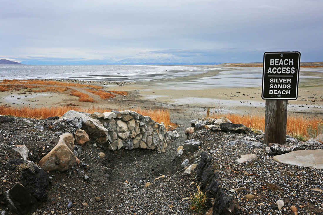
Day 9 was going to be our opportunity to see Antelope Island just northwest of Salt Lake City but the weather was poor once more so after our 2 hour return to the city we had lunch in a little cafe and then went to the movies to see the new Bond film "Spectre", I've got to say they know how to do a movie theatre in Salt Lake City; full reclining leather seats with two armrests per person. Before we knew it the holiday was over and I was dropping Sarah at the airport for her 8pm flight.
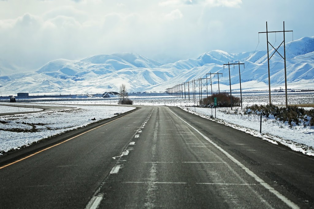
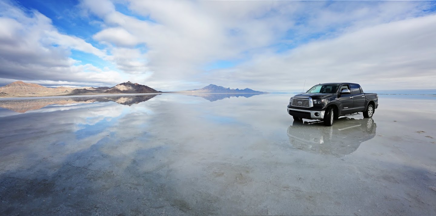
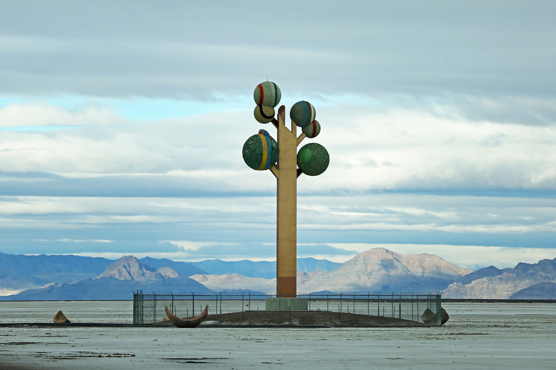
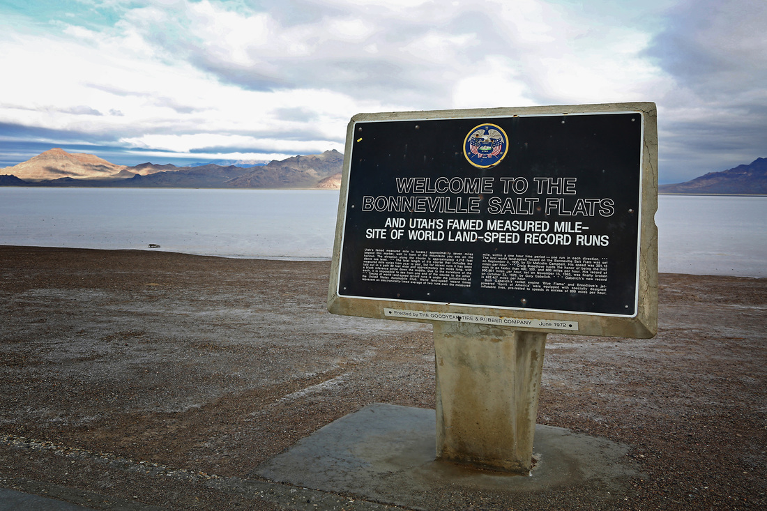
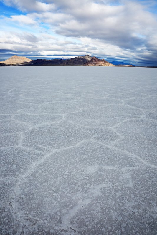
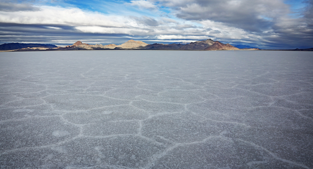
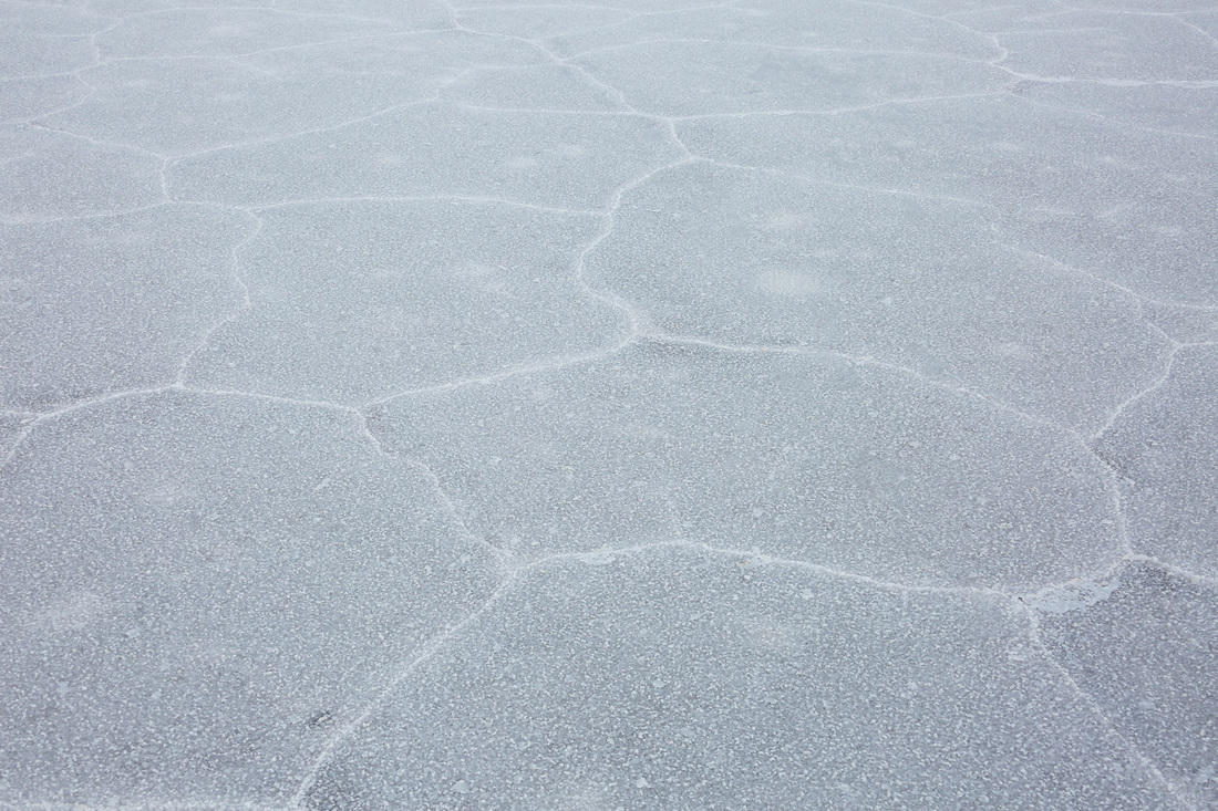
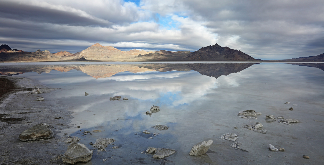
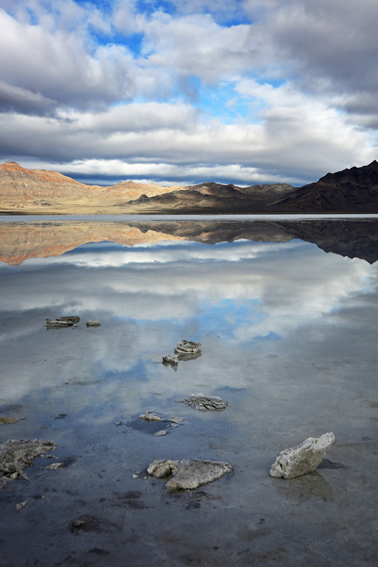
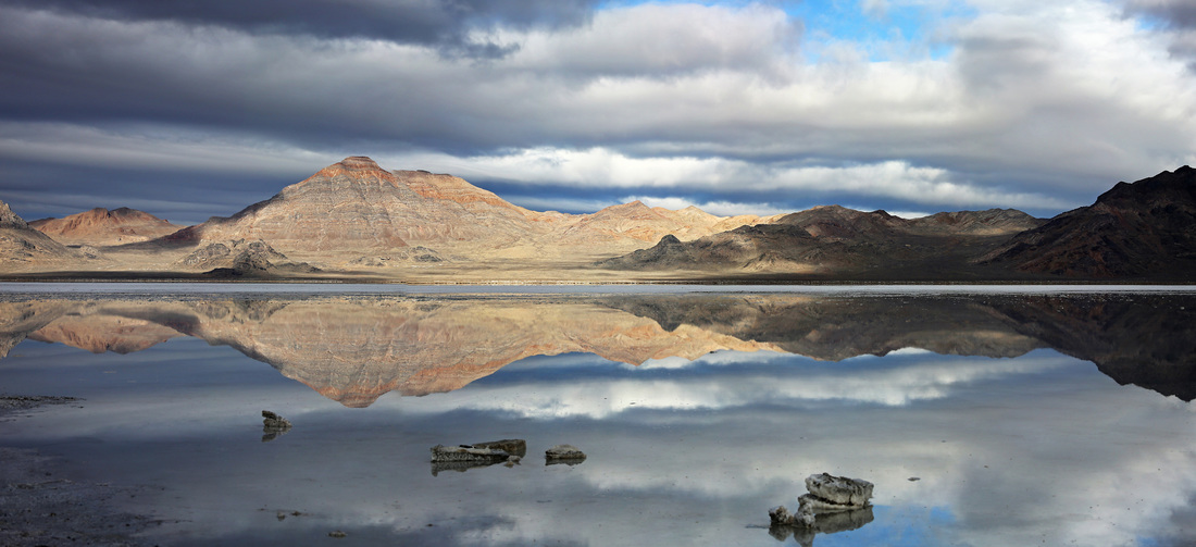
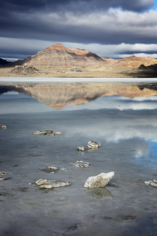
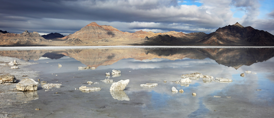
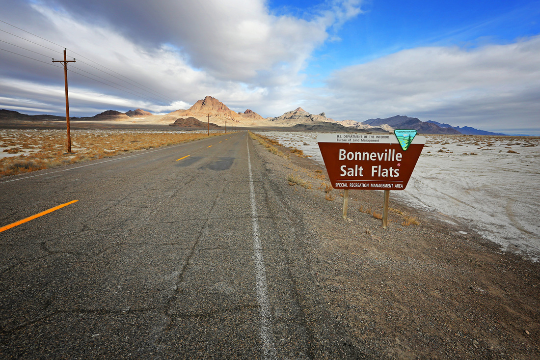
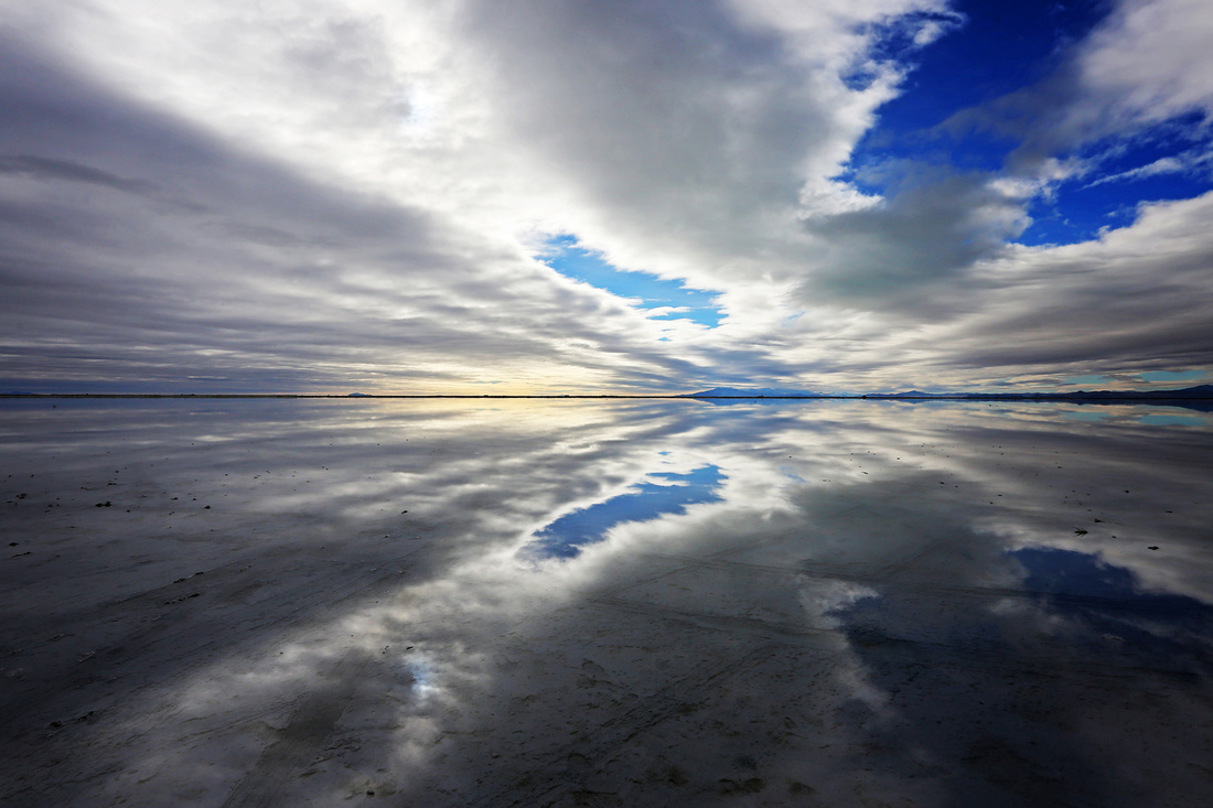
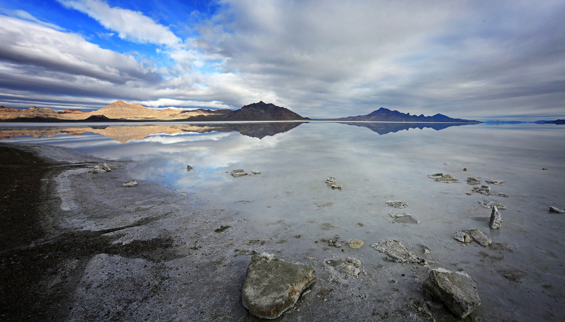
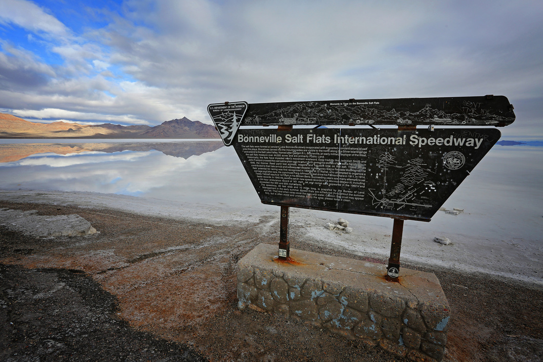
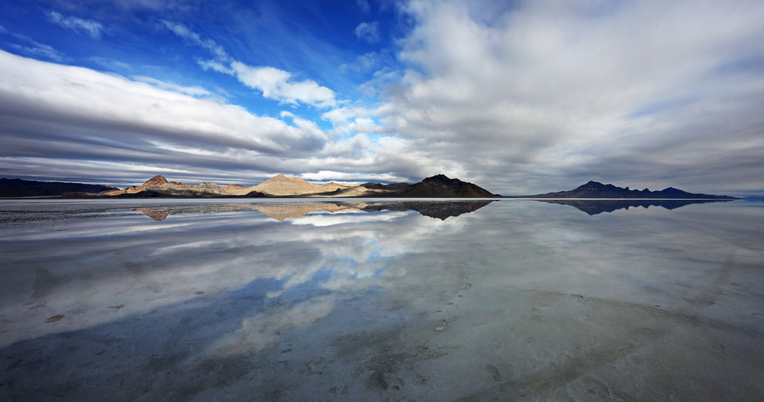
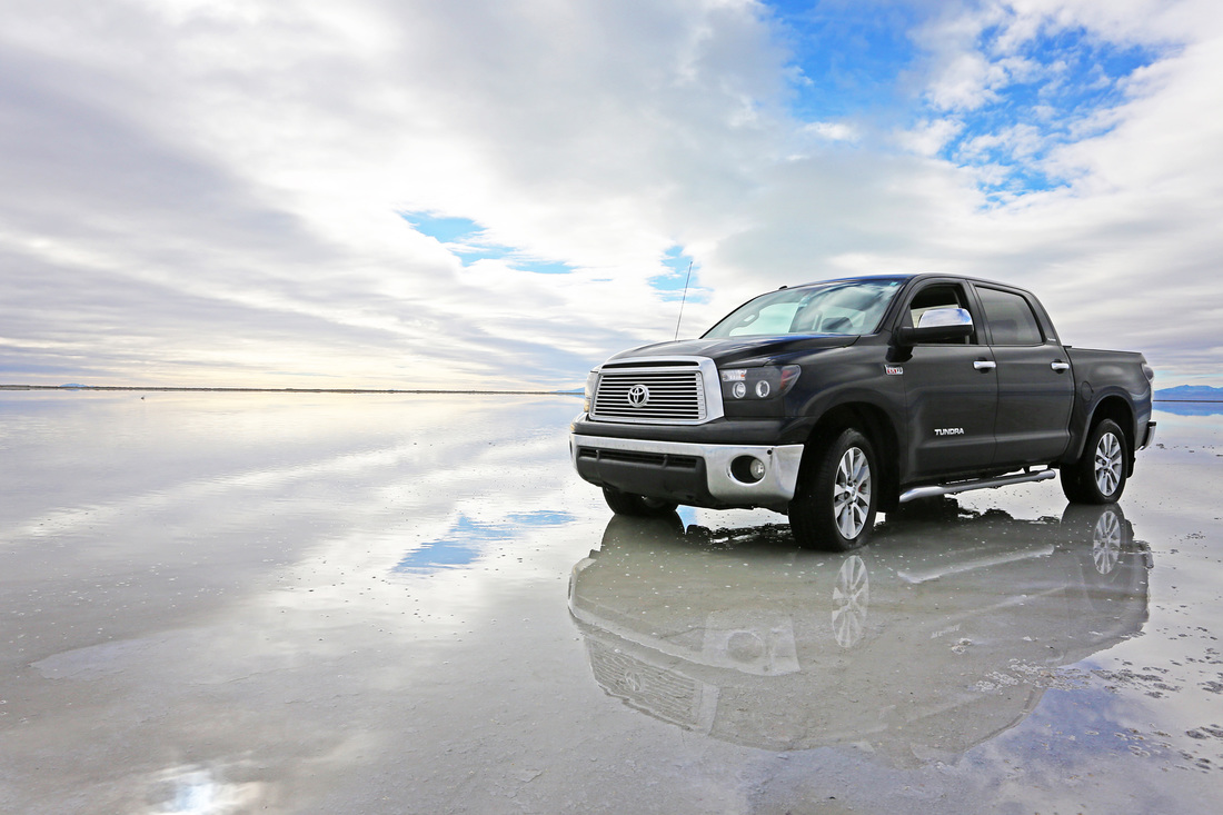
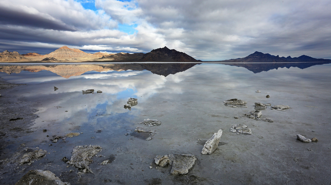
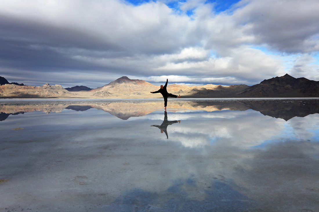
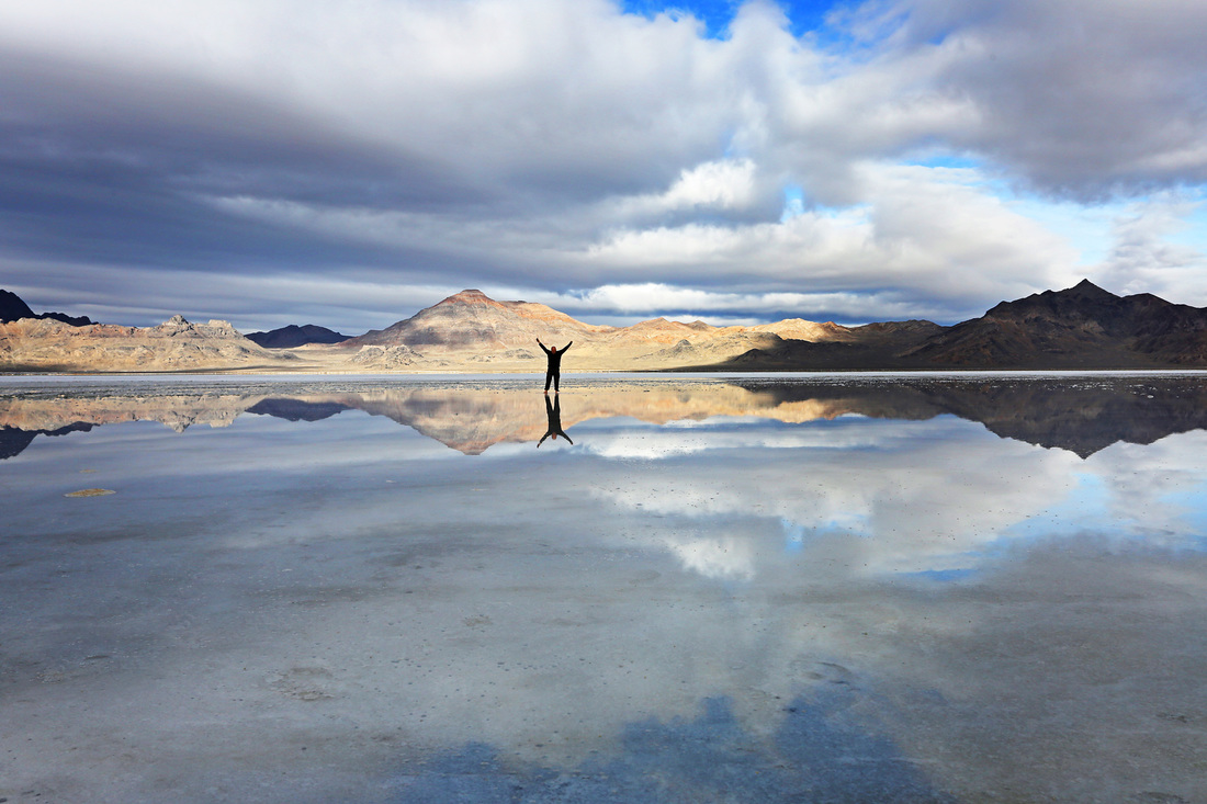
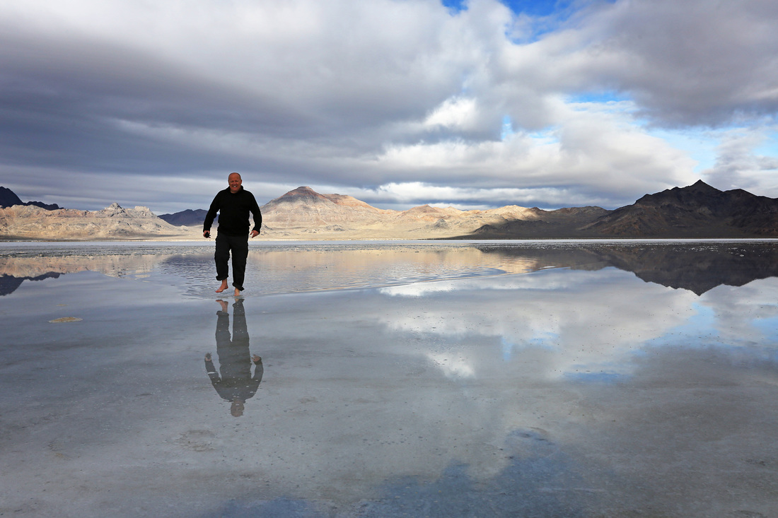
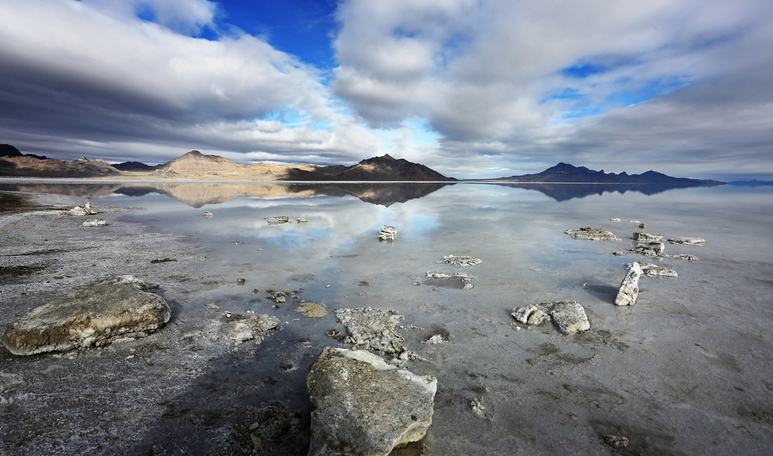
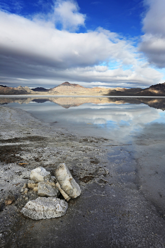
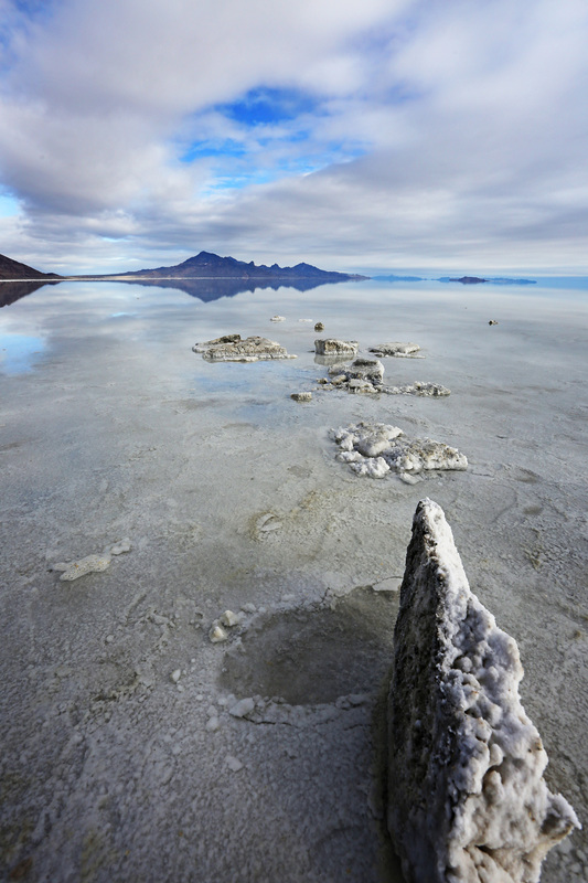
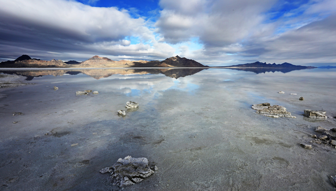
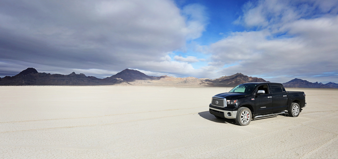
I stayed over in Salt Lake City once again before commencing the drive home. When I got up on the morning of day 10 the city was still shrouded in cloud but I couldn't let the day go by without making an effort to see Bonneville Salt Flats. I decided to begin my route home by heading west on I 80 for 1.5 hours to the home of the land speed record, I just hoped that the cloud might break and luckily for me it did. I spent a good hour or two messing around on the salt flats including thrashing the Tundra along the measured mile and back with the rev counter passing the red and going into the 'please stop' area before I finally called it a day and began the journey home.
I stayed over in Salt Lake City once again before commencing the drive home. When I got up on the morning of day 10 the city was still shrouded in cloud but I couldn't let the day go by without making an effort to see Bonneville Salt Flats. I decided to begin my route home by heading west on I 80 for 1.5 hours to the home of the land speed record, I just hoped that the cloud might break and luckily for me it did. I spent a good hour or two messing around on the salt flats including thrashing the Tundra along the measured mile and back with the rev counter passing the red and going into the 'please stop' area before I finally called it a day and began the journey home.


I drove to Butte Montana at the end of day 10 and stopped overnight in a hotel there, when I rose in the morning freezing rain had sealed the doors to the truck and a blizzard was in full force. 75 mph winds and white out conditions meant the first 4 hours of the journey home on day 11 was all concentration and little fun. Luckily as I crossed the US/Canada border the snow stopped and a little blue sky brightened the remainder of the journey, so much so that I stopped in at Waterton Lakes National Park for lunch before making the final leg home and ending another fantastic road trip.