|
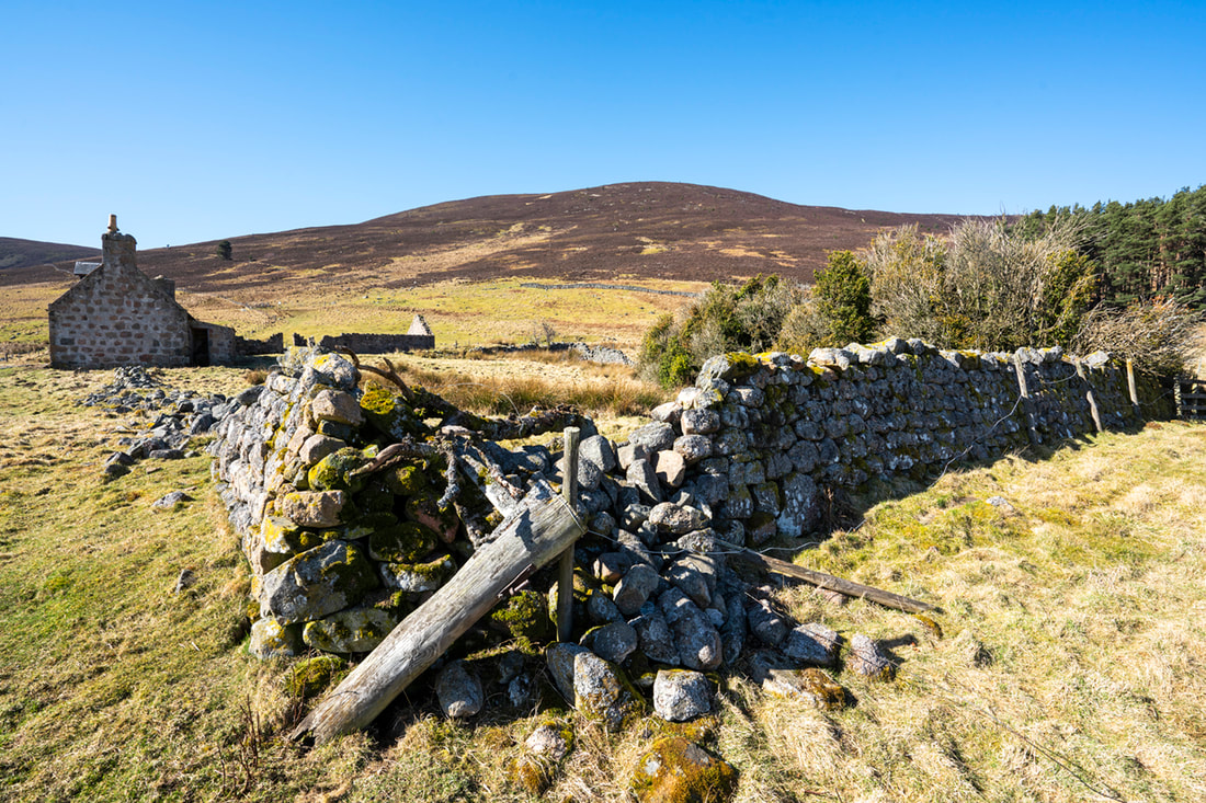
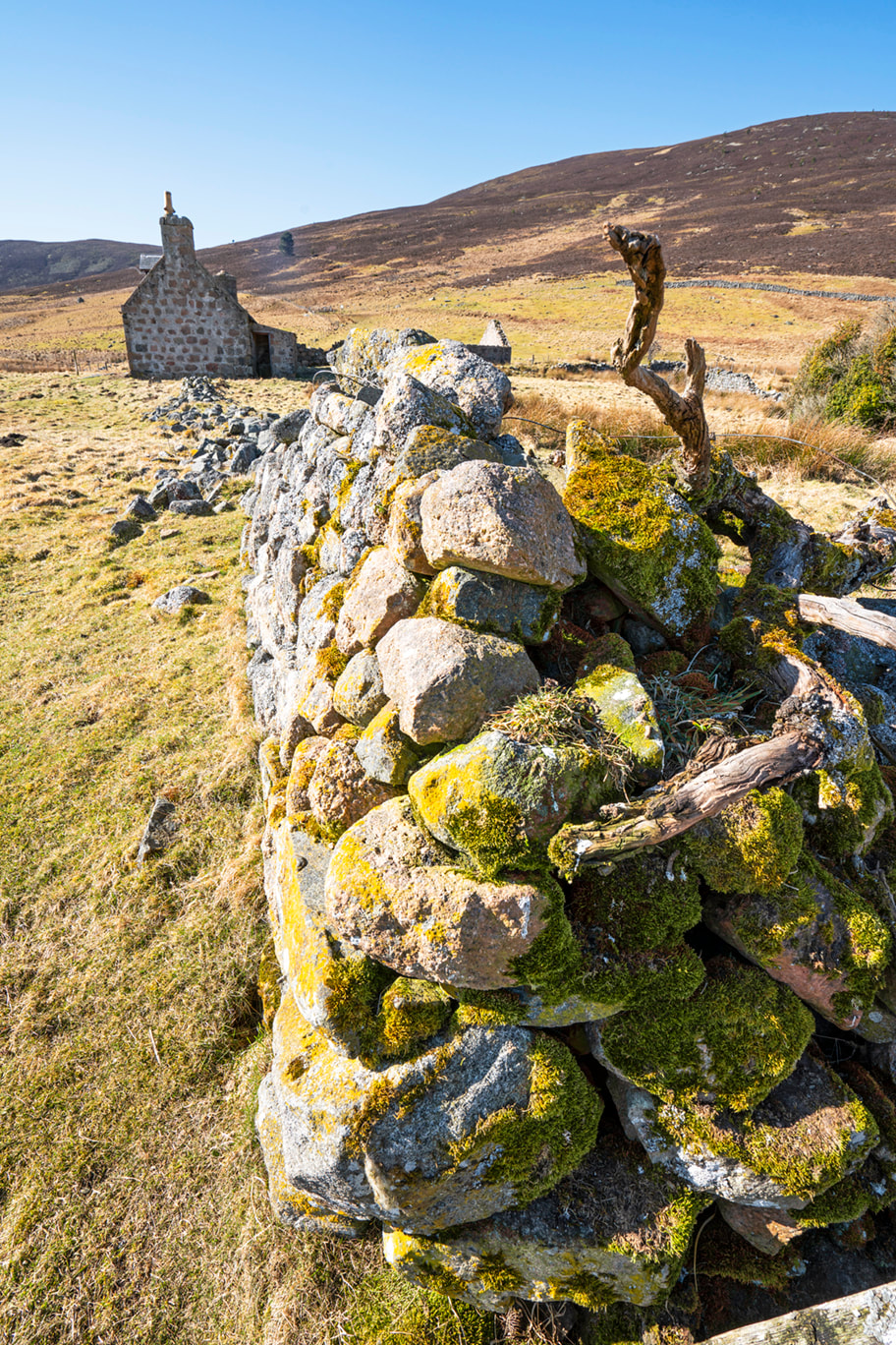
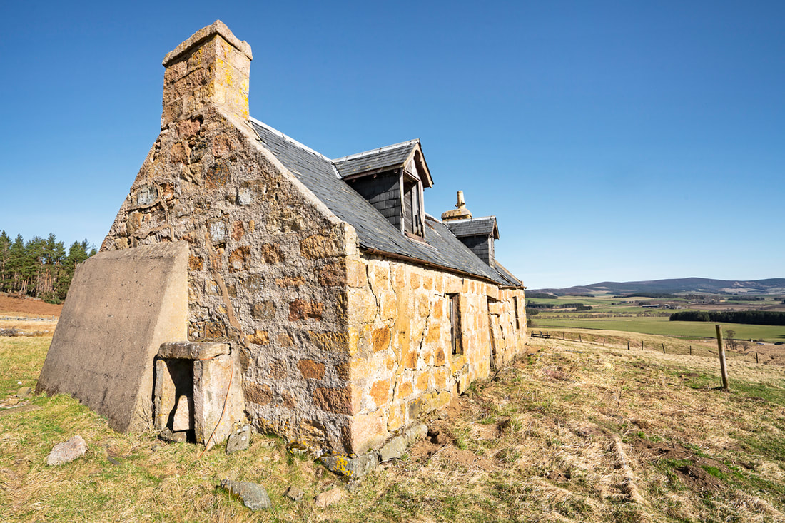
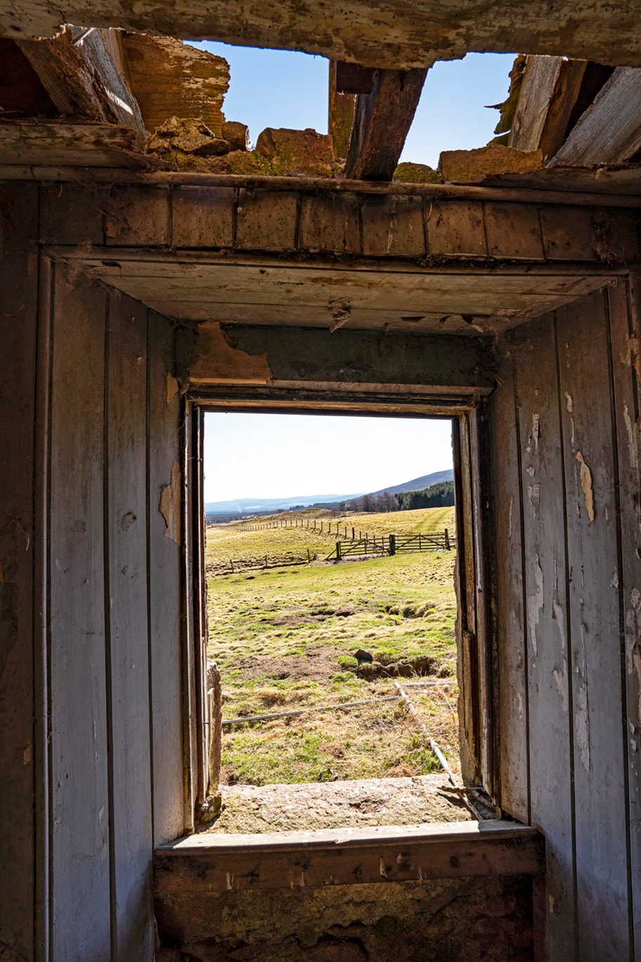
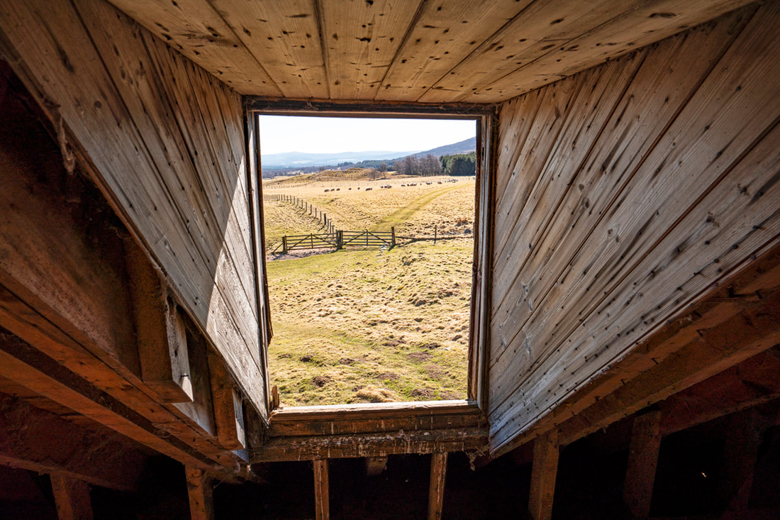
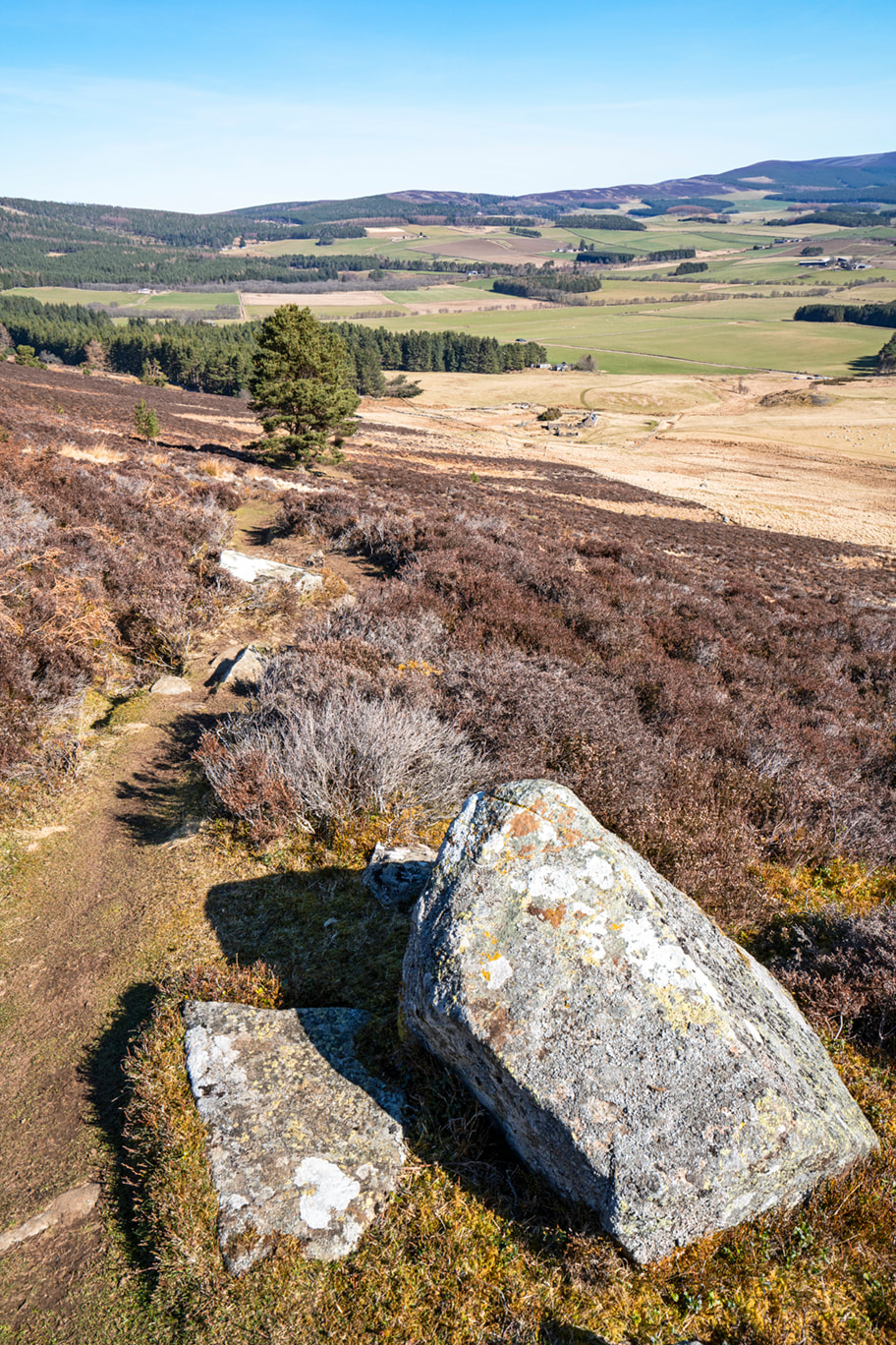
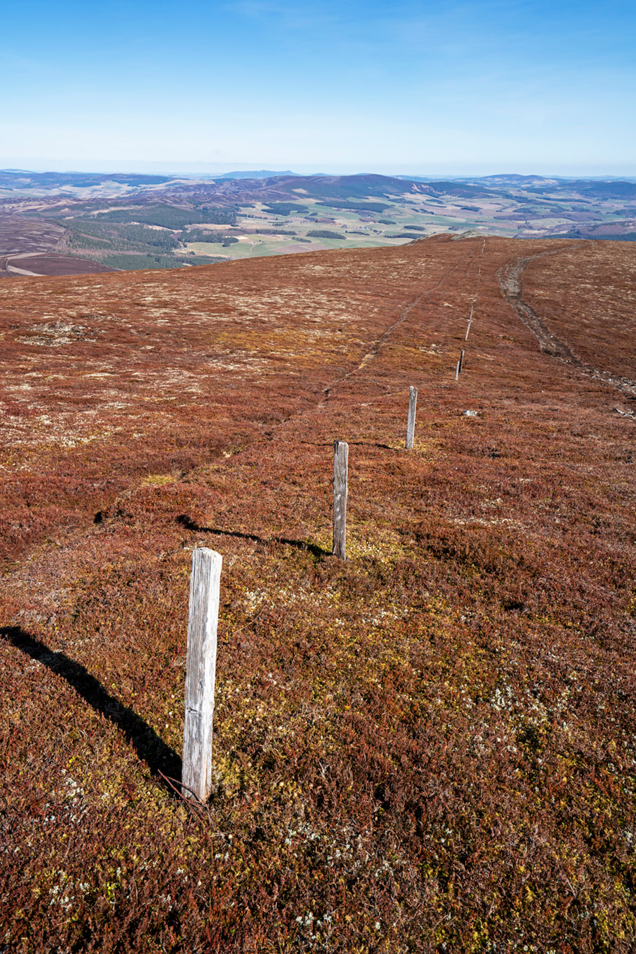
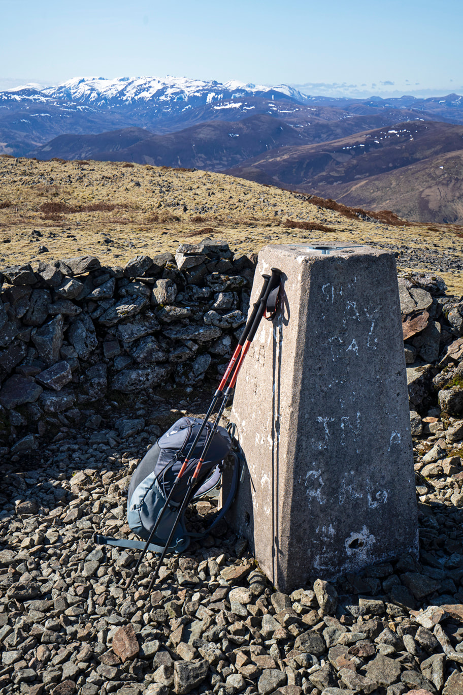
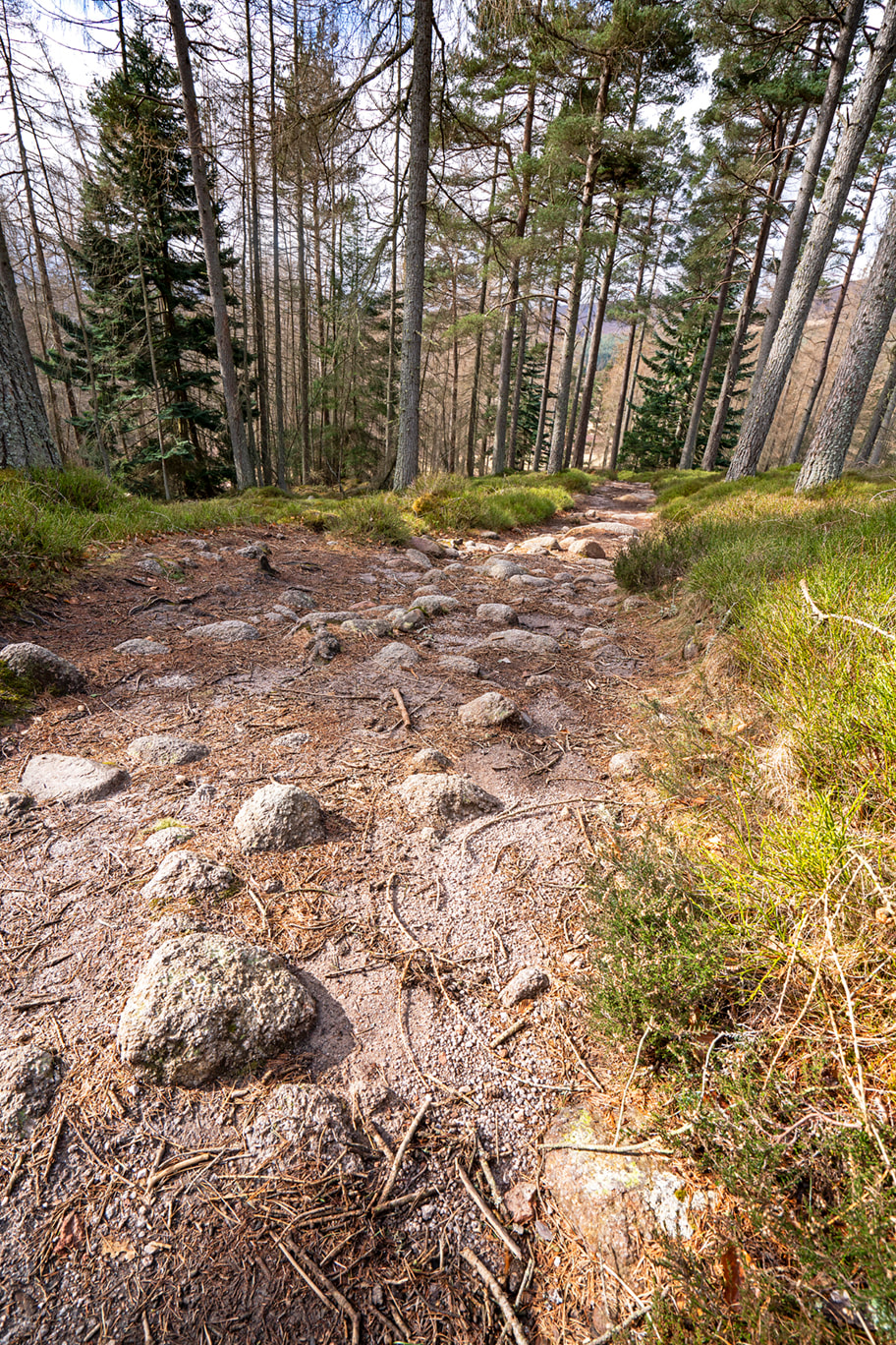
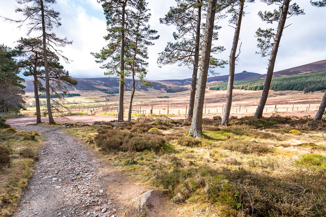
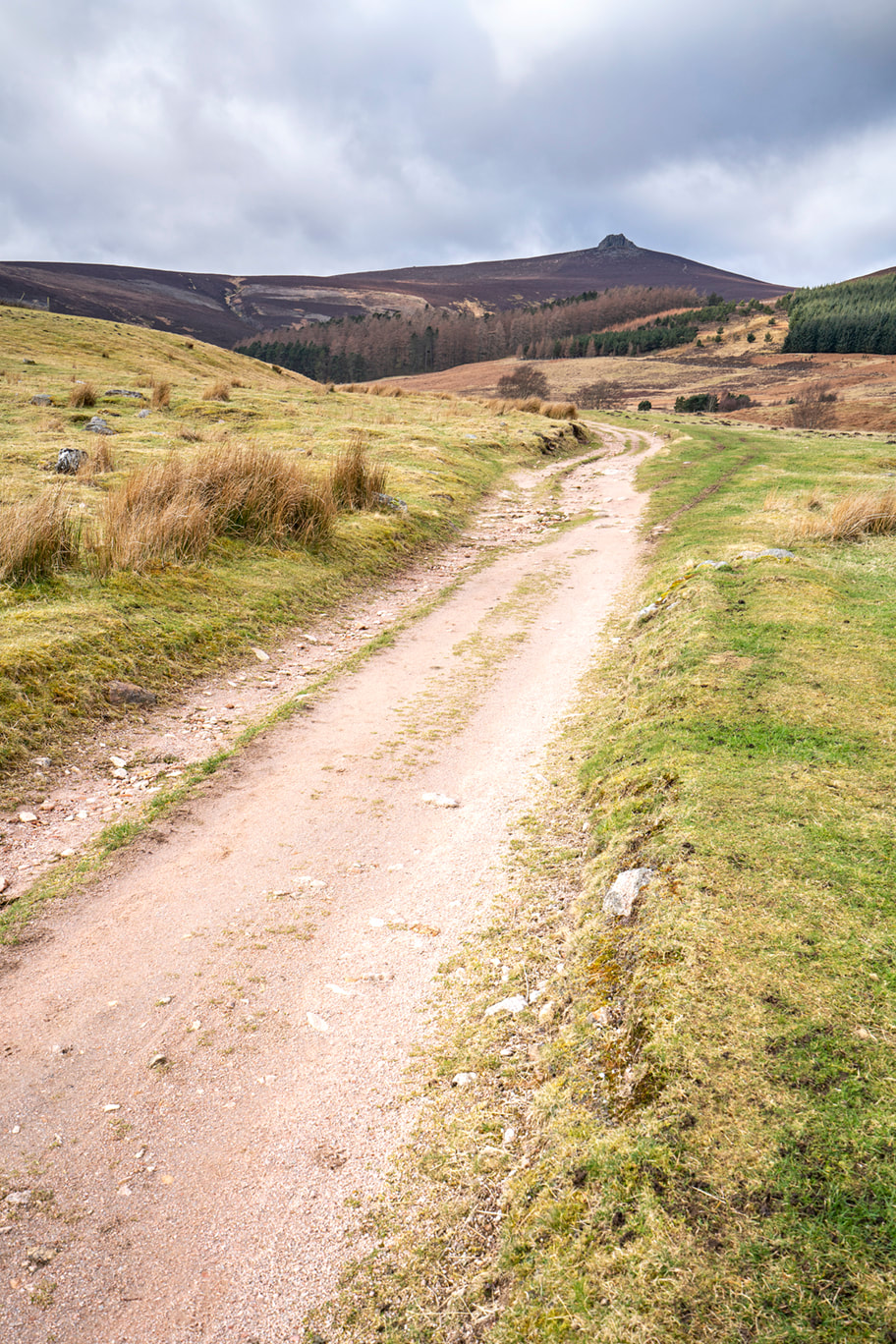
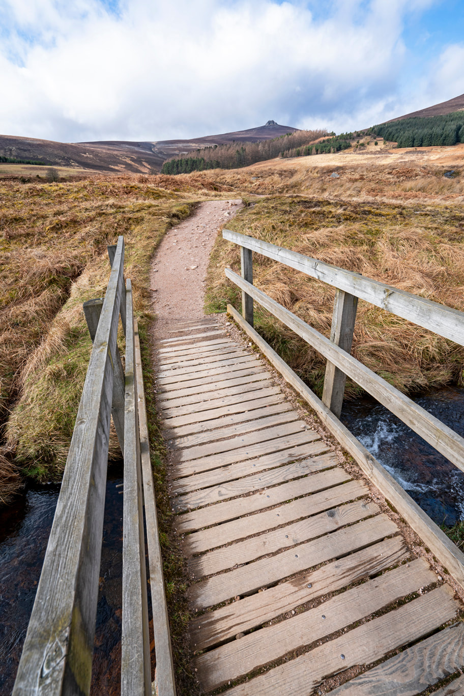
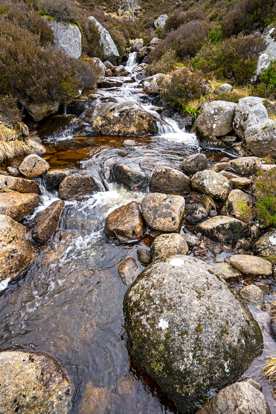
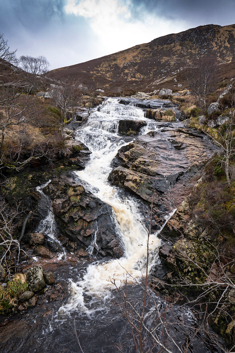
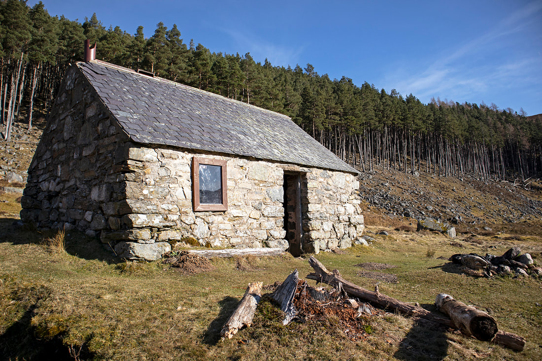
Excuse the play on words in the title, but it had to be done. Morven is a perfect remote hike, or should I say remote feeling hike. As a mountain it's a little small at 871 metres and yet the name Morven translated to English from Scottish Gaelic is Big Mountain. Indeed, it was big enough to catch the eye of Lord Byron who spent time here as a child and captured the memory in his poem "When I roved a young highlander" When I Rov'd A Young Highlander o'er the dark heath, And climb'd thy steep summit, oh Morven of snow! To gaze on the torrent that thunder'd beneath, Or the mist of the tempest that gather'd below..... There are two routes up this attractive bump, a very steep direct assault on the summit mound from the meadow below; or my preferred and far more enjoyable route that meanders along the hillside, around the back, and up a more gentle approach. This gives a much longer hike, which is always my preference, and allows a circuit to be made using the steep ascent route to descend. I last made this hike in March 2011 and little has changed from then to now, with the exception of the little cottage in the meadow at the start of the hike, which is unfortunately, far more dilapidated than it was 11 years ago. There are enough images in the gallery below to give you a feel for this 11km round trip, for those seeking more detail the link in the paragraph above will take you to a description of the full hike made in 2011. 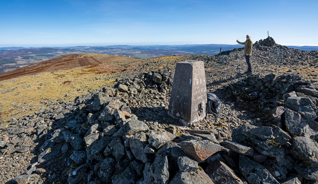
0 Comments
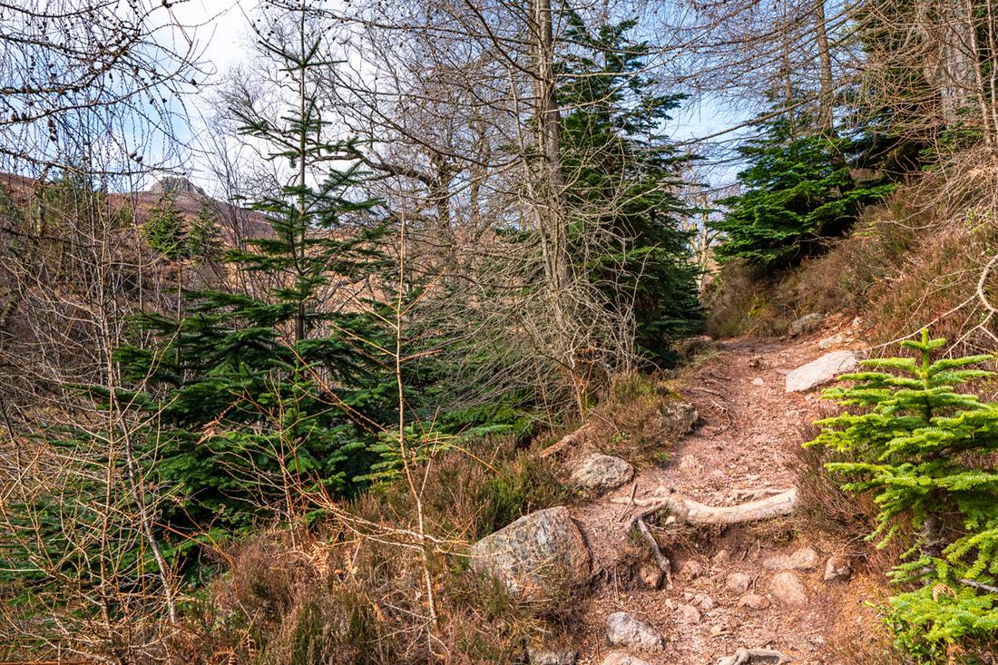
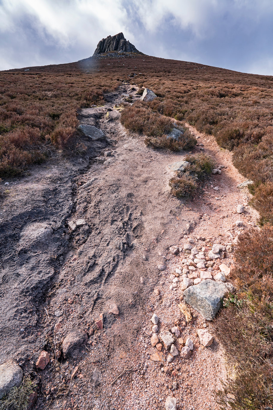
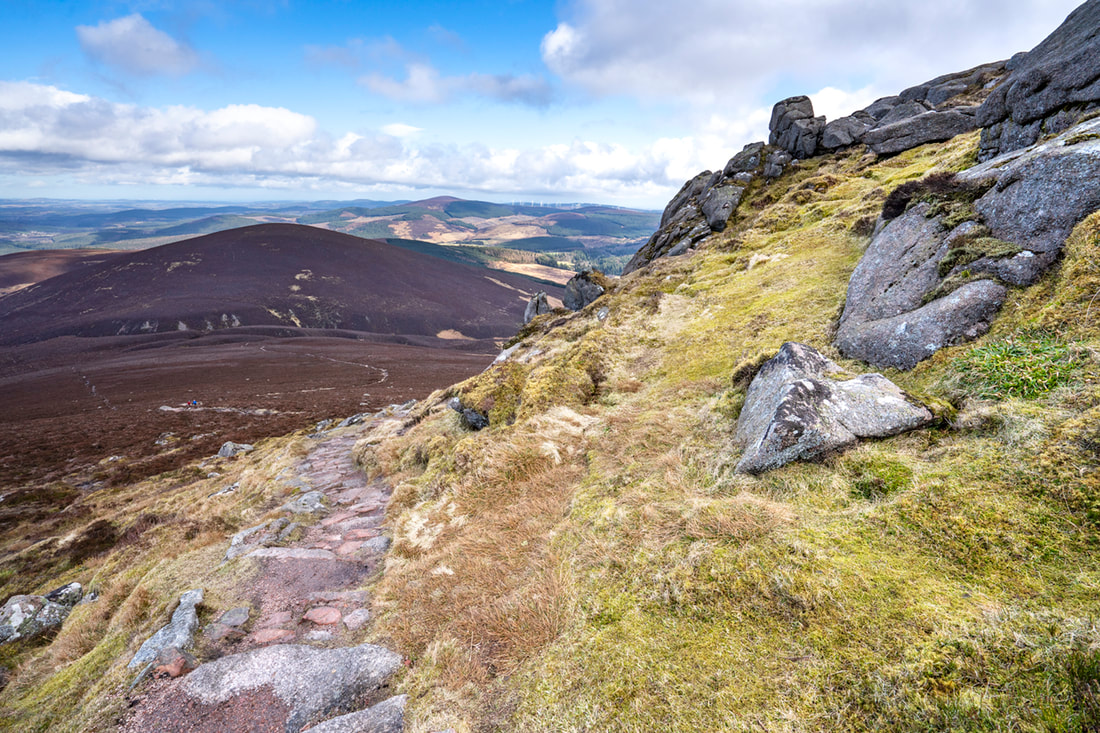
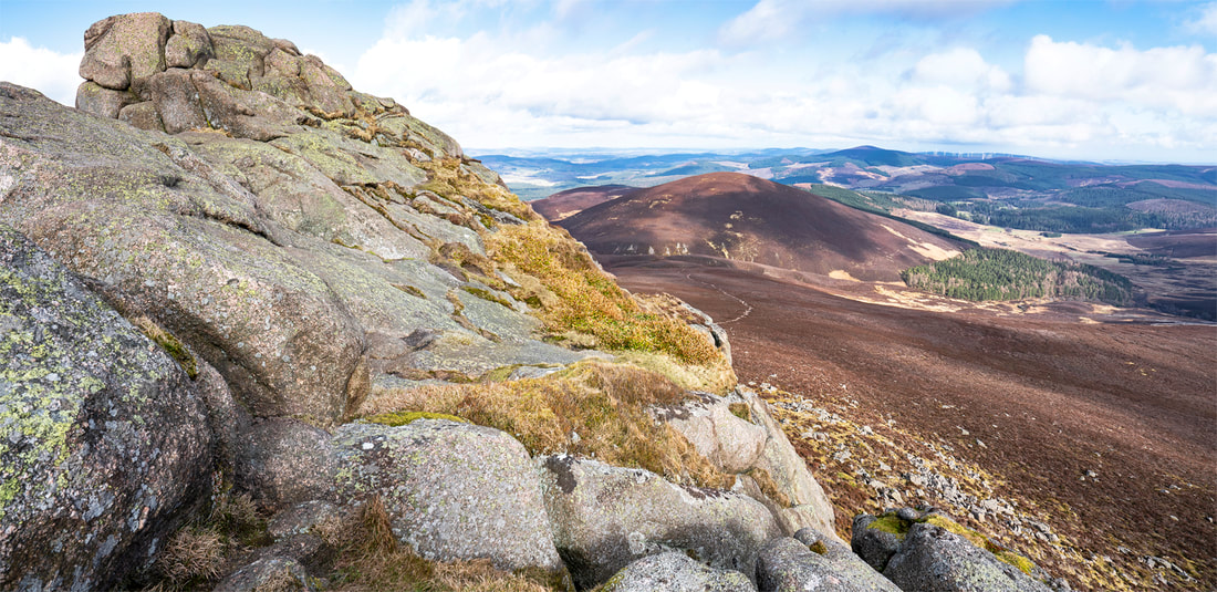
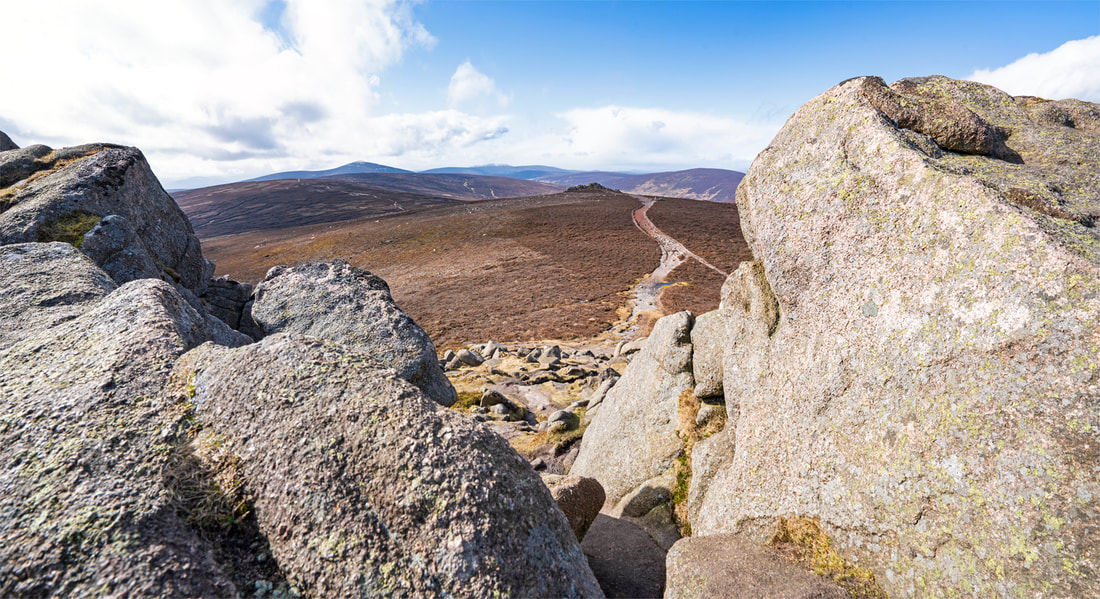
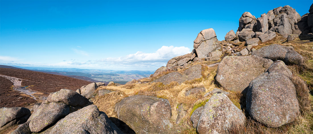
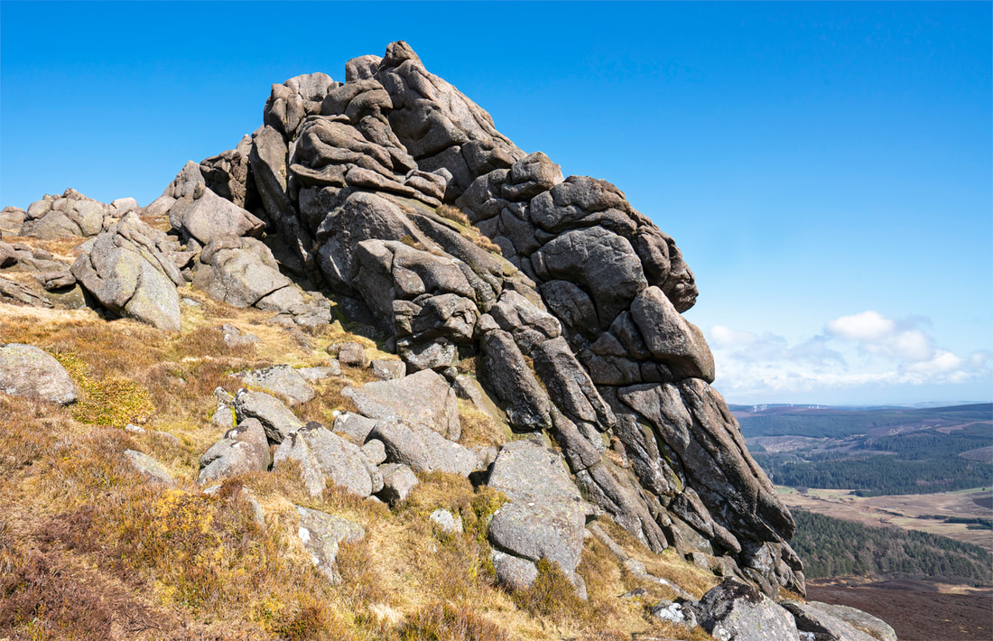
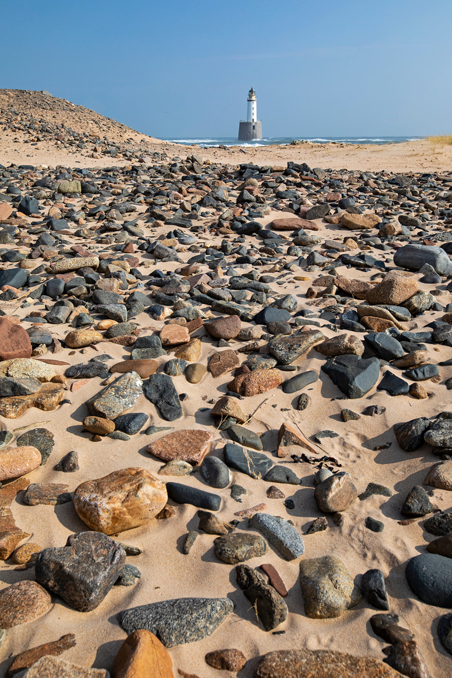
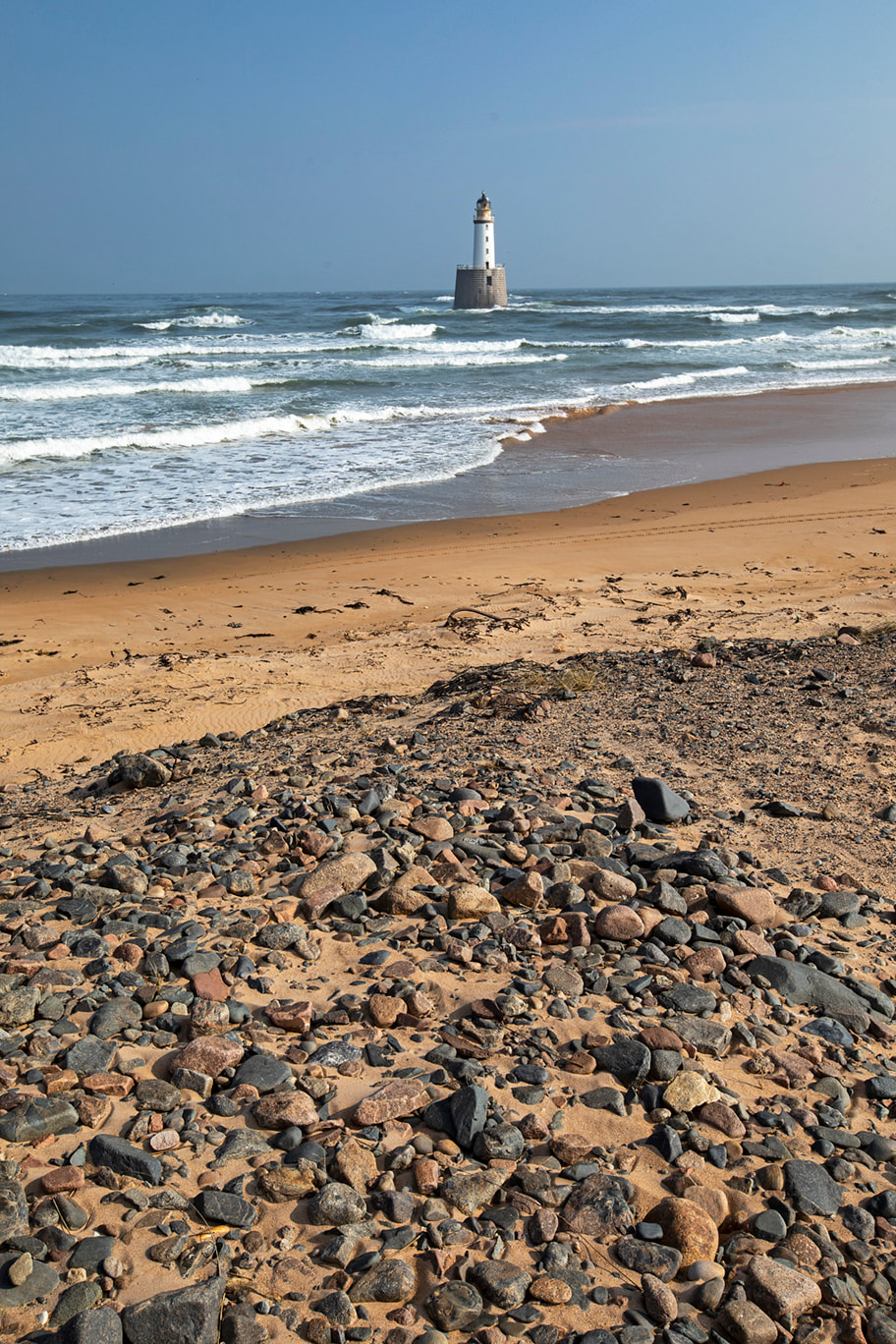
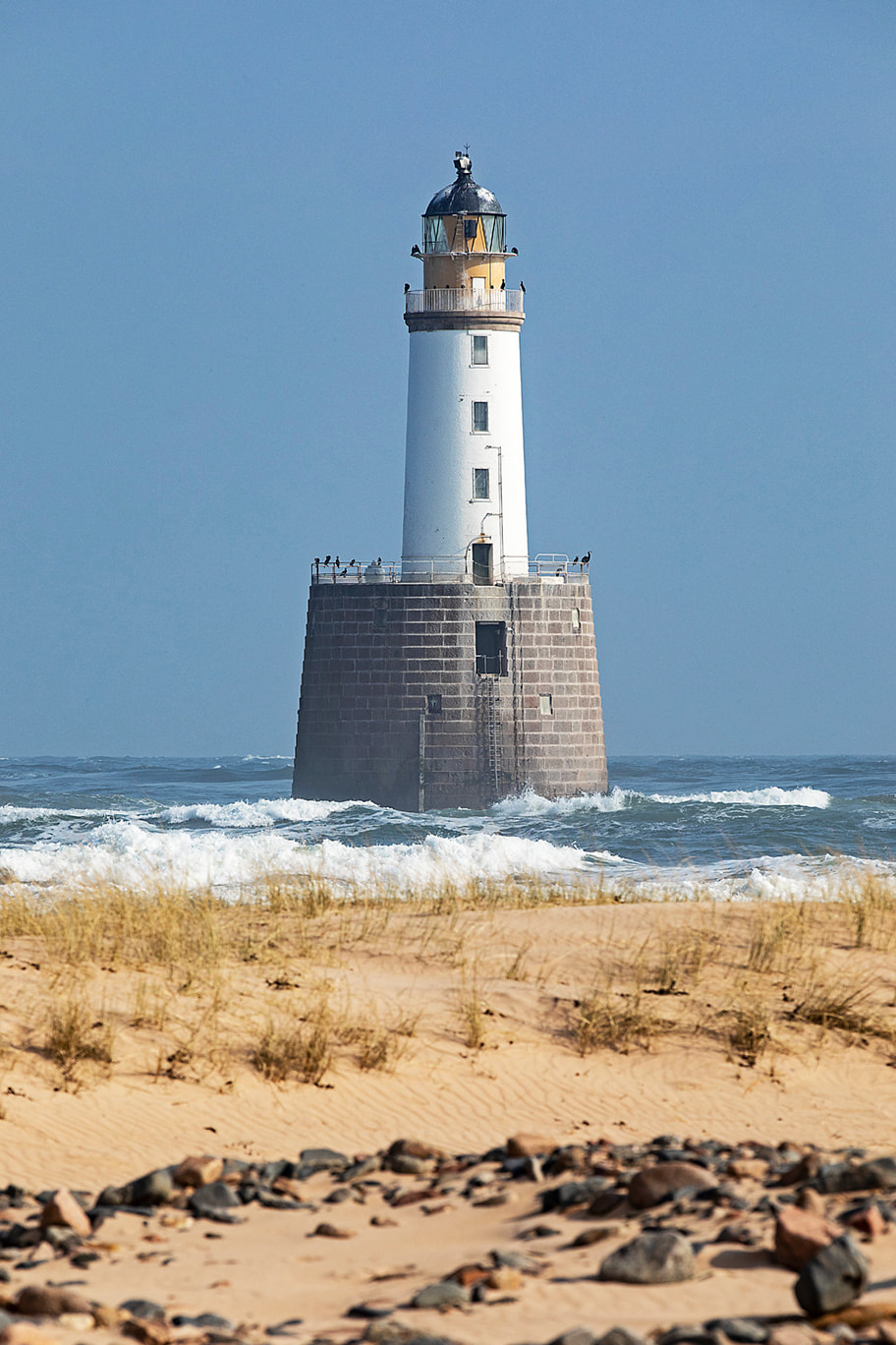
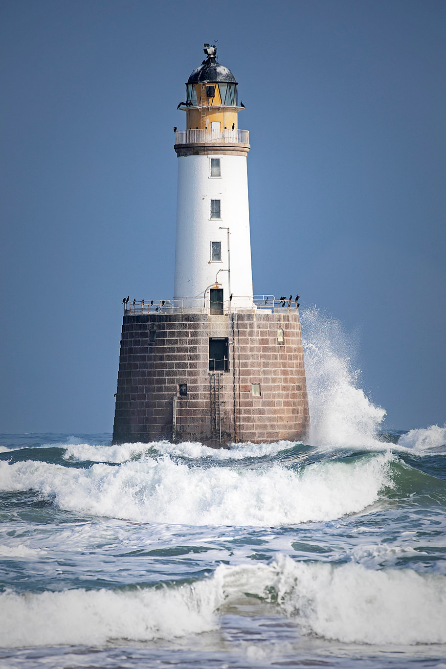
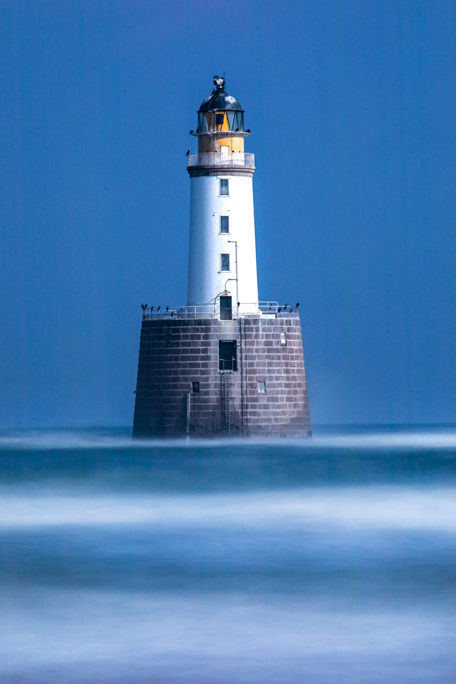
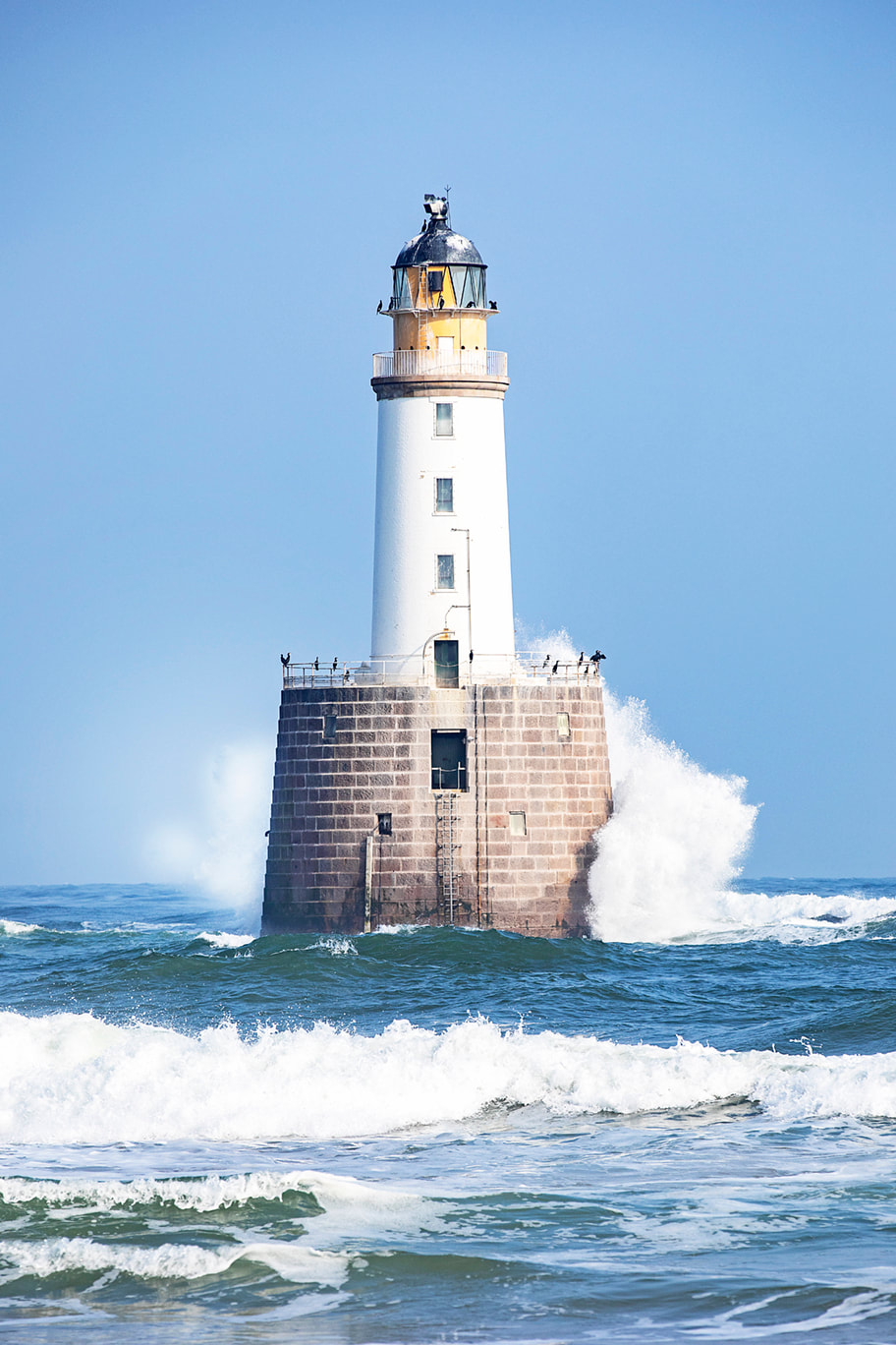
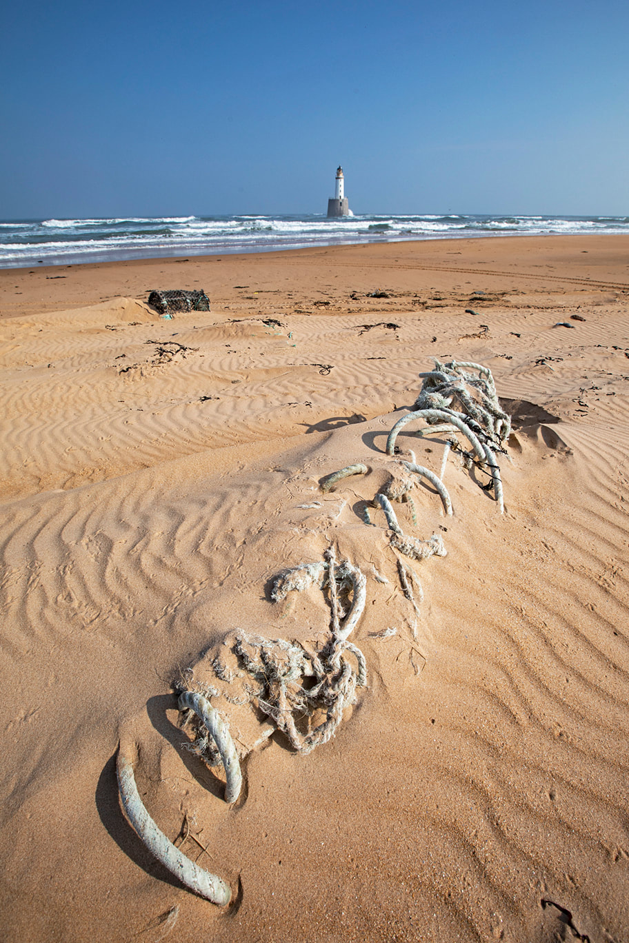
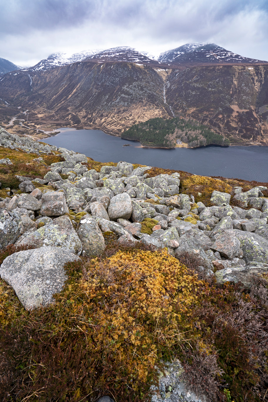
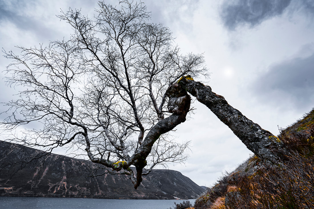
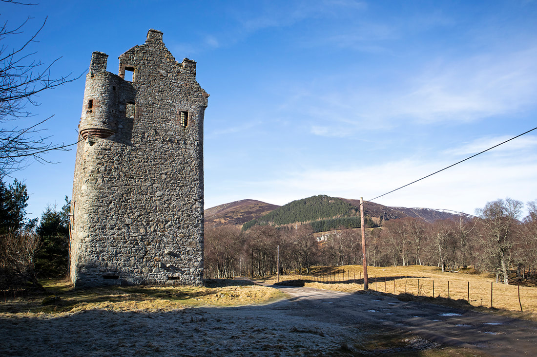
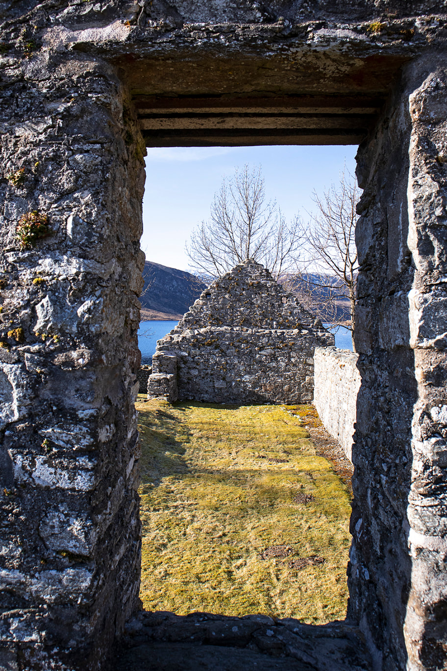
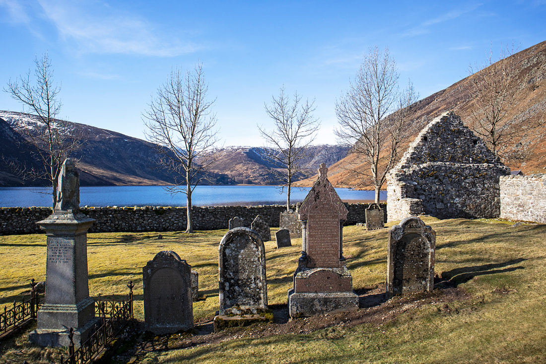
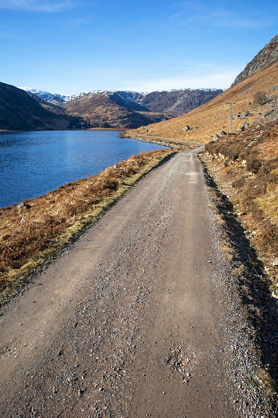
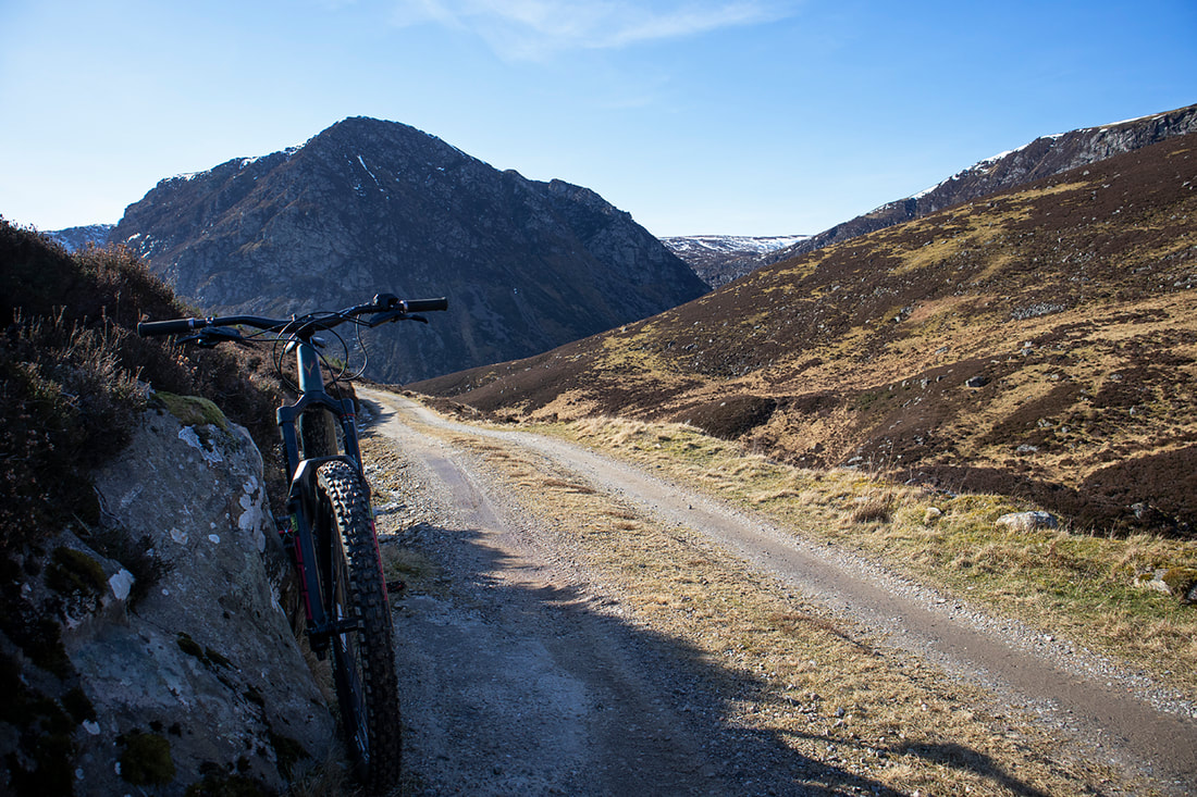
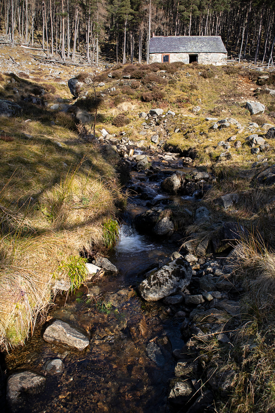
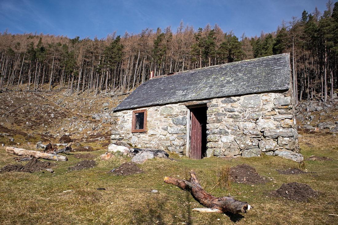
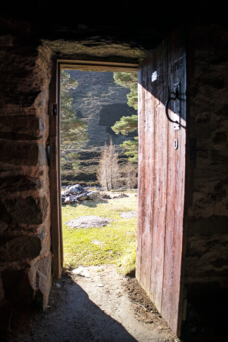
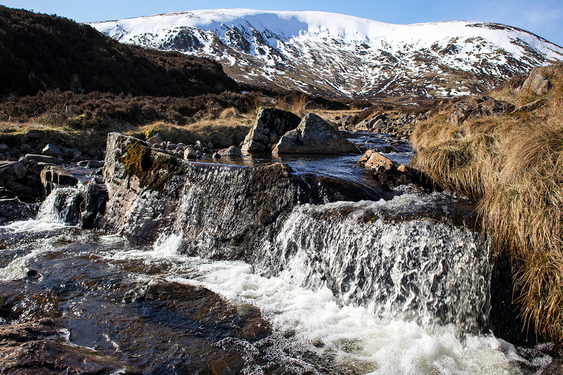
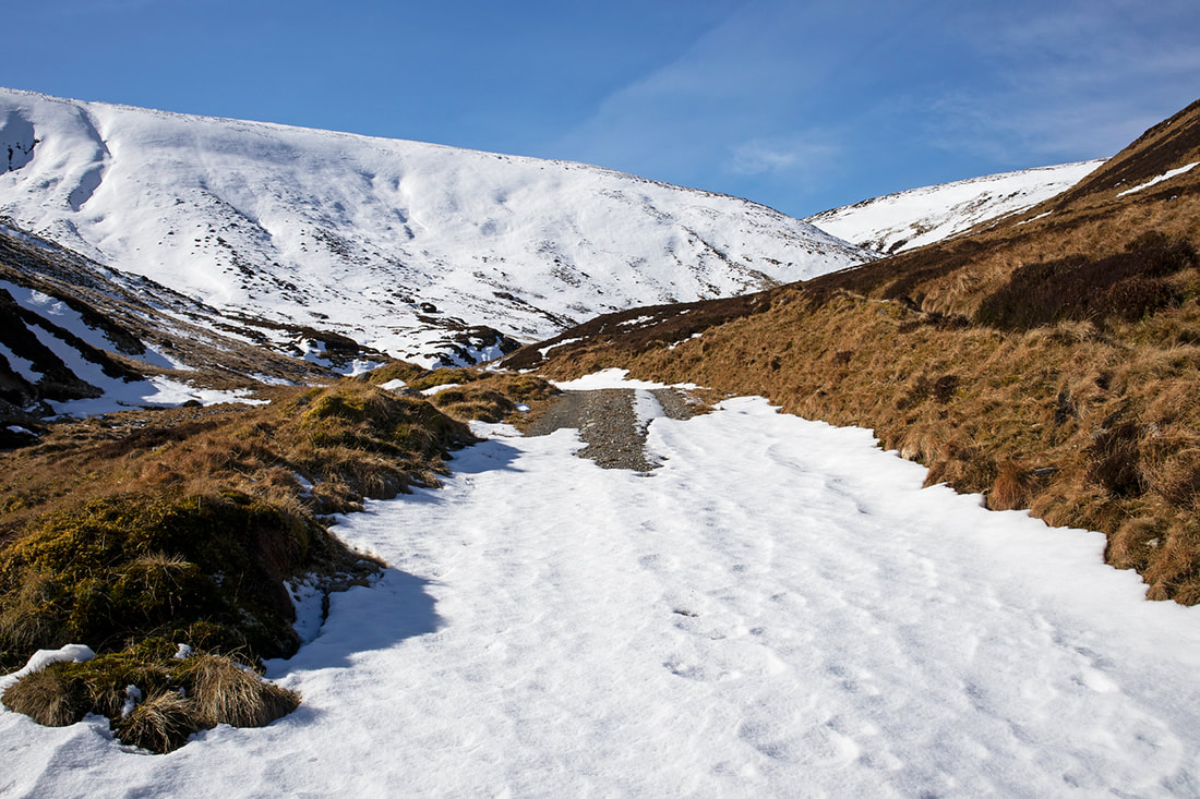
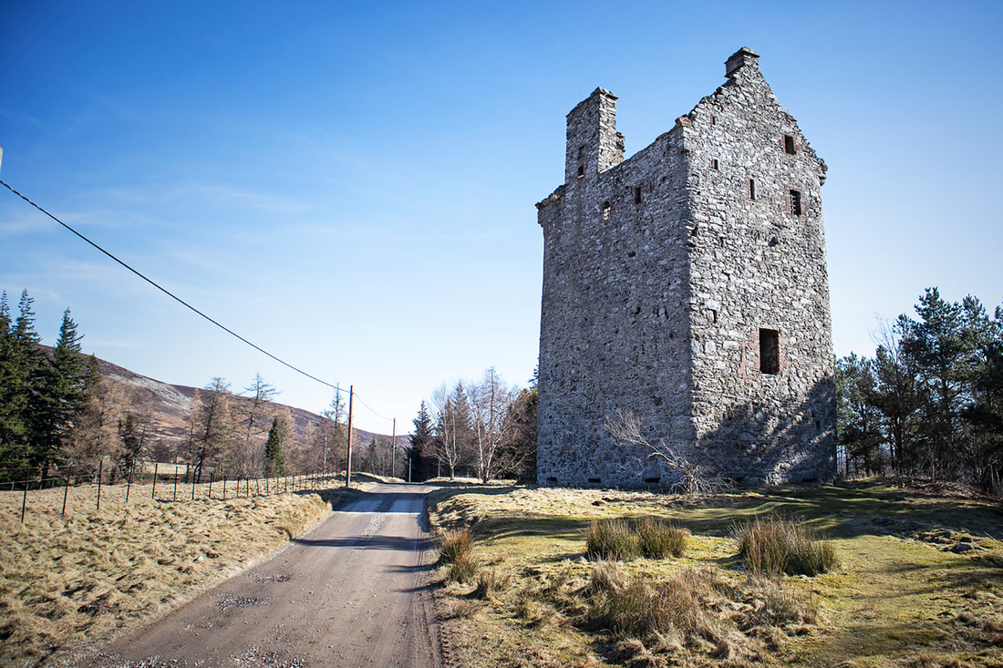
Clachnaben towers above Glen Dye, so much so that its prominent granite tor is visible for miles around. At the summit you can choose to walk up the back of the tor with just a little scramble to access the very top, or you can climb up the front using any one of the dozens of climbing routes available. Whichever route you take to reach the top, it is worth the effort. The 360 degree views are spectacular. There's little wonder that Clachnaben is one of the best known of the lower hilltops in Aberdeenshire. I've made this hike many times now and I hope I will make it many times more, it's quite a steep pull up at the end, so it makes a nice workout for a short round trip. You can see an earlier hike in full on the site if you want to see the whole thing, or you can use the captioned gallery below for the abridged version. 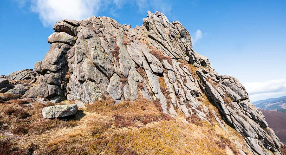 I took a drive up to the northeastern corner of Aberdeenshire today, to scout out Rattray Head Lighthouse for a potential future sunrise photo shoot. It is a stunning lighthouse with excellent prominence making it an obvious choice for photography. The usual buildings associated with the lighthouse are onshore but the structure itself is slightly offshore , its circular base thrashed by the sea with each tide. Obviously this creates great opportunities for photography. Even today, in the unforgiving daylight, I was able to make some nice 'postcard' images as the waves broke against the base. Imagine this image at sunrise, with a high tide or storm adding to the ferocity of the sea, it would be an epic image and I have no doubt that I will be making the journey up here repeatedly in an effort to try and catch the perfect conditions. I think there is also real potential for some night sky photography here, so perhaps I could combine the two by arriving very early and shooting the night sky followed by sunrise. In the mean time here's a few shots taken today at this genuinely stunning location. 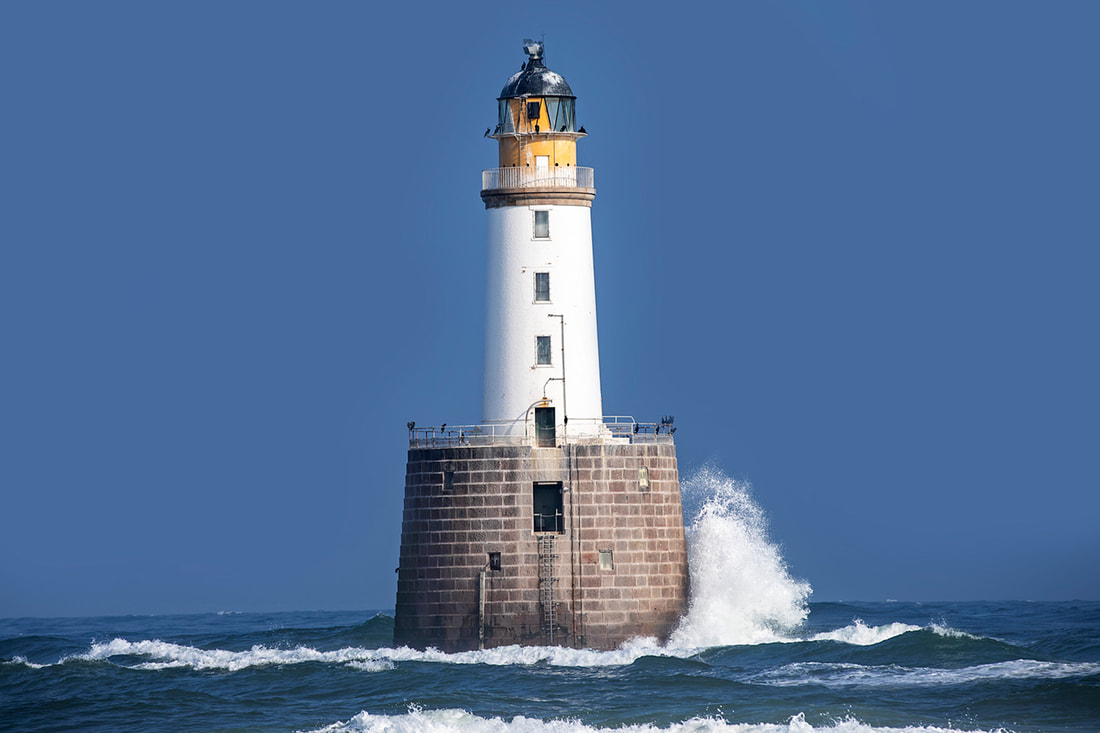 Monday this week saw me covering old tracks again, this time with a hike beside Loch Muick and up the steep sided Corrie Chash toward Broad Cairn. To be honest Broad Cairn was my target for the day, but after 7km I found myself in a strong snow squall and freezing temperatures and decided to turn back. It was still a great hike if a little short at 14km return. The views from the top were stunning, in the distance the White Mounth Munros were dusted with snow, their summits hidden by low cloud and their flanks adorned with fresh meltwater cascading down numerous waterfalls. In the summer or early autumn when days are longer and time allows, there is a wonderful 29km hike taking in the 5 summits that surround the loch. It's not easy, in fact its bloody hard, but it is a fantastic hike and one I'm pleased to have done albeit 11 years ago. There are many other hikes to be had in the area, not least of which is the loch circuit that takes in the spectacular falls at Glas-Allt-shiel. The road to Loch Muick is a steady affair for the last 10k or so, but worth the drive. Parking is in a purpose built car park with a pay and display machine that accepts a card tap. Close to the car park is a small but excellent visitor centre and then it is on to the huge stunning loch itself. All in all it is yet another place to put on your 'visiting Aberdeenshire' list. 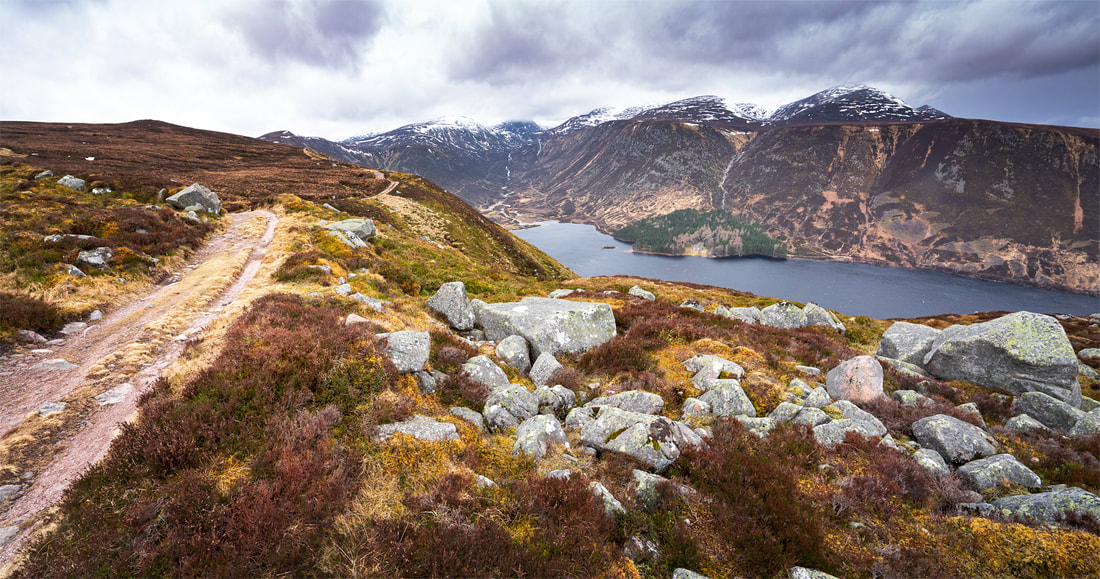 Mondays weather promised a continuance of the dry warm days we have been enjoying for quite a while now, so I thought I would take the mountain bike out and make the most of the conditions. Having previously lived in Aberdeenshire for two years, I am already familiar with the myriad of hard trails crisscrossing the North East of Scotland and as I have intimate knowledge of many of them it wasn't difficult for me to select one for the day. Glen Lee is about an hour south of home in the neighbouring county of Angus and well worth the journey. The route begins in a free car park close to Lochlee Parish Church (not pictured) and almost immediately provides my only real route decision of the day, should I turn north toward Mount Keen or West toward Hunt Hill. I chose the western route because it is truly beautiful and has some interesting photographic opportunities along the way, not least of which is the ruin of the first church in the area, built in the year 600 the Old Glenesk Church was replaced by Lochlee Parish Church in 1803. Its ruins stand on the eastern edge of Loch Lee where the waters lap against the perimeter wall. It was an easy choice for the main image today. Before arriving at the old ruins you pass Invermark Castle, a fine example of a 16th century Tower House which was abandoned in the 18th century and materials from the associated outbuildings were robbed from the site to build Lochlee Parish Church. The route then continues for 2.5km beside Loch Lee before turning north and climbing beside the Water of Lee on the east side of Hunt Hill. Once over the crest of the prolonged ascent, a long downhill brings me to Johnny Gordons Shiel (or Bothy). These basic structures are scattered throughout the mountains of Scotland and are left open for anyone to use. They are usually 4 walls and a roof, a dirt floor, fireplace and occasionally logs (or something similar) for seating. If you're lucky you might also find a raised platform to lift your sleeping bag off the floor but that's it. So, no water, food or toilet facilities, and yet they are invaluable in bad weather, or just to escape the wind or cold while having lunch, or to sleep overnight without having to haul camping gear in with you. I think they are a wonderful resource and a perfect place to take a moment along the trail. Beyond the bothy I ascended again before a short downhill passing the Stables of Lee and getting a soaking by blasting through the Burn of Badrone before climbing again toward the snowline. Soon after this the bridleway became more and more snow covered and less and less manageable until I called it a day and turned back. Only then did I realise just how much ascent I had made, with an almost entirely downhill ride back to the car park I flew along kicking up rocks and getting soaked again at the Burn of Badrone but arriving back at the car in seemingly no time at all, after stopping for one more shot of Invermark Castle. It was only a 25km round trip but packed with interest, beautiful scenery and got my first ride back in Scotland under my belt. 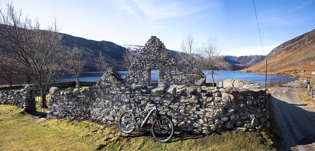 |
AuthorWe arrived in Calgary, Canada on 29th December 2011 to continue our journey. This blog is intended to keep our family and friends informed whilst we explore Canada.You can use the RSS feed below to stay updated. 
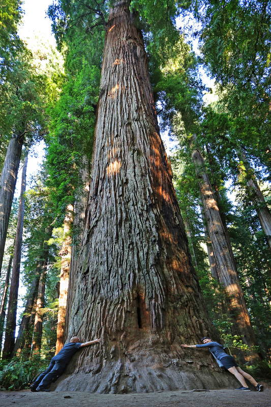
Stout Grove - California
Categories
All
Archives
January 2024
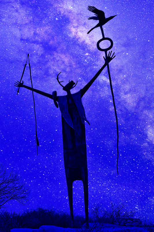
The Shaman, West Texas
|


 RSS Feed